La Niña Advisory Issued, Potential Impacts to Winter Precip & Springtime Tornadoes

La Niña was observed in September, leading to NOAA issuing a La Niña advisory. These conditions are expected to persist through winter into spring, with impacts likely for the upcoming winter season and beyond into next spring. La Niña often plays a role in determining storm tracks during the winter season and severe weather into the spring.
What is La Niña?
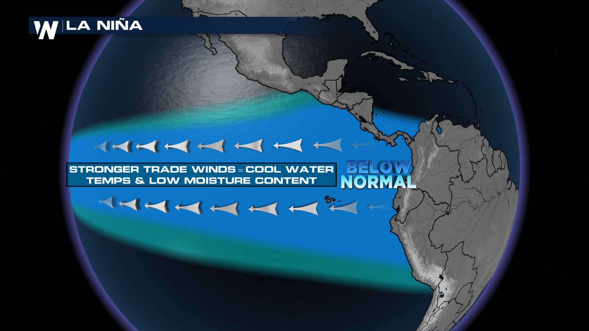
La Niña is one phase of a large circulation over the equatorial Pacific Ocean. The prevalent wind direction will churn up cooler or warmer water, based on the direction of the circulation. When winds are prevailing from the east, it churns up cooler waters near the coast of South America and to the west, while areas in the western Pacific see warmer than average water temperatures during this phase. These cooler waters, along with other large scale circulations, impact how air flows across the United States.
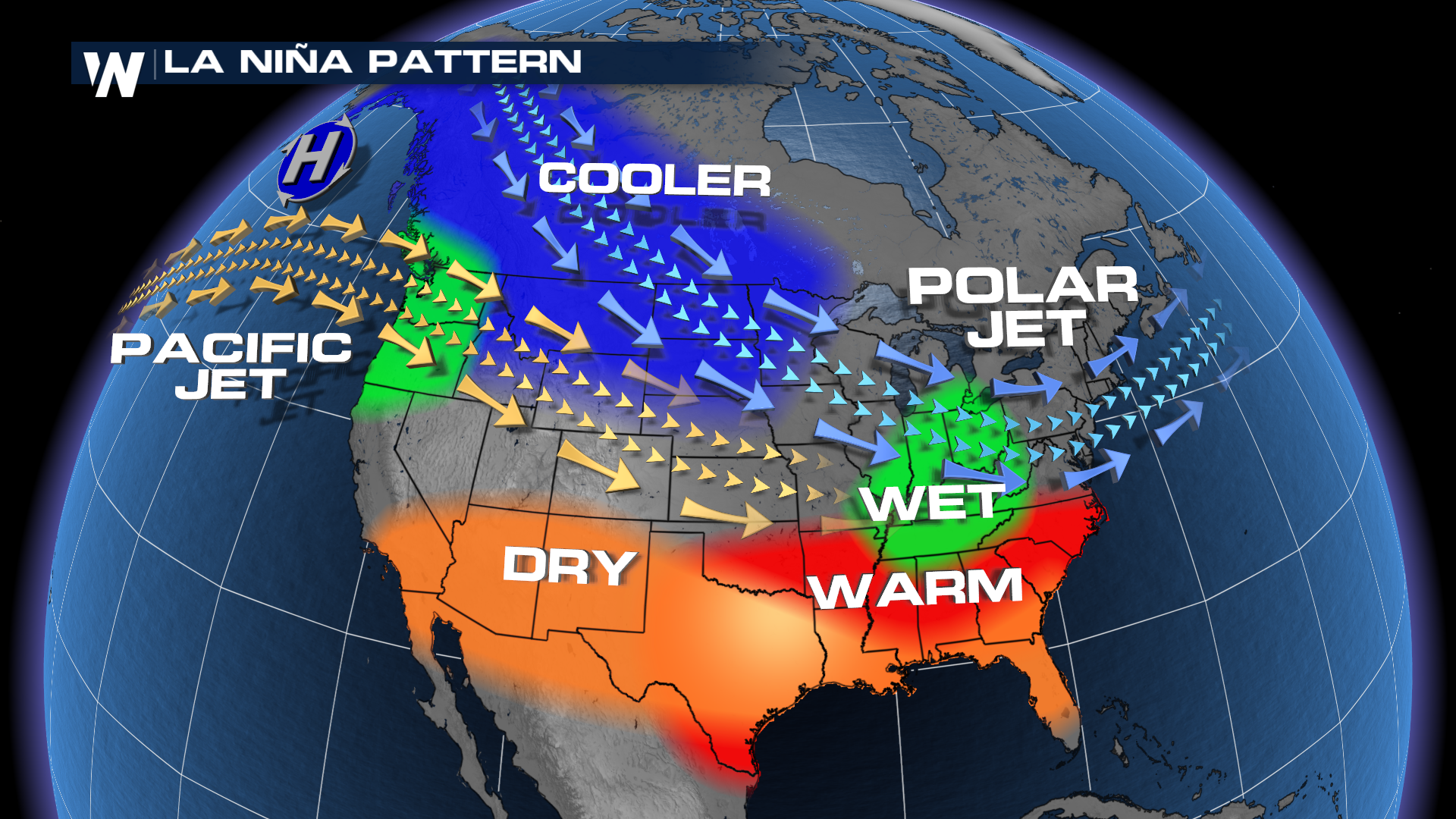
 During strong La Niñas, the jet stream is typically more active from the Northwest through the Great Lakes. This effect is typically less pronounced during weaker events. This often favors better chances for precipitation across the northern tier of the country, including the Northwest and Great Lakes.
Impact for Winter 25'-26'
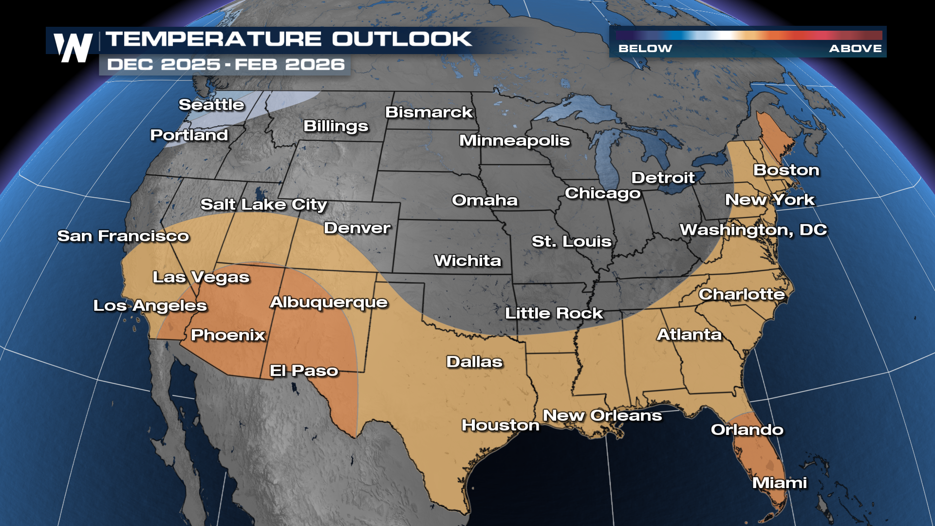
NOAA releases their outlook for the upcoming winter season this Thursday (October 16th) but the Climate Prediction Center continuously updates outlooks for three month periods. These outlooks likely won't change much with next week's update but we'll bring you that forecast when it's released. The temperature and precipitation outlooks for December - February show conditions typical for a La Niña year, with below average temperatures favored in the Pacific Northwest.
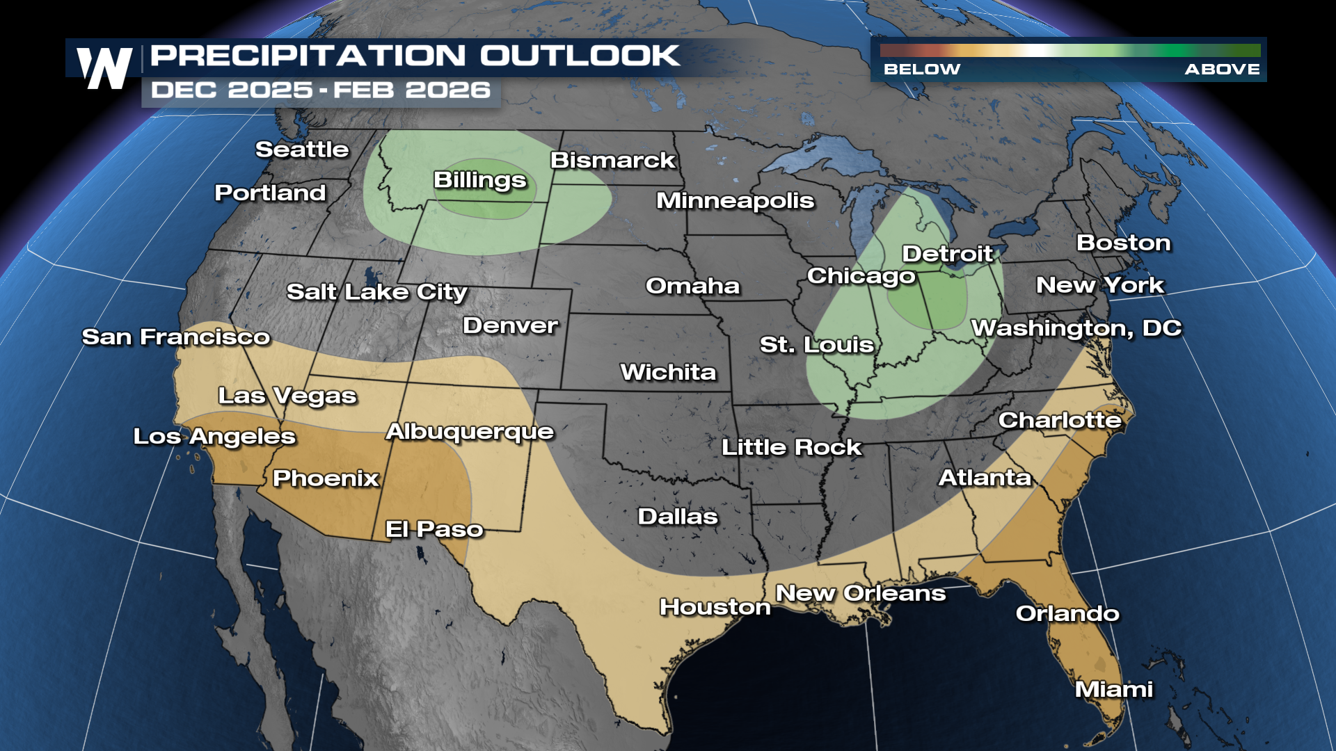
The precipitation outlook also favors conditions fairly typical for a La Niña winter, with above average precipitation favored around the Northern Rockies and Great Lakes/Ohio Valley.
Spring Severe Weather / Tornado Impacts
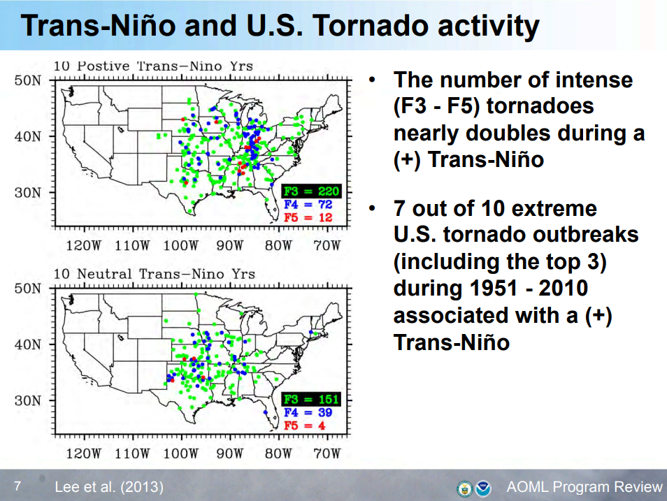
La Niña is expected to decay through the spring months, which can have a big impact on the severe weather season. Studies have shown a increase in the potential for tornado outbreaks over certain areas of the country as La Niña decays into a neutral or El Niño phase. These favored areas include the Central/Southern Plains and around the lower Great Lakes into the Mid-Mississippi Valley.
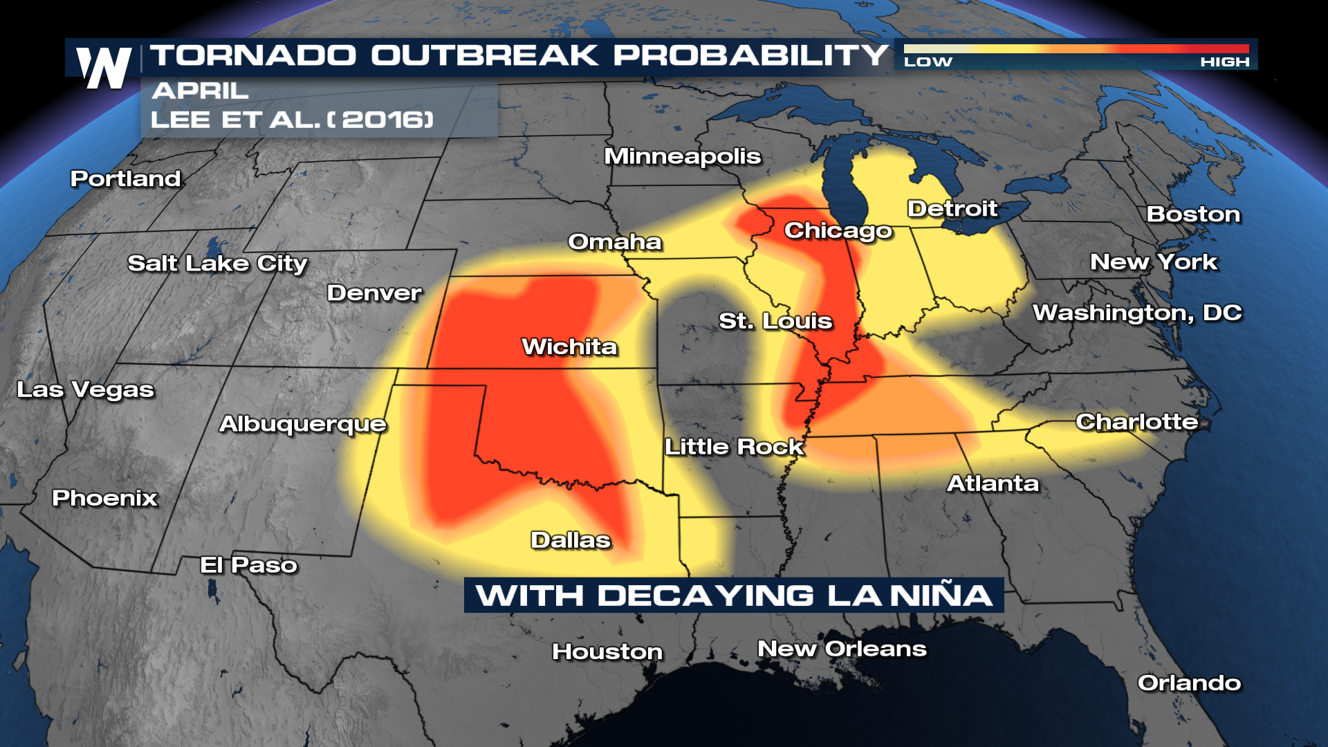
This phase also favors stronger tornadoes, as the number of high end tornadoes and outbreaks increase during this phase.
Seasonal forecasts are difficult to predict with accuracy, so be sure to check the weather forecasts often with WeatherNation for the latest.


