Flooding Issues Slow To Recede

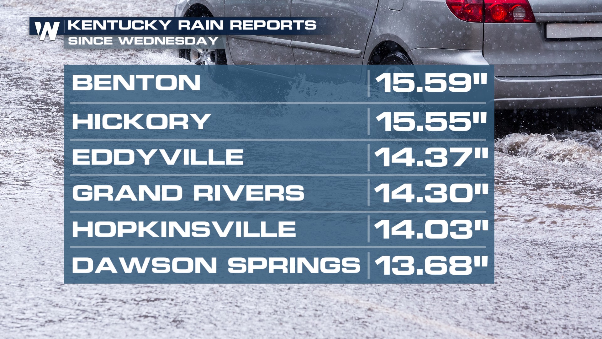
The dangers from previous days' torrential rainfall across the mid-south still loom, as residents begin to return to their neighborhoods. Prolonged heavy rainfall in parts of Kentucky led to over a foot of rain, with other parts of Missouri and Arkansas seeing over 7 inches of rain. A quasi-stationary boundary stalled out, bringing multiple waves of severe weather and torrential rainfall last from April 2nd through 6th, 2025.
Many residents displaced by the flooded waters, wanting to get back home, were instructed by Kentucky Gov. Andy Beshear to wait to return home instead of driving through flooded roadways. Turn Around, Don't Drown. Over half of all flood-related drownings occur when a vehicle is driven into hazardous flood waters.
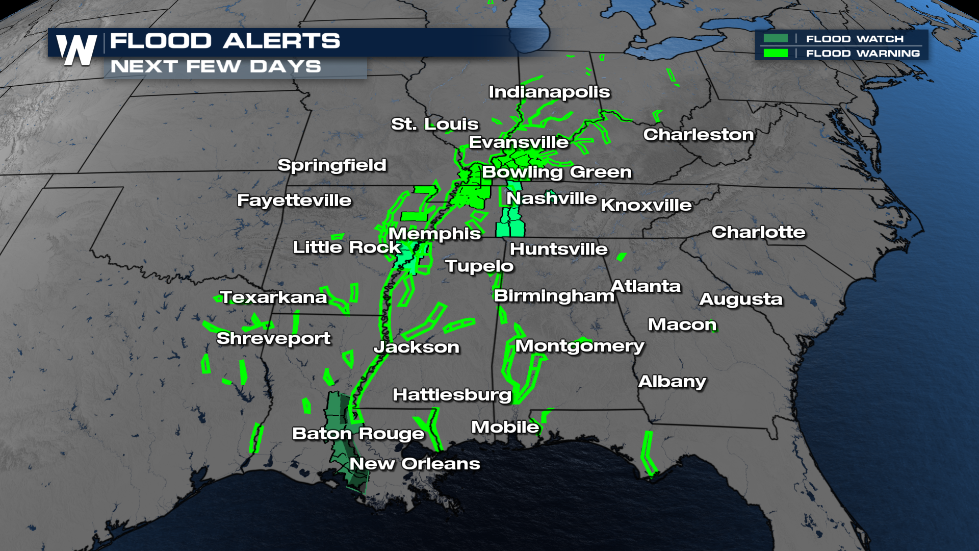
While the storms are long gone, the impacts are still being felt. Flood alerts are ongoing as rivers, creeks, and streams remain high. There are still several roadways that are flooded across several states.
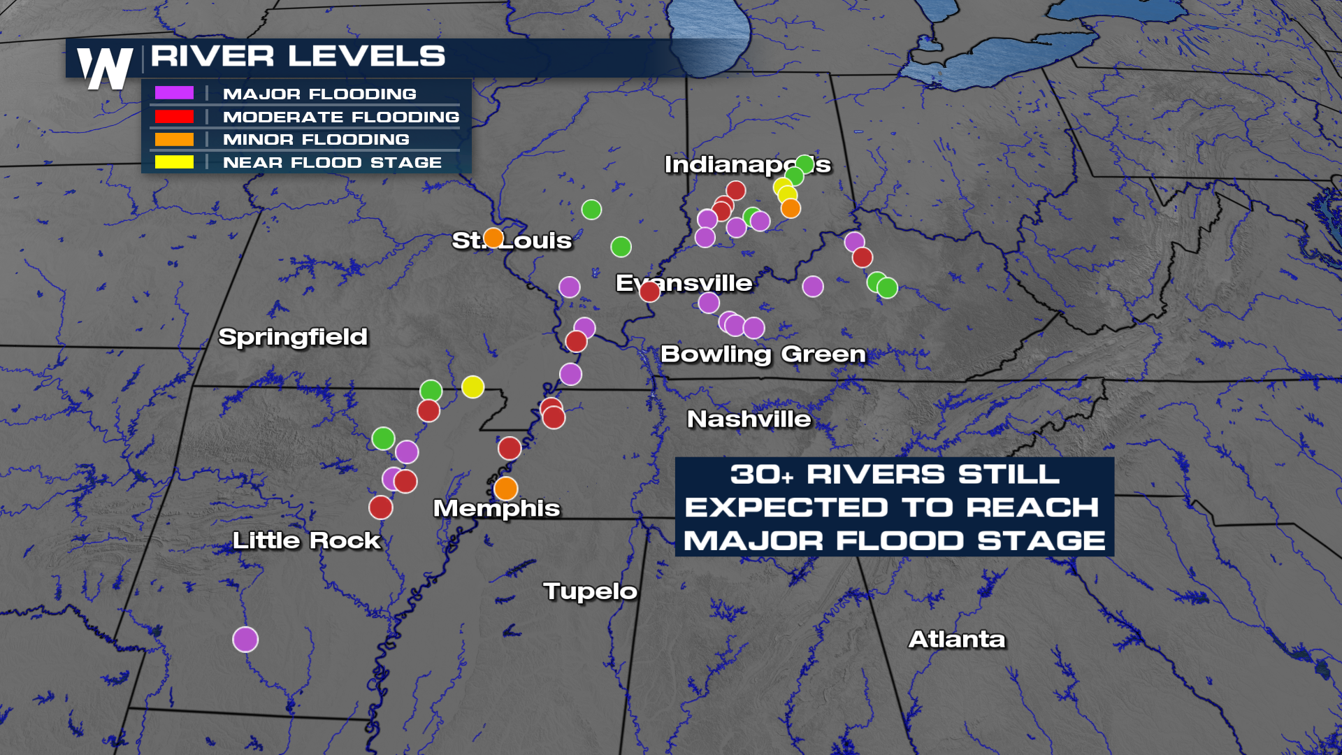
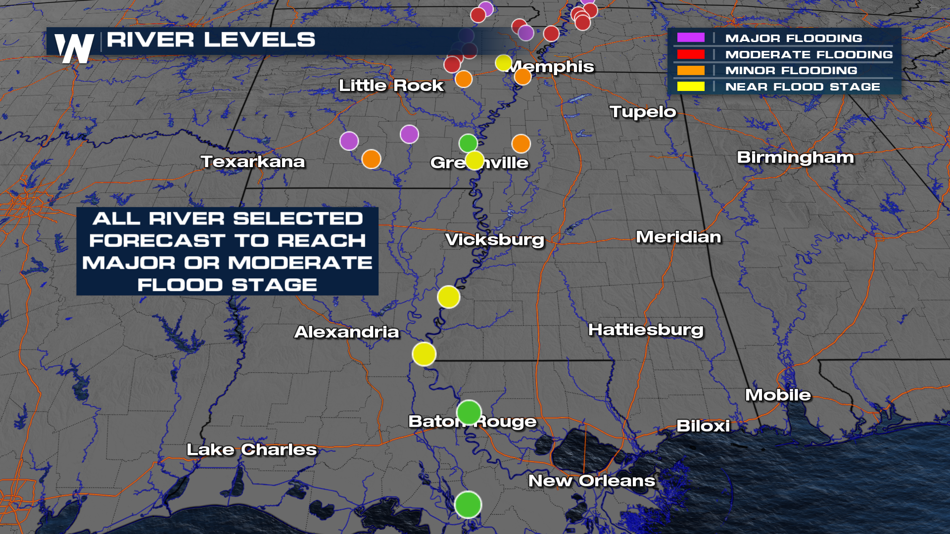
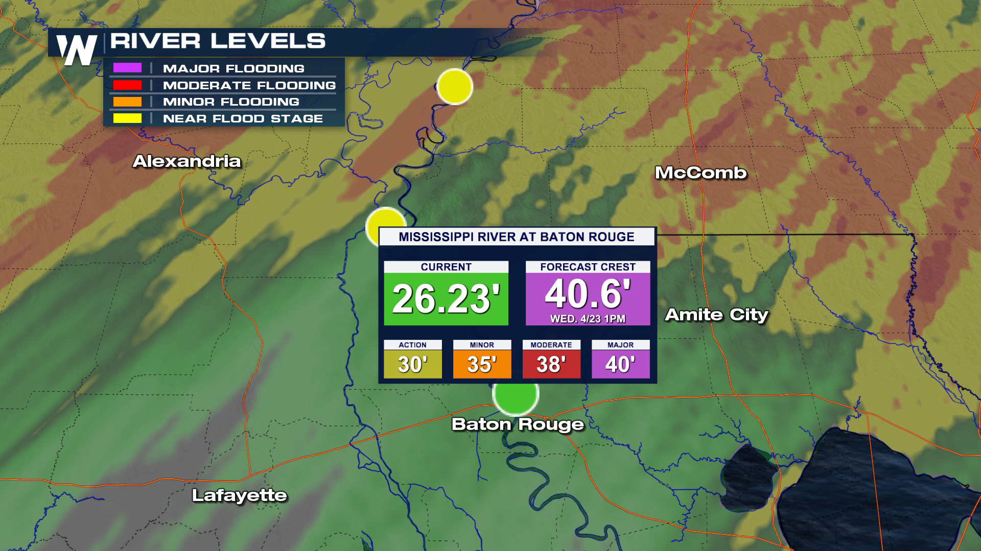
River flooding will continue to be an issue over the coming weeks as the water works downstream. Some of the bigger waterways won't crest until the latter half of this month, where locations along the Mississippi River in Baton Rouge could see Major Flooding 2 weeks from now!
Tune into WeatherNation at the top of the hour for more details.


