Heavy Rain & Snow Winding Down Tonight in California

One last push of the trough responsible for the heavy rain in California will kick off the week. This comes after several systems created major flooding and mudslides over the holidays. The threat of additional flash flooding (including with mudslides and debris flows) and heavy mountain snow will continues on Monday.
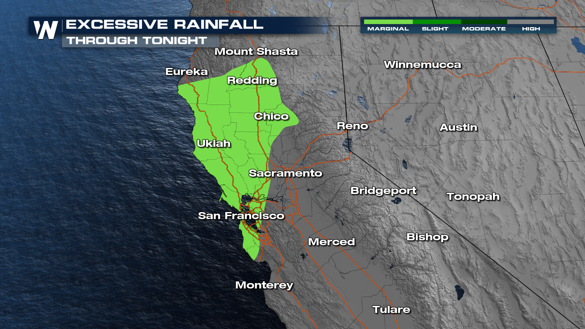
Flooding Threat
Flash flood potential is expected to continue through today with the WPC's excessive rainfall outlook at a MARGINAL (level 1 out of 4) risk.
Timing / Forecast
There is still some lingering rain in northern California happening today through tonight. The surface low will parallel the coast through tomorrow and may bring some minor rain back into southern California.
Snow & Wind
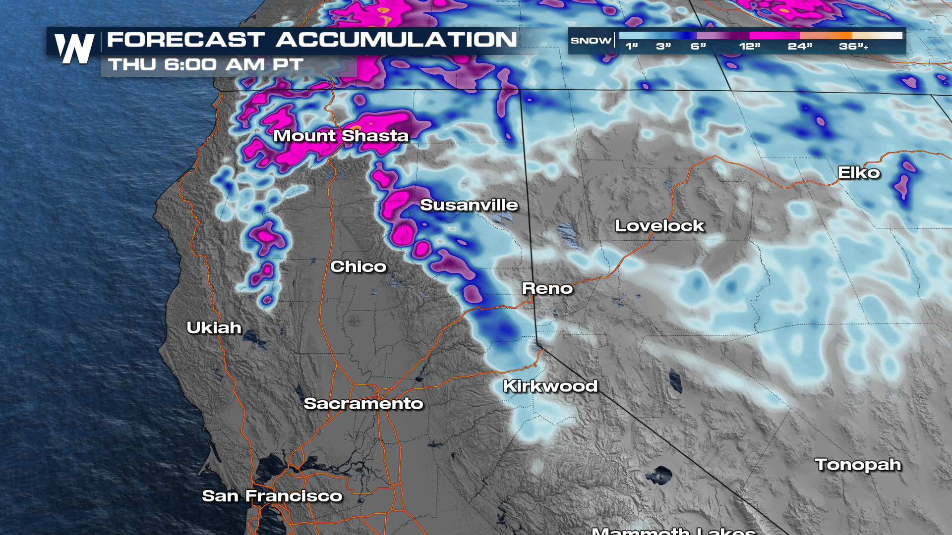
Winter Storm Warnings remain in effect for the Sierra Nevada as well as the Trinity-Shasta mountains through tonight.
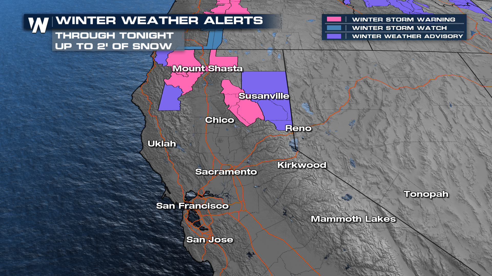
Snowfall totals moving forward are likely in the higher elevations but a couple inches over the Donner pass and up near Mount Shasta could cause road slow-downs on our interstates.
More details on your Western Regional Forecast can always be found :50 past the hour on WeatherNation.


