Relentless Rain Targets Florida as Flood Threat Continues

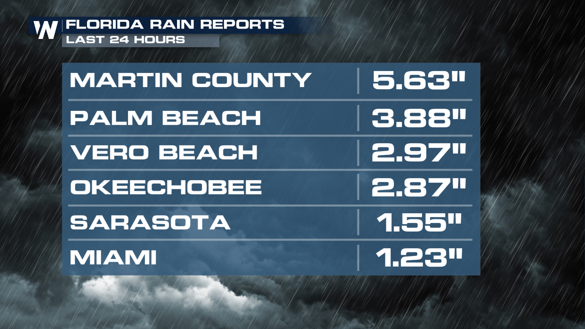
Days of persistent rain have soaked much of Florida, with the latest 24-hour rainfall totals topping 5 inches. A slow-moving system has allowed moisture from the Gulf and the Atlantic to stream into the region, leading to heavy rainfall, localized flooding, and saturated soils.
An upper-level low, combined with a stalled boundary and an abundance of moisture, will lead to periods of heavy rain across the Sunshine State. Forecast models continue to show widespread showers and storms across Florida, especially during the afternoons through Thursday.
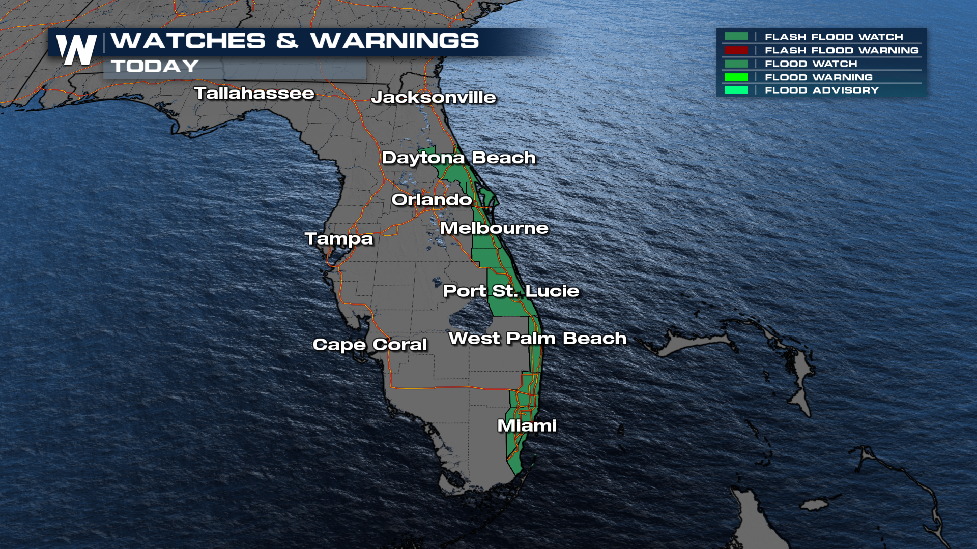
Rainfall totals have quickly added up, with some areas seeing several inches in a short period of time. Flood watches are in effect for the coastline of Florida, as 1-3 inches of rainfall are still possible, with isolated totals over 5 inches possible due to heavy rain bands.
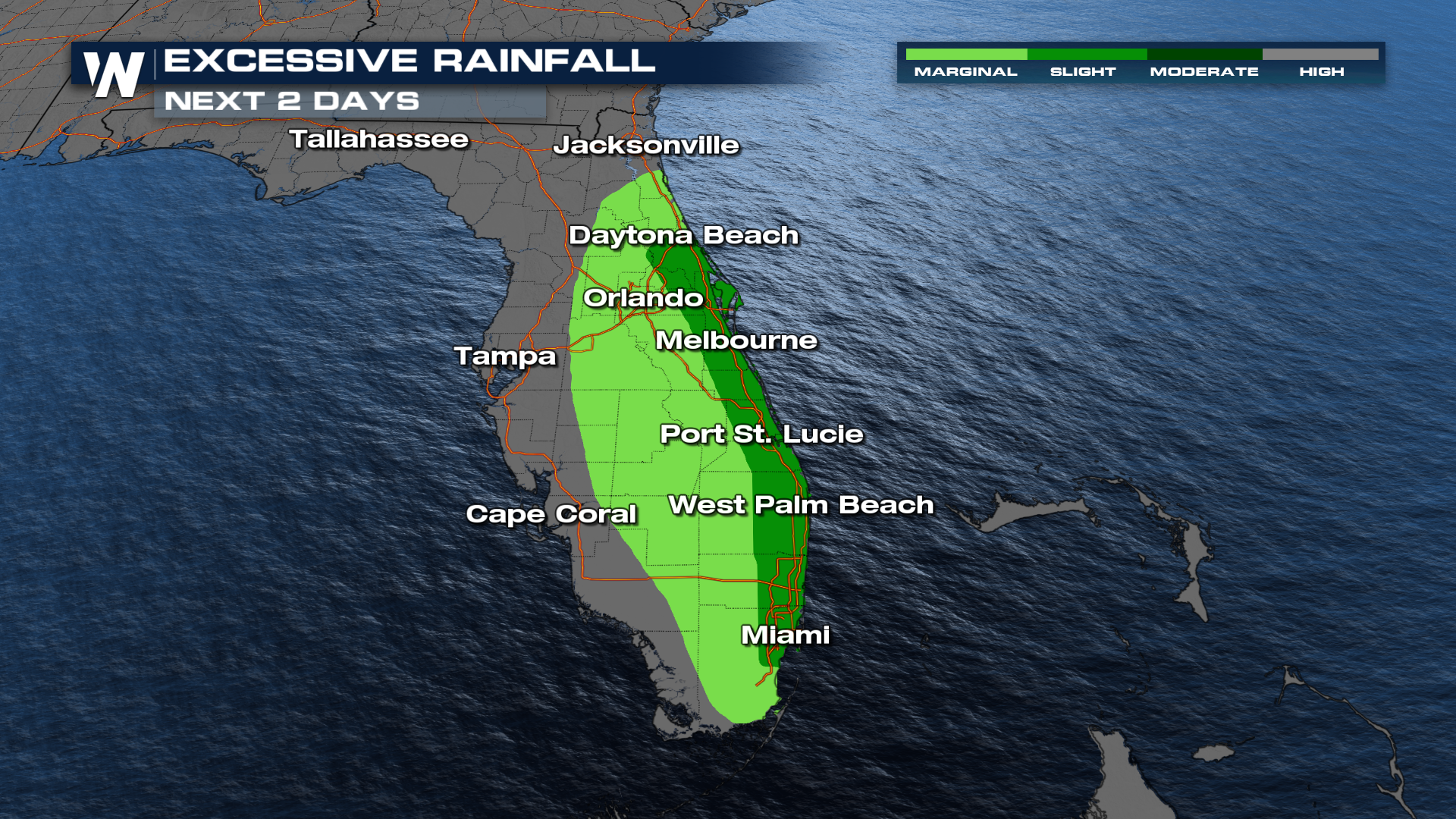
As a result, an excessive rainfall outlook has been issued for parts of the Atlantic Coast, with a level 2 out of 4, SLIGHT risk, for flash flooding for the next several days.
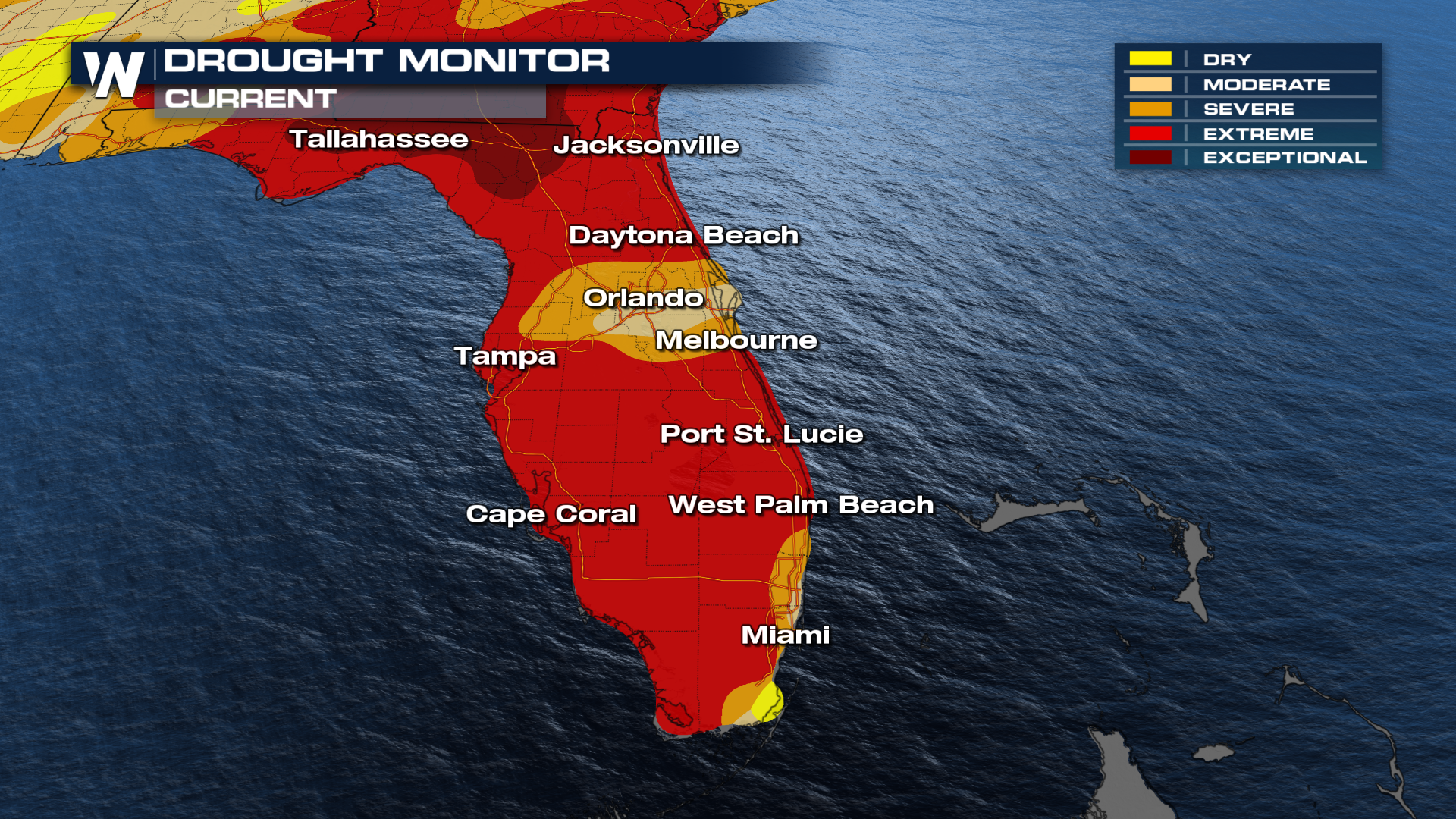
This rain arrives at a critical time, as Florida’s drought conditions have worsened in the latest update. Much of the state is now experiencing extreme to exceptional drought (levels 4-5), which has already led to water restrictions.
So while this rain is much-needed for a drought-stricken state, it also raises concerns for flooding, making this a week of both relief and risk across Florida.


