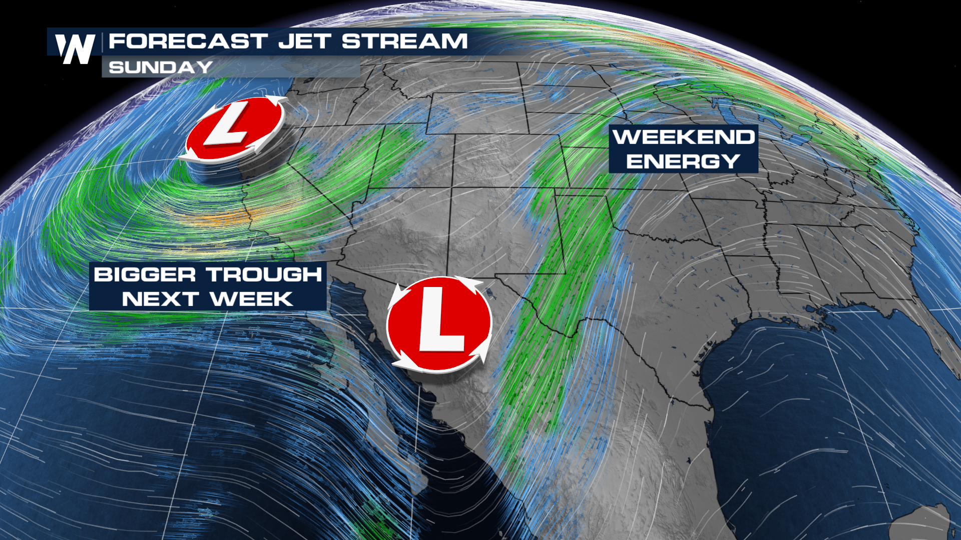
Weekend Closes With More Storms

The peak of spring severe weather season is fast approaching and the outlooks are here to prove it! The Storm Prediction Center has outlooks for severe storms through Wednesday of this week.
Outlooks
The SPC has maintained a SLIGHT risk for severe storms through Monday morning in Texas. This is a level 2 out of 5 risk for severe weather. In Minnesota, there is a MARGINAL risk for severe storms along the surface low.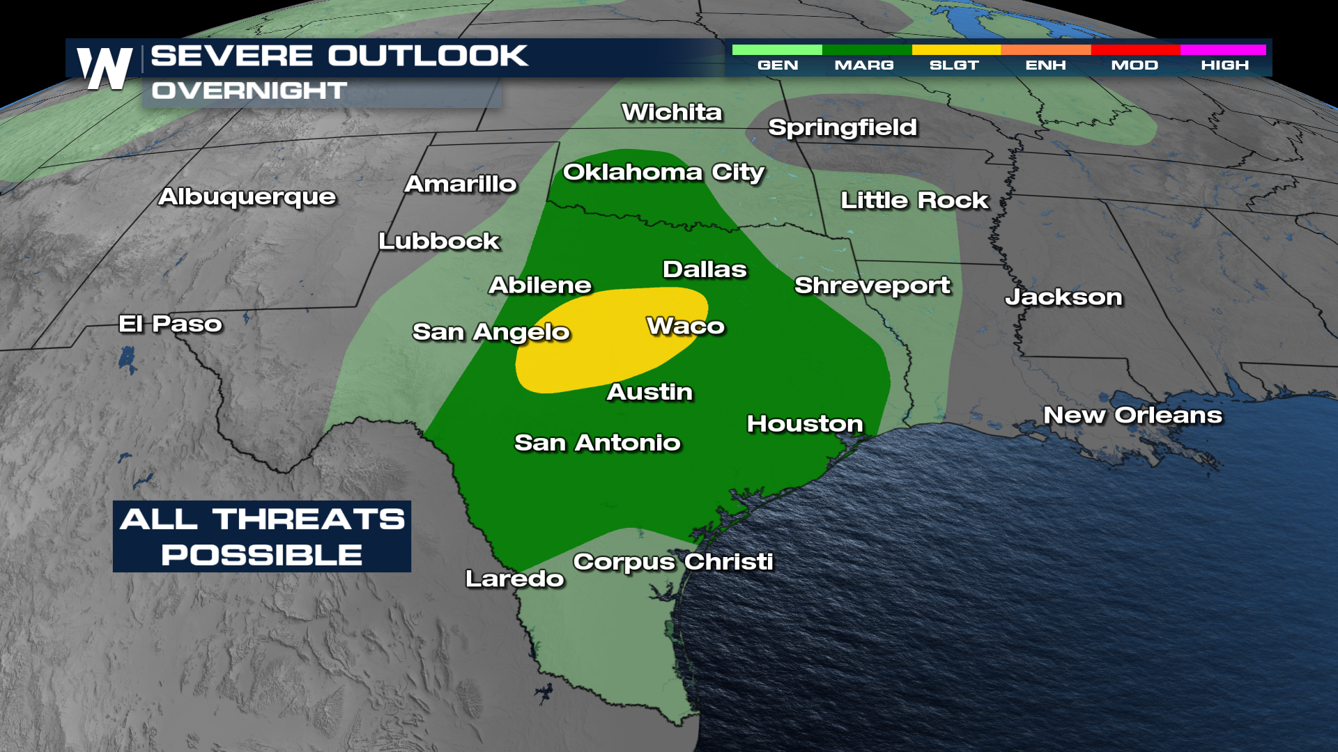
Forecast
Storms have fired up in west Texas and are expected to continue moving into the I-35 corridor through the morning hours. Models anticipate these storms clustering together as the drag through into the morning.
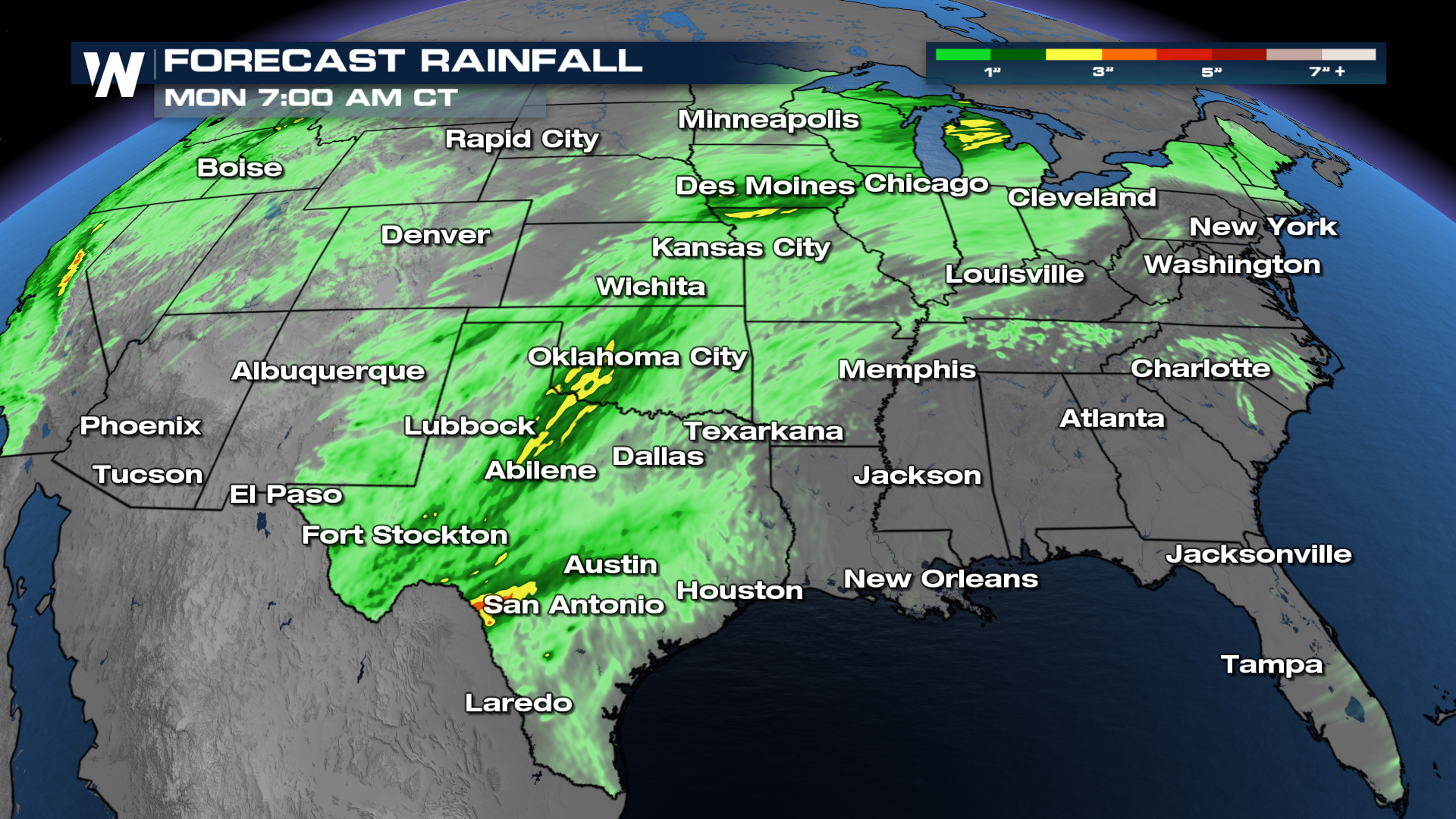
Rainfall & Flood Threat
Heavy downpours are expected with these thunderstorms. Rainfall totals could surpass 3-5" in some areas that see multiple thunderstorms.
MONDAY
A lot of the same question marks move into Monday, with a bimodal severe threat. The area of greatest concern looks to be up around the Great Lakes, where a higher tornado threat resides.


