Rocky Mountain Snowfall Wrapping Up Wednesday
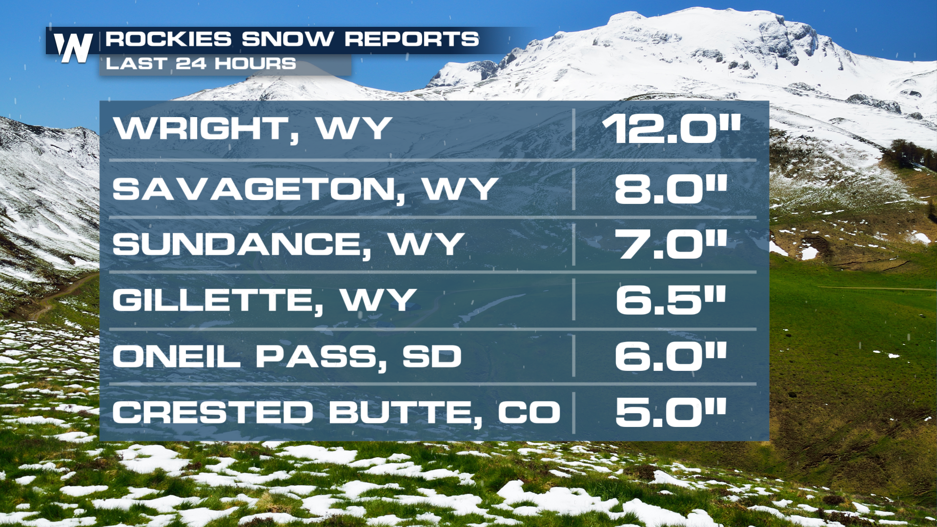
INTERMOUNTAIN WEST - A low-pressure system has moved across the intermountain west leaving behind cooler temperatures, rainfall, and snowfall. The highest snowfall totals with the system came out of Wright, WY with a foot of snow.

TIMING
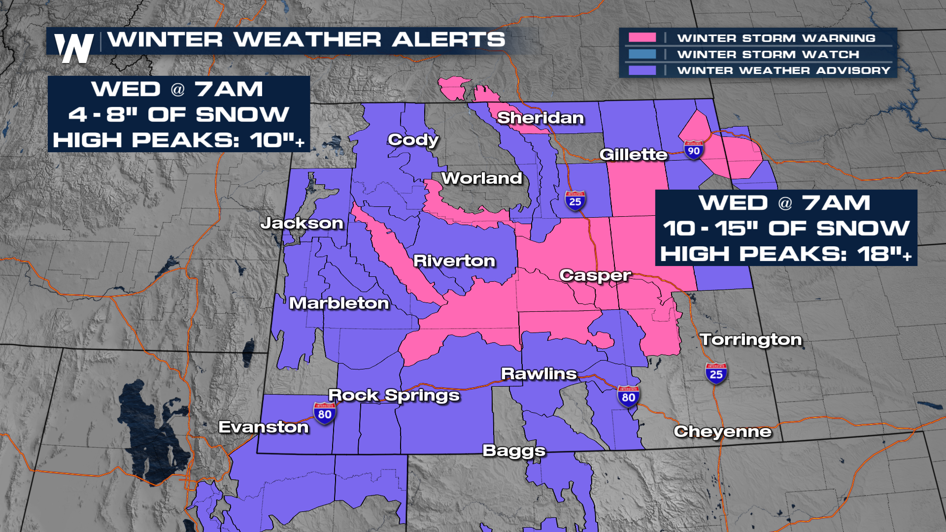
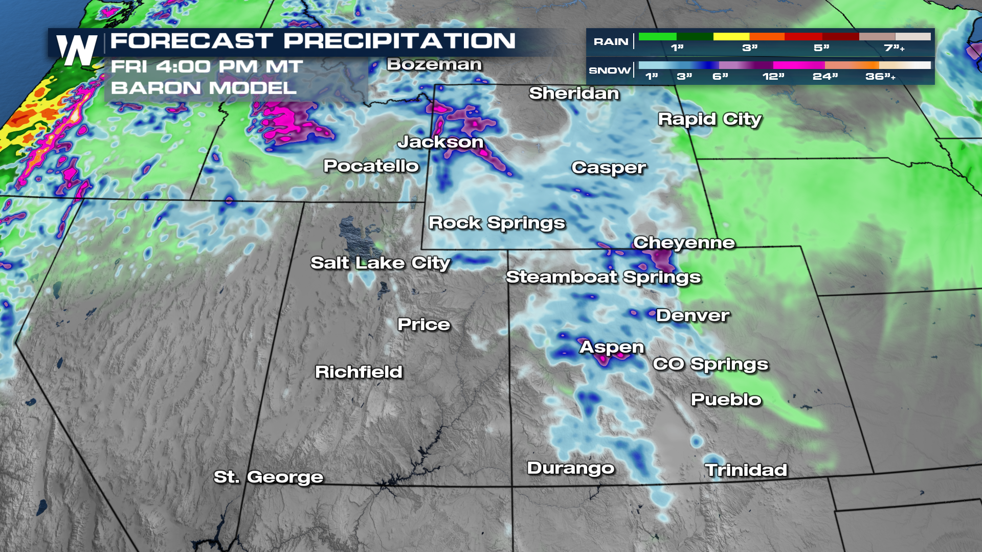
As cool air fills in, rain and snow continue to move through this portion of the country, bringing impacts Wednesday. Especially in Colorado, where the front is still making its way across the state bringing snow. A majority of the winter weather concerns will wrap up late morning, or early afternoon on Wednesday but some additional snowfall will accumulate in higher elevations into Wednesday afternoon.
Colorado & Utah
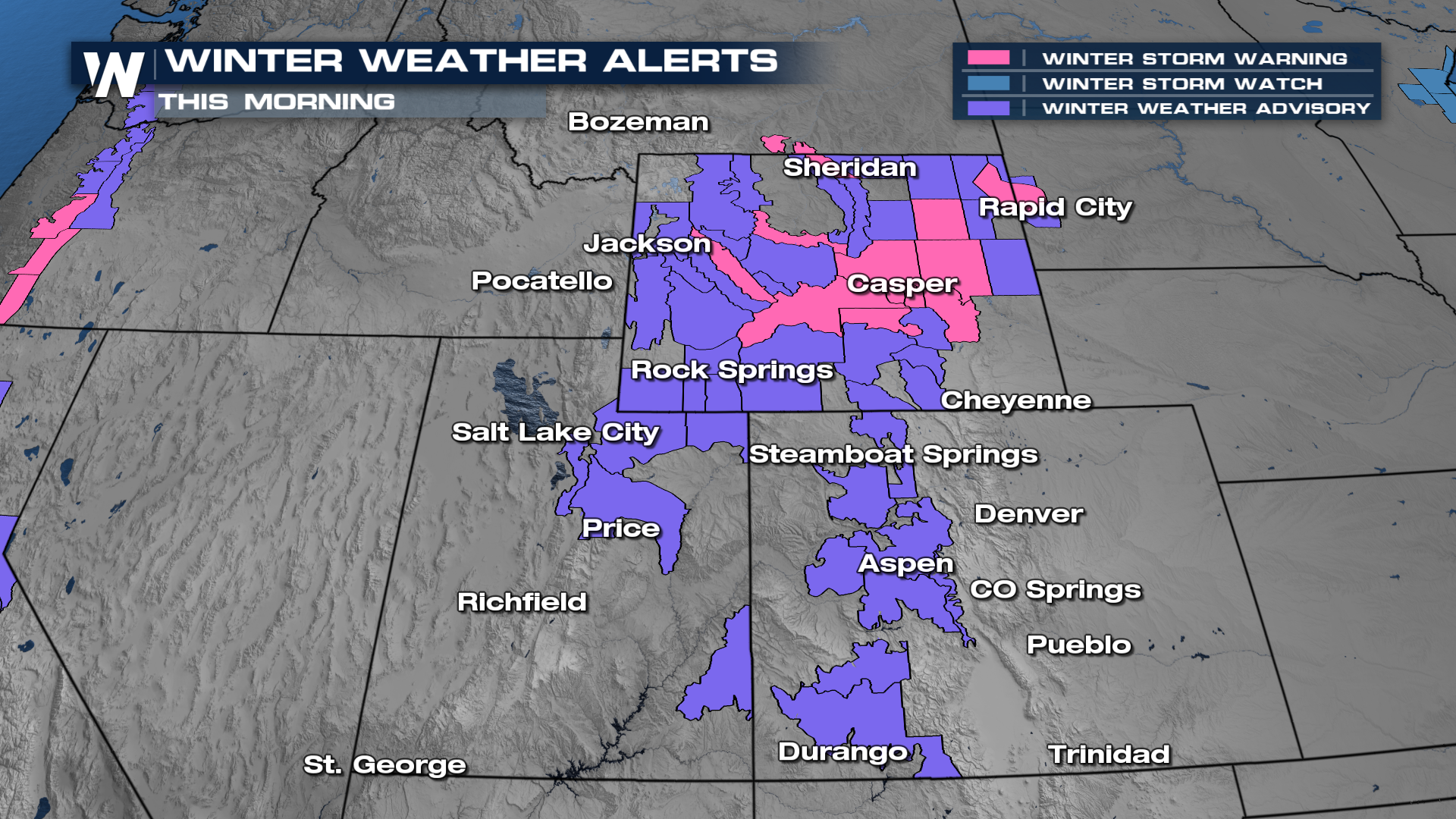
Colorado and Utah will be under winter weather advisories through the morning on Wednesday.
 For the I-25 corridor, into the Denver metro, there will be a chance for a messy commute on Wednesday morning.
Temperatures will drop significantly for highs and lows, compared to the warmth these areas have seen over the last few weeks.
Wyoming
 Accumulations will remain the highest in the higher elevations. Many ski resorts will begin to open up the first two weeks of November, so this is a perfect system for some ample fresh snow pack.
  For more details on localized snowfall totals, be sure to join us live on WeatherNation for your West Regional Forecast at :50 past the hour. We're streaming 24/7.