Labor Day Weekend Storms Push East
Top Stories
1 Sep 2024 10:00 PM
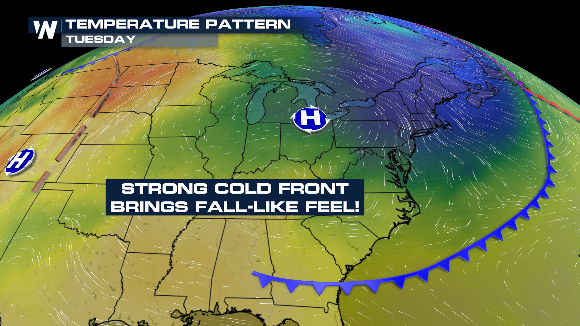
Strong storms continue to move along a cold front from the Mid-Atlantic to the Northeast this Labor Day weekend. The primary threat with these developing thunderstorms will be the potential for strong damaging winds.
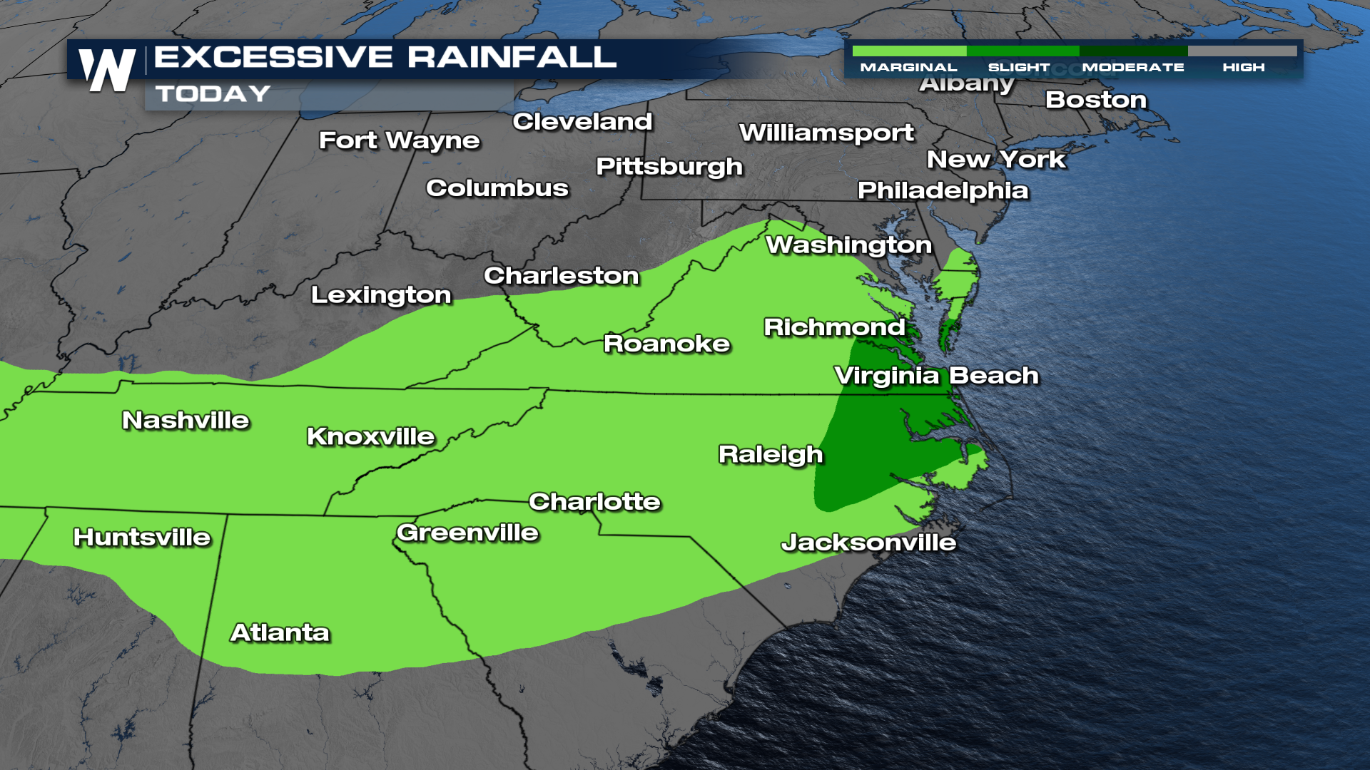
Some of the rain could be heavy in spots on Sunday across the Mid-Atlantic. Following the front, Labor Day is looking better with lots of sunshine and drier air moving in. However, there will still be isolated instances of flooding as the front lingers for portions of the Carolinas.

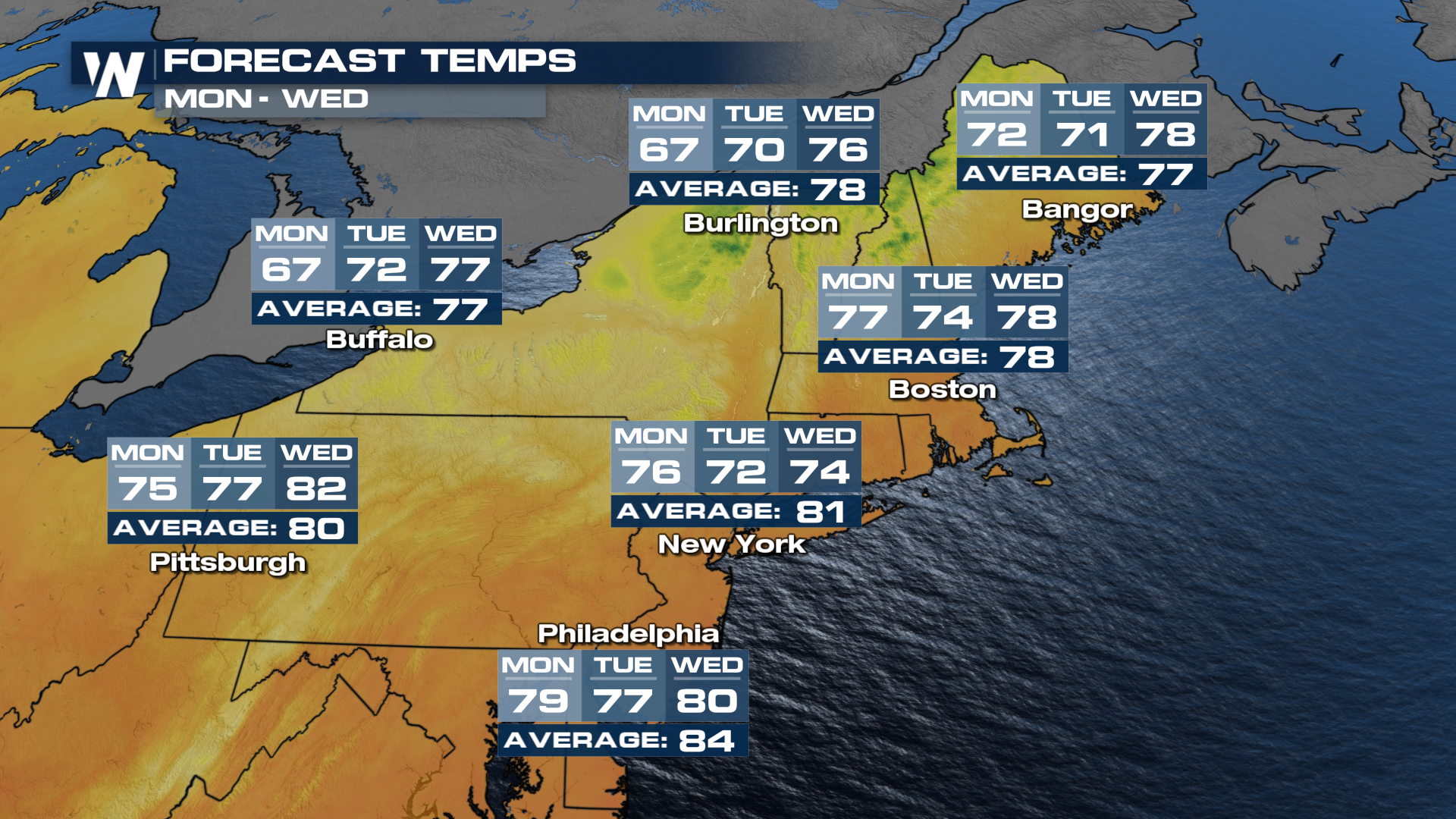
Behind the front, cooler air will pull in. Temperatures will feel more like fall!
 Expect some areas to even drop below average!
 For more on your full eastern regional forecast, tune in to WeatherNation :10 past the hour.
All Weather News
More