Storms linger for the Southeast
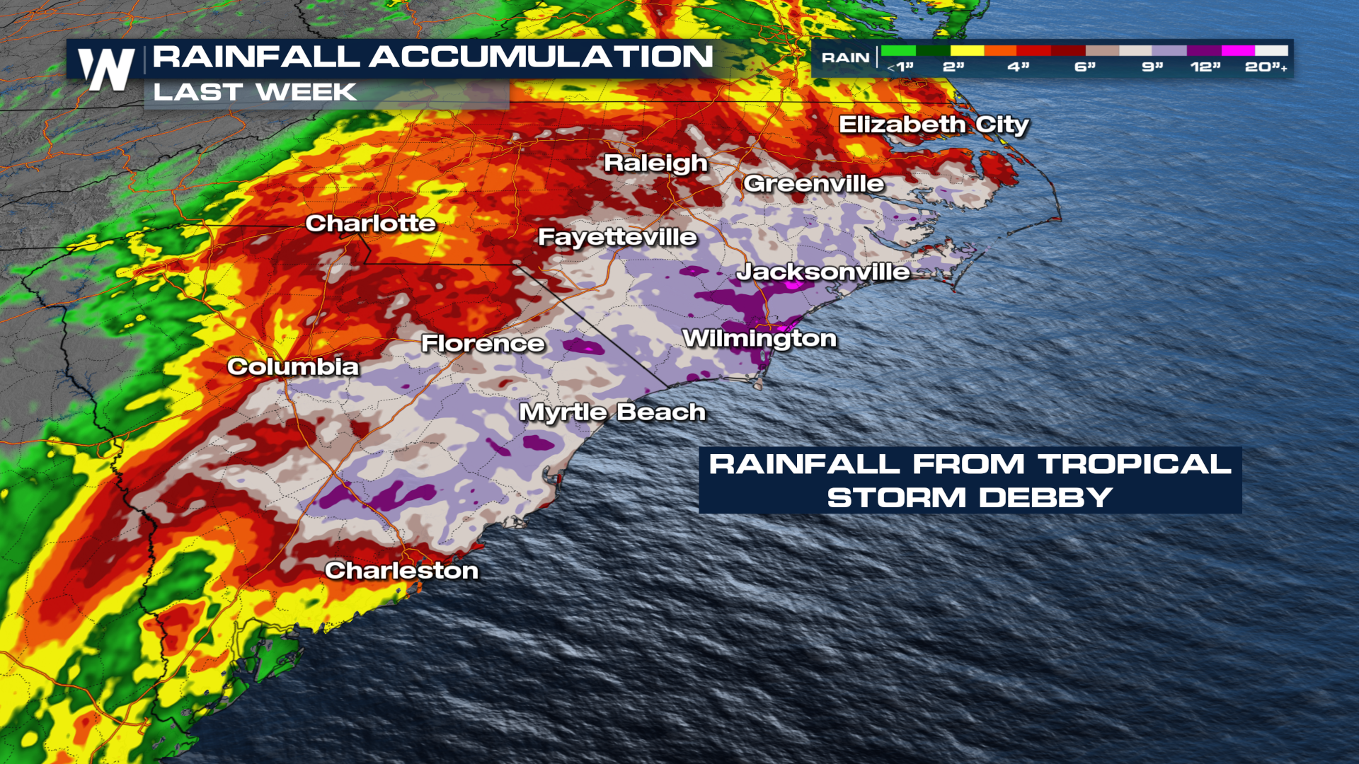
Tropical Storm Debby dumped a serious amount of rainfall in the Carolinas last week. The same frontal boundary that helped push Debby's remnants farther to the north and out of the south stalled over the southeastern U.S. and continued the heavy rainfall into the early workweek. Both Wilmington, NC, and Charleston, SC have seen over a FOOT of rain so far this month, and we're only in the middle of August.
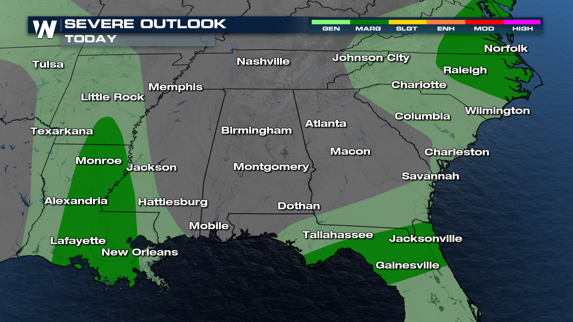
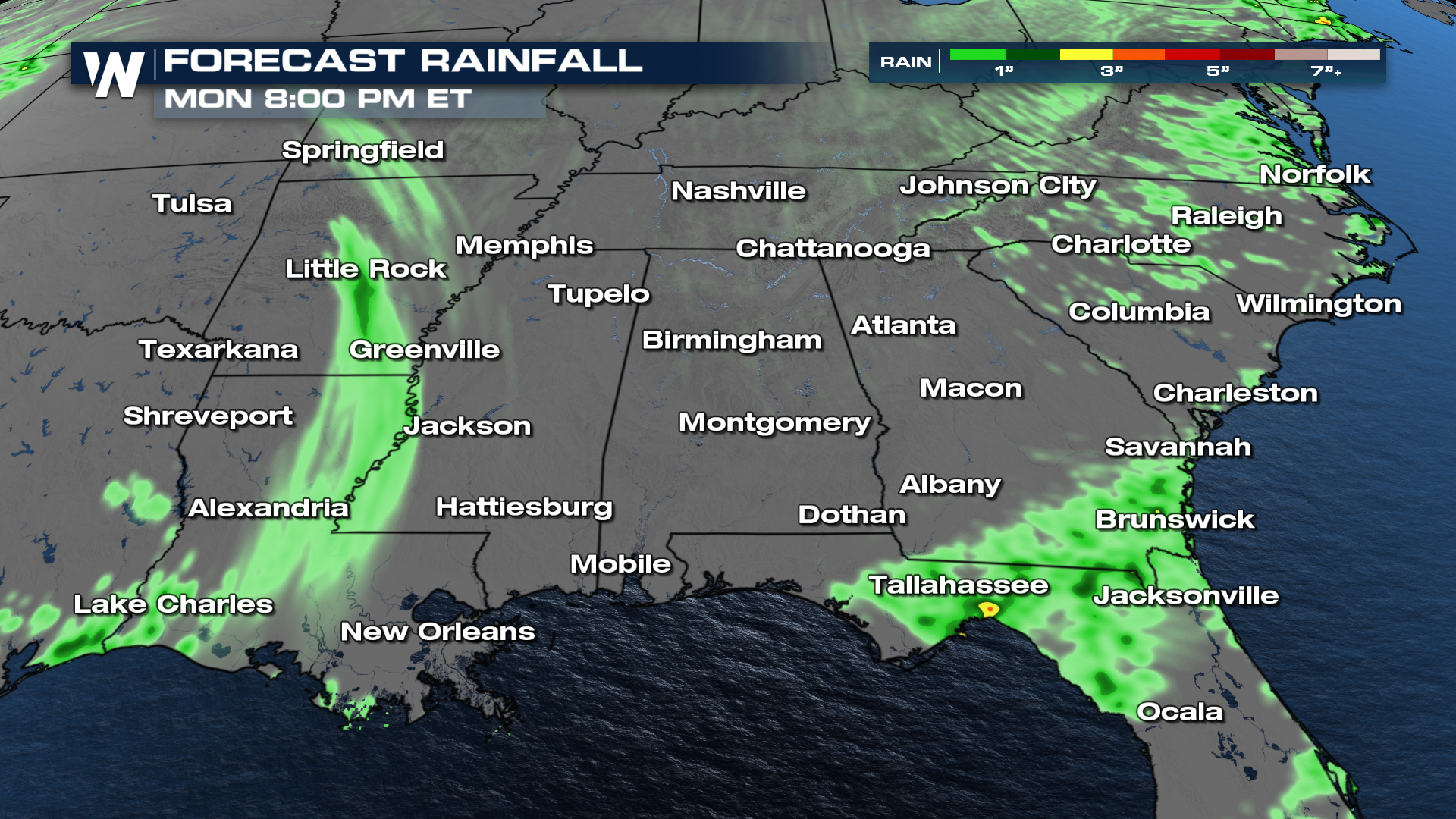
 A front will be moving farther south this Monday with cooler and drier air expected behind the front. Strong storms are expected along the boundary each day through Monday before the front loses energy. The greatest chance for storms to continue is expected to occur primarily in the afternoons, though complexes of thunderstorms may persist overnight in this warm/moist environment.
Strong winds are expected to be the primary threat on Monday. Flooding is another threat, with isolated hail and tornadoes not out of the question.
 River flooding is still an issue in the Carolinas. Since the region is highly saturated, renewed flooding could be an issue with additional rain showers and storms. Additional rainfall totals between 1-3" is possible, so additional rainfall exacerbates flooding concerns.
 Get the latest forecast for the Southeast, or any region of the country, live on WeatherNation or on demand anytime with the WeatherNation app.