A Look at Monday's Tornadoes in the Southern Plains
Special Stories
20 May 2019 3:39 PM
The Storm Prediction Center (SPC) issued a HIGH RISK for severe weather on Monday (May 20, 2019) as a tornado outbreak was looking very likely. This was the first time since May 2017 that the SPC issued such an outlook. By Monday afternoon the forecast began to verify.
Numerous rotating supercell thunderstorms popped up across west Texas and Oklahoma. Tornadoes, damaging wind, large hail, heavy rain, and frequent lightning dotted the landscape of the southern Plains.
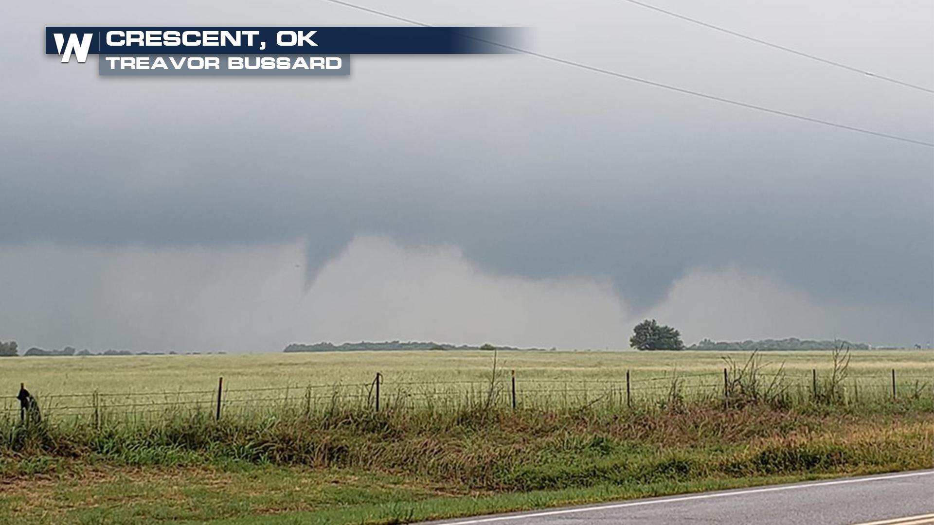
Here's a look at some of the storms caught on camera.
https://twitter.com/WeatherNation/status/1130566623381737473
The first tornado of the event was observed in Cottle County, Texas near the community of Paducah.
[playlist type="video" ids="107913"]
Other strong storms popped up in neighboring Oklahoma with visible rotation in the clouds.
[playlist type="video" ids="107914"]
Many storms contained sizable hail, including storms that passed through Keystone Lake, Oklahoma.
https://twitter.com/WeatherNation/status/1130563718217998336
Heavy downpours also led to the threat of flash flooding in this region as well.
[playlist type="video" ids="107915"]
[playlist type="video" ids="107917"]
Be sure to check back for updates. In the meantime, follow WeatherNation online and on social media (FACEBOOK & TWITTER) for more information and wild weather video.
All Weather News
More
Major River Flooding Causes Damage; Another Day of Storms in New Mexico
A powerful low pressure system has been movin
26 Oct 2026 1:00 AM

Mount Slushmore? Taking a look at Dakota Snow Chances
The cooler weather is finding places to go fi
26 Oct 2026 12:10 AM

Tropical Storm Vance Swirling in the Pacific, Olana Forms East of Hawaii
After becoming a hurricane Friday, Vance has
26 Oct 2026 12:00 AM

Sunny Day Flooding; King Tides Surge This Week
This week, the ocean is coming to low lying a
25 Oct 2026 8:55 PM

Warmer Than Average: Above-Normal Temperatures Across the Central U.S. This Week
WHAT TO EXPECTA ridge of high pressure linger
25 Oct 2026 10:15 AM


Several Fires Break Out in SoCal Last Week Amid Santa Ana Wind Event
Santa Ana winds helped several fires grow qui
19 Oct 2026 1:25 PM