Accumulating Snow This Weekend From the High Plains to Great Lakes
Special Stories
2 Feb 2018 3:35 PM
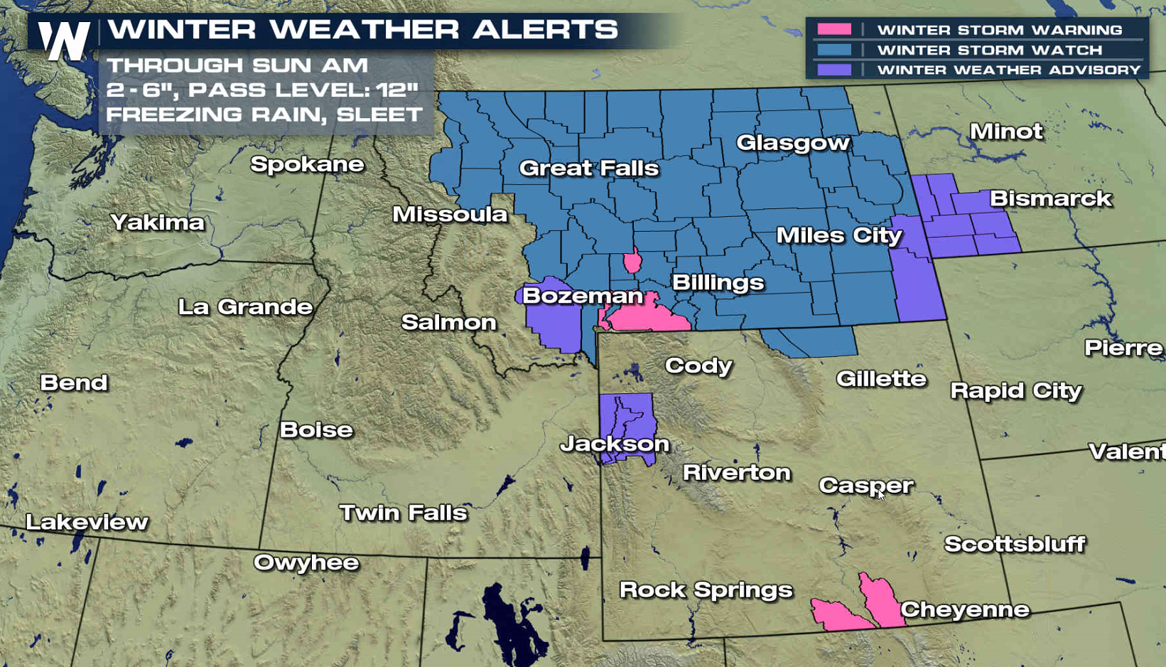
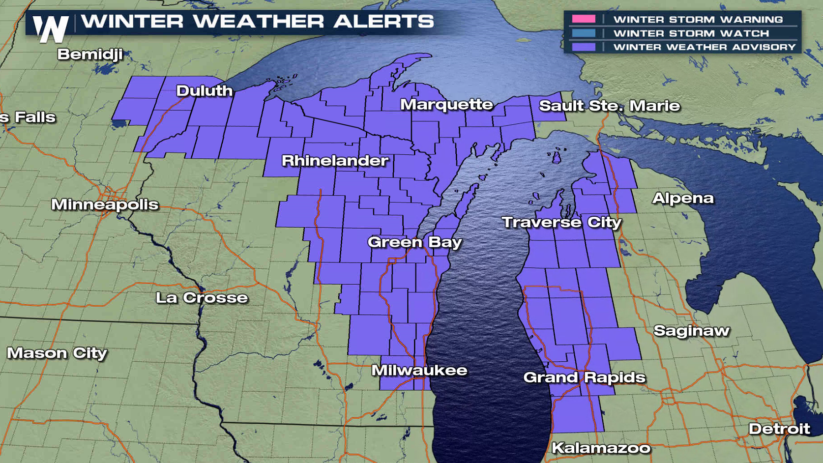
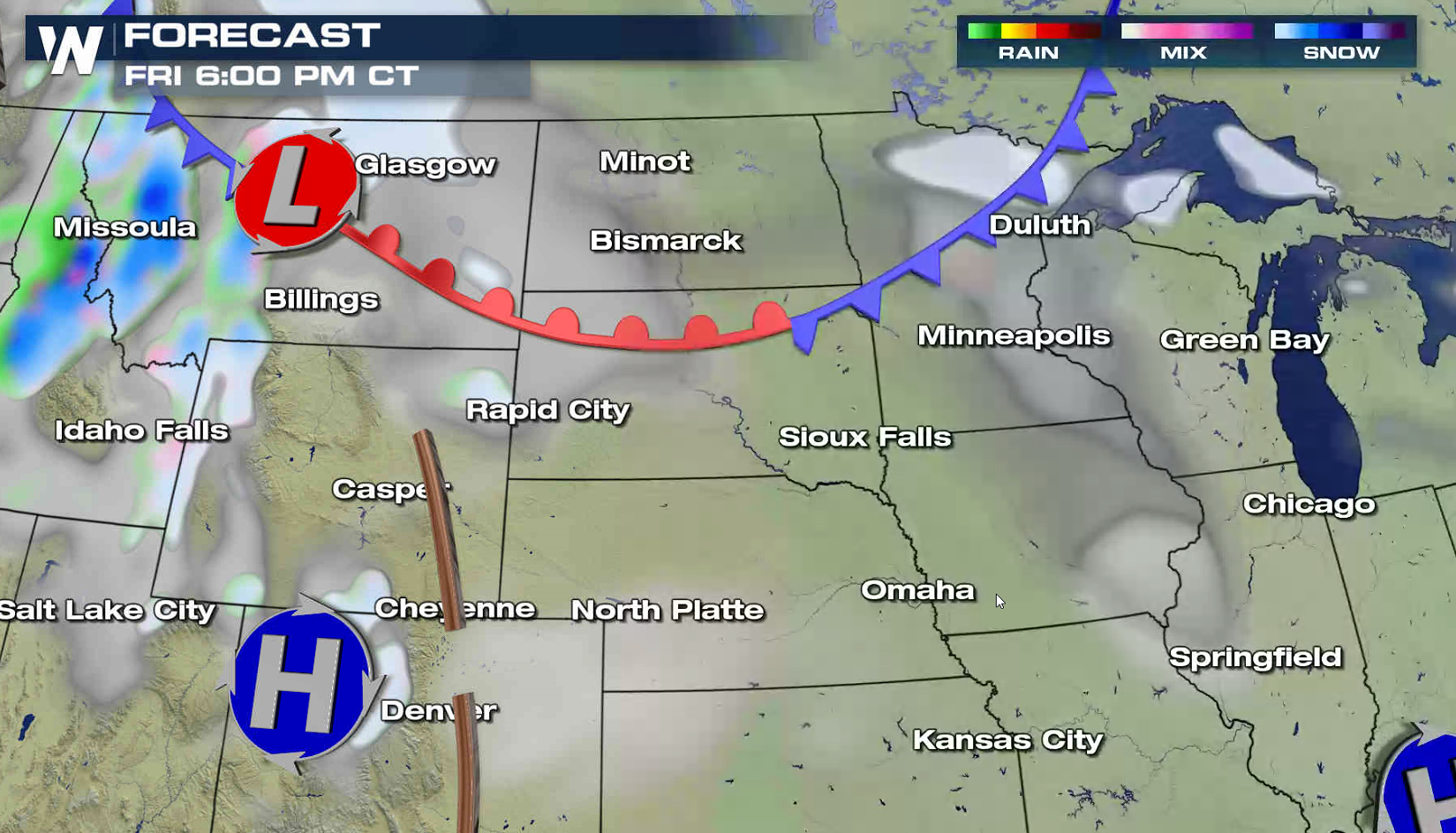
A series of fast moving storm systems will move from the High Plains to the Great Lakes this weekend, spreading fluffy snow over the region. A few areas could see as much as 6", with the highest mountain peaks approaching a foot. Some sleet and freezing rain is possible in Montana. Winter weather alerts extend from Wyoming to Michigan.
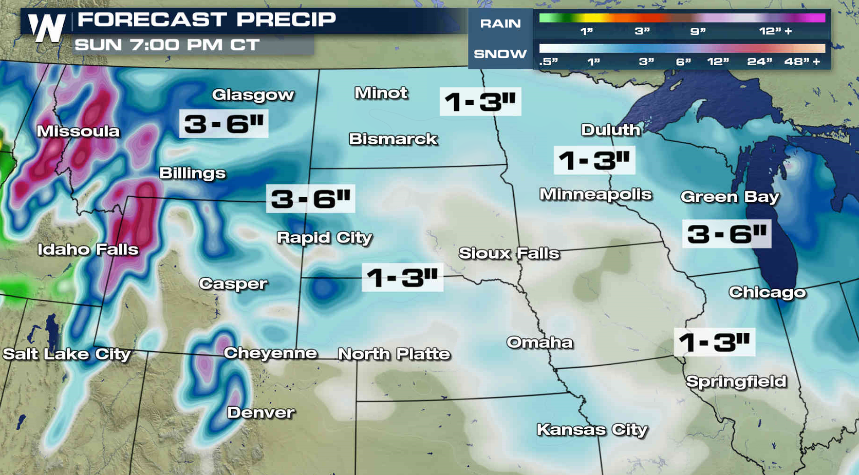
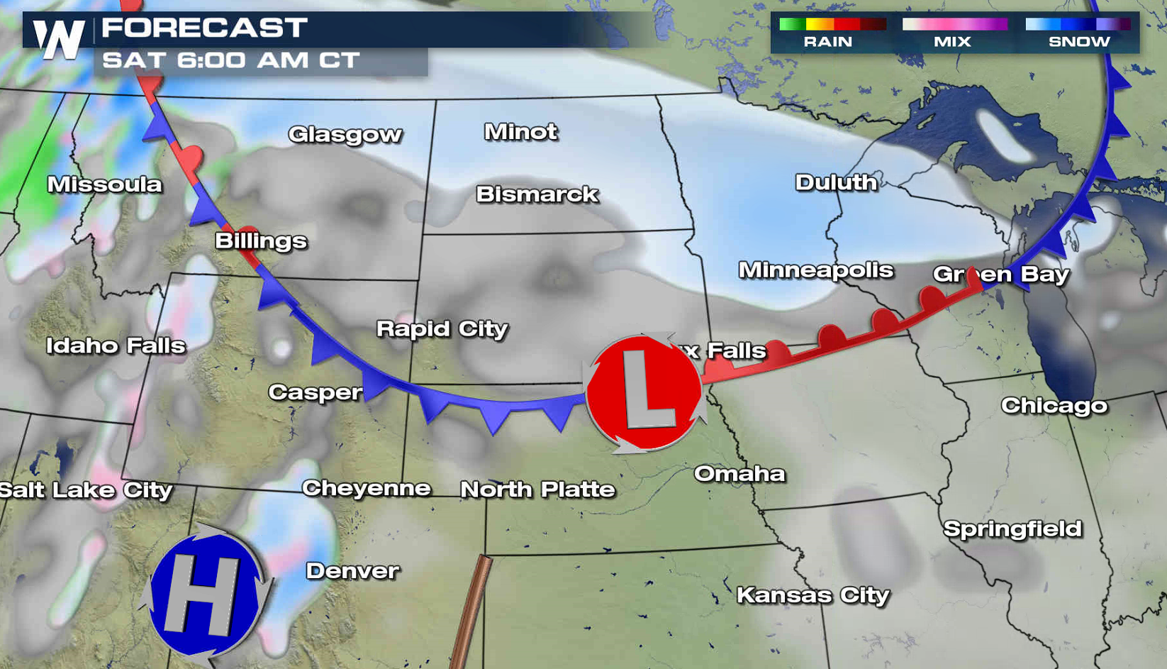
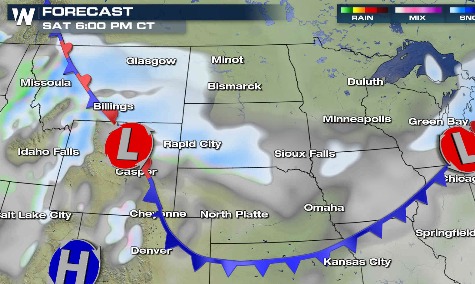
 The first low will push out of Canada this evening and across the Northern Plains Saturday morning. This will bring the first wave of precipitation to the area. The second low will develop near the Tetons Saturday and push into the Great Lakes Sunday, producing additional accumulations throughout the region.
The first low will push out of Canada this evening and across the Northern Plains Saturday morning. This will bring the first wave of precipitation to the area. The second low will develop near the Tetons Saturday and push into the Great Lakes Sunday, producing additional accumulations throughout the region.
All Weather News
More
Severe Storms in the Midwest Could Dampen Holiday Plans
NORTHERN PLAINS - A frontal system is expecte
4 Jul 2025 3:20 AM

Near Seasonal Temperatures for Many Come July 4th!
AAA is expecting over 70 million travelers to
4 Jul 2025 3:15 AM

NHC Monitoring Front in the Southeast Ahead of 4th of July
Tropical downpours for a long holiday weekend
4 Jul 2025 3:10 AM

Flossie is No More, Eastern Pacific Remains Active
Post Tropical FlossieThe National Hurricane C
4 Jul 2025 3:05 AM


Northwest Heat Met With Thunderstorm Risk
NORTHWEST - Today, portions of Montana are un
3 Jul 2025 12:00 AM

Severe Weather Threat Continues in the Midwest
It has been an active, severe season across t
30 Jun 2025 9:00 PM