An Active Severe Weather Week Ahead
Special Stories
26 Mar 2018 9:36 AM
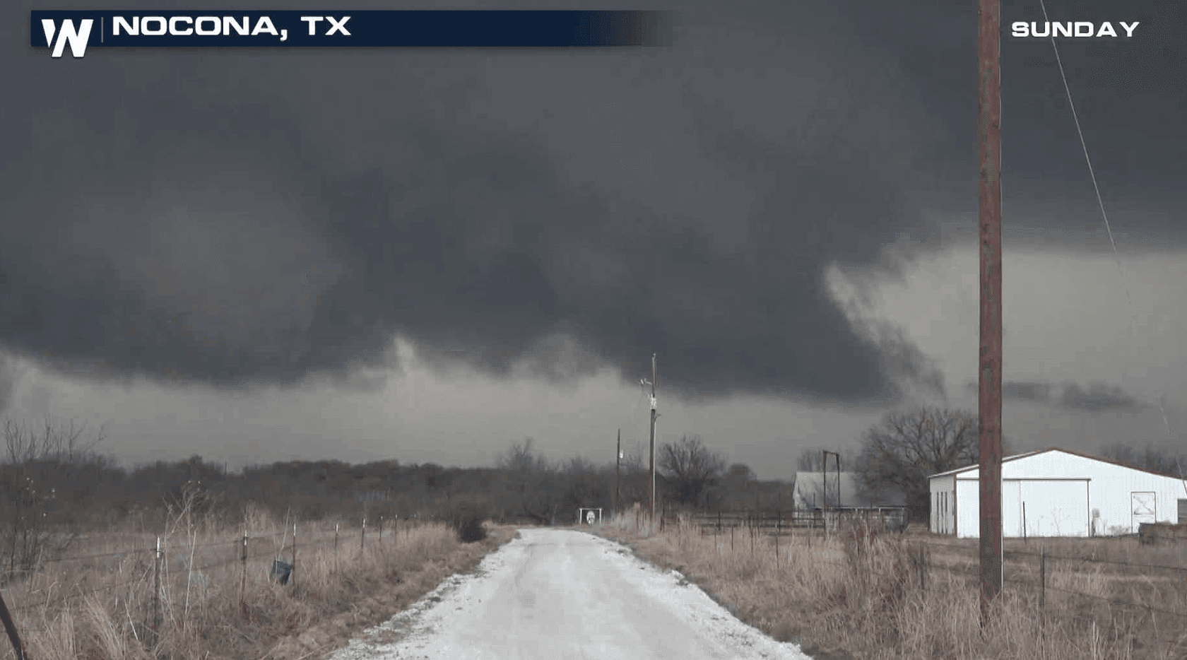
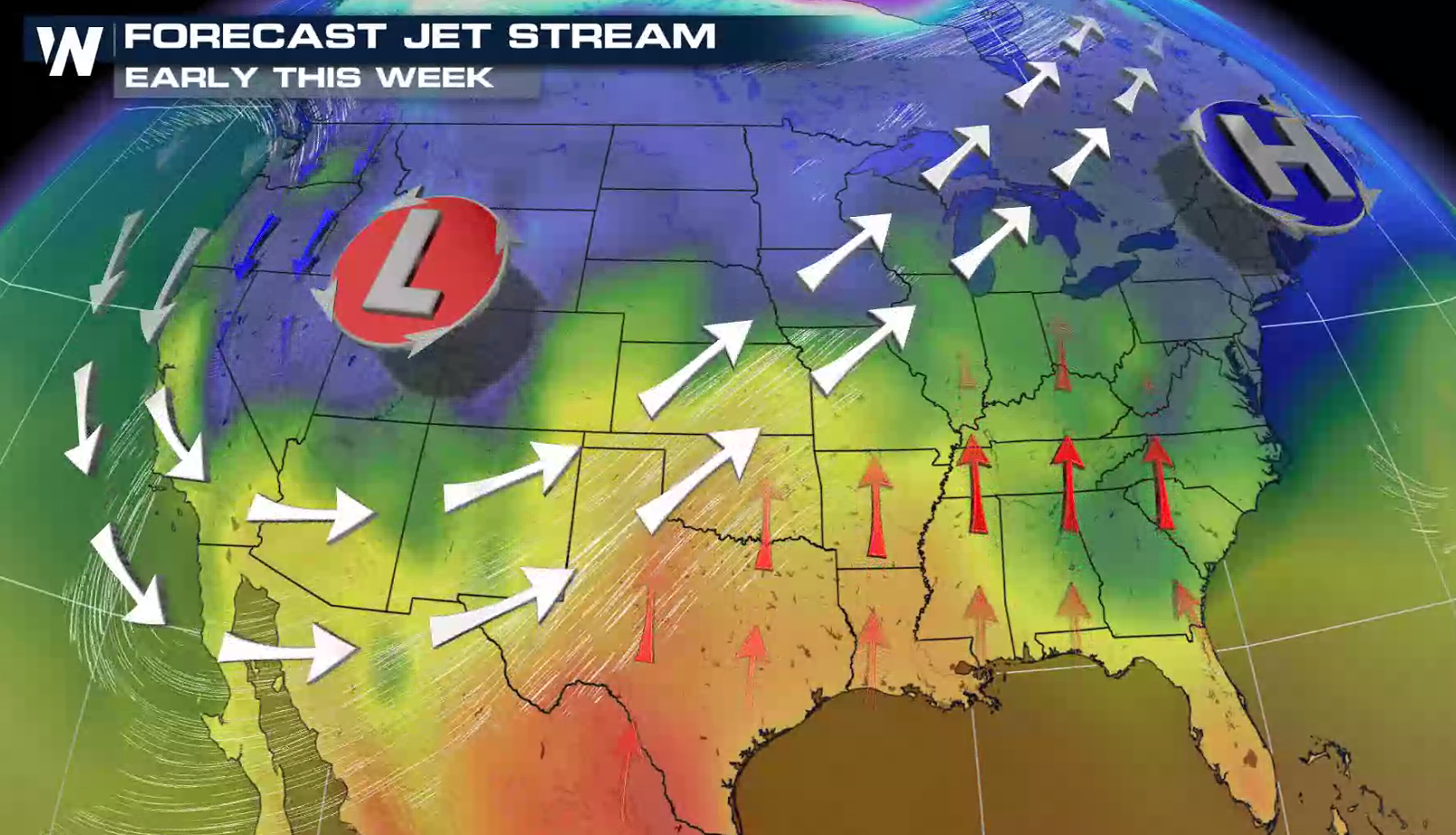
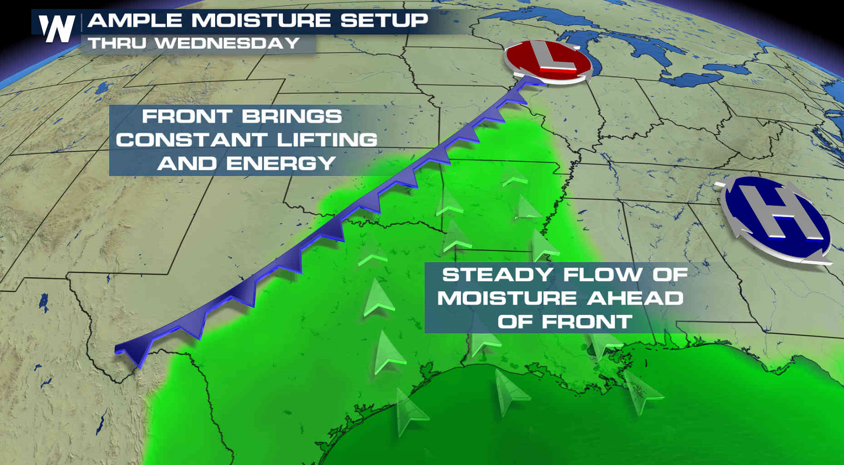
An active pattern is setting up across the southern Plains and Mississippi Valley this week for the potential of severe thunderstorms. The Storm Prediction Center has a risk for nearly every day. A strong, digging Jet Stream coupled with a slow moving front will be the focus for storm development. Abundant humidity flowing in from the Gulf of Mexico along with warmer temperatures will help to fuel severe storms this week.
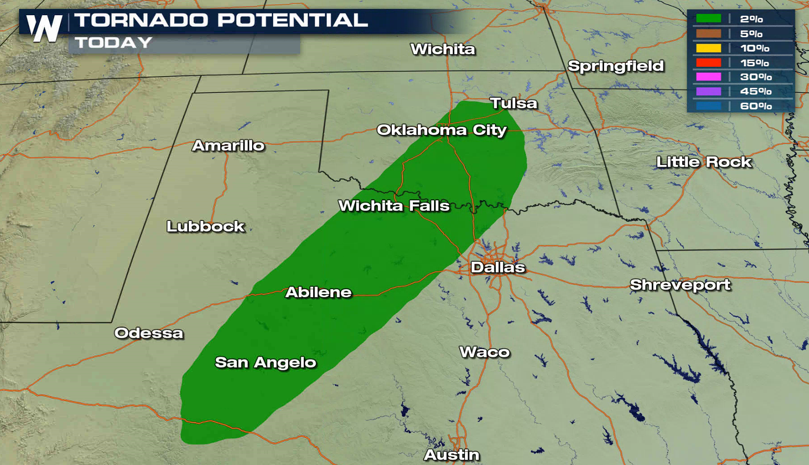
 The Storm Prediction Center upgraded the outlook and there is now an enhanced risk for severe thunderstorms for Monday.
https://www.facebook.com/WeatherNation/posts/10156374003344874
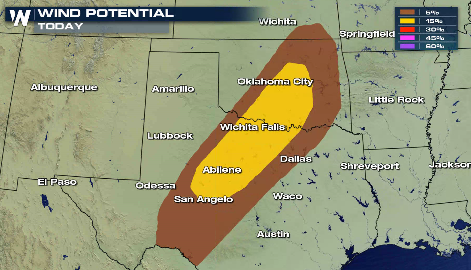
The tornado potential is low today due to weak low-level wind shear. Large hail greater than an inch in diameter and strong wind gusts higher than 60 mph are the more significant severe weather threats.
The Storm Prediction Center upgraded the outlook and there is now an enhanced risk for severe thunderstorms for Monday.
https://www.facebook.com/WeatherNation/posts/10156374003344874
The tornado potential is low today due to weak low-level wind shear. Large hail greater than an inch in diameter and strong wind gusts higher than 60 mph are the more significant severe weather threats.
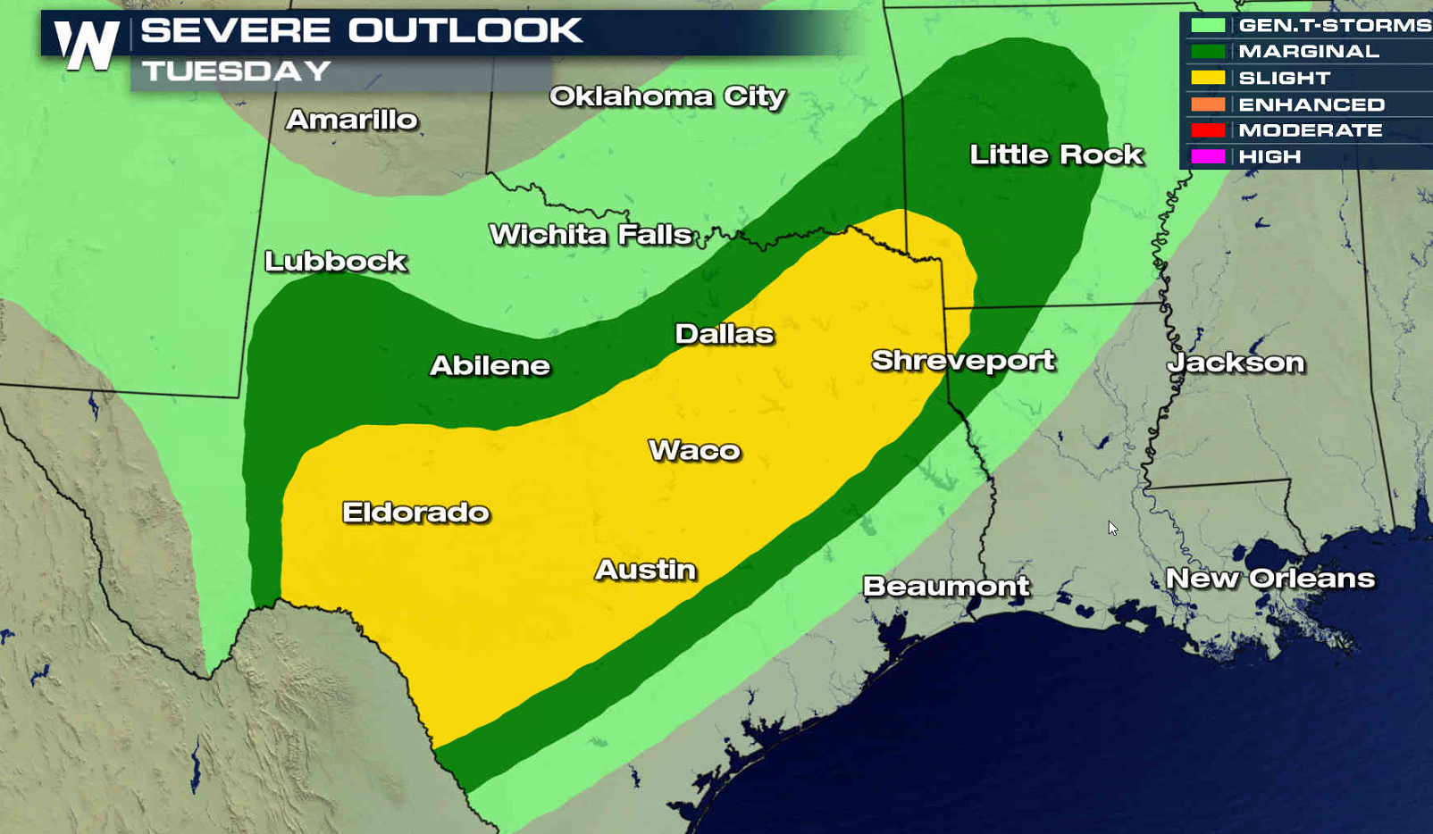
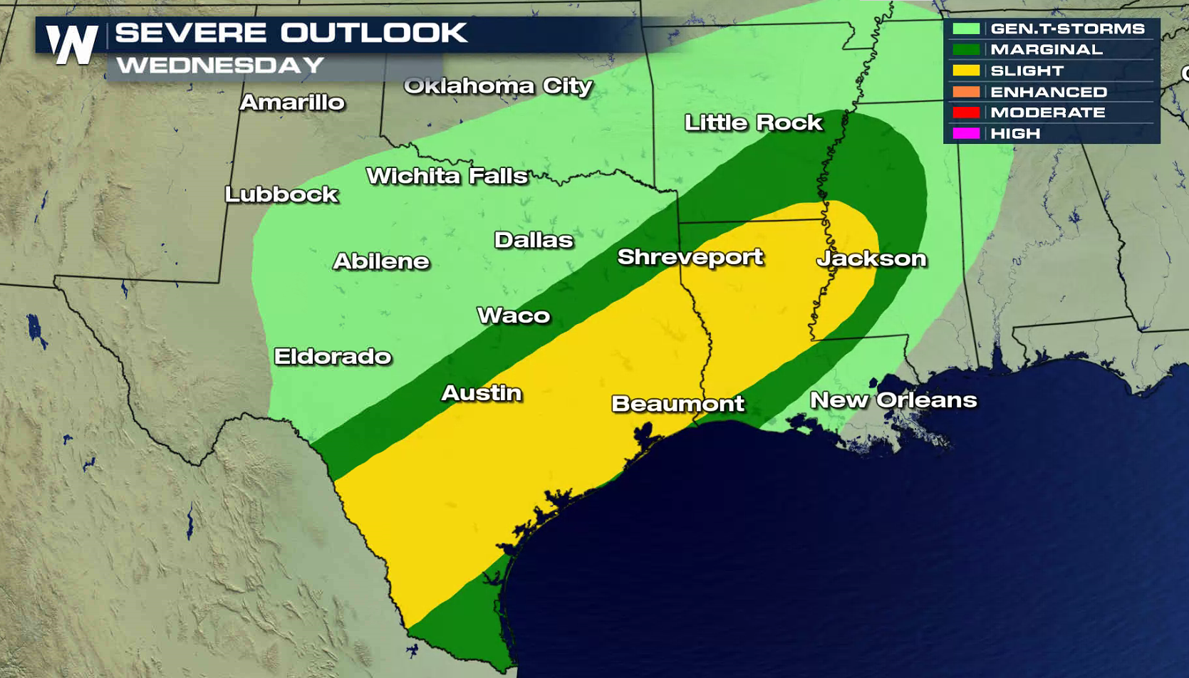
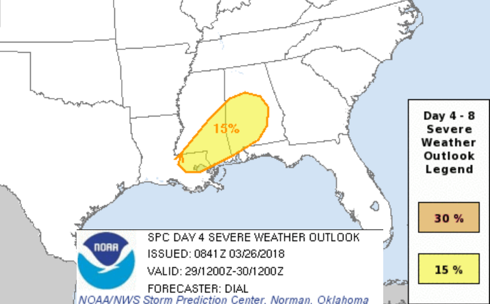
 The severe weather risk area shifts slightly southward on Tuesday from the Arklatex to the Mexican Border. As the cold front slowly pushes to the south Wednesday, the threat region moves to along the Gulf of Mexico from Texas to Mississippi.
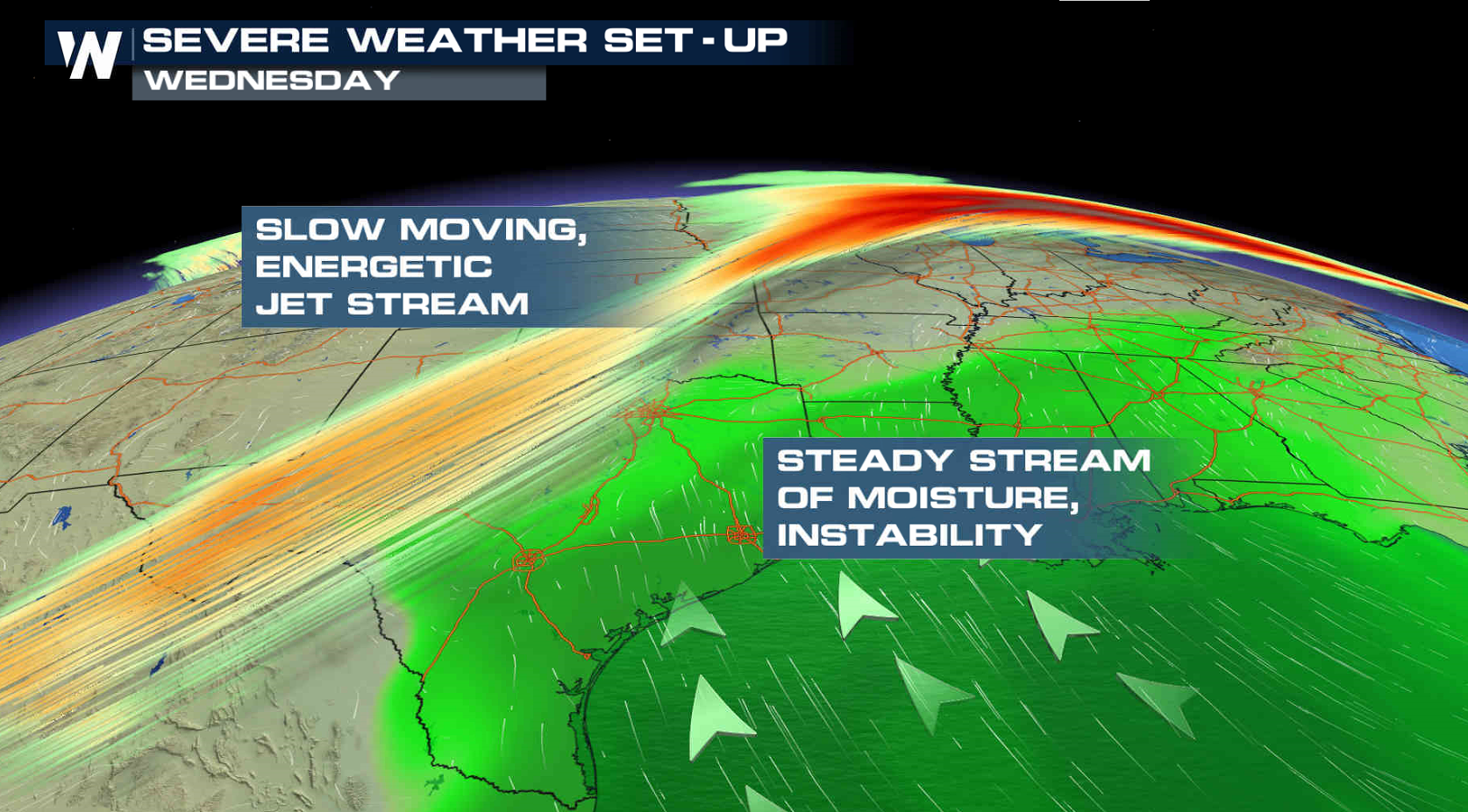 The Jet Stream will remain strong and humidity levels high for Wednesday into Thursday, keeping the severe weather threat in the forecast. Stay tuned to WeatherNation on-air and online for severe weather forecasts and live reports in the field all week.
 For WeatherNation: Meteorologist Mace Michaels
The Storm Prediction Center upgraded the outlook and there is now an enhanced risk for severe thunderstorms for Monday.
https://www.facebook.com/WeatherNation/posts/10156374003344874
The tornado potential is low today due to weak low-level wind shear. Large hail greater than an inch in diameter and strong wind gusts higher than 60 mph are the more significant severe weather threats.
The severe weather risk area shifts slightly southward on Tuesday from the Arklatex to the Mexican Border. As the cold front slowly pushes to the south Wednesday, the threat region moves to along the Gulf of Mexico from Texas to Mississippi.
The Jet Stream will remain strong and humidity levels high for Wednesday into Thursday, keeping the severe weather threat in the forecast. Stay tuned to WeatherNation on-air and online for severe weather forecasts and live reports in the field all week.
For WeatherNation: Meteorologist Mace MichaelsAll Weather News
More
Wildfire Outbreak in the Pacific Northwest
SPOKANE, WA - On Saturday, August 1st, the Ol
3 Aug 2026 1:55 AM

More Storms for the East Through Monday
A low-pressure system that moved through the
3 Aug 2026 1:50 AM


After Reaching Category 5, Genevieve Weakens in the Pacific
PacificGenevieve formed last Friday south of
3 Aug 2026 12:30 AM

Flooding, Severe Storms Target the Midwest Again
After an active week of storms across the nor
1 Aug 2026 1:40 AM

Flooding Risk Increases as Heavy Rain Targets the Tri-State Area
Tuesday, heavy rainfall moved across the Nort
30 Jul 2026 12:25 AM

Severe Weather: Energy From the Midwest Now in the Southeast
UPPER MIDWEST - Through Monday, dangerous tor
29 Jul 2026 10:30 PM