Active Weather Pattern Continues in the Northwest
Top Stories
13 Dec 2019 9:00 AM
A strong upper-level system moving into the Pacific Northwest is bringing strong winds, heavy rain and mountain snow. Areas in Washington, Oregon and Northern California could have rain chances that last through the upcoming weekend. Heavy snow will fall from the Cascades to the Rockies. Here is the very latest:
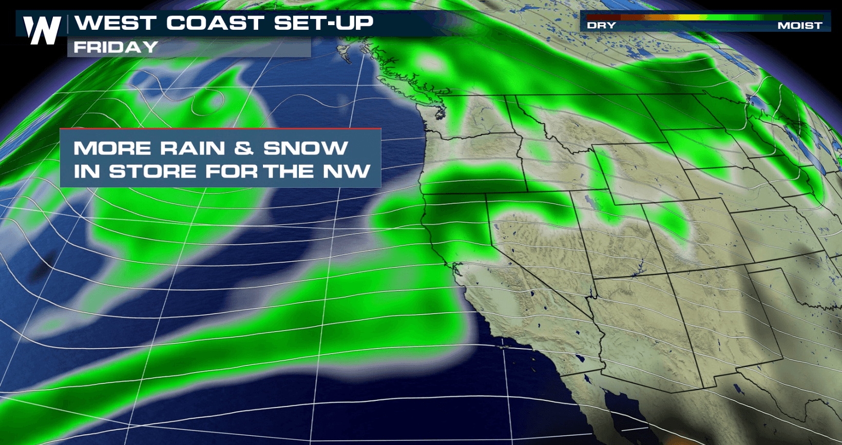
 Additional energy aloft in the Gulf of Alaska and the northern Pacific will come together and move into the Northwest. As moisture is pushed up into the cold air of the higher elevations, heavy snow will fall. Winter alerts extend from the Cascades to the Rockies.
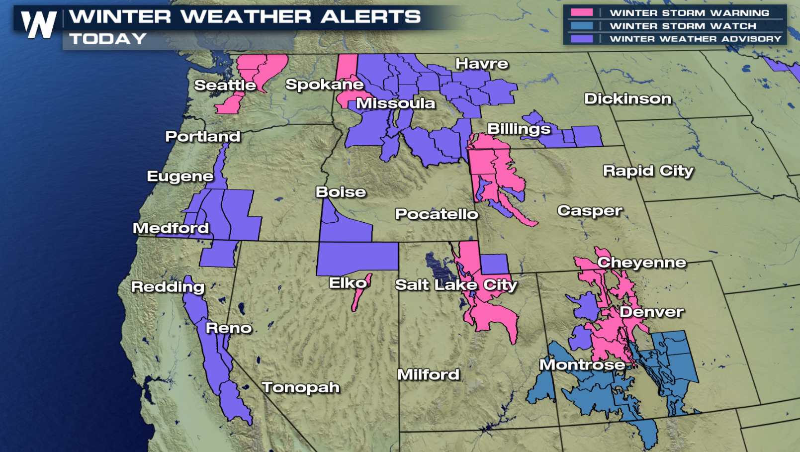
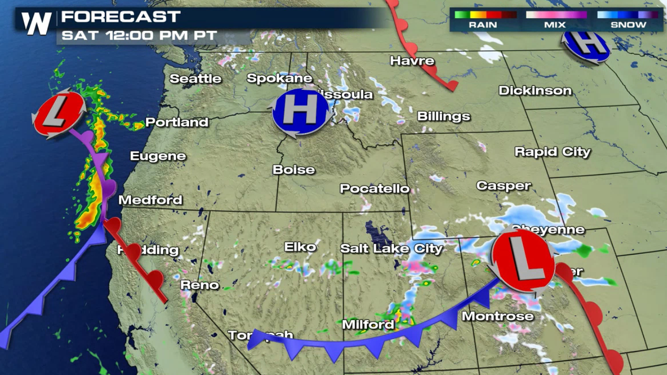
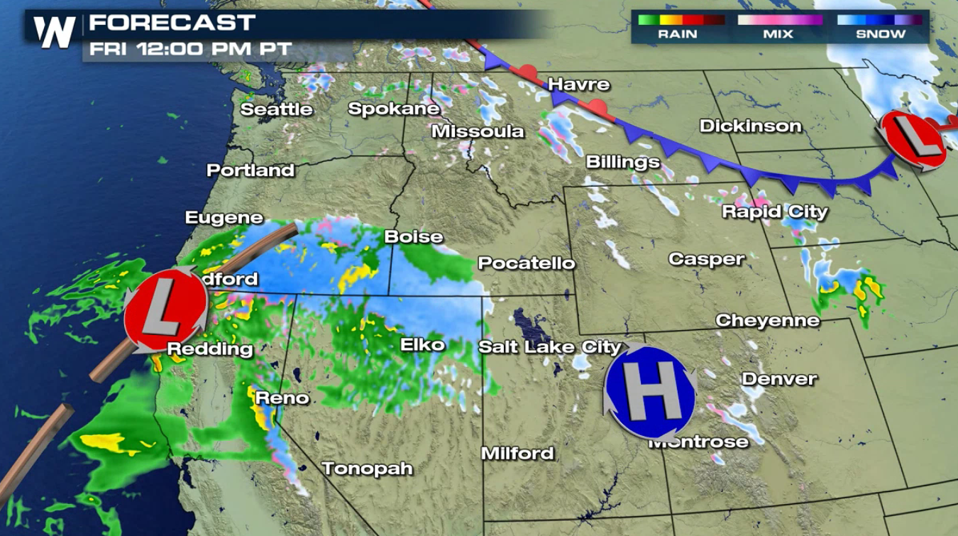 A weakening front is swinging through the Northwest today (Friday), producing showers from California to Washington. There could be some isolated pockets of heavy rain, but the stronger energy will be arriving this weekend. Snow will be spread throughout the higher elevations.
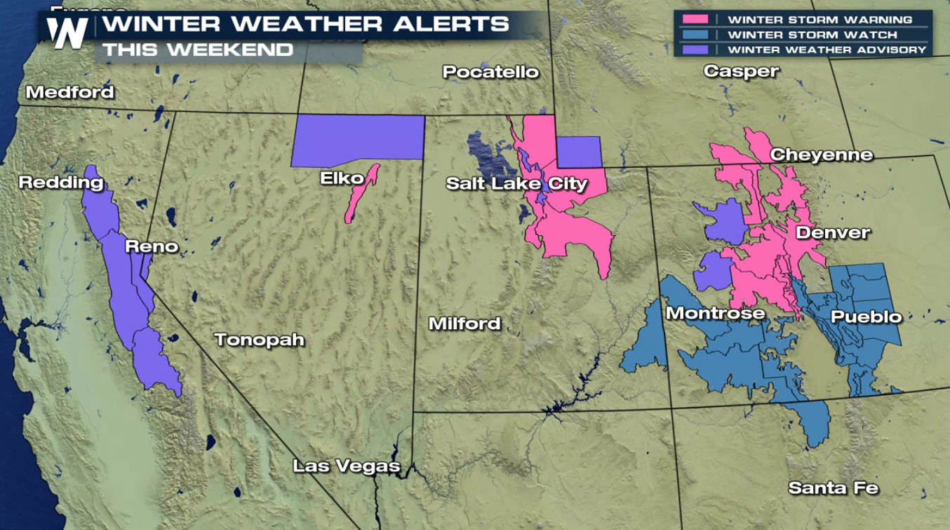
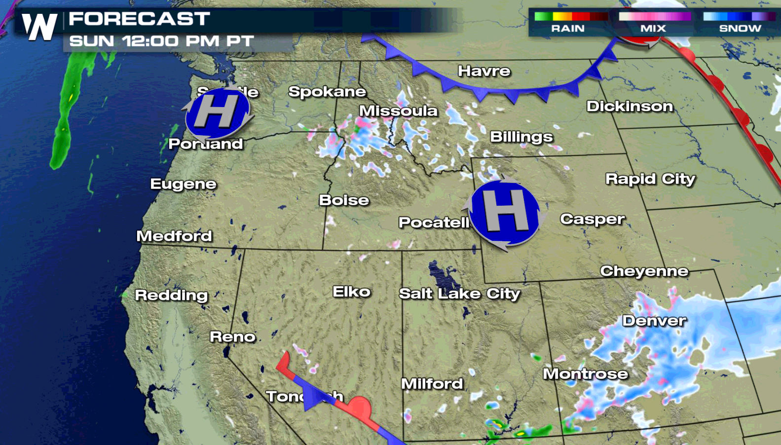
 With the slow moving aspect of this storm system, the precipitation chances will last through this weekend. By later Sunday, rain and snow will become more scattered and not as widespread.
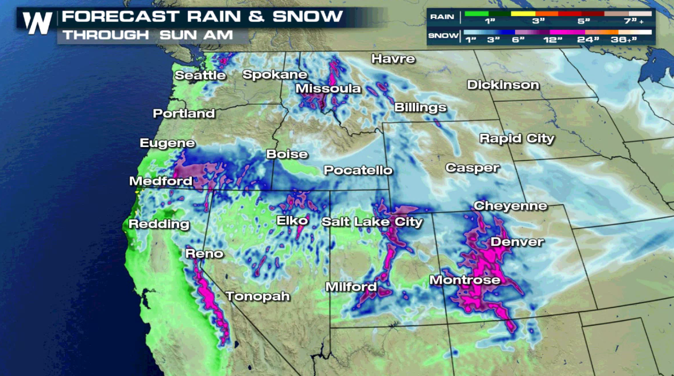
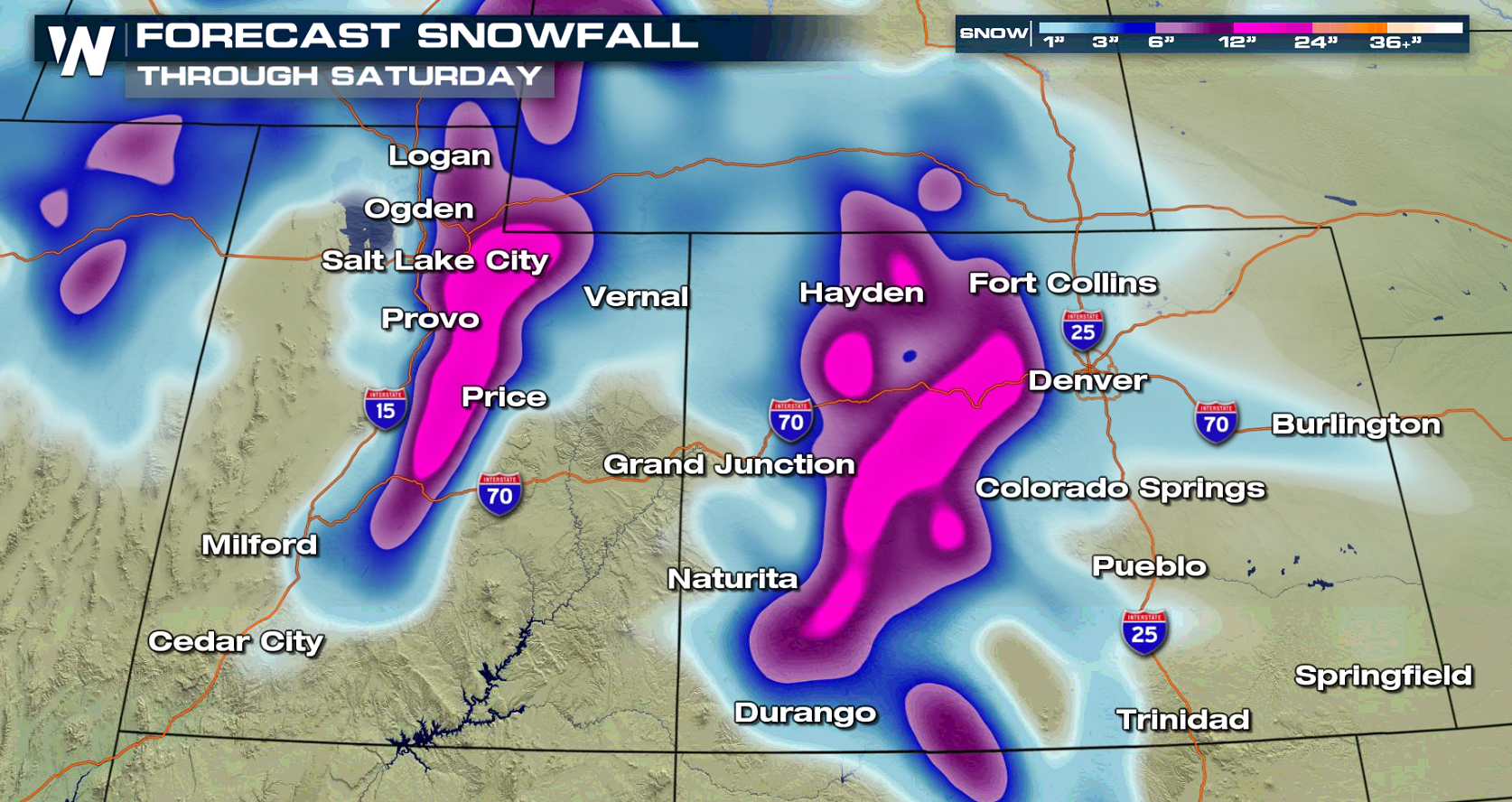
Some high snowfall will be possible from the Cascades to the Rockies. The Wasatch and Rockies will see well over a foot of snow.
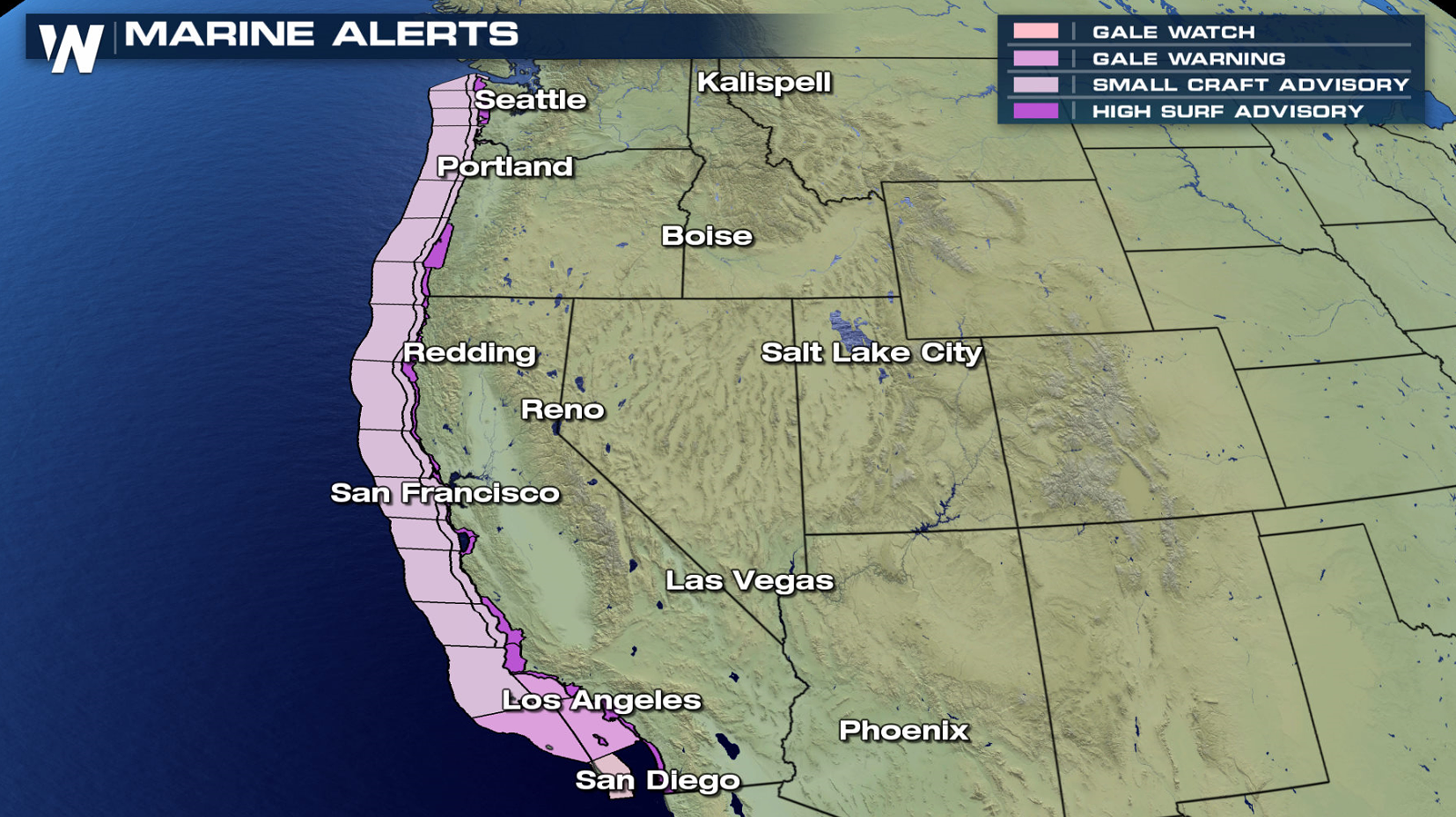 The other weather variable this setup will provide will be the strong winds. The strongest winds will likely be over the open waters of the Pacific where wind speeds will range from 40 to 50 knots. Areas along the coast of Washington and Oregon could have rough seas and dangerous surf. Marine alerts and high surf advisories have been issued as the system approaches.
As always, WeatherNation will keep you up to date with the very latest on this storm. System. Curious how you can stream our 24/7 weather coverage? Just click on this link to see--->WeatherNation Stream
The other weather variable this setup will provide will be the strong winds. The strongest winds will likely be over the open waters of the Pacific where wind speeds will range from 40 to 50 knots. Areas along the coast of Washington and Oregon could have rough seas and dangerous surf. Marine alerts and high surf advisories have been issued as the system approaches.
As always, WeatherNation will keep you up to date with the very latest on this storm. System. Curious how you can stream our 24/7 weather coverage? Just click on this link to see--->WeatherNation Stream
Alerts
Additional energy aloft in the Gulf of Alaska and the northern Pacific will come together and move into the Northwest. As moisture is pushed up into the cold air of the higher elevations, heavy snow will fall. Winter alerts extend from the Cascades to the Rockies.
Forecast
A weakening front is swinging through the Northwest today (Friday), producing showers from California to Washington. There could be some isolated pockets of heavy rain, but the stronger energy will be arriving this weekend. Snow will be spread throughout the higher elevations.
With the slow moving aspect of this storm system, the precipitation chances will last through this weekend. By later Sunday, rain and snow will become more scattered and not as widespread.
Snowfall and Rainfall Potential
Wind Forecast
The other weather variable this setup will provide will be the strong winds. The strongest winds will likely be over the open waters of the Pacific where wind speeds will range from 40 to 50 knots. Areas along the coast of Washington and Oregon could have rough seas and dangerous surf. Marine alerts and high surf advisories have been issued as the system approaches.
As always, WeatherNation will keep you up to date with the very latest on this storm. System. Curious how you can stream our 24/7 weather coverage? Just click on this link to see--->WeatherNation Stream
All Weather News
More
East Gears Up for Stormy, Wet Weekend
A low pressure system crashing through the Mi
1 Aug 2026 11:35 AM


Flooding, Severe Storms Target the Midwest Again
After an active week of storms across the nor
1 Aug 2026 1:40 AM


After Reaching Category 5, Genevieve Weakens in the Pacific
PacificFausto is now a post-tropical cyclone.
31 Jul 2026 1:30 AM

Flooding Risk Increases as Heavy Rain Targets the Tri-State Area
Tuesday, heavy rainfall moved across the Nort
30 Jul 2026 12:25 AM

Severe Weather: Energy From the Midwest Now in the Southeast
UPPER MIDWEST - Through Monday, dangerous tor
29 Jul 2026 10:30 PM