Sierra to the Rockies: Flooding Rain & Heavy Snow

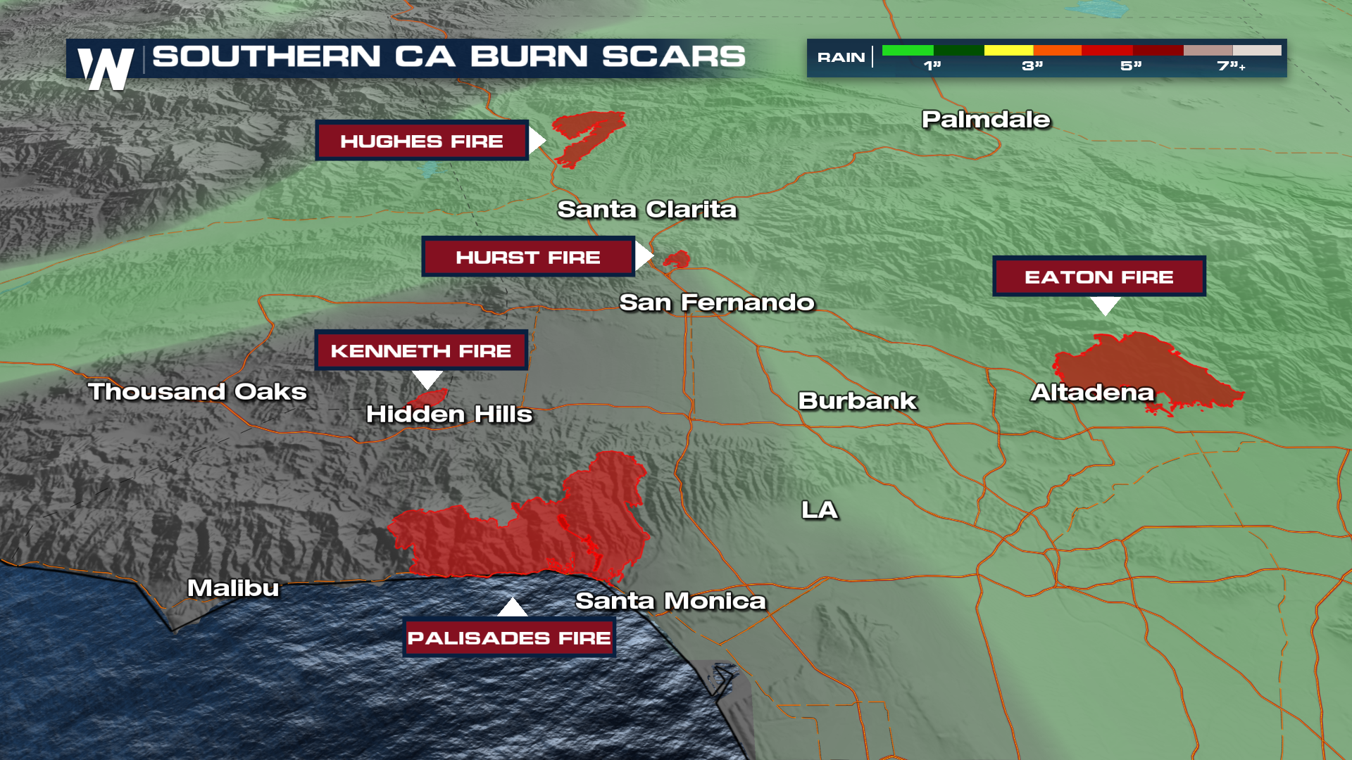
As of Wednesday, all evacuation orders have been lifted for Los Angeles after torrential rain fell over burned areas. The warnings were issued for areas with burn scars from earlier fires, like the Palisades, Hurst, and Sunset fire zones, due to the threat of mud and debris flows. Heavy rainfall, snow, and gusty winds continue to calm down for the southern half of the Golden State as a strong trough continues to move to the northeast.
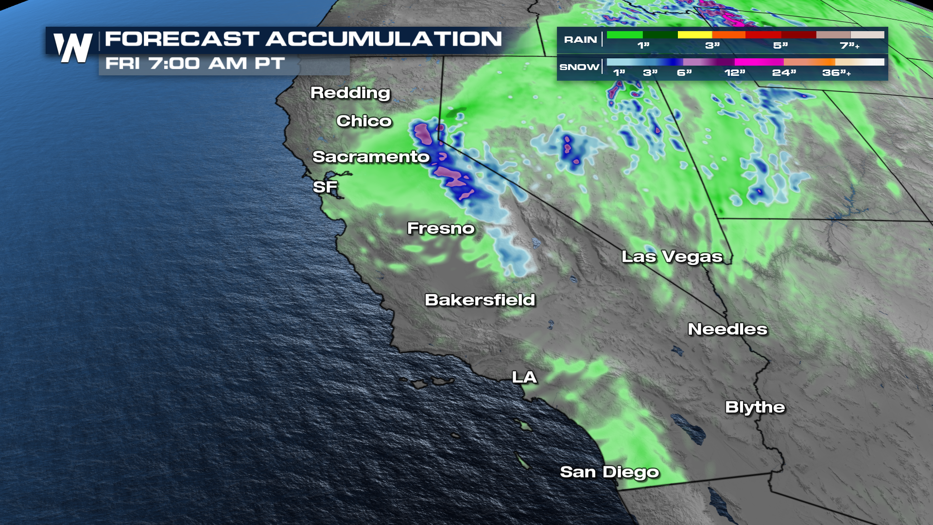
Rainfall reached up to 9 inches in California's Haines Canyon, in southern California. The threat of heavy rainfall and snow moves to the northern half of the state this morning.
Rainfall totals appear impressive for an October storm system in California, considering it is early in the season for such heavy precipitation.
Rain & Flooding
Flash flooding and debris flows will be possible through early Wednesday despite the rain having already happened. The heaviest of the rain has occurred, with storm totals likely having been upwards of 3 inches, which keeps the burn-scarred areas of southern California from recent wildfires at risk.
Snowfall
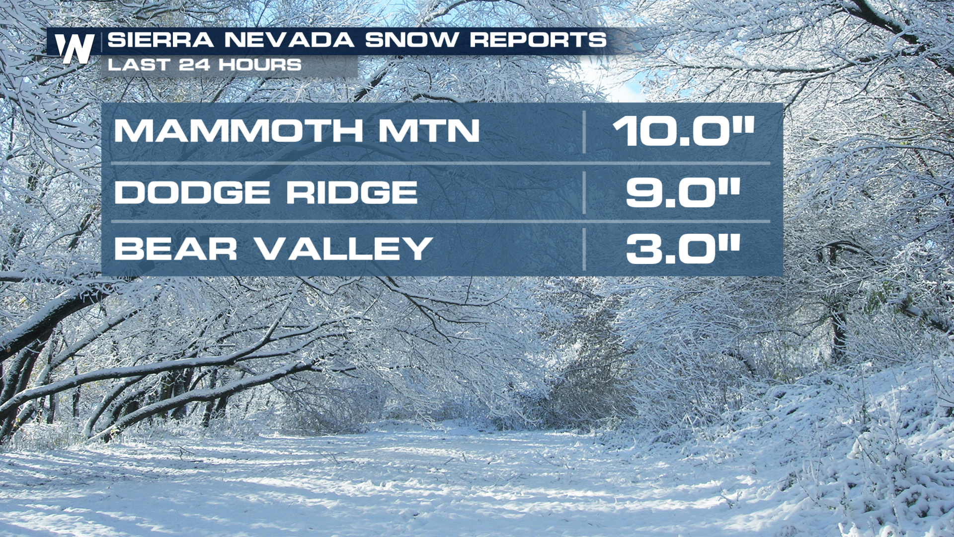
Once this event is complete by Wednesday afternoon, snowfall totals may have topped a foot or even two feet in the high Sierra, while areas around the Donner Pass can expect 6-12 inches at the summit. Here are snowfall totals as of Wednesday AM.
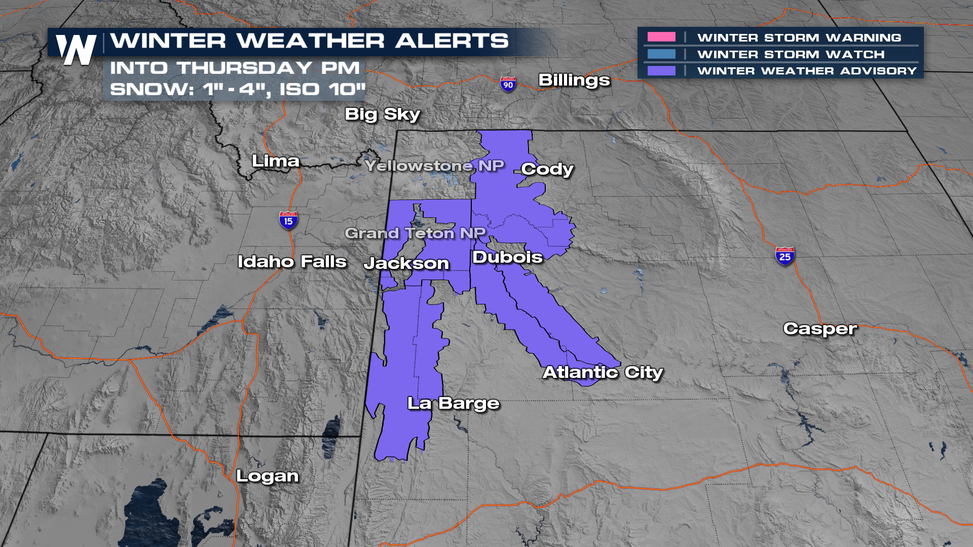
Winter Storm Warnings (Pink) and Winter Weather Advisories (Purple) have now been dropped for the Sierra Nevada Range but more winter alerts have been issued for areas like Jackson, WY as this system lifts to the NE.
Stay with Weather Nation for the latest, with your West Regional forecast every :50 past the hour.


