Active Weather to Start the Week
Top Stories
22 Sep 2018 6:41 PM
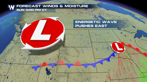
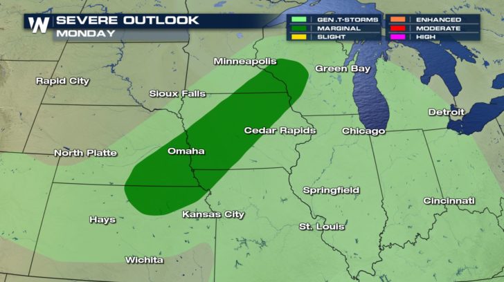
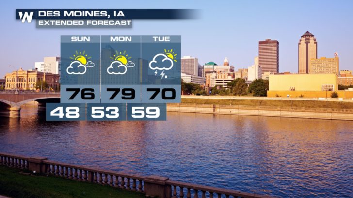
After a very active end to the week for the Upper Midwest, the weekend has been a much needed break. However, things change as the new week begins. Another low pressure system rolls off the Rockies and returns the risk for severe storms Monday afternoon and evening. This risk extends from areas like La Crosse, WI to northern Kansas.
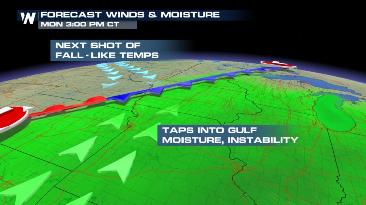
 As this low pressure system moves eastward early this week, warmth and moisture is pumped in from southerly winds. This southerly flow helps to aid in favorable dynamics for severe storms. Behind the cold front associated with this system is much colder air. Where these two contrasting air masses collide is where severe storms will be possible.
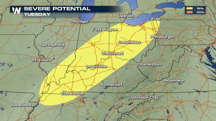
 As the system move east into the Ohio and Tennessee River Valleys on Tuesday, the threat for severe also moves with it.
 For WeatherNation, Meteorologist Kate Mantych
As this low pressure system moves eastward early this week, warmth and moisture is pumped in from southerly winds. This southerly flow helps to aid in favorable dynamics for severe storms. Behind the cold front associated with this system is much colder air. Where these two contrasting air masses collide is where severe storms will be possible.
As the system move east into the Ohio and Tennessee River Valleys on Tuesday, the threat for severe also moves with it.
For WeatherNation, Meteorologist Kate MantychAll Weather News
More

More Storms for the East Through Monday
A low-pressure system that moved through the
3 Aug 2026 12:20 PM


After Reaching Category 5, Genevieve Weakens in the Pacific
PacificGenevieve formed last Friday south of
3 Aug 2026 12:30 AM

Flooding, Severe Storms Target the Midwest Again
After an active week of storms across the nor
1 Aug 2026 1:40 AM

Flooding Risk Increases as Heavy Rain Targets the Tri-State Area
Tuesday, heavy rainfall moved across the Nort
30 Jul 2026 12:25 AM