After a Busy Summer, NOAA’s Hurricane Gliders are Returning Home
Special Stories
11 Nov 2020 2:00 AM
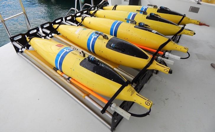
[Gliders gather key ocean temperature and salt content data, which are used to help improve hurricane forecast models. Credit: NOAA AOML]
[Written by NOAA] NOAA’s hurricane gliders are returning home after a successful journey during the 2020 hurricane season. These gliders were deployed off the coasts of Puerto Rico, Dominican Republic, the U.S. Virgin Islands, the Gulf of Mexico, and the eastern U.S. to collect data for scientists to use to improve the accuracy of hurricane forecast models.
The un-crewed gliders are equipped with sensors to measure salt content, temperature, and other physical, chemical, and environmental parameters as they move through the ocean down to a half mile below the surface. The gliders are battery powered, piloted remotely, and can operate and transmit data under hurricane conditions. Upon reaching the ocean surface, the gliders transmit ocean profile data via satellite for immediate use in hurricane forecast models.
https://www.youtube.com/watch?v=mLAwcXt8_3I
Due to the strong interaction between oceans and the atmosphere during the passage of a hurricane, the accurate representation of the ocean in hurricane forecast models is an emerging priority that is leading to improved hurricane intensity forecasts. The hurricane gliders provide high-volume, high-resolution, real-time data in areas where hurricanes frequently travel and intensify or weaken, but where there may traditionally be a scarcity of ocean observations. The gliders are significantly increasing the observations from these key areas where hurricanes form. Studies led by NOAA’s Atlantic Oceanographic and Meteorological Laboratory (AOML) together with academic institutions have shown that the data from gliders and floats are key to improving the accuracy of hurricane intensity forecasts.
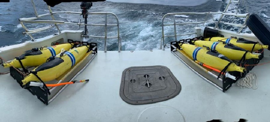
NOAA scientists have deployed underwater gliders to monitor ocean conditions each hurricane season since 2014. Scientists deployed 15 gliders this summer to gather data during the 2020 hurricane season throughout the Caribbean, tropical Atlantic, and in the Florida Current.
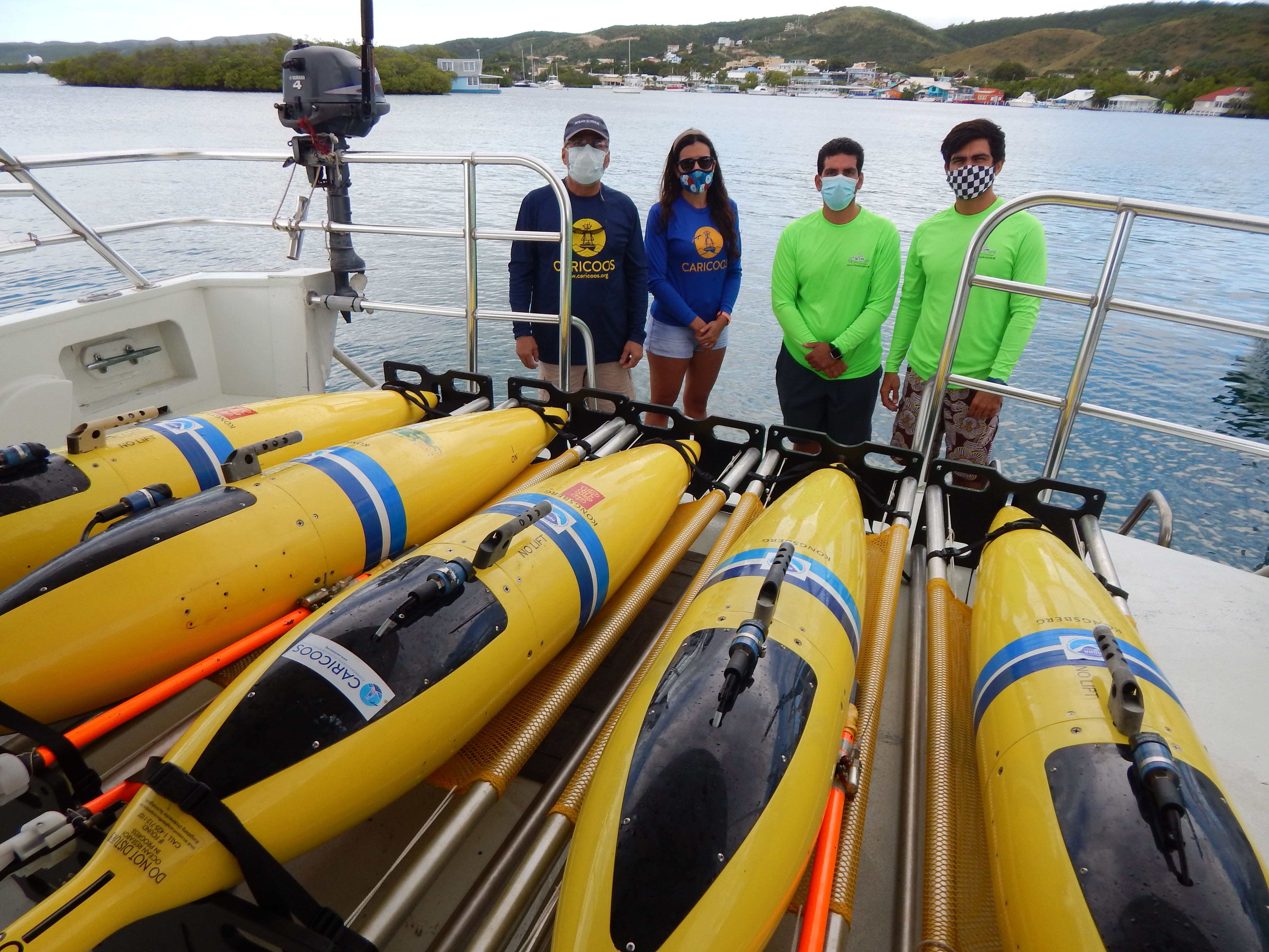 [AOML and partner scientists pose behind four hurricane gliders, which are returning to land after spending much of the 2020 hurricane season at sea. Credit: NOAA AOML]
NOAA and partner gliders collected more than 13,200 data points — known as observations or profiles — of temperature, salinity, and dissolved oxygen. These gliders gathered data during Hurricane Isaias (July 2020), Tropical Storm Josephine (August 2020), and Hurricane Laura (August 2020).
To prepare for the 2020 hurricane season, NOAA AOML scientists trained new glider pilots and technicians from partner institutions in Puerto Rico and the Dominican Republic. In April, NOAA and the U.S. Integrated Ocean Observing System (IOOS) hosted an online workshop with the partners to plan glider deployments in the tropical North Atlantic Ocean, Caribbean Sea, South and Mid- Atlantic Ocean, and Gulf of Mexico. This training played a critical role in this year’s operations as NOAA and its partners were able to continue the hurricane glider project operations despite uncertainties related to COVID-19. This training turned out to be crucial to ensuring successful operations given the restrictions in travel.
https://www.youtube.com/watch?v=vKXuMpGLulo
NOAA’s Atlantic Oceanographic and Meteorological Lab worked in partnership with IOOS, the U.S. Navy, the Caribbean Coastal Ocean Observing System (CARICOOS) regional association, the University of Puerto Rico, the Cooperative Institute for Marine and Atmospheric Studies (CIMAS), and the Maritime Authority in the Dominican Republic (ANAMAR), and Southeast Coastal Ocean Observing Regional Association (SECOORA).
All AOML glider data is available in real-time from the IOOS Glider Data Assembly Center and AOML Gliders website. Additionally all glider and in-situ and satellite observations are posted in real-time in the NOAA AOML Hurricane OceanViewer.
[AOML and partner scientists pose behind four hurricane gliders, which are returning to land after spending much of the 2020 hurricane season at sea. Credit: NOAA AOML]
NOAA and partner gliders collected more than 13,200 data points — known as observations or profiles — of temperature, salinity, and dissolved oxygen. These gliders gathered data during Hurricane Isaias (July 2020), Tropical Storm Josephine (August 2020), and Hurricane Laura (August 2020).
To prepare for the 2020 hurricane season, NOAA AOML scientists trained new glider pilots and technicians from partner institutions in Puerto Rico and the Dominican Republic. In April, NOAA and the U.S. Integrated Ocean Observing System (IOOS) hosted an online workshop with the partners to plan glider deployments in the tropical North Atlantic Ocean, Caribbean Sea, South and Mid- Atlantic Ocean, and Gulf of Mexico. This training played a critical role in this year’s operations as NOAA and its partners were able to continue the hurricane glider project operations despite uncertainties related to COVID-19. This training turned out to be crucial to ensuring successful operations given the restrictions in travel.
https://www.youtube.com/watch?v=vKXuMpGLulo
NOAA’s Atlantic Oceanographic and Meteorological Lab worked in partnership with IOOS, the U.S. Navy, the Caribbean Coastal Ocean Observing System (CARICOOS) regional association, the University of Puerto Rico, the Cooperative Institute for Marine and Atmospheric Studies (CIMAS), and the Maritime Authority in the Dominican Republic (ANAMAR), and Southeast Coastal Ocean Observing Regional Association (SECOORA).
All AOML glider data is available in real-time from the IOOS Glider Data Assembly Center and AOML Gliders website. Additionally all glider and in-situ and satellite observations are posted in real-time in the NOAA AOML Hurricane OceanViewer.
All Weather News
More

More Storms for the East Through Monday
A low-pressure system that moved through the
3 Aug 2026 12:20 PM


After Reaching Category 5, Genevieve Weakens in the Pacific
PacificGenevieve formed last Friday south of
3 Aug 2026 12:30 AM

Flooding, Severe Storms Target the Midwest Again
After an active week of storms across the nor
1 Aug 2026 1:40 AM

Flooding Risk Increases as Heavy Rain Targets the Tri-State Area
Tuesday, heavy rainfall moved across the Nort
30 Jul 2026 12:25 AM