Strong July Trough Shakes Up Temperatures

"Enough of this heat, already" - everybody
In the middle of July, you don't often get a strong enough system to bring temperatures back some 30 degrees. So enjoy the breath of fresh air where it's available. The Northern Rockies and High Plains are going to be the beneficiaries of this one, breaking the 100 heat in a substantial way. That's the reward for the suffering they go through in the Winter.
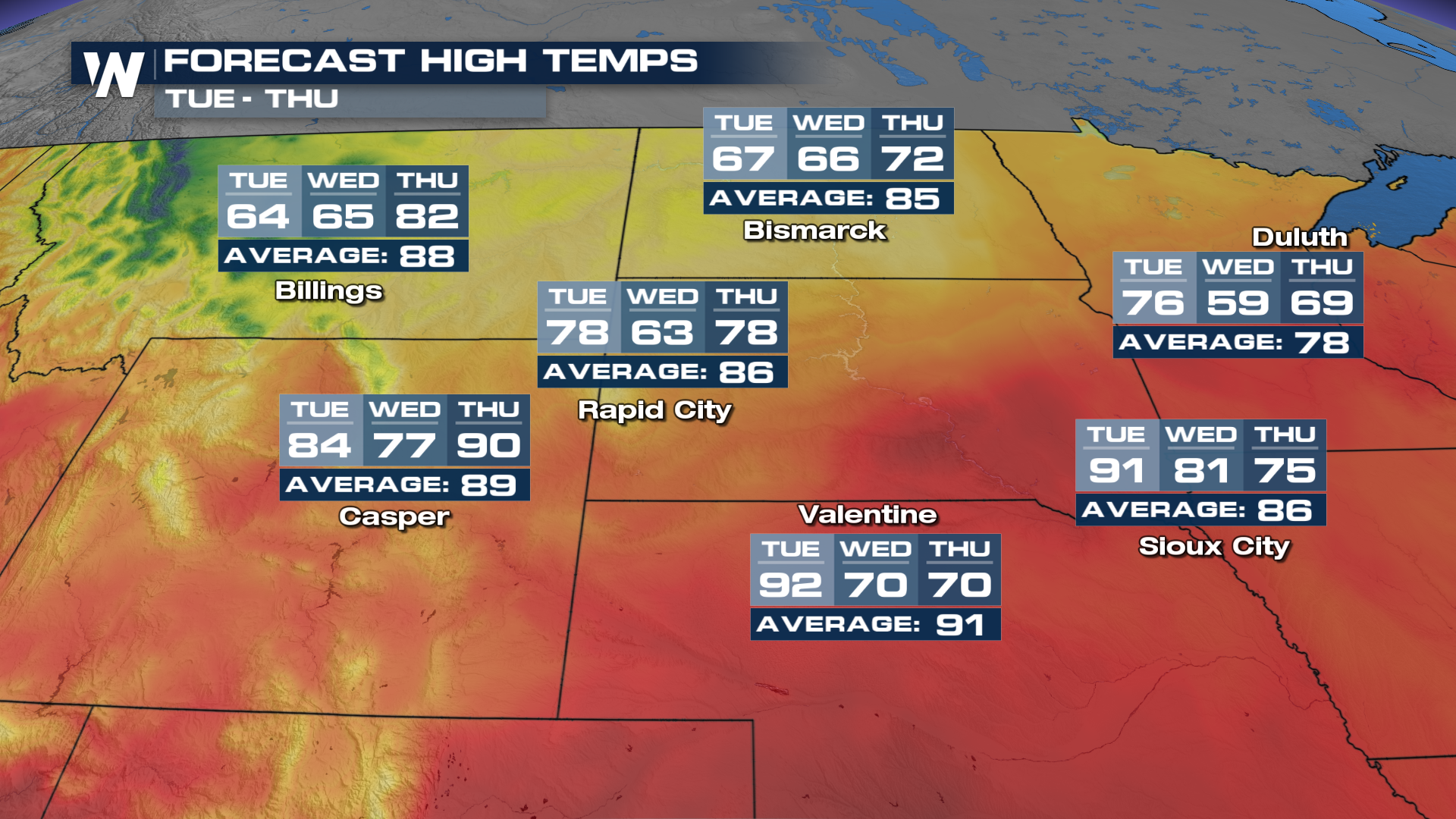
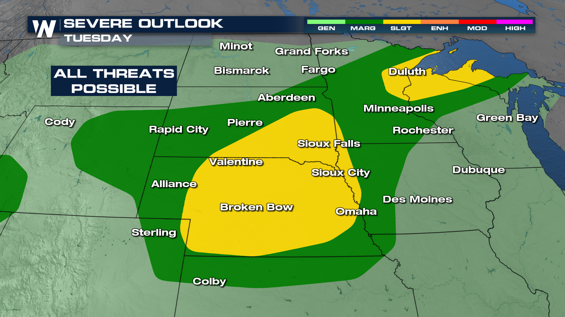
Some areas will plummet into the 60s on Tuesday, after the mid-to-upper 90s! That kind of swing means someone is going to get severe weather. Expect strong to severe storms through Tuesday and Wednesday.
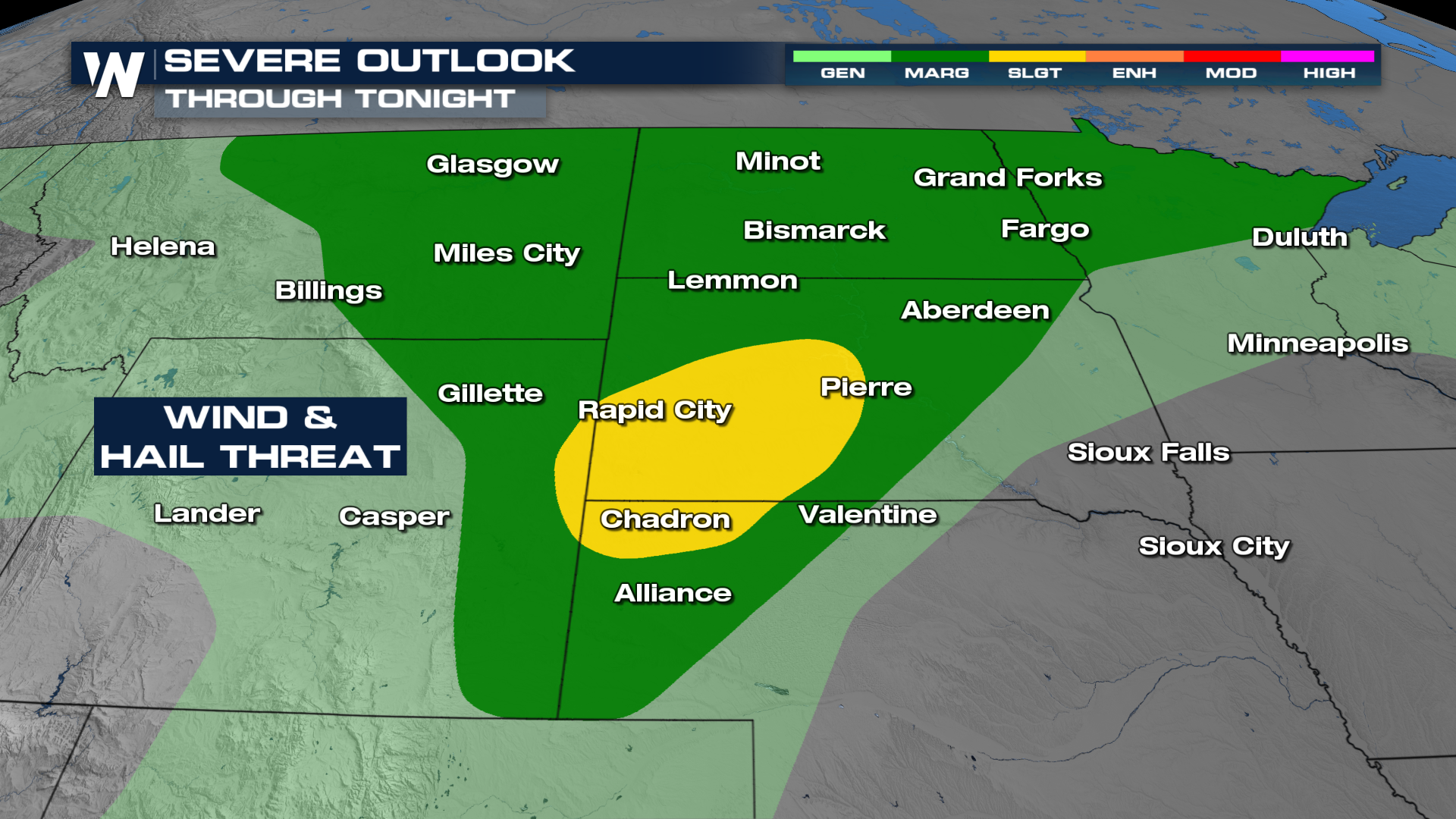
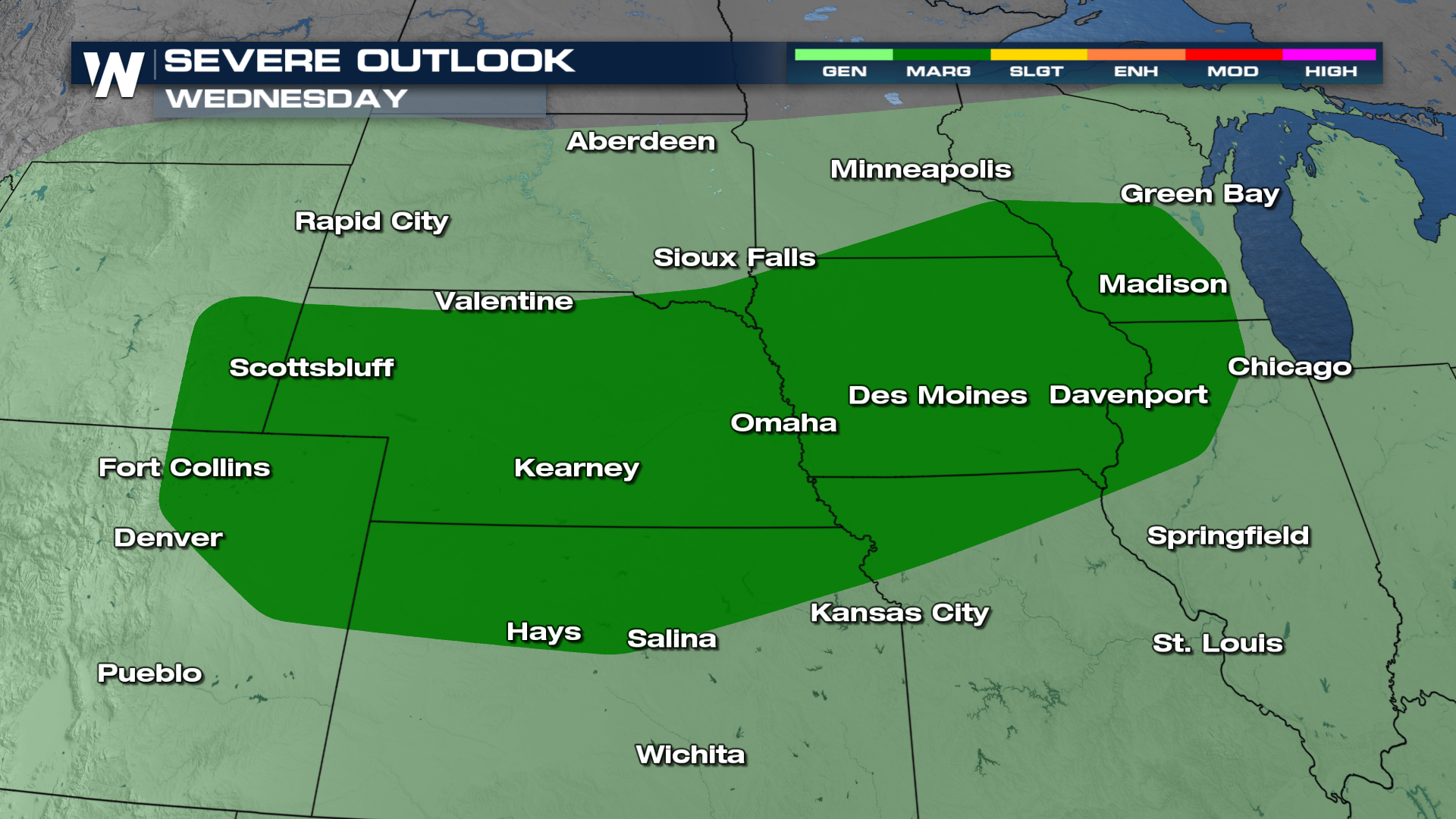
 The SPC has also issued a marginal risk through Wednesday across the Plains.
The better-organized storms appear to take shape on Tuesday, with the best bet being around South Dakota and Nebraska. All threats will be on the table Tuesday, but it'll be more of a damaging wind/large hail threat.
Storms look to fire a little late in the day Monday as the system comes together. Once the front starts driving south, a better push will generate storms Tuesday afternoon-evening.


