Heavy Rain and Snow for Intermountain West

High-elevation snowfall, heavy rainfall, and cooler temperatures are all in the forecast for the western and northwestern United States with two incoming upper-level troughs to keep the pattern active. This upper-level trough (or low) is the same trough responsible for snowfall in the Sierra Nevada on Monday. It will team up with a secondary low from the Pacific to draw in Pacific moisture and cooler temperatures.
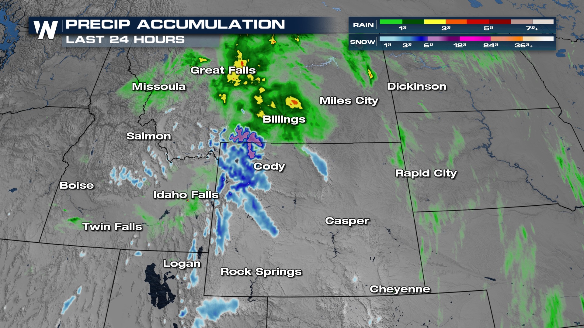
Rainfall totals in Montana have already reached over two inches, and snowfall totals in the Absarokas and Tetons have accumulated up to a couple of inches as well.
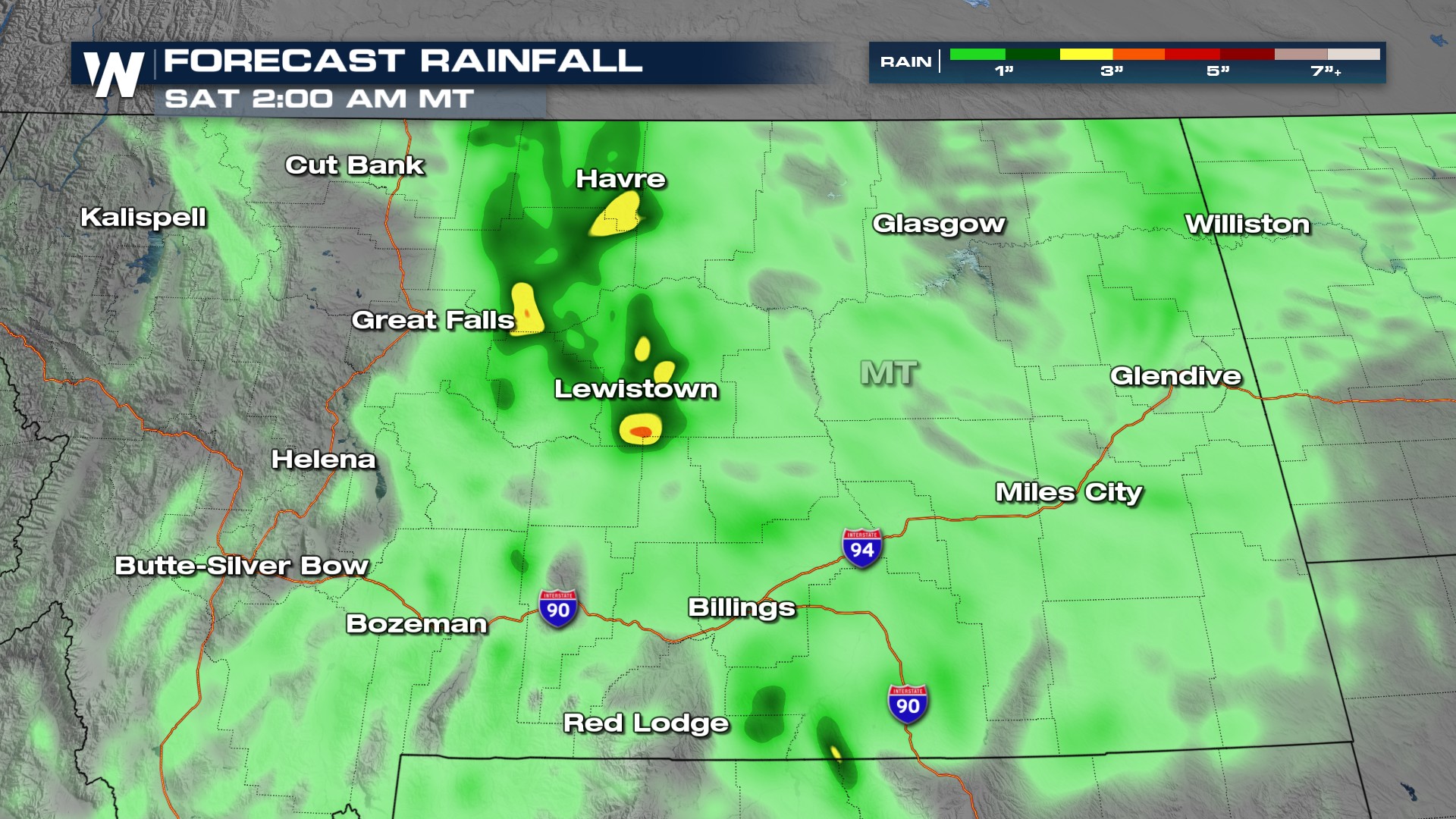
 The forecast still brings in a couple more inches of rainfall, but as this low pushes away into Canada the heaviest rain should settle down.
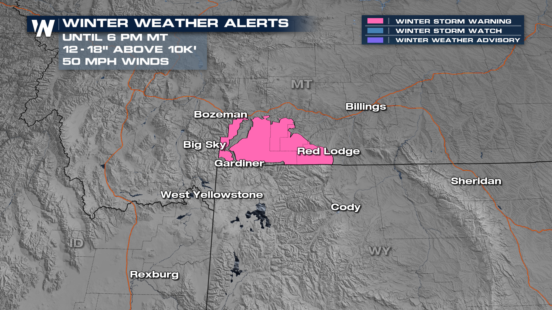
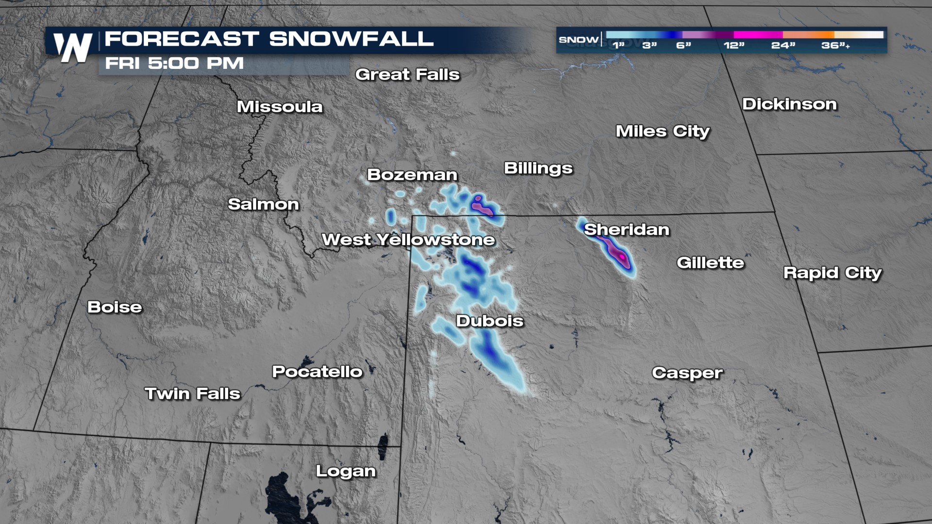 At the surface, with cooler upper-level conditions, we could even see a few stronger thunderstorms across the Intermountain West. It will remain active, with heavy rain and high-elevation snowfall to spill in as we get through the next couple of days. A foot of snow and 50 mph winds will cause some travel issues in parts of the Absorokas, where a Winter Storm Warning has been issued.
 With the location and set-up of the low-pressure area, central Montana will see the heaviest rainfall. The low will move to the east through the overnight hours, and clearer and drier conditions will be in place for Thursday.
The Weather Prediction Center has issued a marginal and slight (level 1 and 2 out of 4) risk for flash flooding in Montana through tonight. Precipitation totals may be in excess of 3-5"+ across Montana.
 More on your Western Regional Forecast can be found :50 past the hour on WeatherNation.


