Another Round of Fire Danger for the Southwest & Florida

The transition from Winter to Spring is often very windy and the next few days will be no exception. Where dry conditions exist, especially where drought is in place, fire danger will increase.
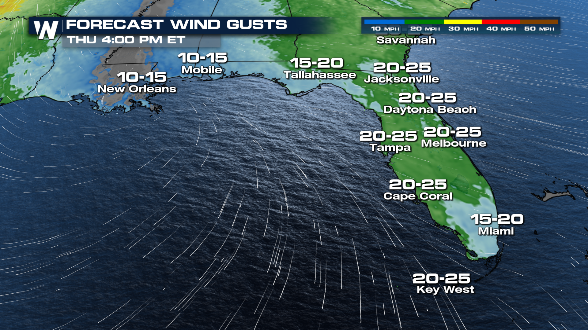
Florida
As a cold front exits the east coast on Thursday, dry and breezy conditions are leading to elevated fire danger in Florida, especially in Central Florida, where Red Flag Warnings are in effect (top of page). Winds are expected to be sustained around 15 - 25 mph this afternoon with stronger gusts.
Southwest
Coming off the heels of the critical fire threat in Texas and the Southwest earlier this week, the forecast shows another round of fire danger starting up on Thursday and continuing into Saturday. Another developing low will move from California into the Rockies before ejecting out into the Plains by the end of the week. Fire weather watches and warnings are up again for parts of West Texas and New Mexico.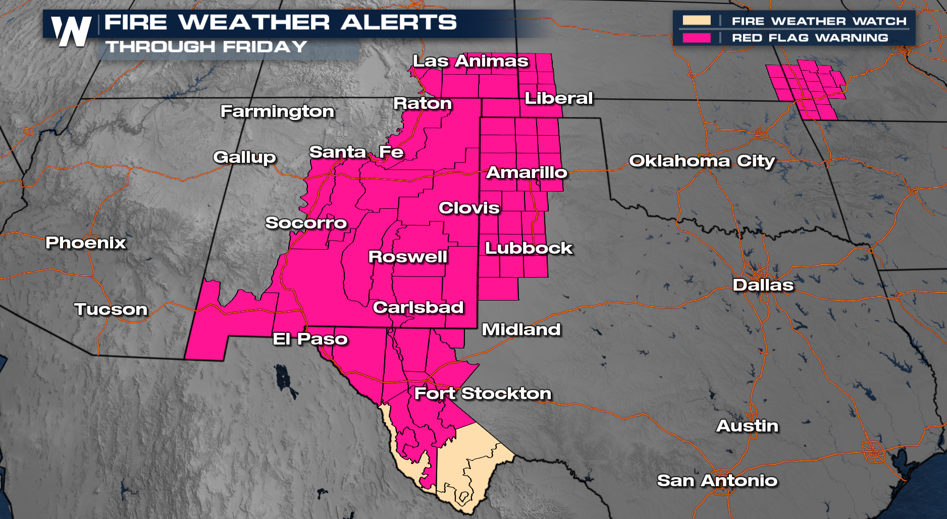
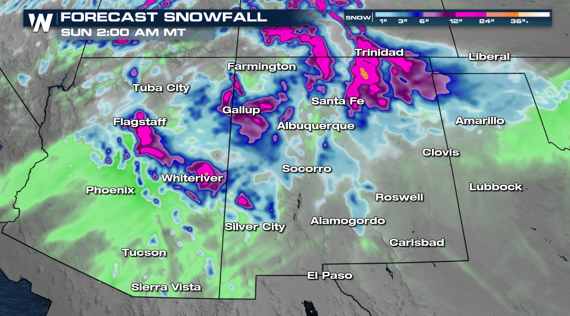
Winds will be quite strong, particularly in the afternoons through Saturday as multiple low pressure systems move from the mountains to the east.
Moisture is much needed in this part of the country. However, drought continues to build in the Southwest, especially locations along the Rio Grande and Mexican border. As normal, try to avoid anything that can cause a spark for the end of the work week. Precipitation is expected in some of these fire prone areas from Thursday night into Saturday morning.