Another Round of Rain and Snow for the Northeast
Special Stories
13 Nov 2018 11:20 AM
FORECAST
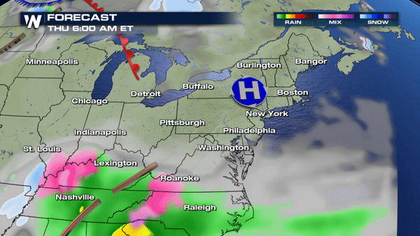
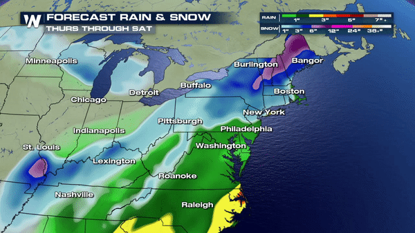
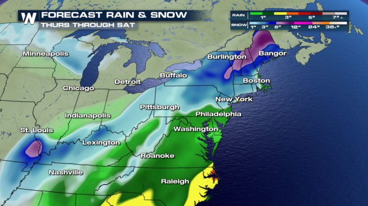 A low pressure system moving in from the southeast is going to bring more heavy rain and snow to the northeast. This will start up Thursday evening and will last all day on Friday. By early Saturday morning, the precipitation will clear out leaving us with dry conditions to wake up to. We are expected to see 1 to 3 inches of rain and anywhere from 1 to 12 inches of snow with this system.
TEMPERATURE FORECAST
A low pressure system moving in from the southeast is going to bring more heavy rain and snow to the northeast. This will start up Thursday evening and will last all day on Friday. By early Saturday morning, the precipitation will clear out leaving us with dry conditions to wake up to. We are expected to see 1 to 3 inches of rain and anywhere from 1 to 12 inches of snow with this system.
TEMPERATURE FORECAST
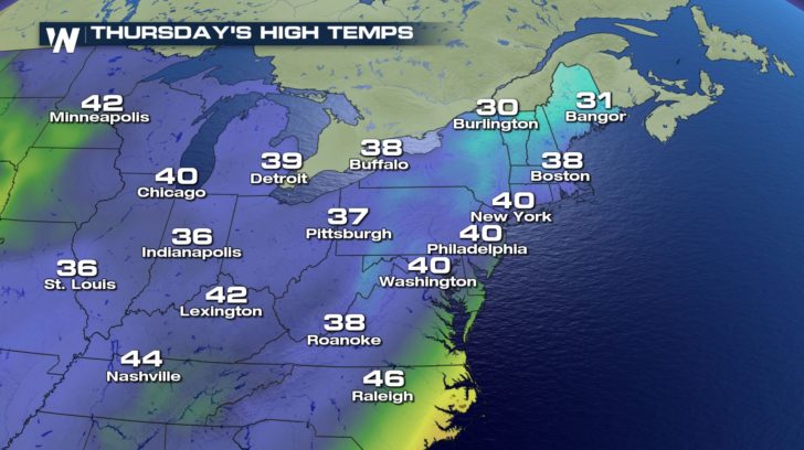
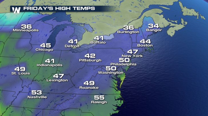 Temperatures will be quite cold on Thursday, but we will see a small warm up for the end of our work-week.
A low pressure system moving in from the southeast is going to bring more heavy rain and snow to the northeast. This will start up Thursday evening and will last all day on Friday. By early Saturday morning, the precipitation will clear out leaving us with dry conditions to wake up to. We are expected to see 1 to 3 inches of rain and anywhere from 1 to 12 inches of snow with this system.
TEMPERATURE FORECAST
Temperatures will be quite cold on Thursday, but we will see a small warm up for the end of our work-week.All Weather News
More
East Gears Up for Stormy, Wet Weekend
A low pressure system crashing through the Mi
1 Aug 2026 11:35 AM


Flooding, Severe Storms Target the Midwest Again
After an active week of storms across the nor
1 Aug 2026 1:40 AM


After Reaching Category 5, Genevieve Weakens in the Pacific
PacificFausto is now a post-tropical cyclone.
31 Jul 2026 1:30 AM

Flooding Risk Increases as Heavy Rain Targets the Tri-State Area
Tuesday, heavy rainfall moved across the Nort
30 Jul 2026 12:25 AM

Severe Weather: Energy From the Midwest Now in the Southeast
UPPER MIDWEST - Through Monday, dangerous tor
29 Jul 2026 10:30 PM