Another Stormy Stretch Along the Front Range

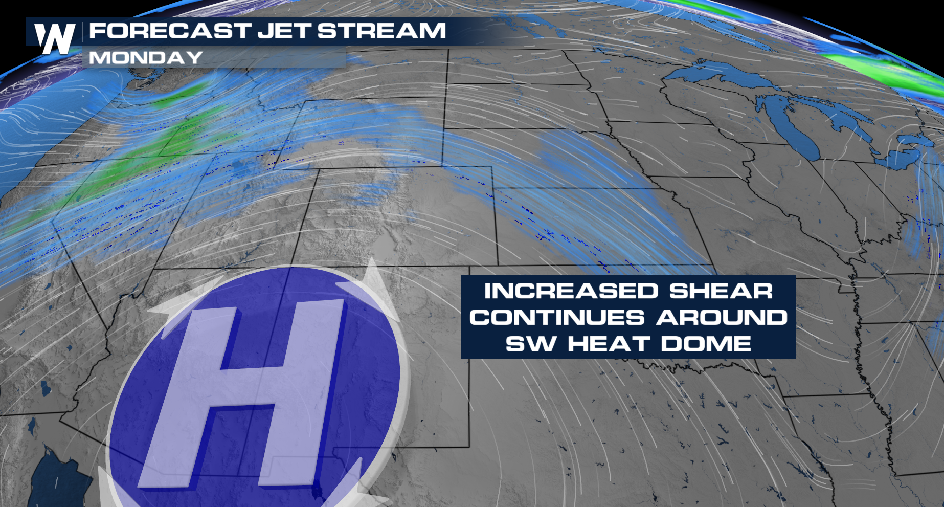
Strong winds in the upper levels of the atmosphere. This time of year, storms are easy to come by around the foothills of the Rocky Mountains, but strong jet stream energy is going to try to organize them. We saw how well it can organize storms last week, with a tornado-warned storm dropping baseball-sized hail in Cheyenne, and softballs in Kansas Sunday night.
Upper Level Set-Up
Severe storms will remain in the forecast as the jet stream energy remains elevated around the strong ridge of high pressure in Arizona. As storms fire up around the Rockies, the jet stream energy will help organize storms and carry them to the east into the Plains, where they'll be able to strengthen.
Severe Weather Outlooks
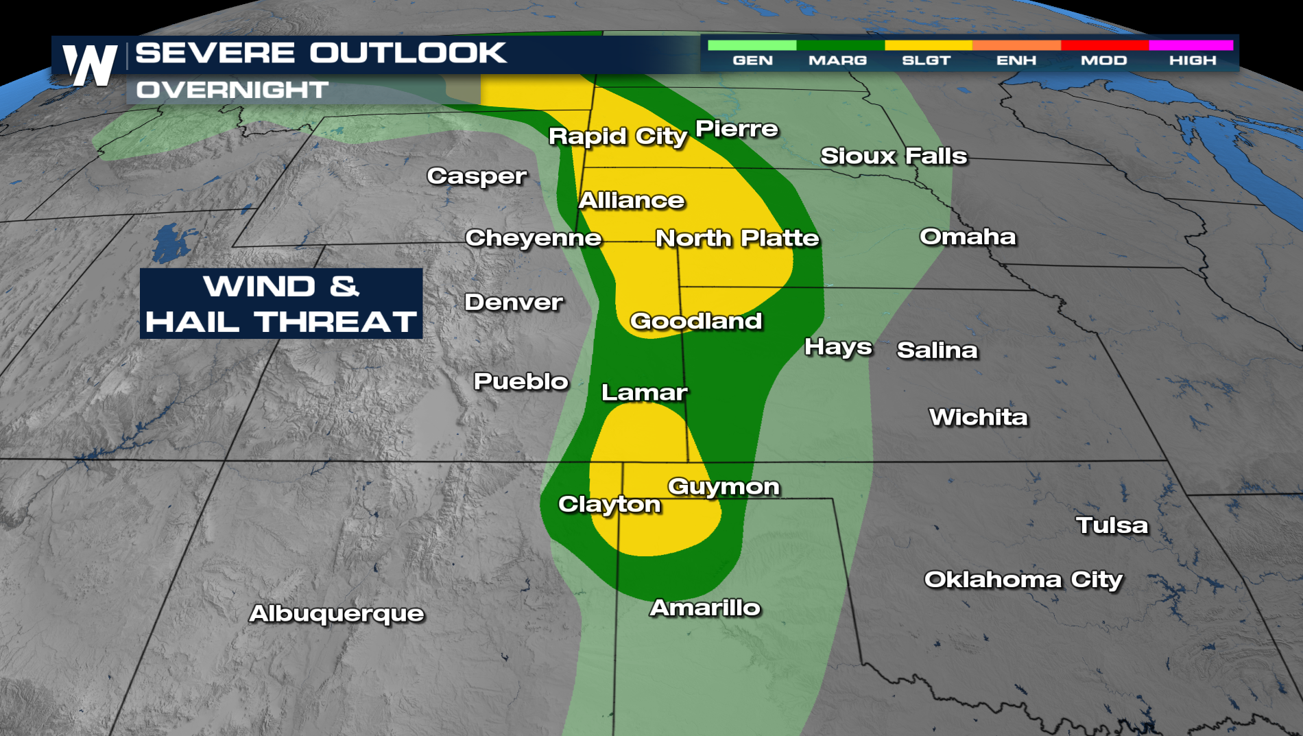
Isolated severe storms will remain in the forecast this afternoon and Tuesday as a new low-pressure system is moving out of the Northern Rockies.
Forecast Timing
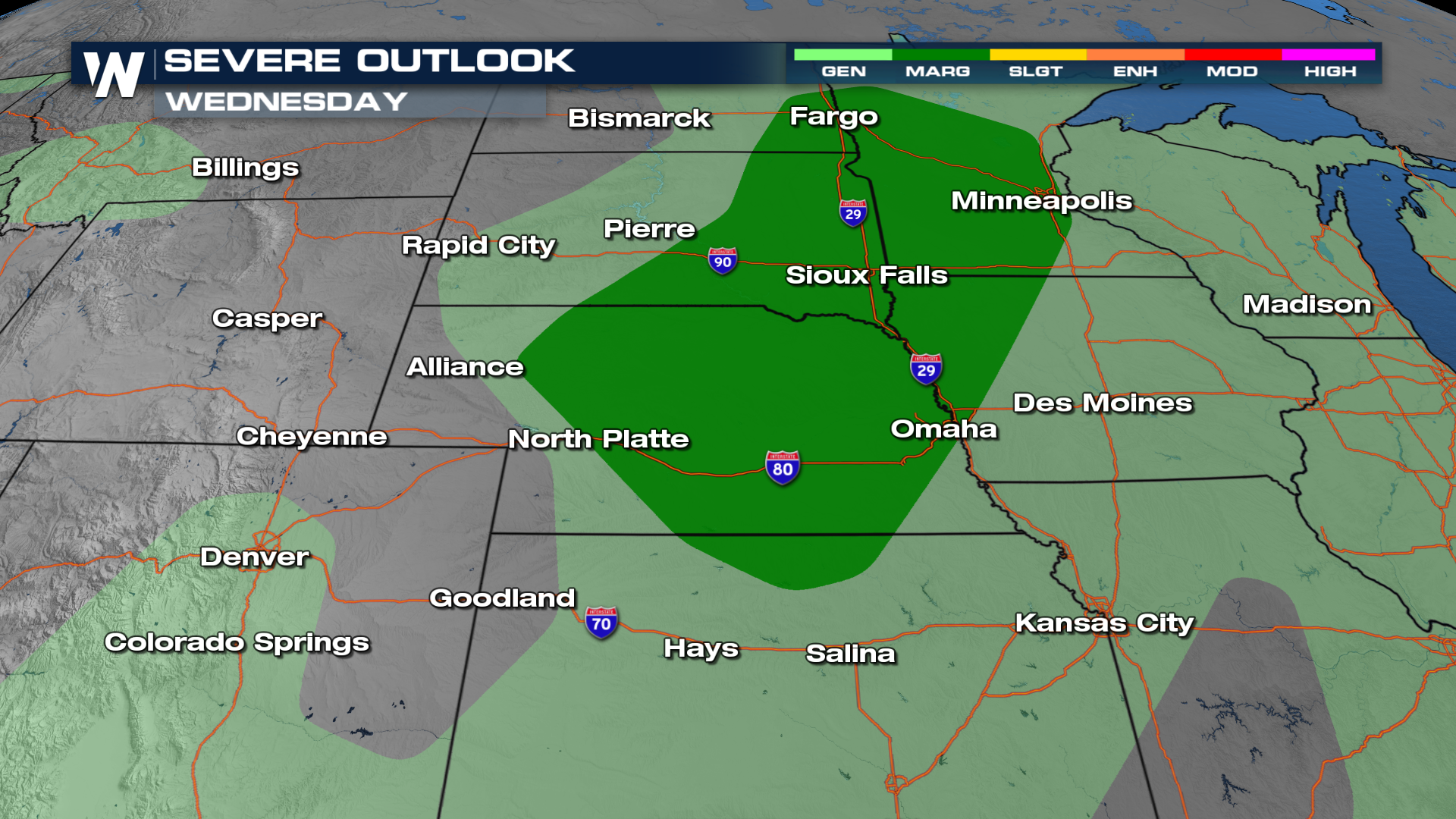
Expect storms to peak with daytime heating. A few storms will linger overnight as a low-pressure system lingers. As the low pushes north, more storms will develop again on Tuesday, with some storms sticking around for your morning commute.


