Historic Snow Leaves Slick Roads

While the snow has ended, the slippery travel hasn't.
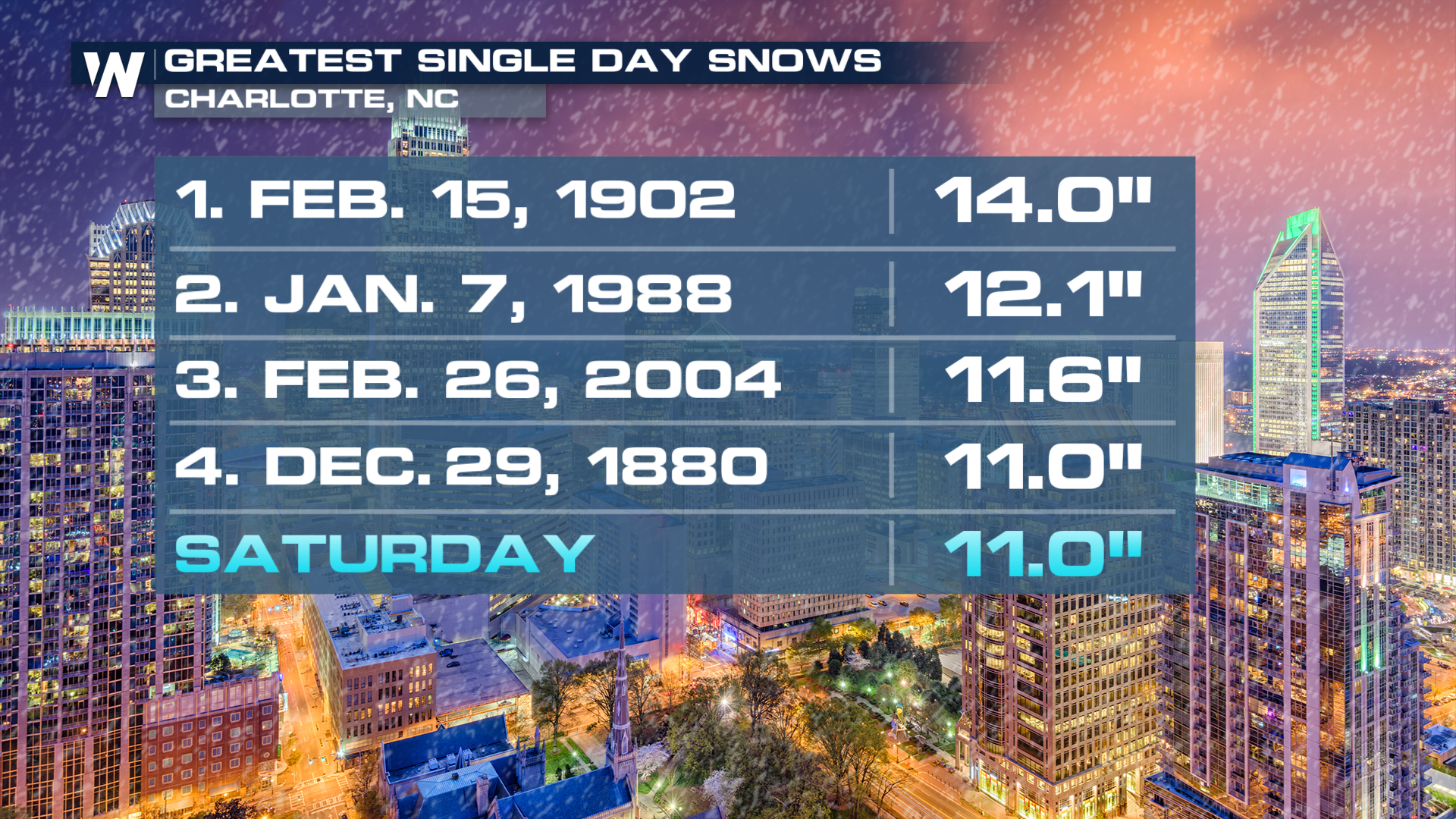
This comes after some locations in the Carolinas have seen historic snow totals, comparable with some of the heaviest snows in recent history. In addition to heavy snow, this low brought strong winds to the East Coast, coastal flooding, and has pulled arctic air all the way to South Florida. Miami and West Palm Beach are a couple of the FL cities that broke record lows on Sunday AM.
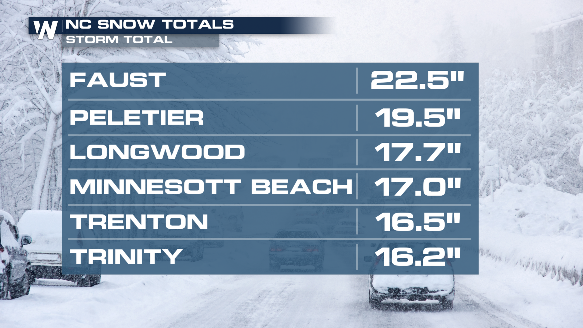
 Totals in some North Carolina cities exceeded 20"!
 Sunshine's helping start the melting process. However, anything that might melt during the day will likely refreeze during the overnights. Leaving slick roads for the morning commute. Wednesday morning lows and road temperatures will continue to see improvements, this will help some of that snow and ice begin to melt and stay melted.
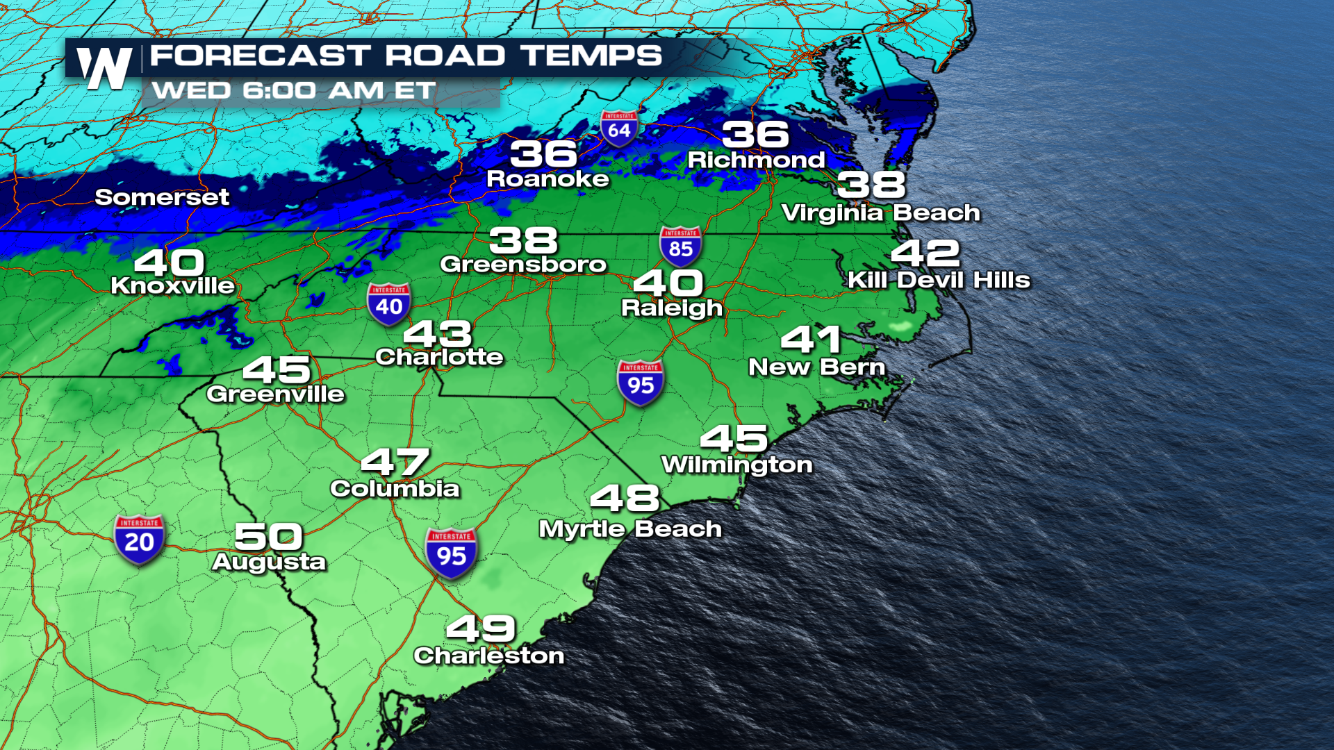
Temperatures will climb into the 40's by the middle of the week, which should help get any of the leftover snow to clear out. Another chance of rain/snow moves into the forecast by Wednesday, but it doesn't appear to be quite as threatening.


