Atlantic High-Activity Eras: What Does it Mean for Hurricane Season?
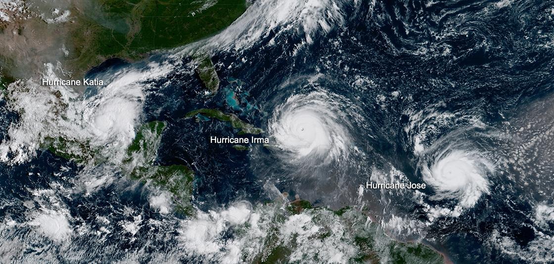
[Geocolor image from GOES-16 shows Hurricane Katia (l) Hurricane Irma (m) and Hurricane Jose (r) in the Atlantic Ocean on September 7, 2017. (NOAA Satellites)]
[NOAA] Why are some Atlantic hurricane seasons more active than others?
For any given season, multiple ocean and atmospheric conditions, such as El Nino or La Nina, influence whether Atlantic storms develop, how big they get and how long they last. Since 1995, we have been experiencing what scientists refer to as an active or high-activity era for Atlantic hurricane seasons — a natural, cyclical phenomenon.
How did we get here?
Scientific studies point to the Atlantic Multi-decadal Oscillation (AMO) as the most prominent link to the active era we are in.
The AMO cycle swings between extended periods, typically lasting 20-40 years, of warm and cool phases in North Atlantic Ocean temperatures. The atmospheric conditions that make way for the AMO warm phase can create the perfect storm and heighten Atlantic hurricane activity and storm strength. These conditions include:
-
Warmer sea surface temperatures
-
Increased thunderstorm activity; and
-
Drastic changes in wind speed and direction.
Conversely, low-activity eras, when Atlantic hurricane seasons are relatively quiet, are associated with the cool phase of the AMO. (A similar phenomenon also occurs in the Eastern Pacific that affects the frequency and intensity of hurricanes in that part of the world.)
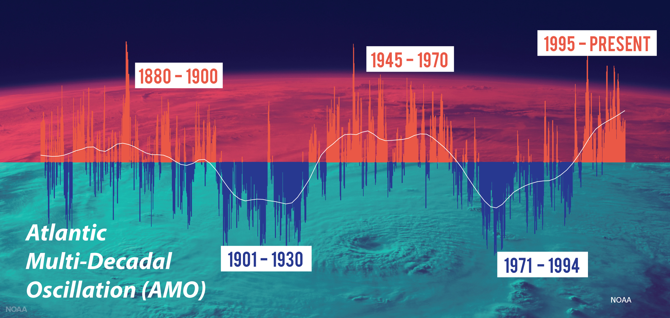
[Consistent with the changing phases of the Atlantic Multi-Decadal Oscillation (AMO), Atlantic high-activity eras have occurred from 1880 to 1900, 1945 to 1970 and 1995 to the present. Low-activity eras occurred during 1901-1930 and 1971-1994. High-activity eras in the Atlantic can increase the frequency and intensity of hurricanes. (NOAA NWS)]
Since the Atlantic high-activity era began in 1995, 17 of the last 25 hurricane seasons (including 2019) have seen higher-than-normal numbers of storms. During this period, the Atlantic basin endured an average of 15 named storms of which three to four became major hurricanes with winds of 111 mph or higher.
Scientists continue to closely watch for shifting conditions that could indicate a change in the AMO pattern, but the end of the active era we are experiencing still remains to be seen.
The costs of a high-activity era
When a hurricane strikes, it brings many lethal hazards with it, including storm surge, flash flooding and high winds. But tropical cyclones are not only life-threatening, they are also pocket-shattering. In fact, these destructive storms are the most costly of all weather and climate disasters, according to NOAA’s National Centers for Environmental Information.
Since 1995, the U.S. has sustained 34 tropical cyclones that have claimed more than 6,100 lives (source: NCEP database). Overall property and infrastructure damages for each storm reached or exceeded $1 billion (includes Consumer Price Index adjustment to 2019), with a total cost of more than $26 billion to date.
What you can do
One thing is for certain: In the face of increasing vulnerability to more intense and frequent storms, it's vital to stay prepared.


