Rip Current Risk High For Atlantic Beaches As Ernesto Moves North

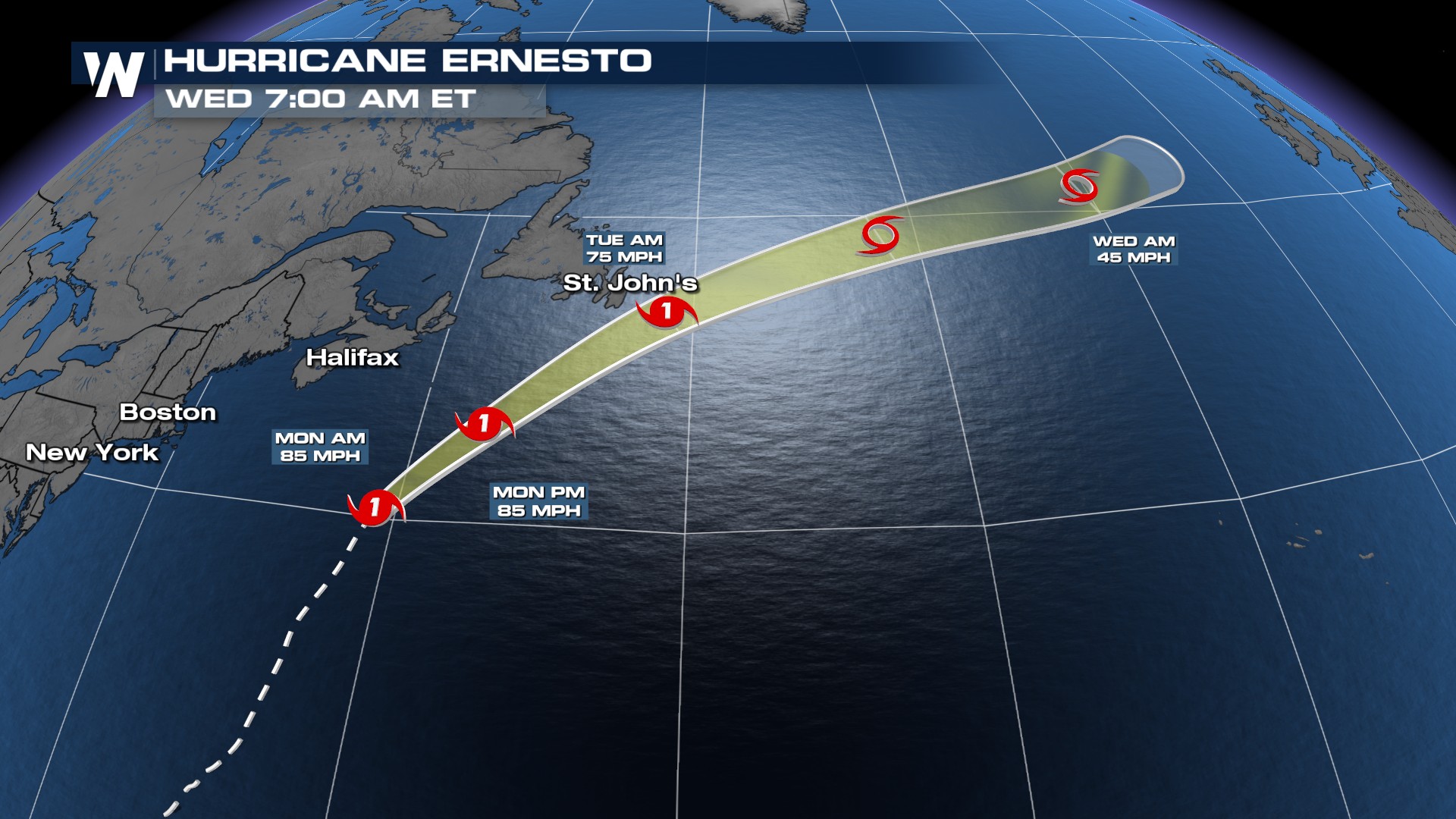
Ernesto returned to hurricane status on Sunday as it continued its northerly track across the Atlantic. The storm is expected to bring rain, wind, and surf impacts to Newfoundland Monday night into Tuesday, before heading to Ireland & the UK around Thursday. Ernesto made landfall in Bermuda early Saturday morning around 4:30 AM AST, with winds sustained around 85 mph and a central pressure of 972 mb.
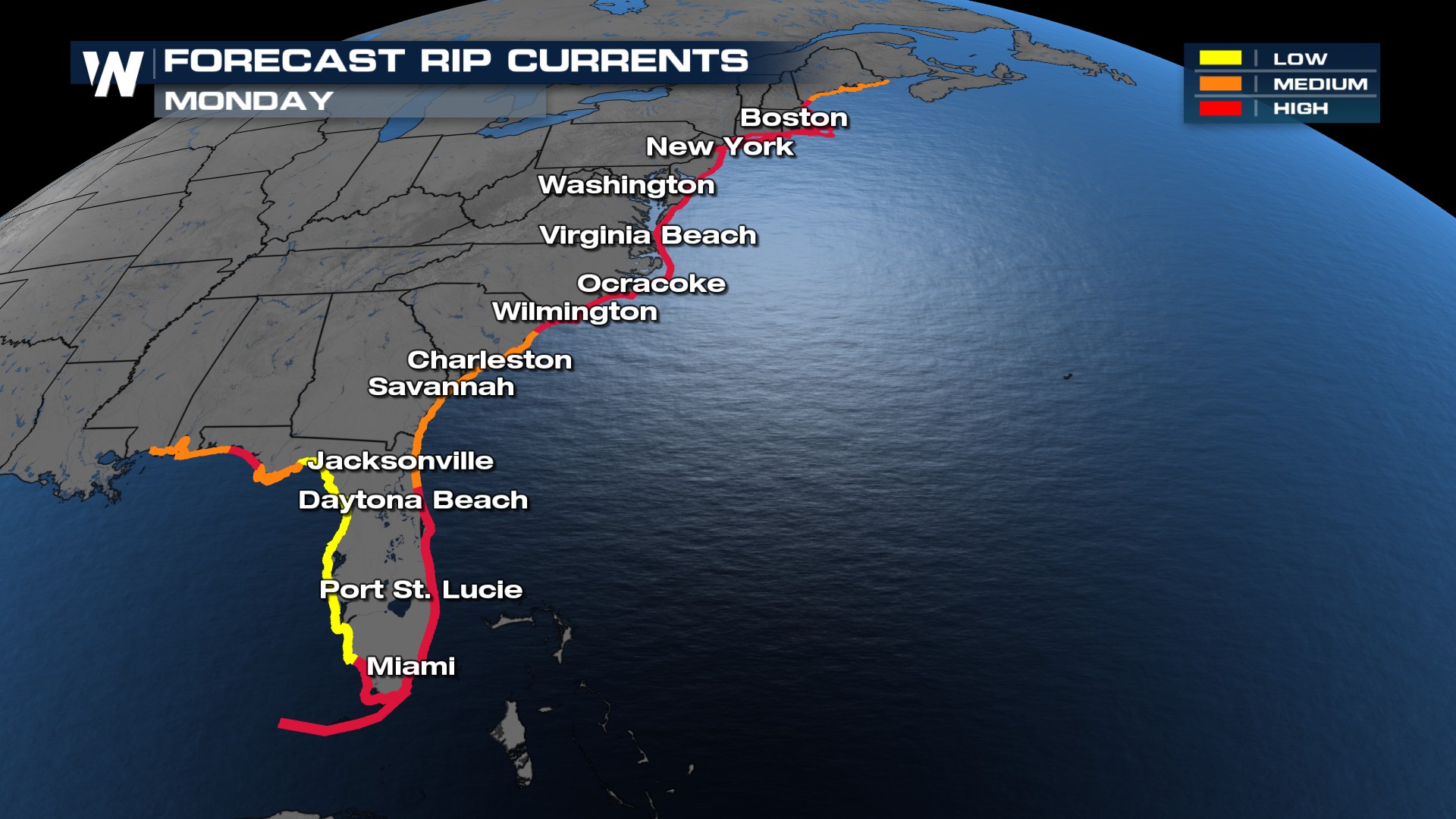
Ernesto will continue to send large swells to the East Coast of the United States through Monday. Wave heights of 4-8 feet are expected for many beaches. The risk for rip currents for most of the east coast will remain high or moderate through Monday. Check the beach flags for hazards! Remember, a red flag means rip currents are likely.
Caribbean Impacts
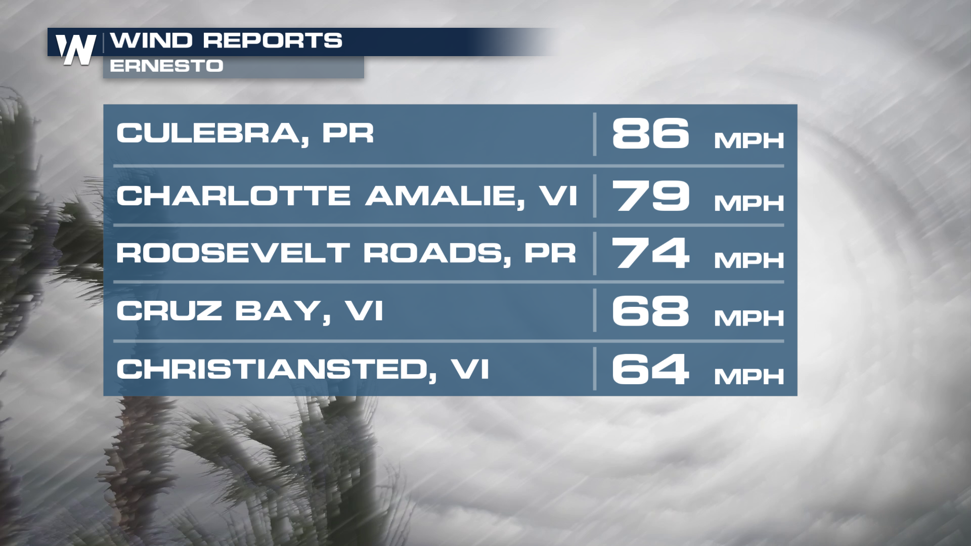
Previously, wind gusts over Puerto Rico and the Virgin Islands were recorded as high as 86 mph as the storm moved through earlier this week. As of Friday afternoon, around 100,000 households remain without power, a big improvement from mid-week when more than half of the island lost power access.
 Some of those higher winds have knocked some limbs out of trees in Puerto Rico. These islands are hilly, perhaps mountainous in spots, which means heavy rain and strong winds can hit particularly hard.
Long Term
The Climate Prediction Center's tropical outlook for the 2 and 3-week time frame shows an active period ahead for tropical development. During the next 2 weeks, there is a broad area of favorability in the Atlantic. This region has a >40% chance of tropical formation through the week of August 21 - 27th.
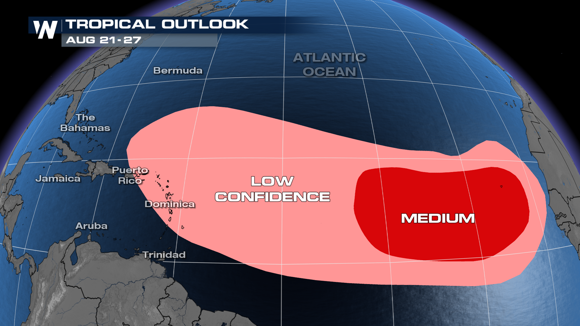 During week 3, the area of highest favorability across the Atlantic is in areas with seasonably warm sea surface temperatures. According to the CPC, "with more easterly waves favored to exit West Africa towards the end of the month, 60% chances are issued from 35W to 55W where negative shear anomalies are favored to be strongest heading into September."
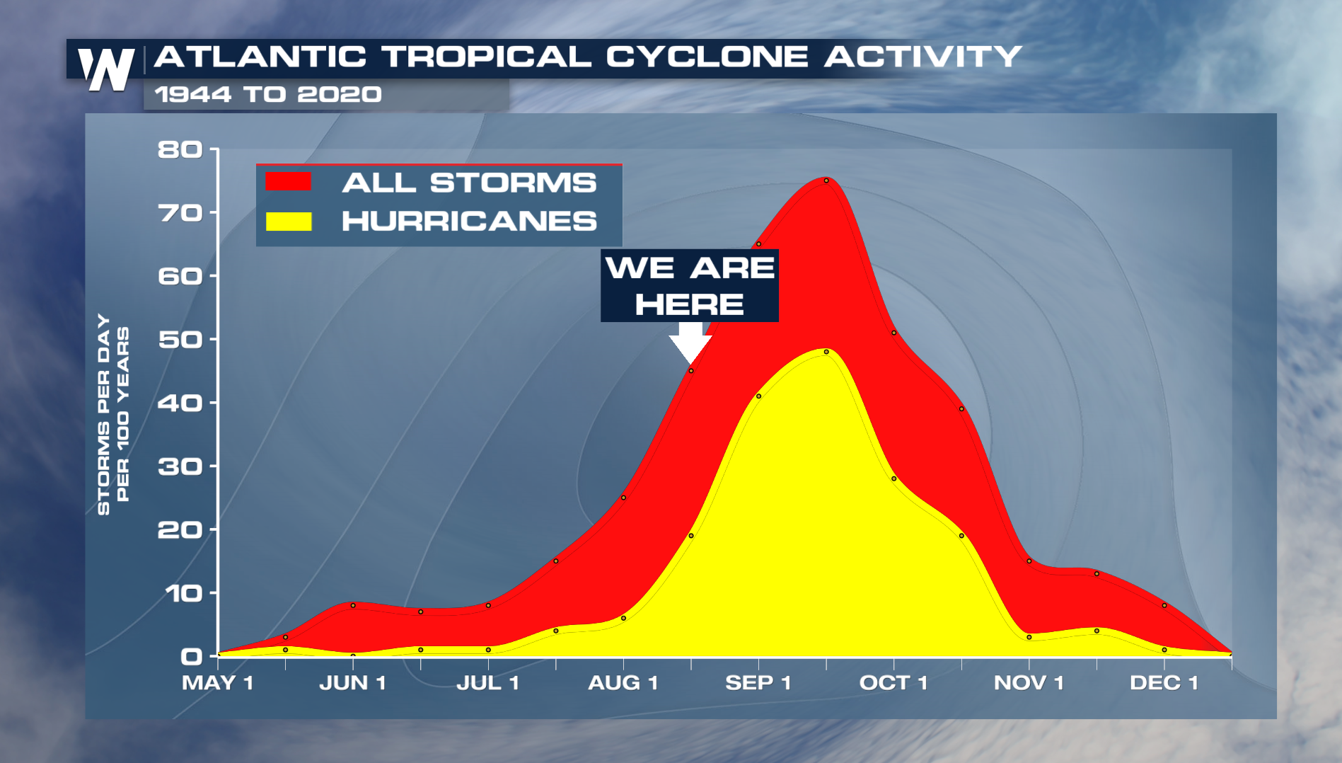
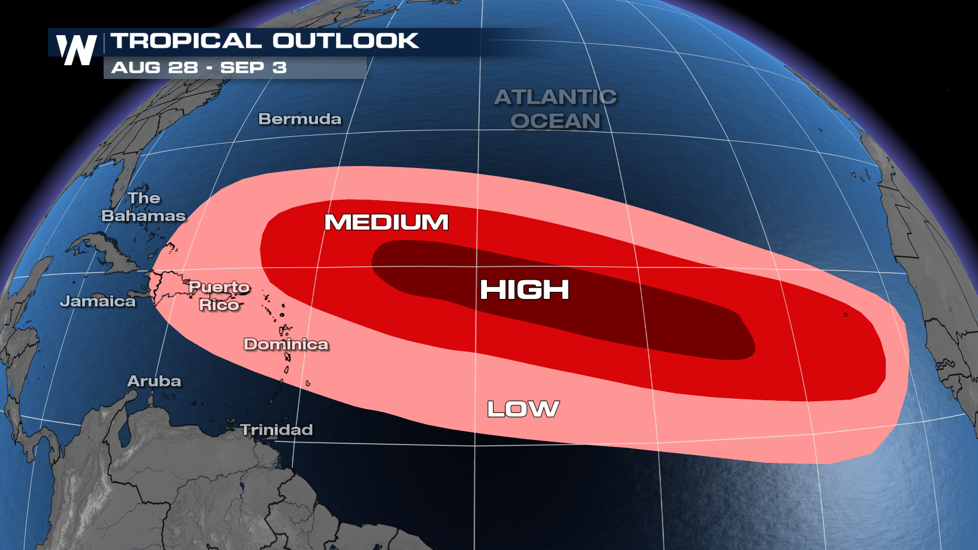 Typically in August, this is where tropical systems develop. Activity in the Atlantic often ramps up considerably during August and continues through September and it only takes one storm to impact you. Please stay weather-aware and continue to make preparations before any storm is even in the forecast.
As a reminder, 2024 is expected to be above average for tropical activity due to a La Nina forming during the peak of hurricane season in September. It only takes one storm to impact you and the time to prepare is before the storm hits!


