Atmospheric River Brings Summer Rain to the PNW
An atmospheric river (or AR for short) is hitting the West Coast bringing heavy rain and gusty winds to the Pacific Northwest. Atmospheric Rivers are common during the Fall and Winter months, even into the Spring but are less common this late into the year. ARs are rated on a scale of 1 to 5 and this week's AR was a level 3. In addition to the rainfall will be gusty winds, over the highest peaks upwards of 70 mph. Even Seattle picked up some winds, downing trees and power lines Monday morning.
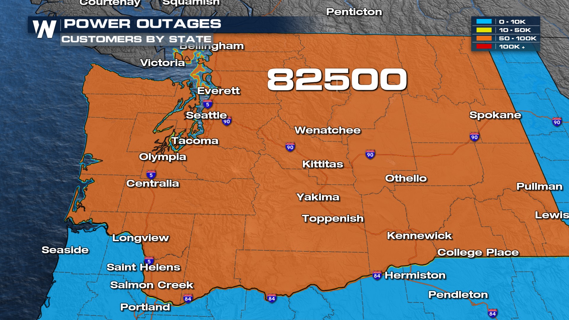
Power outages peaked Monday morning with over 80,000 customers without power, mainly around Seattle and Tacoma.
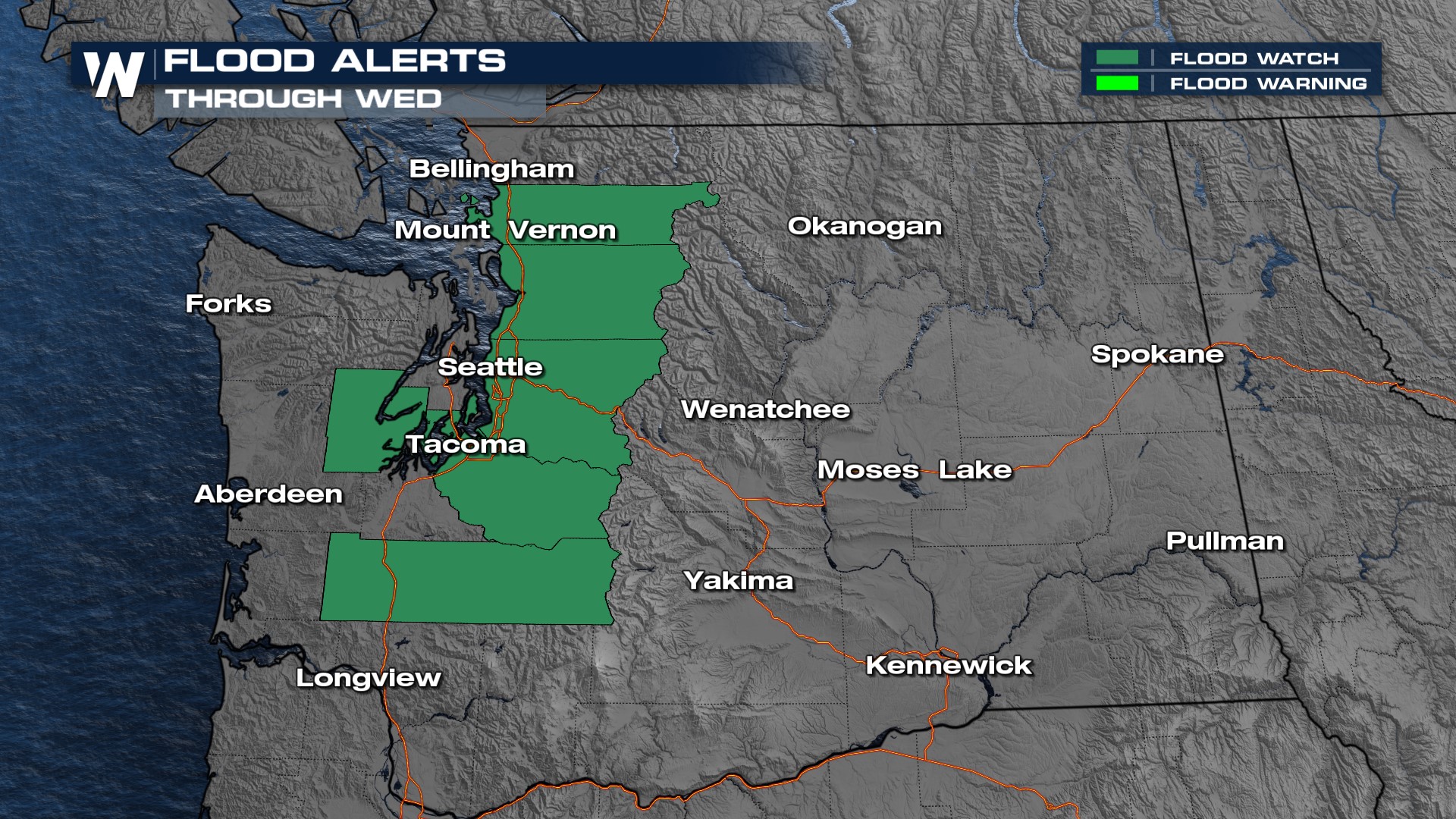
 Coastal Washington saw over 5" in the last few days, and Portland, OR over an inch. A few rainfall records were broken on Sunday in Oregon for the heavy rainfall in Astoria, McMinnville and Portland, all seeing their highest daily rainfall. Additional rainfall will be minimal, less than 0.5" for many outside isolated spots with closer to 1". With the ongoing rain and high-elevation snowmelt, flood alerts are in effect across Washington and Idaho through Midweek.
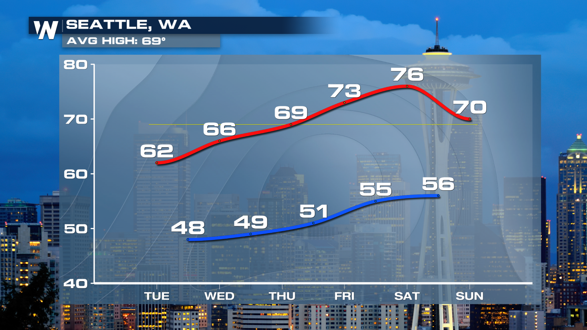
 Steadier rain winds down Tuesday with just a few lingering showers. We likely see a few flakes fly for the highest elevations of the Cascades as the AR is funneled around a low-pressure system, drawing in cooler air. Don't worry, a warmup is on the way and by the middle and end of this week, highs will be pushing 80° in Seattle! It is all thanks to a ridge of high-pressure building in the Southwest bringing record-breaking temperatures to the region this week.
