Teddy Makes Landfall in Nova Scotia as a Post-Tropical Cyclone

Special Stories
23 Sep 2020 11:00 AM
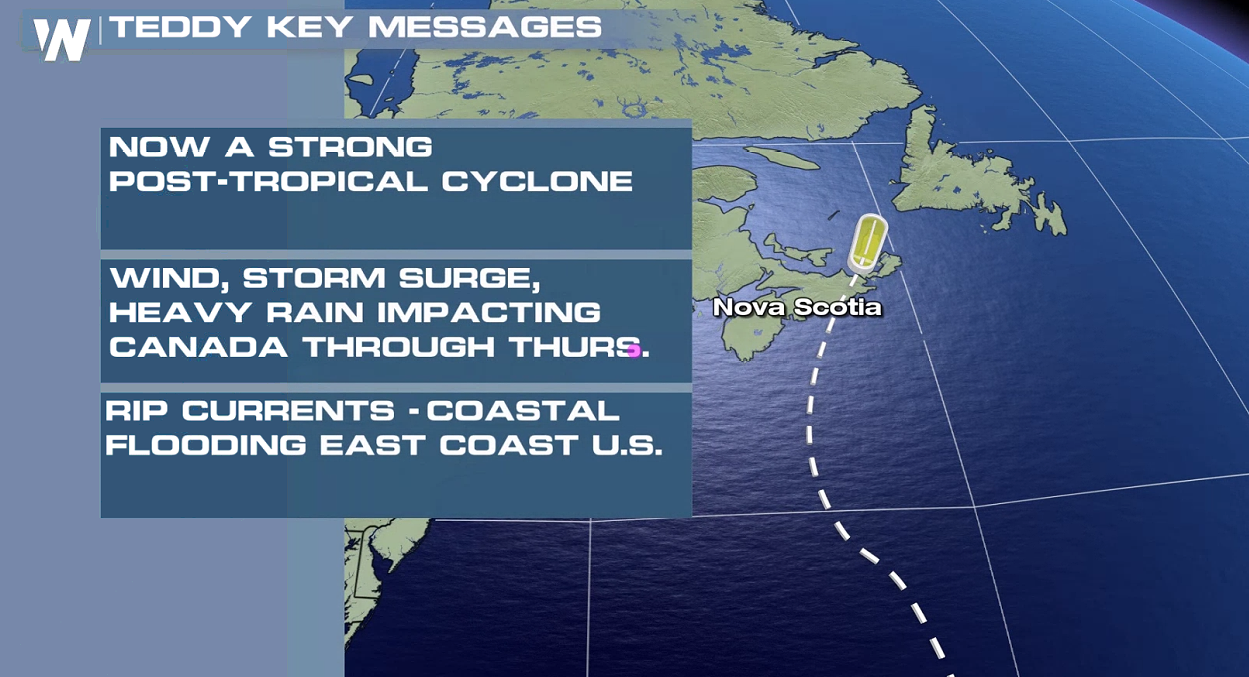
After Paulette made landfall in Bermuda last week, Hurricane Teddy edged in a little too close for comfort. Teddy strengthened to a category 4 storm late last week, but gradually weakened as it approached Canada. Teddy is now a 'post-tropical cyclone', but still maintains tropical storm strength with winds of 60 mph. A 'post-tropical' status means its the energy from boundaries between warm and cold air masses that maintain its strength as opposed to it being fueled by warm ocean waters.
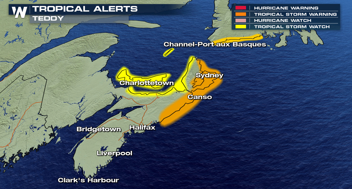
 The Canadian Hurricane Centre has issued a Tropical Storm Warning for the south coast of Nova Scotia from Ecum Secum to Meat Cove and from Port aux Basques to Francois in Newfoundland. A Tropical Storm Watch from Meat Cove to Brule in Nova Scotia, Magdalen Islands in Quebec, and for Prince Edward Island.
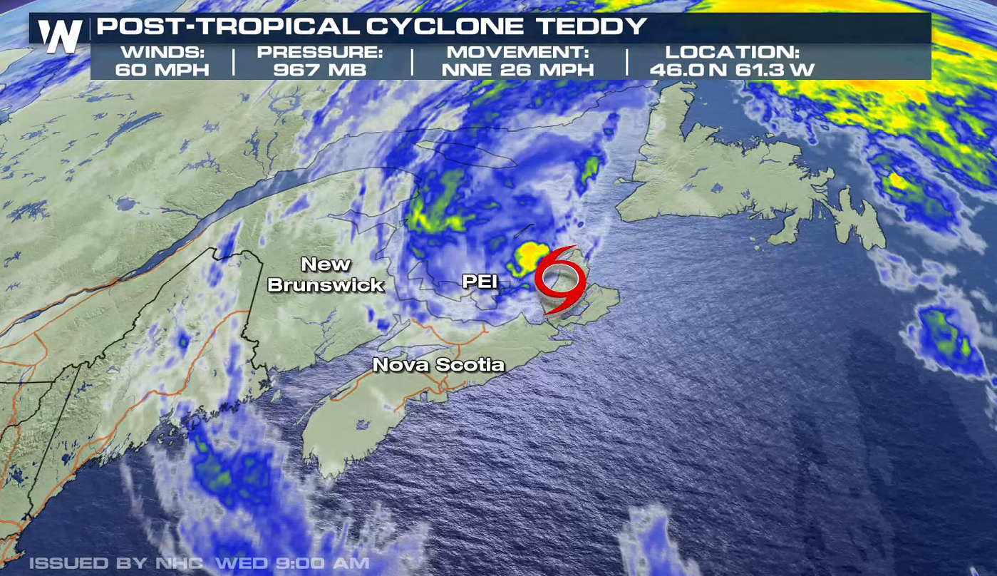 Teddy moved across Nova Scotia earlier today (Wednesday), making landfall near Ecum Secum, Nova Scotia, near 8:00 AM AST, with maximum sustained winds near 65 mph (100 km/h), and a minimum central pressure of 964 mb (28.47 inches).
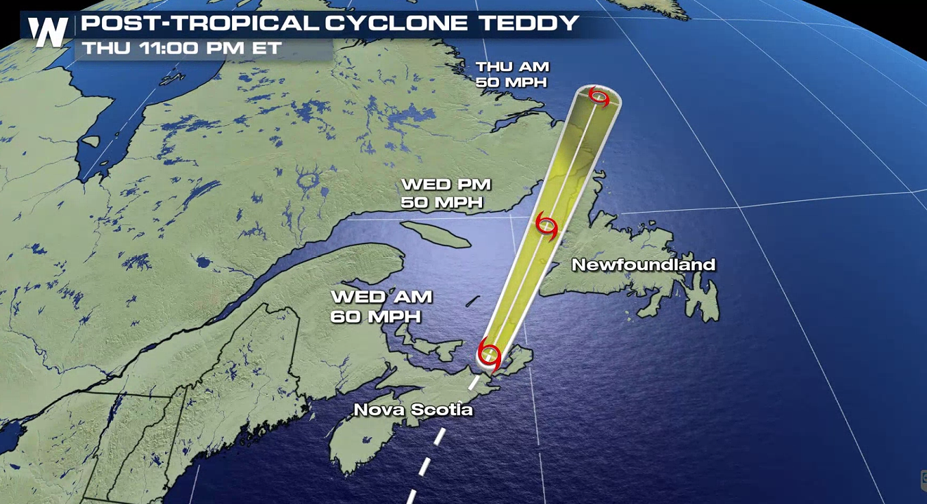 Teddy will cross the Gulf of St. Lawrence today (Wednesday), and pushing into Newfoundland tonight and east of Labrador Thursday. The storm will continue to weaken as it moves back into the colder North Atlantic waters.
Keep checking with WeatherNation for more updates.
Teddy will cross the Gulf of St. Lawrence today (Wednesday), and pushing into Newfoundland tonight and east of Labrador Thursday. The storm will continue to weaken as it moves back into the colder North Atlantic waters.
Keep checking with WeatherNation for more updates.
The Canadian Hurricane Centre has issued a Tropical Storm Warning for the south coast of Nova Scotia from Ecum Secum to Meat Cove and from Port aux Basques to Francois in Newfoundland. A Tropical Storm Watch from Meat Cove to Brule in Nova Scotia, Magdalen Islands in Quebec, and for Prince Edward Island.
Teddy Statistics
Teddy moved across Nova Scotia earlier today (Wednesday), making landfall near Ecum Secum, Nova Scotia, near 8:00 AM AST, with maximum sustained winds near 65 mph (100 km/h), and a minimum central pressure of 964 mb (28.47 inches).
Teddy Forecast Track
Teddy will cross the Gulf of St. Lawrence today (Wednesday), and pushing into Newfoundland tonight and east of Labrador Thursday. The storm will continue to weaken as it moves back into the colder North Atlantic waters.
Keep checking with WeatherNation for more updates.All Weather News
More
Stormy Pattern Ahead for the Northern Plains
NORTHERN PLAINS - Severe weather is in the fo
8 Jul 2026 1:20 AM

After Flooding in the NE, Strong Storms Stick Around
NEW JERSEY - Heavy rainfall rates of around 2
8 Jul 2026 1:10 AM


Slow-Moving Front No Longer Expected to Develop Tropically, Monitoring Eastern Pacific
Early in the season, we watch closer to the c
1 Jul 2026 12:15 AM

'MCS' Season Brings Severe and Flooding Threats Across the Southeast
As Summer settles in across the Central U.S.,
28 Jun 2026 2:10 AM