Returning Back to the Freezer This Week

It's been a cold start to the week for millions! Areas around the Great Lakes and Ohio River Valley took the most recent Arctic outbreak on the chin, with temperatures plummeting below zero in some instances. On Monday, as winds flipped out of the south, we began to thaw out and most of us are feeling either seasonable or above average by Wednesday. However...
...The Arctic air isn't getting shoved too far away. This week, we unlock another block of the cold stuff and slide it southward. The good news? It looks like it's not quite as brutal as the last shot.
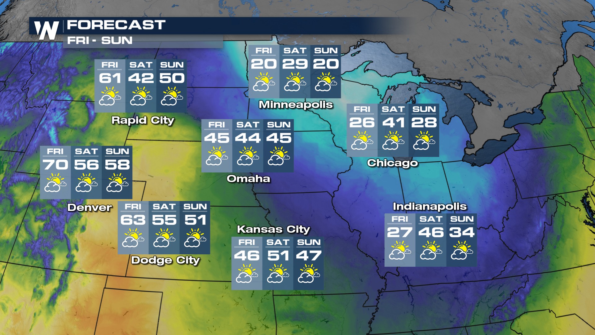
A system will emerge out of the Rockies again, moving into much warmer temperatures by Wednesday. How much rain/snow/mud will that system drop?
Relate Article: Sloppy System Moves into the Midwest
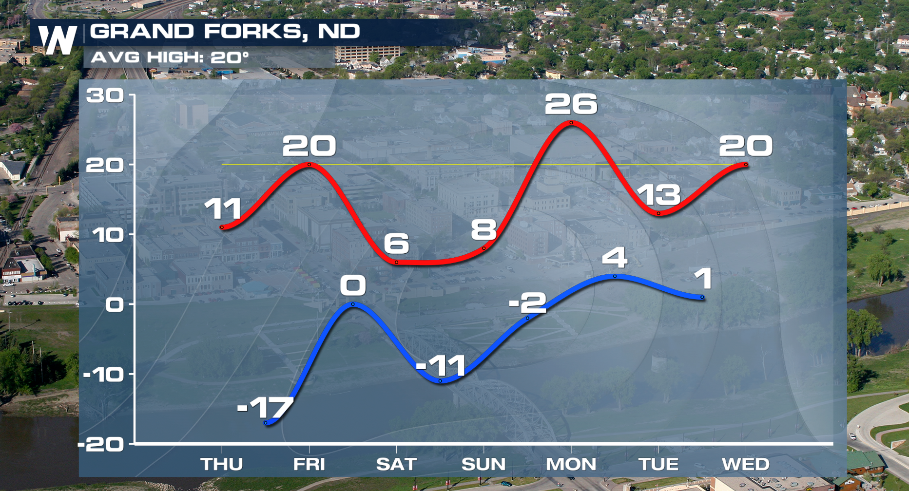
More importantly, the temperatures swinging on the other side of it will send another chill down the spine of the Heartland. Wednesday night will be the rudest, while Thursday night will likely be the coldest, but should see the winds subsiding. Bismarck, the usual poster child for nasty cold, will only top out in the single digits Thursday afternoon and Grand Forks will be near 20 below Friday AM.
Like a trampoline, temperatures rebound the following day for most.


