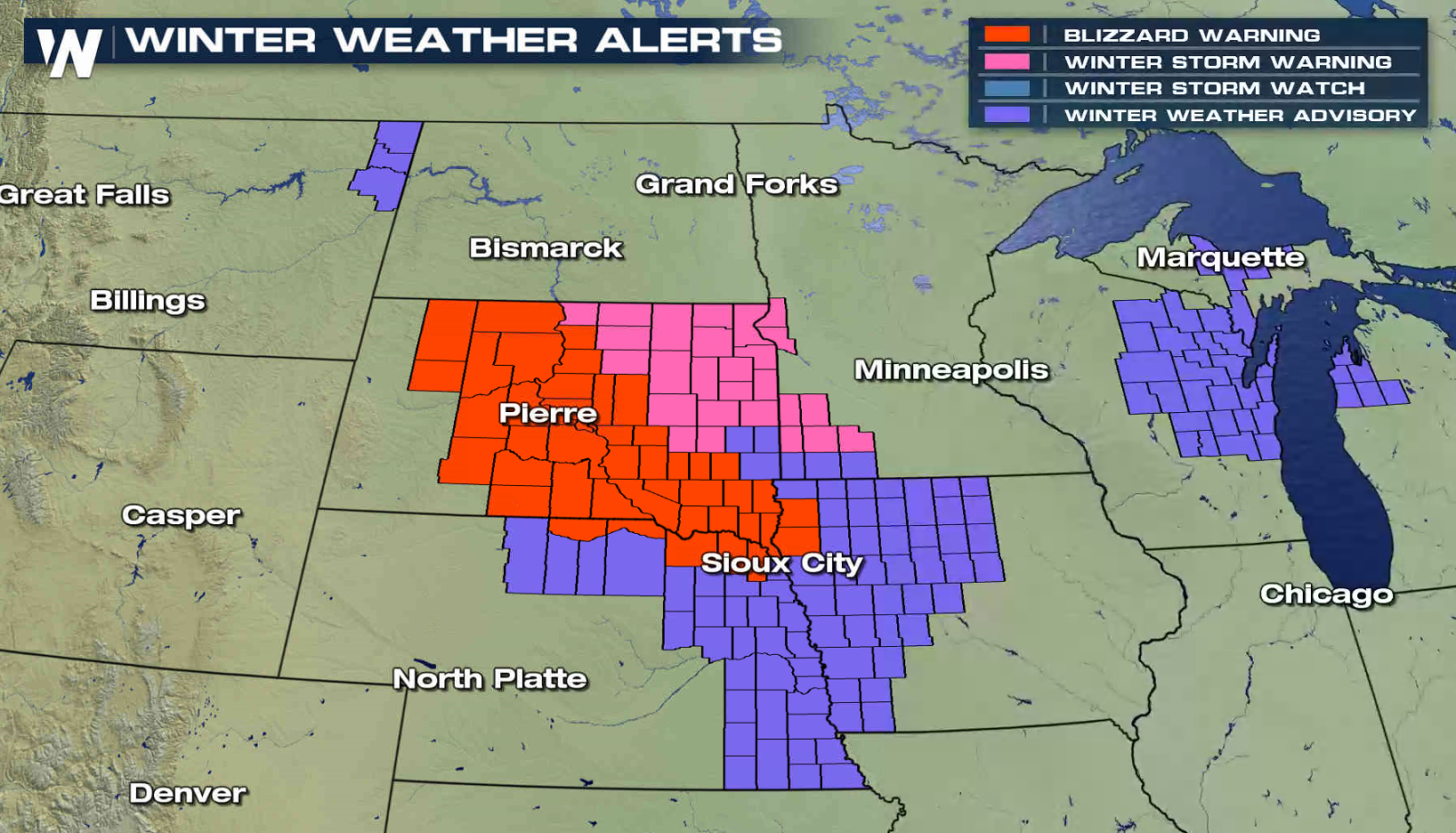
Blizzard Warnings Continue in the High Plains
Special Stories
6 Mar 2018 9:11 AM
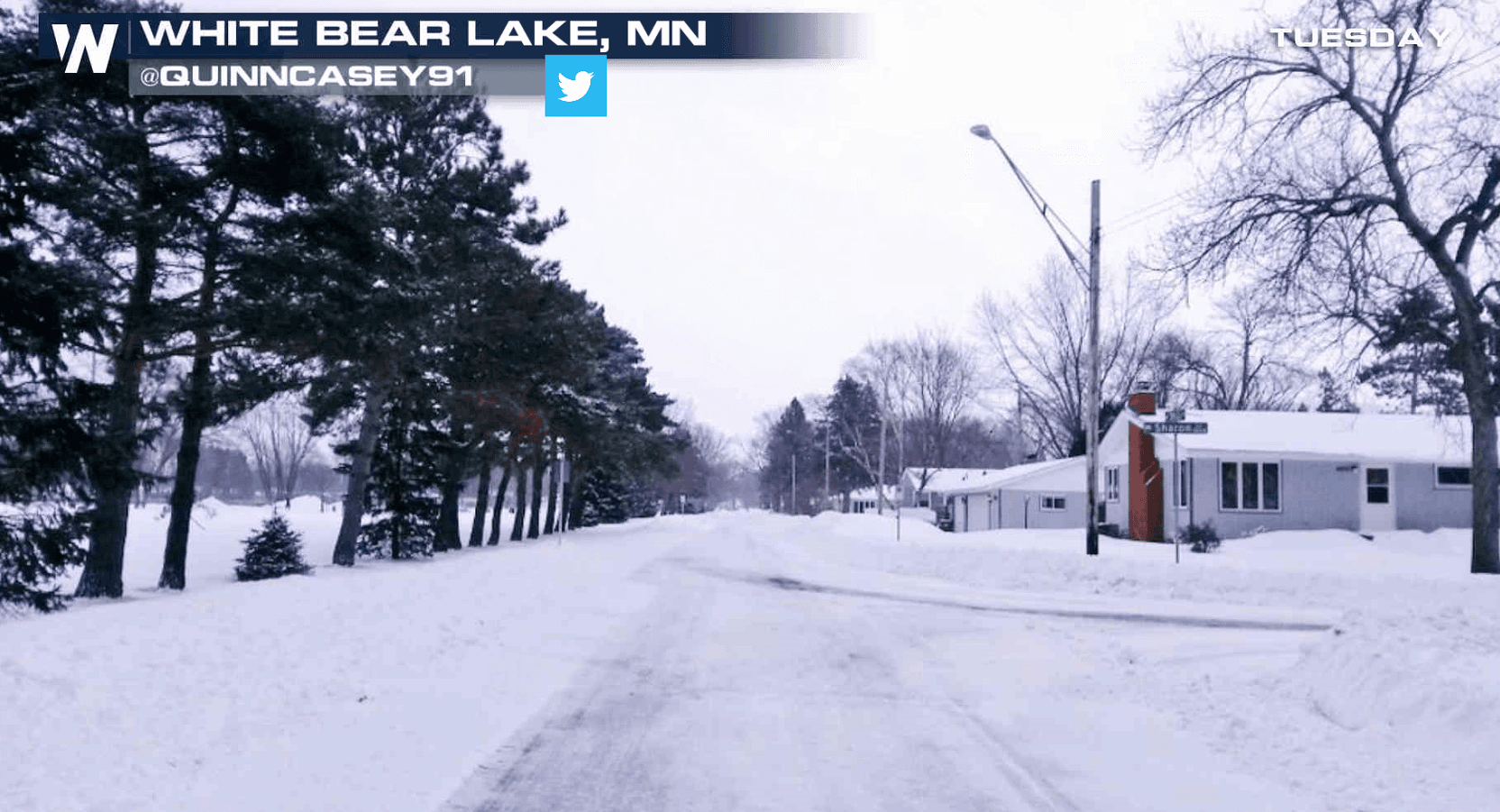
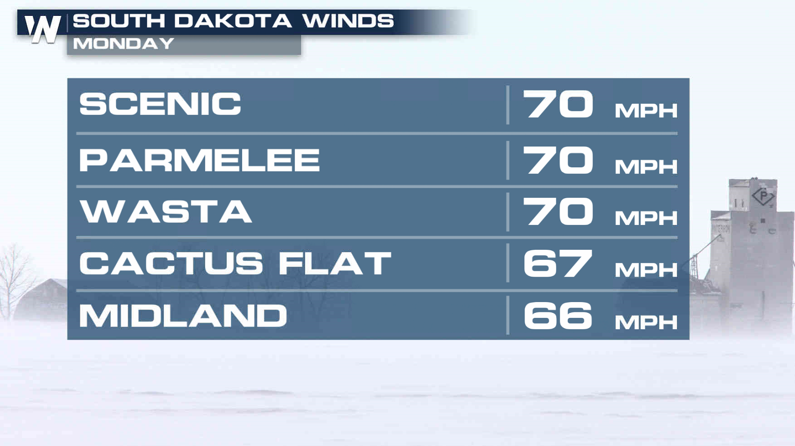
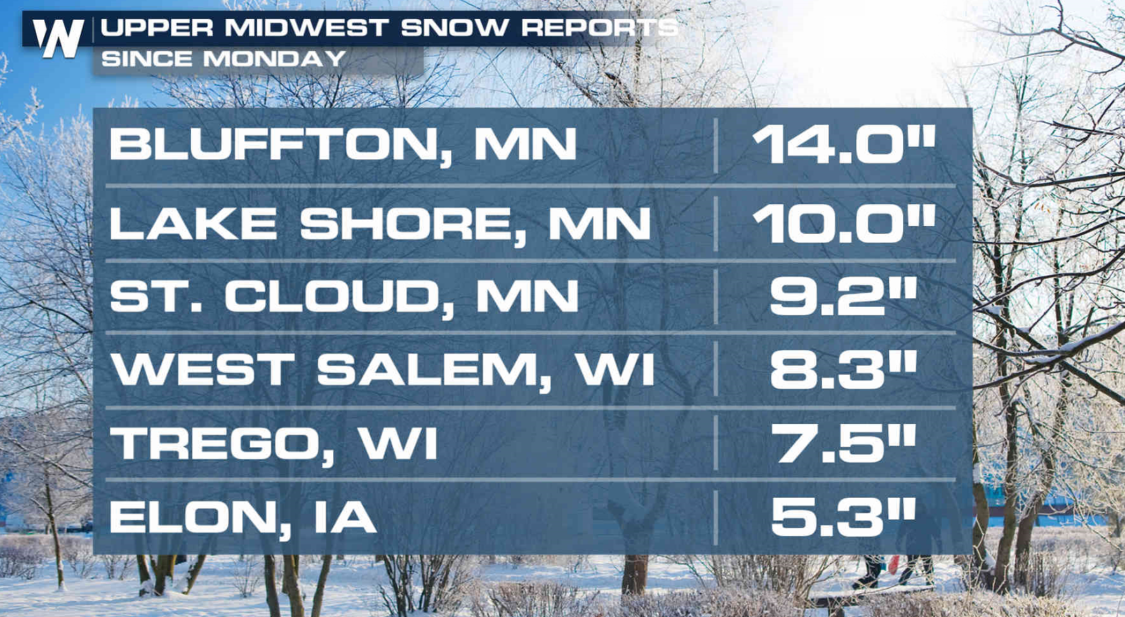
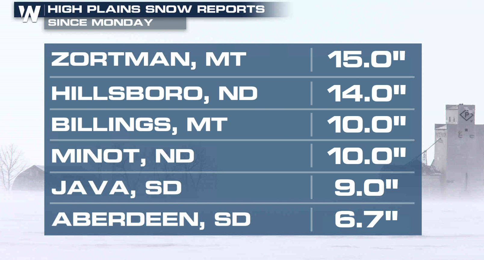
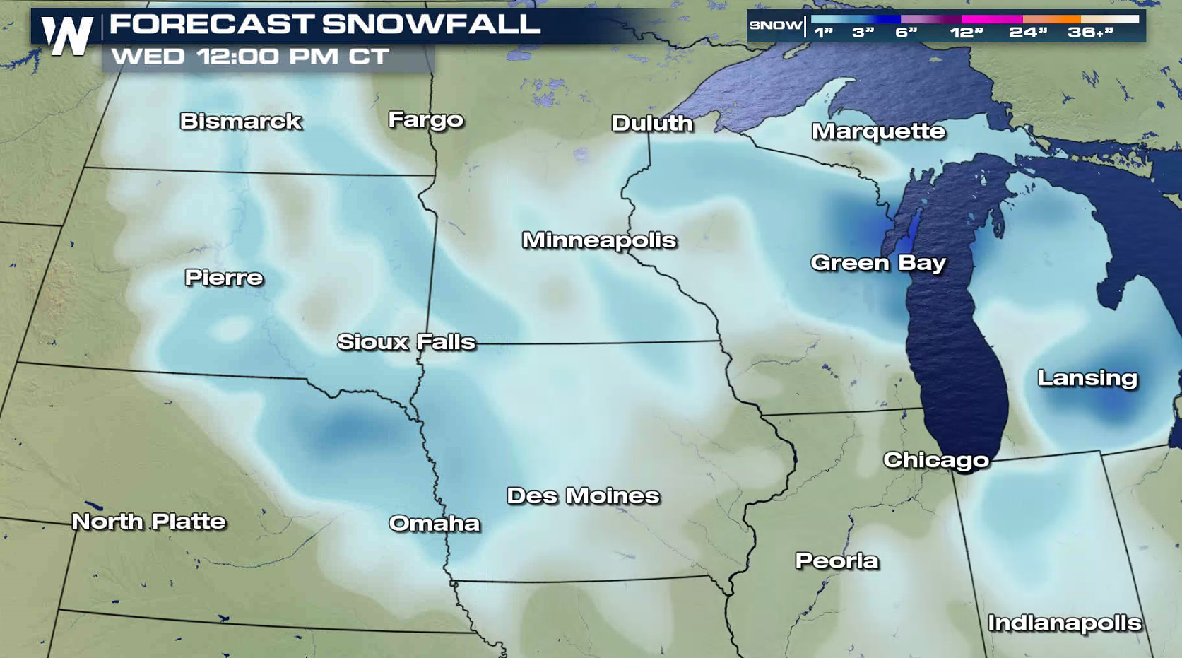
Strong winds and heavy snow have been moving through the Midwest to start this week. Gusts to 70 mph were clocked in South Dakota. Snowfall accumulations reached to over a foot in Montana, North Dakota, and Minnesota.
 Blizzard Warnings remain in effect through midday from central South Dakota into northeastern Nebraska and northwestern Iowa. A few inches of additional accumulation is likely, with occasional wind gusts above 30 mph.
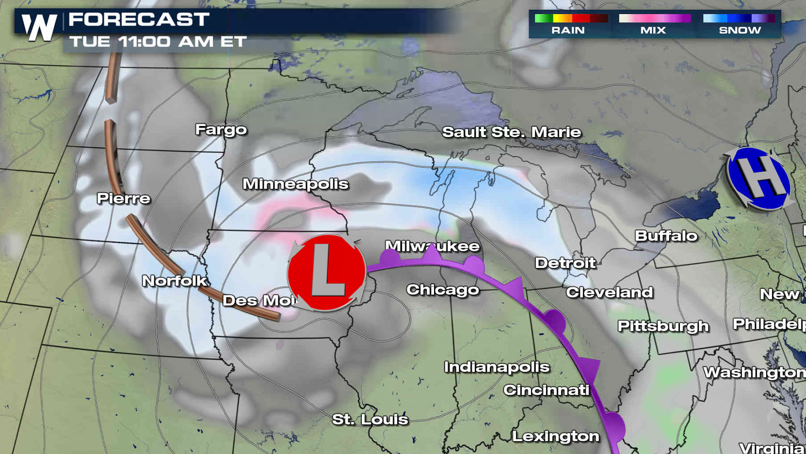
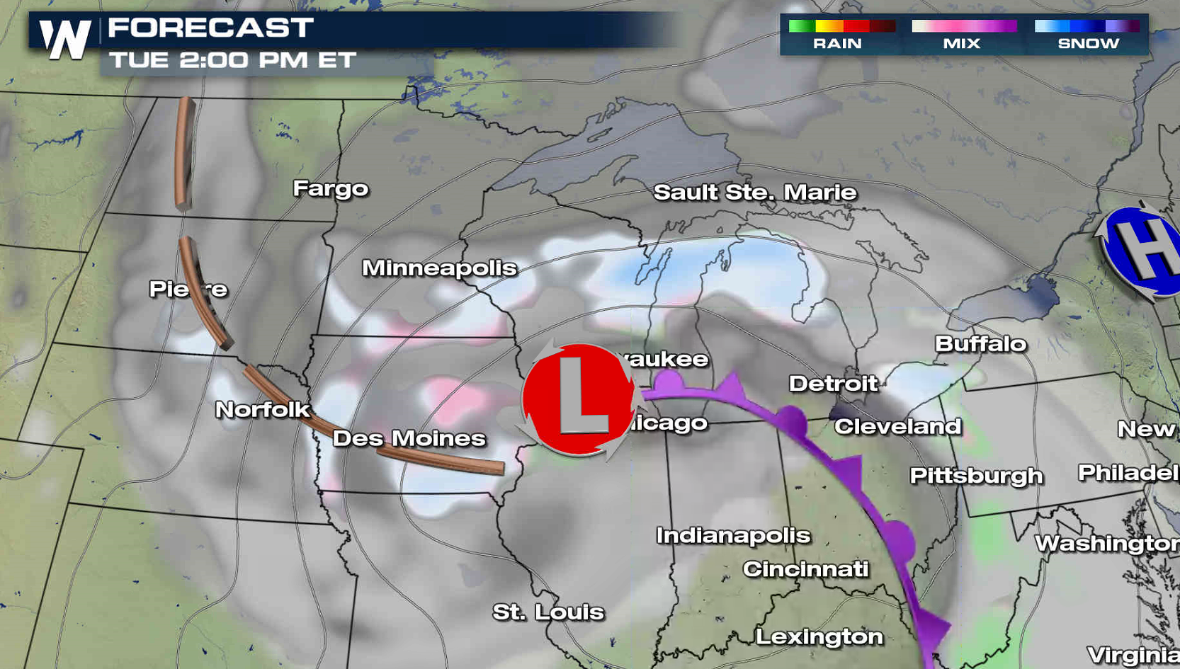
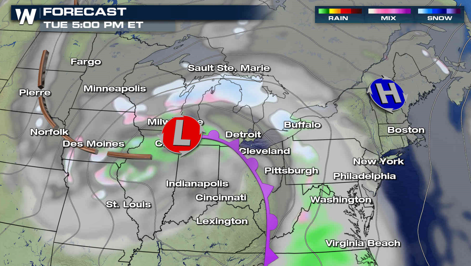
 The low pressure center will gradually weaken throughout the day as it slowly moves from Iowa to Lake Michigan. The wind will continue to decrease and snow showers will become more scattered.
 For WeatherNation: Meteorologist Mace Michaels
Blizzard Warnings remain in effect through midday from central South Dakota into northeastern Nebraska and northwestern Iowa. A few inches of additional accumulation is likely, with occasional wind gusts above 30 mph.
The low pressure center will gradually weaken throughout the day as it slowly moves from Iowa to Lake Michigan. The wind will continue to decrease and snow showers will become more scattered.
For WeatherNation: Meteorologist Mace MichaelsAll Weather News
More
Hurricane Center Monitoring Florida for Tropical Development
Residents and visitors to the Southeast will
30 Jun 2025 10:00 PM

Barry Makes Landfall, Watching Flossie Next
While the Eastern Pacific has made most of th
30 Jun 2025 9:40 PM

Severe Storms For the East Coast Through Tuesday
Frontal systems have been crossing the northe
30 Jun 2025 9:00 PM

Severe Weather Threat Continues in the Midwest
It has been an active, severe season across t
30 Jun 2025 9:00 PM


Where Rain Could Dampen Holiday Travel Plans
AAA is expecting over 70 million travelers to
30 Jun 2025 3:00 PM

Thunderstorms Possible in the Southeast Overnight
SOUTHEAST - Strong thunderstorms have develop
28 Jun 2025 2:40 AM