Interstates Re-Open After Blizzard Conditions Post-Christmas

Roads have mostly reopened across the Plains of Colorado, Nebraska, Kansas, and South Dakota after a post-Christmas blizzard left many at their holiday destination unable to go home.
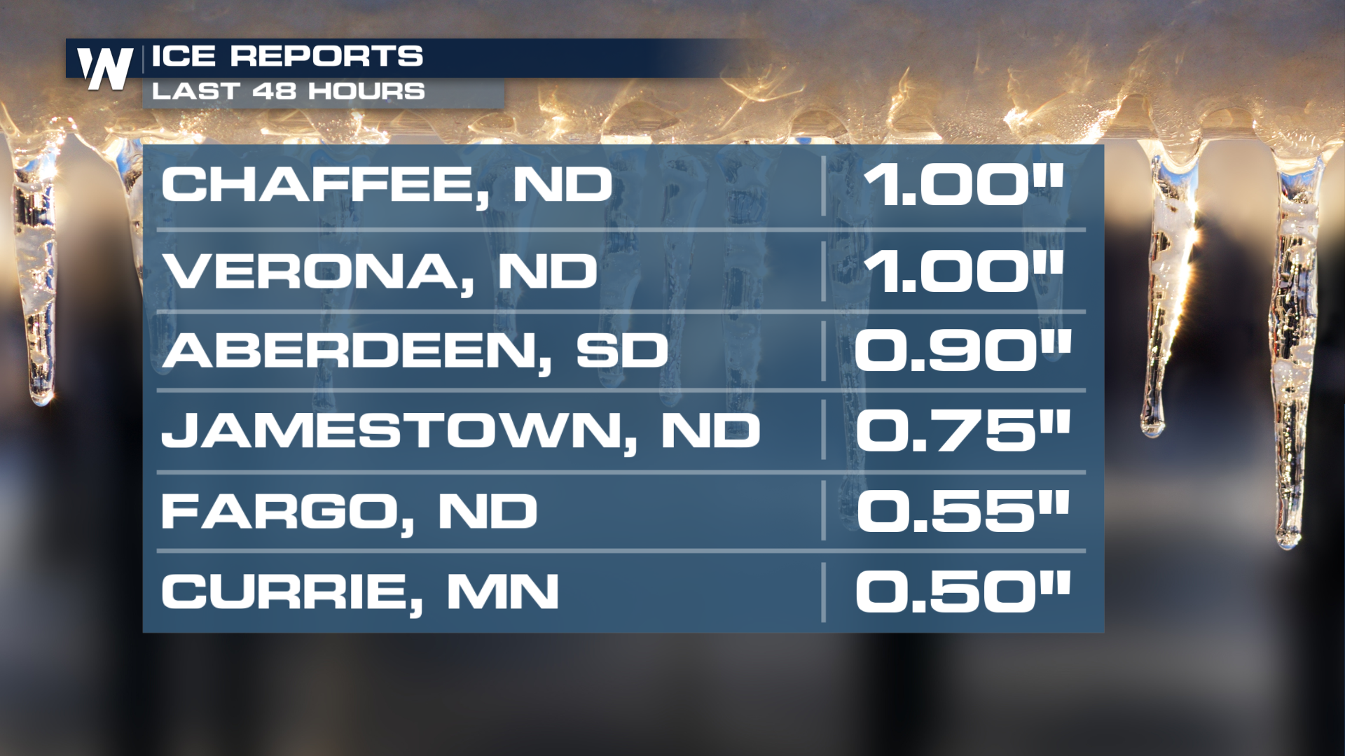
The storm was responsible for over a foot of snow in Nebraska, eastern Colorado, and South Dakota. On the north side of the system, freezing rain produced ice accumulations of up to an inch in North Dakota! When you get to these numbers, this can cause branches to break, powerlines to come down, and make travel impossible. Many residents in the Peace Garden State are waking up without power, especially closer to the Fargo and Jamestown areas.
 If you're doing any traveling on the roads today, be sure to keep a close eye on road conditions and closures on Nebraska's DOT, Colorado's DOT, Kansas's DOT, South Dakota's DOT, and North Dakota's DOT websites.
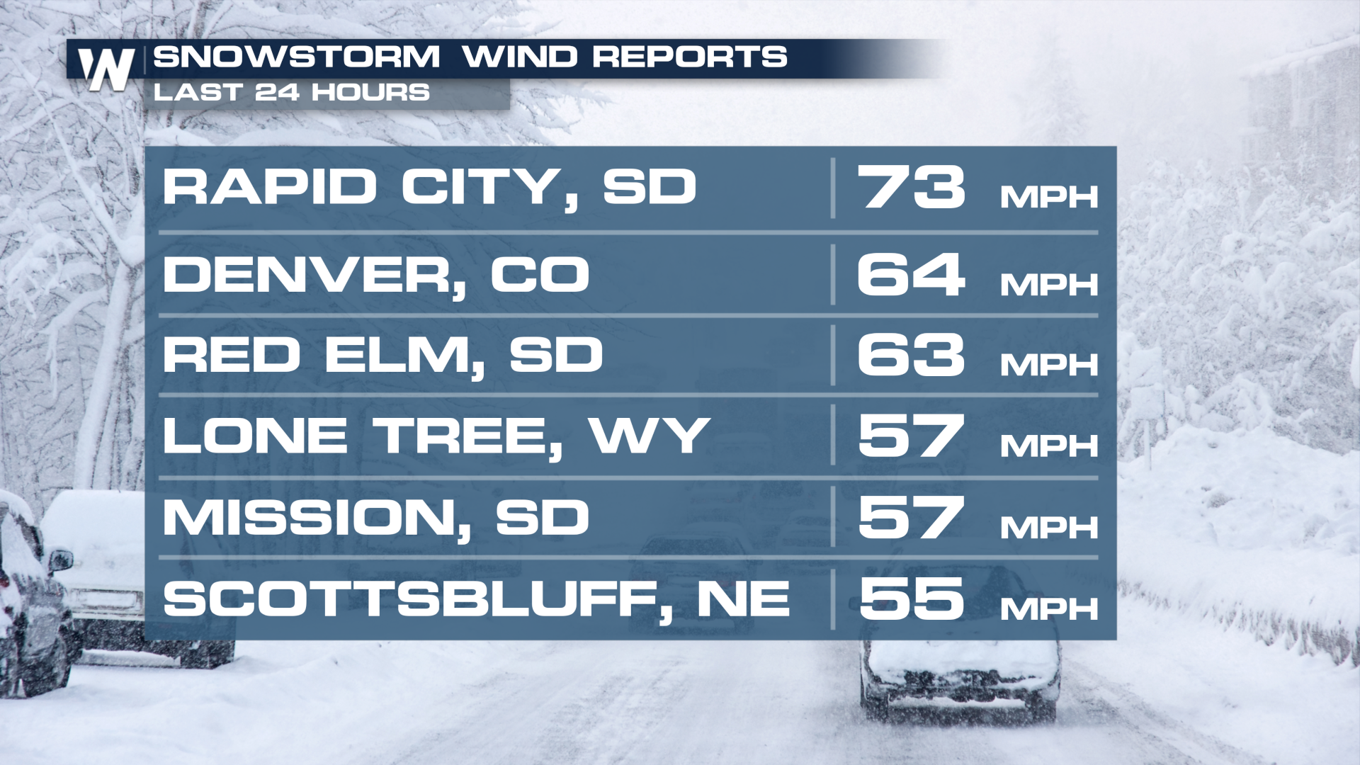
 We saw some very impressive winds out of this system. The airport at Rapid City recorded a 73 mph wind gust early Tuesday morning! DIA also getting in on some of the strong winds. A 64 mph gust came out of Denver! That is tropical storm force! Strong winds will continue throughout the day on Tuesday and even into Wednesday morning for parts of Nebraska.
We recommend packing your patience and being prepared for possible turbulence if you're doing any flying today.


