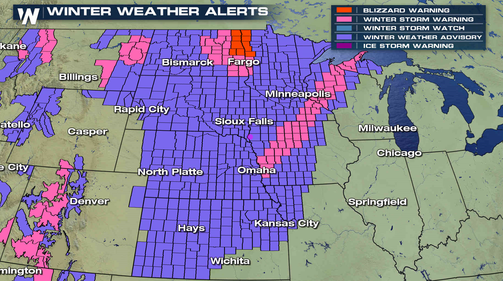
Blizzard Warnings Issued in Minnesota and North Dakota
Special Stories
10 Jan 2018 4:06 PM
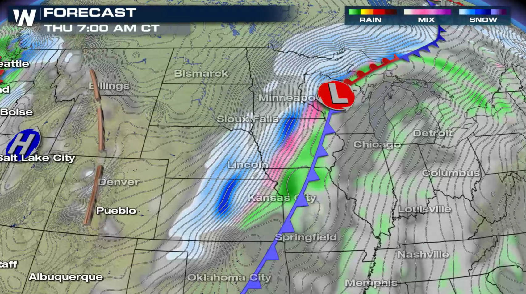
Strong winds and a few pockets of heavy snow will create blizzard conditions in portions of the Upper Midwest tonight into Wednesday morning. A Blizzard Warning has been issued in the Red River Valley of North Dakota and Minnesota. 3" to 6" of snow with 40 mph wind gusts will produce near whiteout conditions in open areas. Winter Storm Warning extend from near Omaha to Marquette, where a narrow band of heavy snow will fall with accumulations up to 8".
 https://twitter.com/NWSGrandForks/status/951201695517822977
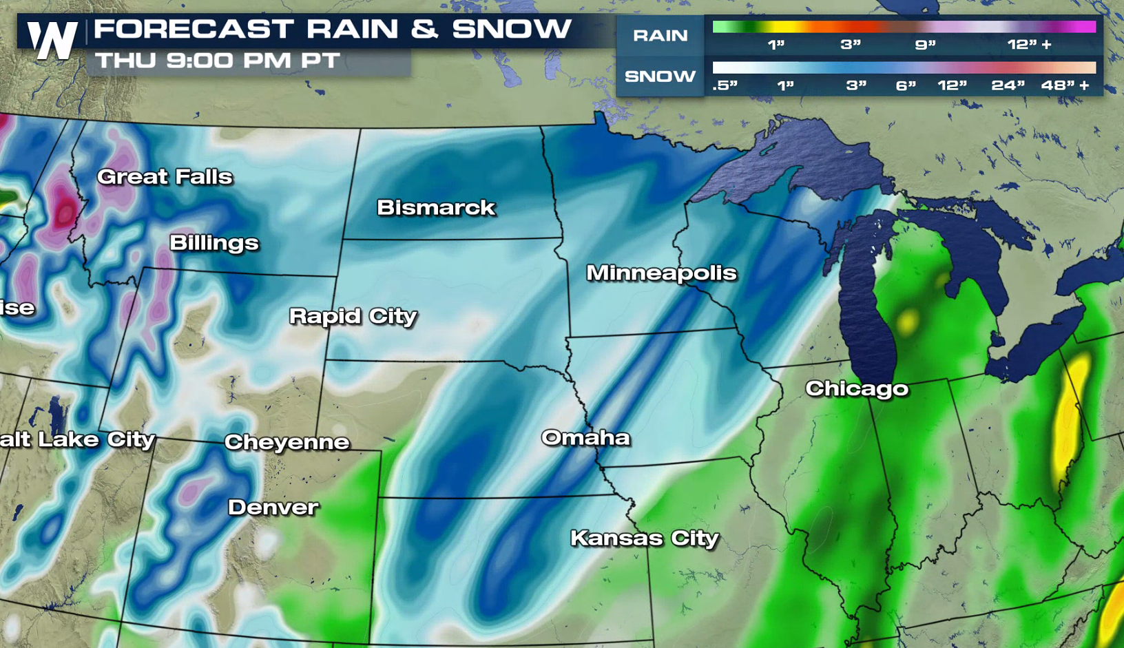
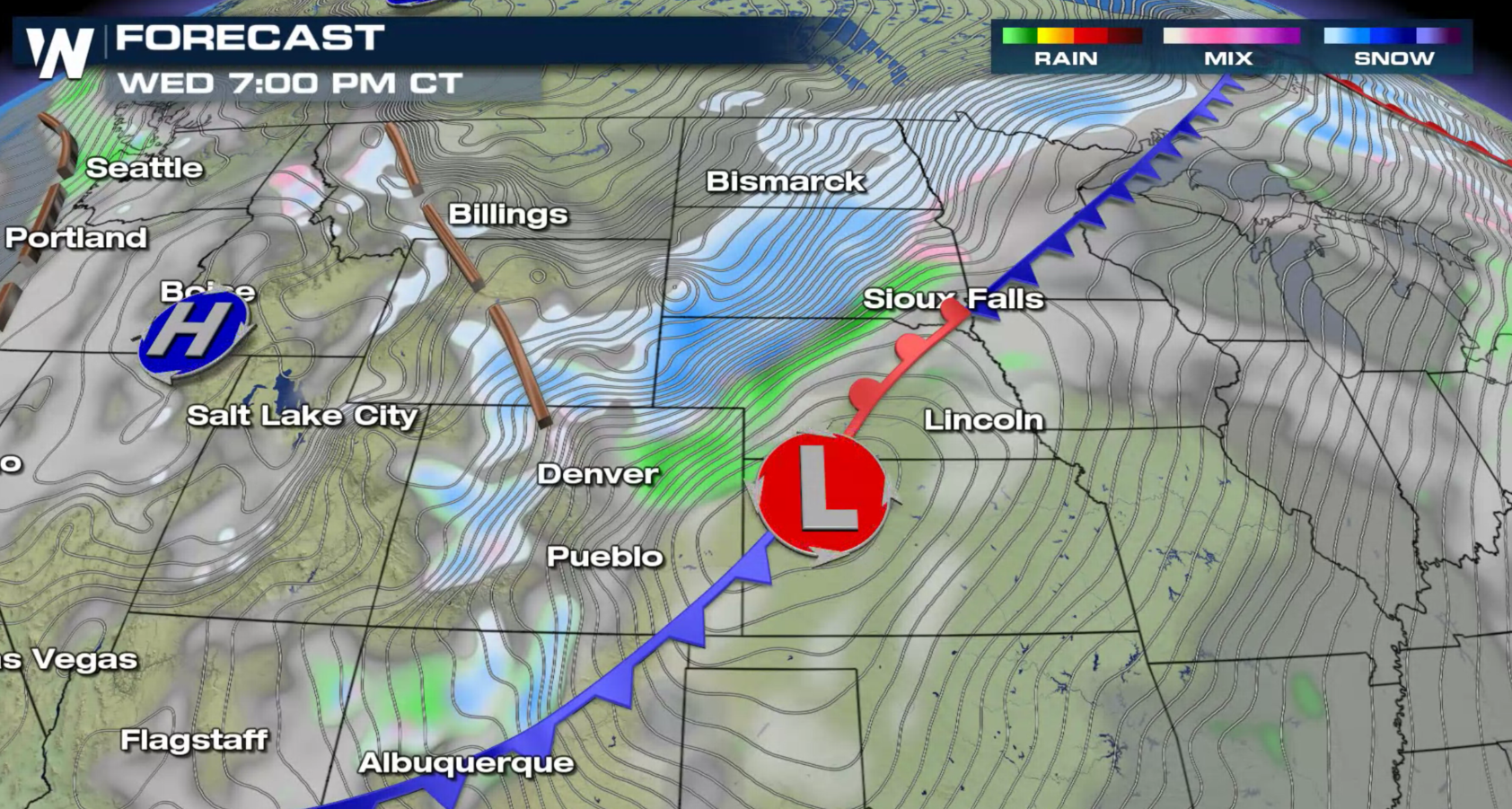
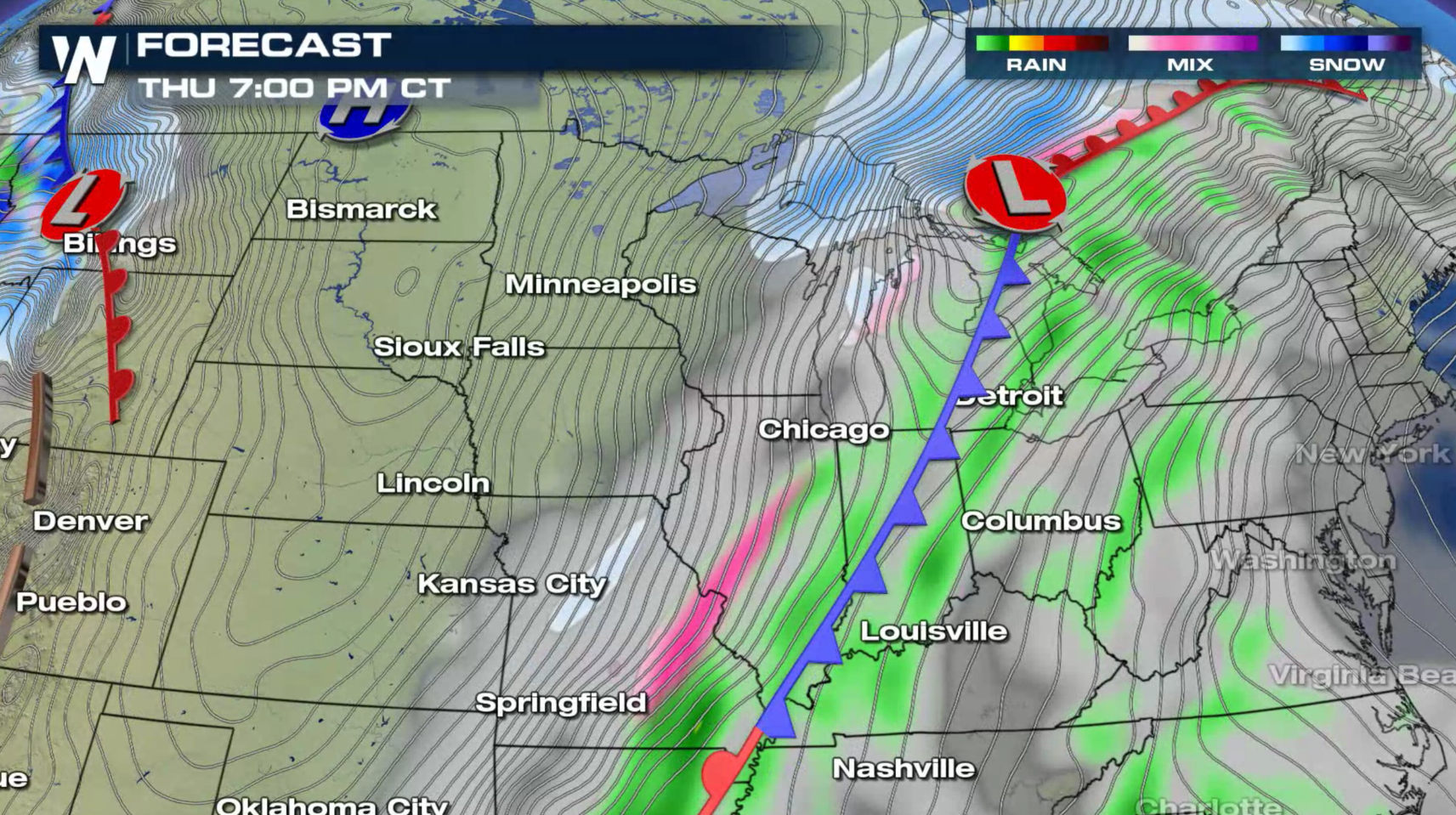
The strong low is expected to intensify as it moves out of Colorado this evening, pushing into the Upper Peninsula of Michigan Thursday night. The fast moving system won't have much time to deposit widespread, significant snowfall accumulations, but wind is expected to be the biggest concern. The system will likely produce gusts as high as 40 mph. This will create significant blowing and drifting snow, reducing visibility, especially in open country. Blizzard conditions are possible in some areas, especially the near the Red River. Travel will likely become extremely difficult, if not impossible
https://twitter.com/NWSGrandForks/status/951201695517822977
The strong low is expected to intensify as it moves out of Colorado this evening, pushing into the Upper Peninsula of Michigan Thursday night. The fast moving system won't have much time to deposit widespread, significant snowfall accumulations, but wind is expected to be the biggest concern. The system will likely produce gusts as high as 40 mph. This will create significant blowing and drifting snow, reducing visibility, especially in open country. Blizzard conditions are possible in some areas, especially the near the Red River. Travel will likely become extremely difficult, if not impossible
 For WeatherNation: Meteorologist Mace Michaels
https://twitter.com/NWSGrandForks/status/951201695517822977
The strong low is expected to intensify as it moves out of Colorado this evening, pushing into the Upper Peninsula of Michigan Thursday night. The fast moving system won't have much time to deposit widespread, significant snowfall accumulations, but wind is expected to be the biggest concern. The system will likely produce gusts as high as 40 mph. This will create significant blowing and drifting snow, reducing visibility, especially in open country. Blizzard conditions are possible in some areas, especially the near the Red River. Travel will likely become extremely difficult, if not impossible
For WeatherNation: Meteorologist Mace MichaelsAll Weather News
More
More Storms for the East Through Monday
A low-pressure system that moved through the
2 Aug 2026 10:40 PM

Wildfire Outbreak in the Pacific Northwest
SPOKANE, WA - On Saturday, August 1st, the Ol
2 Aug 2026 10:35 PM


After Reaching Category 5, Genevieve Weakens in the Pacific
PacificGenevieve formed on last Friday south
2 Aug 2026 6:25 PM

Flooding, Severe Storms Target the Midwest Again
After an active week of storms across the nor
1 Aug 2026 1:40 AM

Flooding Risk Increases as Heavy Rain Targets the Tri-State Area
Tuesday, heavy rainfall moved across the Nort
30 Jul 2026 12:25 AM

Severe Weather: Energy From the Midwest Now in the Southeast
UPPER MIDWEST - Through Monday, dangerous tor
29 Jul 2026 10:30 PM