California Snow Pack Dwinlding After Dry January

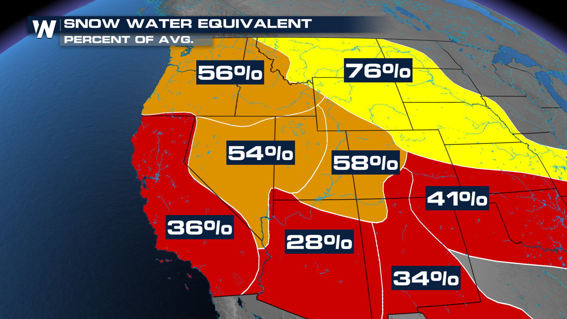
Following a surge of wet storms systems in December and early January, snowpack in the Sierra Nevada mountains has shrunk considerably. Going from 89 percent of the average to 59 percent as the Calendar rolls into February. The Department of Water Resources (DWR) conducted a snow survey on Friday, January 30th, to assess current conditions and discuss impacts.
California and much of the west have been under the influence of a massive blocking ridge of high pressure. This has kept storms charging to the north into Canada before descending across the Midwest and Eastern United States, which has been under siege from cold and snowy systems.
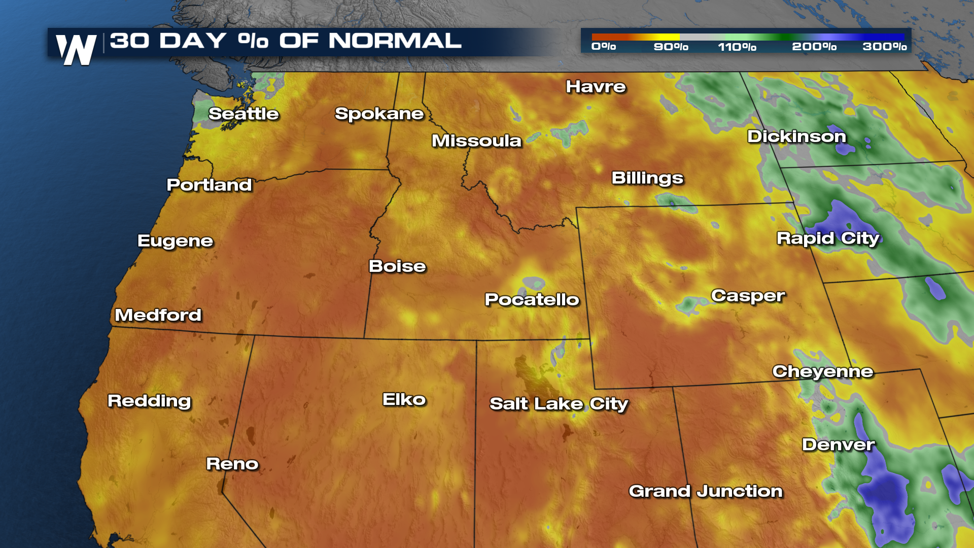
The lack of January storms has left an abysmal snowpack across the Western United States, with record low numbers at many of the monitoring stations in the mountains. It hasn't just been a lack of storms, but also warm weather, which has led to high elevation snow and low elevation rain or melting.
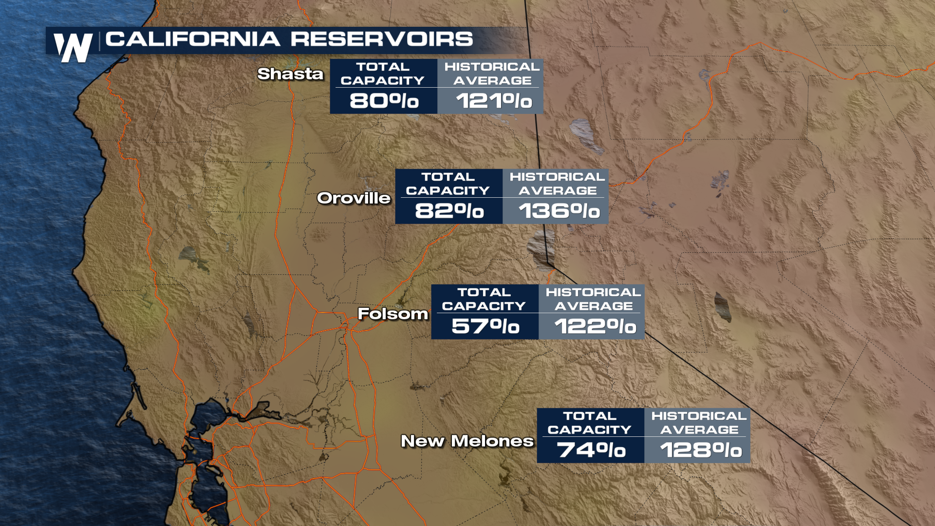
The good news is California has had three wet winter seasons preceding this year, which has left reservoirs with plenty of water. About 30 percent of the state's drinking water comes from the snow pack.
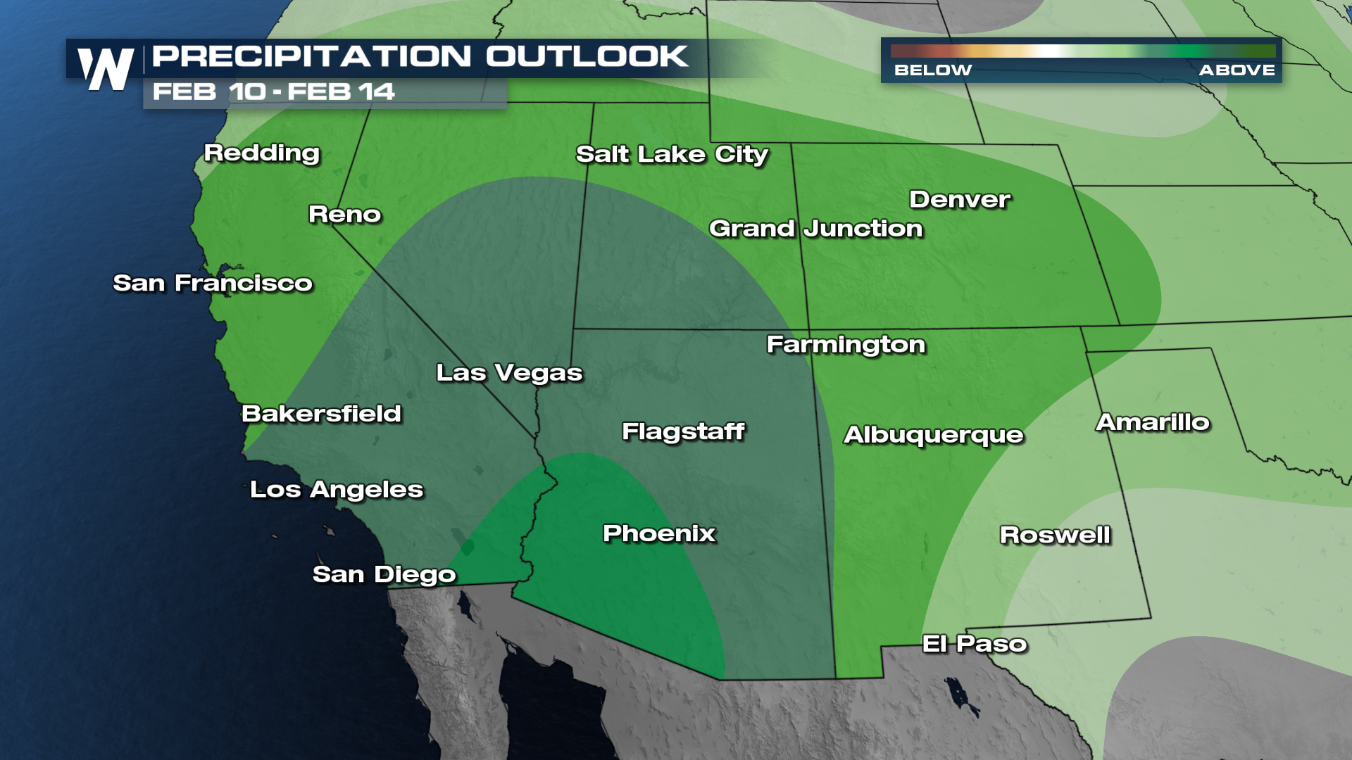
While the short term looks mostly dry for the west, above average precipitation is favored in the medium range forecast as the jet stream pattern could flip around the middle of the month. While full recovery of the snowpack across the entire west is unlikely, getting several moisture pack storm systems could greatly benefit the region.