Catastrophic Flooding Hits Central Tennessee
Special Stories
23 Aug 2021 7:10 PM
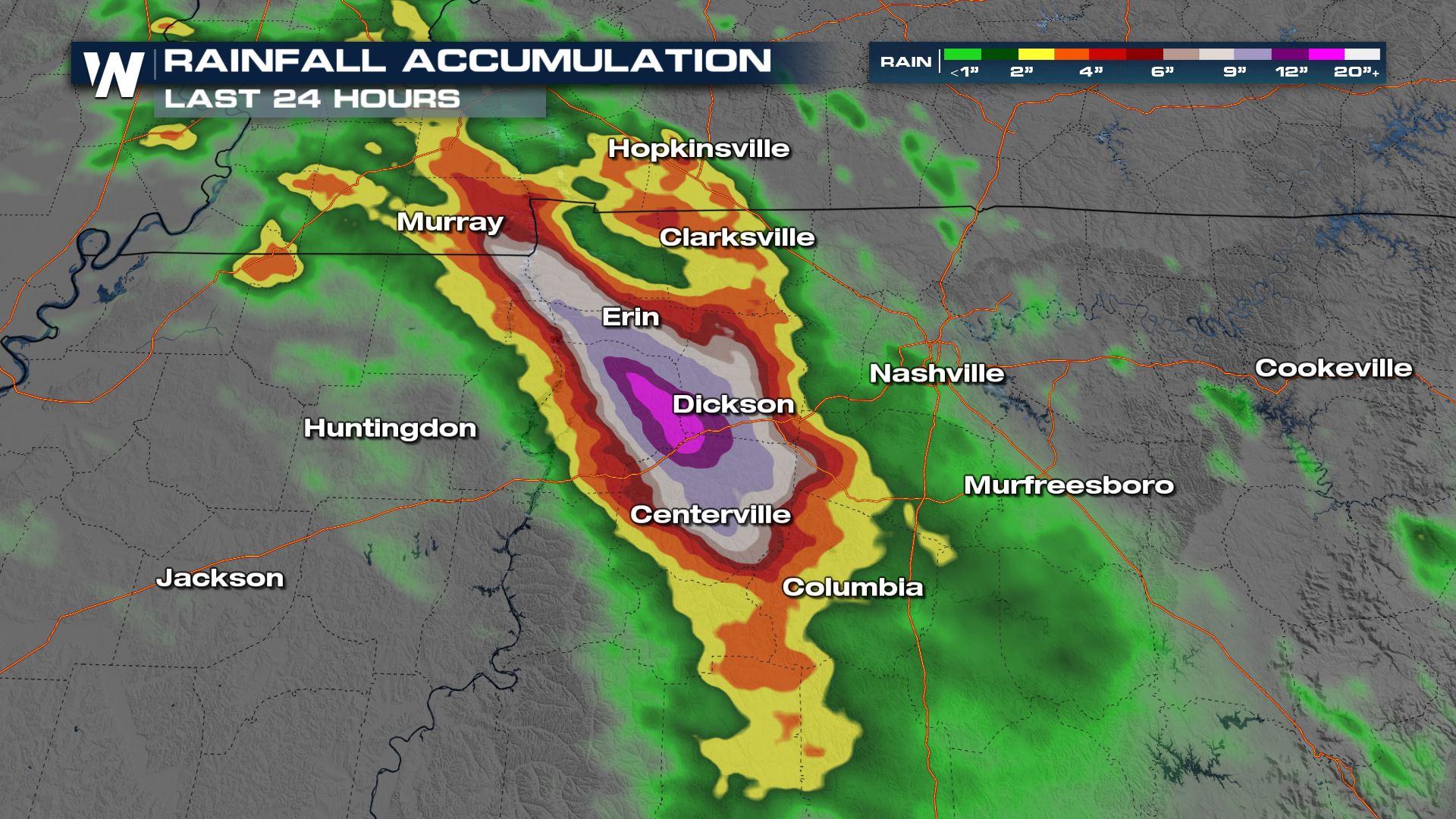
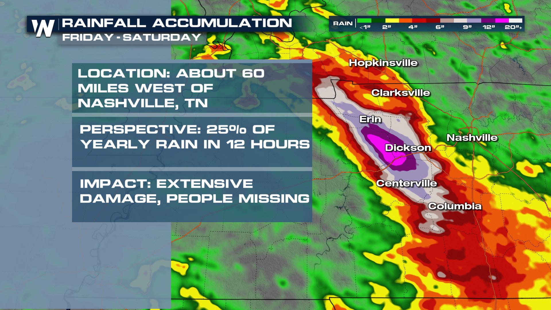
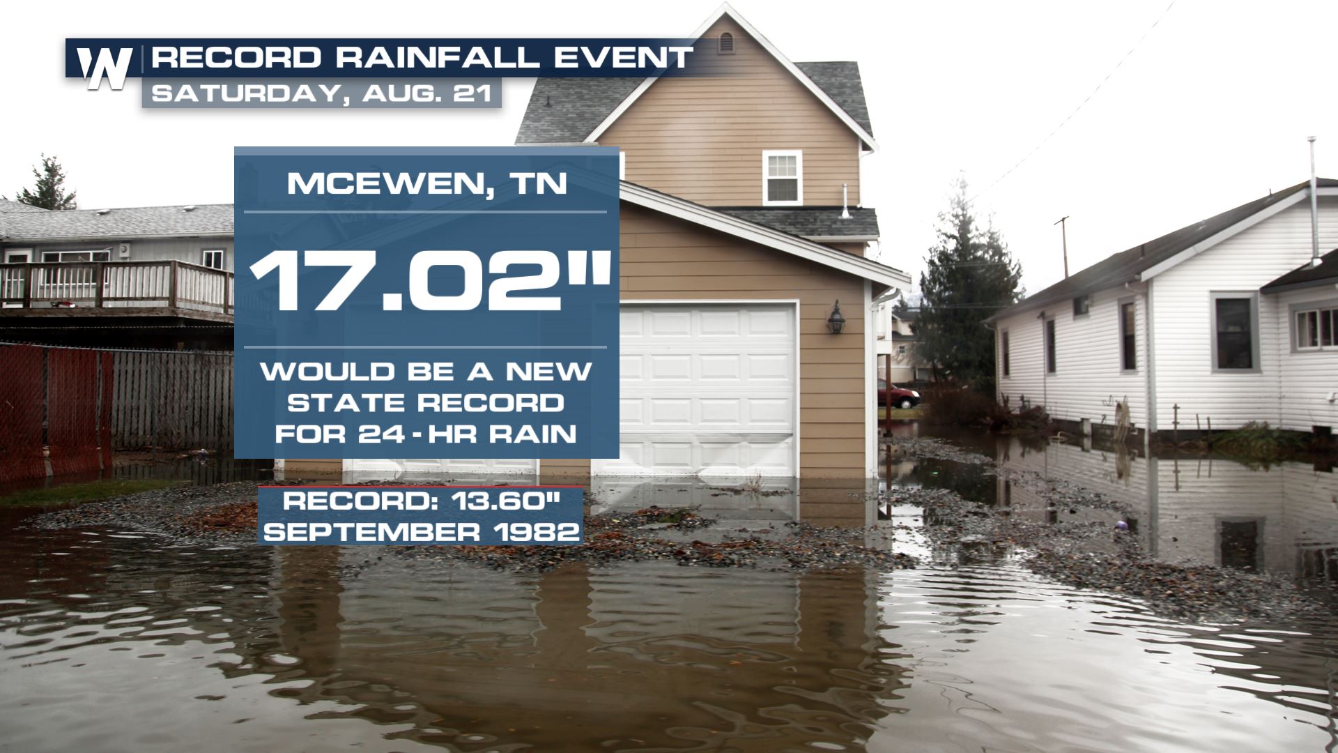
A complex of torrential rain and thunderstorms unloaded on portions of West Central Tennessee and Southwestern Kentucky on Saturday. As much as 9 inches of rain fell during a 6 hour time span, with as much as 11 inches in some isolated areas, and possibly one report of over 17" (this particular report is under investigation by the National Weather Service to verify its accuracy). All of that rain led to multiple water rescues, homes being carried off their foundations, and tragically is responsible for taking the lives of at least 22 individuals.
Drone footage from our field correspondent shows the chaos all of this has left in the town of Waverly. It looks more like tornado damage as opposed to a flooding event.
https://twitter.com/WeatherNation/status/1429745232753614853
https://twitter.com/WeatherNation/status/1429126400234110980
The National Weather Service in Nashville called the situation, "catastrophic."
https://twitter.com/NWSNashville/status/1429104198113705996
The flooding led to the closure of I-40 near mile marker 153, in addition to the Piney River in Vernon topping it's historical crest by more than 10 feet.
[embed]https://twitter.com/NWSNashville/status/1429118952697892868[/embed]
 Less rain is expected across central Tennessee in the coming days, allowing time to clean up and for search & recovery efforts.
Less rain is expected across central Tennessee in the coming days, allowing time to clean up and for search & recovery efforts.All Weather News
More
Severe Storm Threat Returns to the Midwest
After several tornadoes ripped through the Mi
31 Jul 2026 2:20 AM


After Reaching Category 5, Genevieve Weakens in the Pacific
PacificFausto is now a post-tropical cyclone.
31 Jul 2026 1:30 AM

Flooding Risk Increases as Heavy Rain Targets the Tri-State Area
Tuesday, heavy rainfall moved across the Nort
30 Jul 2026 12:25 AM

Severe Weather: Energy From the Midwest Now in the Southeast
UPPER MIDWEST - Through Monday, dangerous tor
29 Jul 2026 10:30 PM

Southeast Flood Risk Lingers Near Stalled Front
A stalled boundary over the Southeast will ke
25 Jul 2026 10:55 AM