Climate Prediction Center Outlook from February through April
Special Stories
2 Feb 2022 6:50 PM
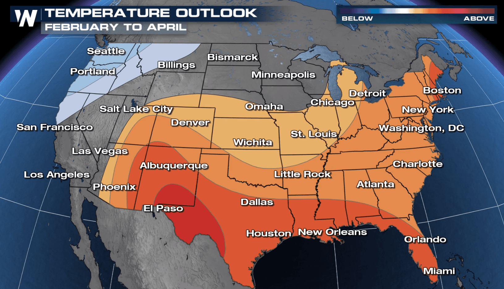
The Climate Prediction Center recently issued their 90-day outlook covering February, March and April. Much of the nation is expected to see warmer than average temperatures. The forecast highlights an area from the Four Corners through the Plains and Gulf Coast to the Eastern Seaboard. Odds favor below normal temperature in the Pacific Northwest.
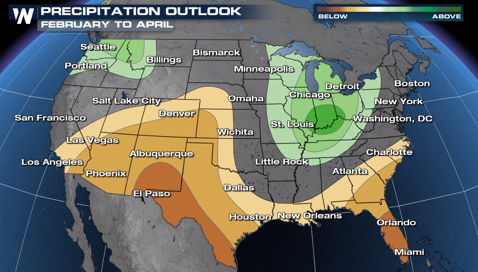
 The Great Lakes, Ohio Valley and the Northwest will likely see a wet period with above average precipitation in the forecast. Drier than normal weather is forecast from the Southwest into the Southeast.
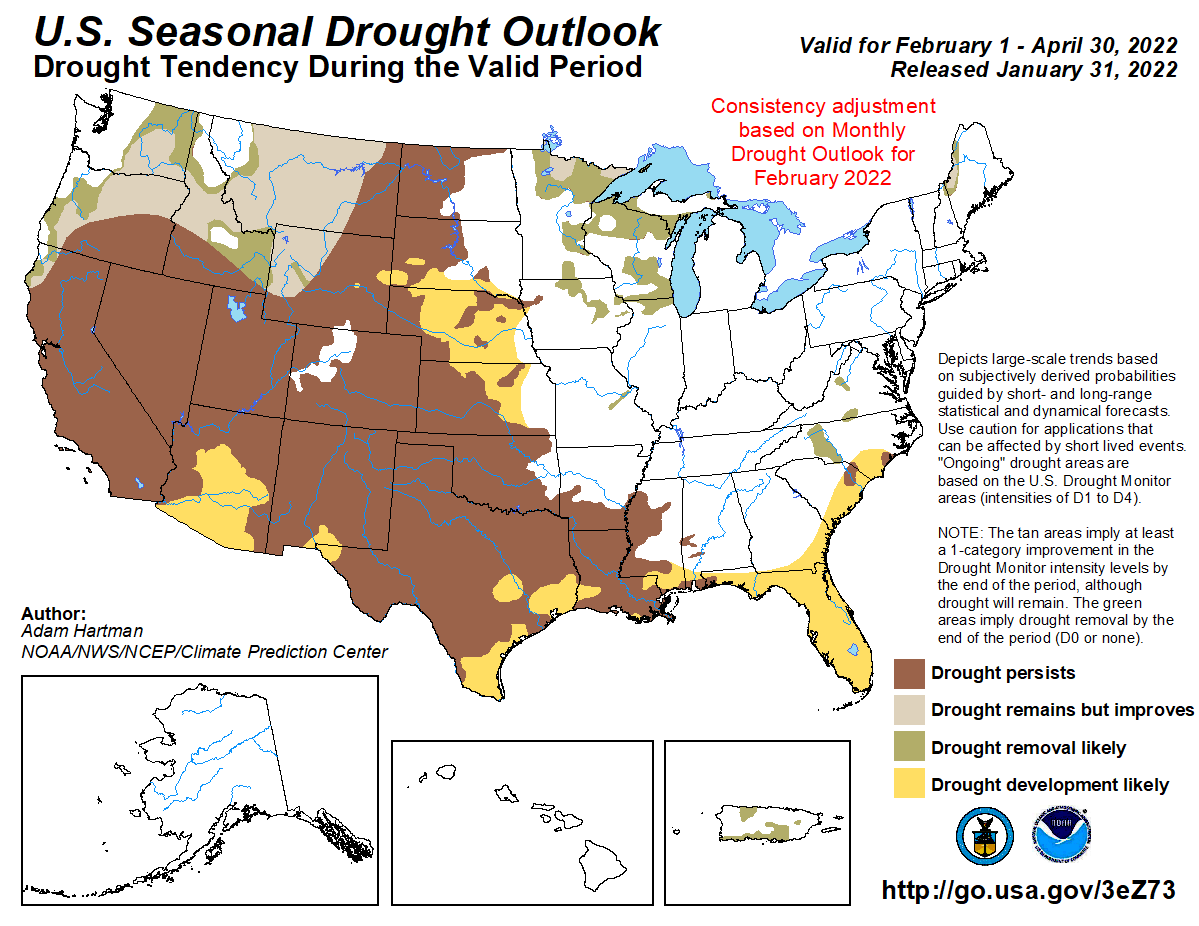
 The dry conditions will lead to a continuation of drought conditions across the West and Plains. Drought development will also potentially increase across the southeast!
 A persistent La Nina was the driving factor in the forecast for February and the Climate Prediction Center expects conditions to last for several months. La Nina occurs when the waters of the Pacific Ocean show a general trend of cooling, the opposite of an El Nino. During La Nina periods, the Jet Stream is not usually active in the Southern U.S. This usually leads to less storms systems and below average precipitation. Cooler than normal weather typically occurs across the northern tier of the country and occasionally wetter periods as well.
The Great Lakes, Ohio Valley and the Northwest will likely see a wet period with above average precipitation in the forecast. Drier than normal weather is forecast from the Southwest into the Southeast.
The dry conditions will lead to a continuation of drought conditions across the West and Plains. Drought development will also potentially increase across the southeast!
A persistent La Nina was the driving factor in the forecast for February and the Climate Prediction Center expects conditions to last for several months. La Nina occurs when the waters of the Pacific Ocean show a general trend of cooling, the opposite of an El Nino. During La Nina periods, the Jet Stream is not usually active in the Southern U.S. This usually leads to less storms systems and below average precipitation. Cooler than normal weather typically occurs across the northern tier of the country and occasionally wetter periods as well.All Weather News
More

More Storms for the East Through Monday
A low-pressure system that moved through the
3 Aug 2026 12:20 PM


After Reaching Category 5, Genevieve Weakens in the Pacific
PacificGenevieve formed last Friday south of
3 Aug 2026 12:30 AM

Flooding, Severe Storms Target the Midwest Again
After an active week of storms across the nor
1 Aug 2026 1:40 AM

Flooding Risk Increases as Heavy Rain Targets the Tri-State Area
Tuesday, heavy rainfall moved across the Nort
30 Jul 2026 12:25 AM