Storms Possible Again in the Southeast
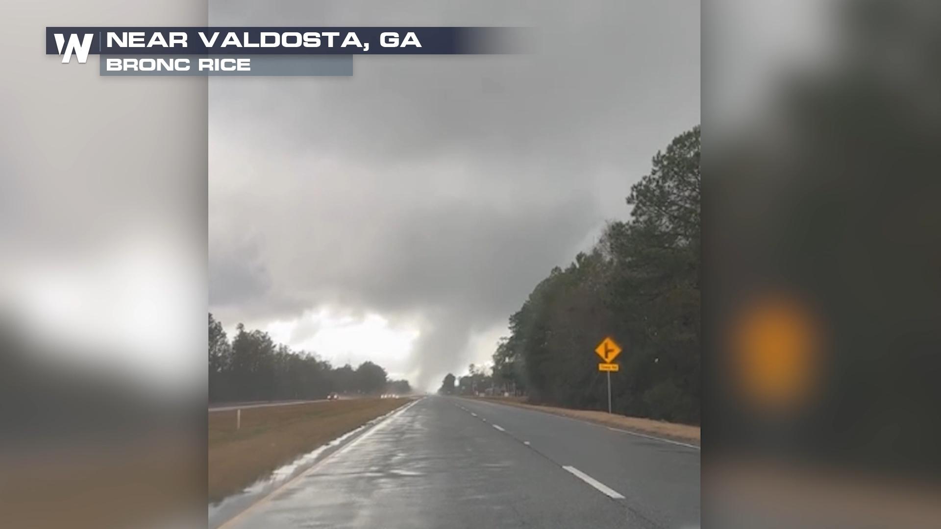
Non-stop rain and severe weather impacted the southeast on Sunday with numerous tornado warnings around the Florida panhandle and southern Georgia. It wasn't just tornados either - multiple hail reports and strong wind reports were seen across the Southeast Sunday.
A strong surface low-pressure system, capable of producing a few severe thunderstorms with hail, strong winds, and even a few isolated tornadoes, will remain across the state into Monday. Some of these may get up to 1" thick, which is enough to hurt if it hits you, and is enough to put small dents in vehicles. Elsewhere across the state, strong wind will be possible through the Florida Keys, with some gusts capable of reaching up to 60 miles per hour!
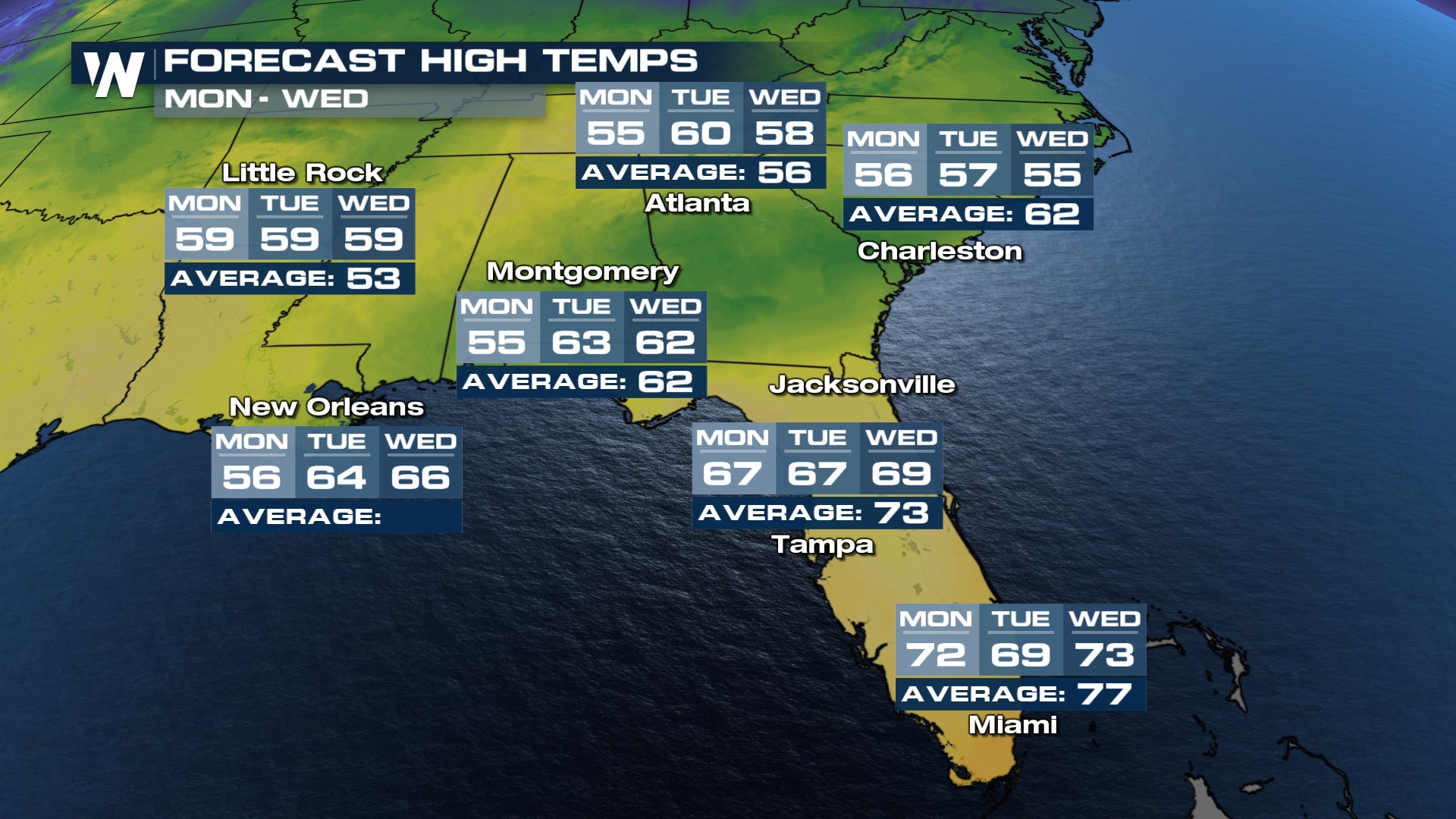
Temperatures will be cool behind the area of low pressure, a couple of degrees below average through Tuesday. We will see sunshine return by Wednesday with temps warming back towards average by the end of the week.