Cold Front Brings Severe Weather
Special Stories
17 Jul 2018 10:51 AM
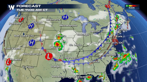
A cold front pushing through the Northeast and tailing down into the High Plains could bring severe weather to both of the regions, for today.
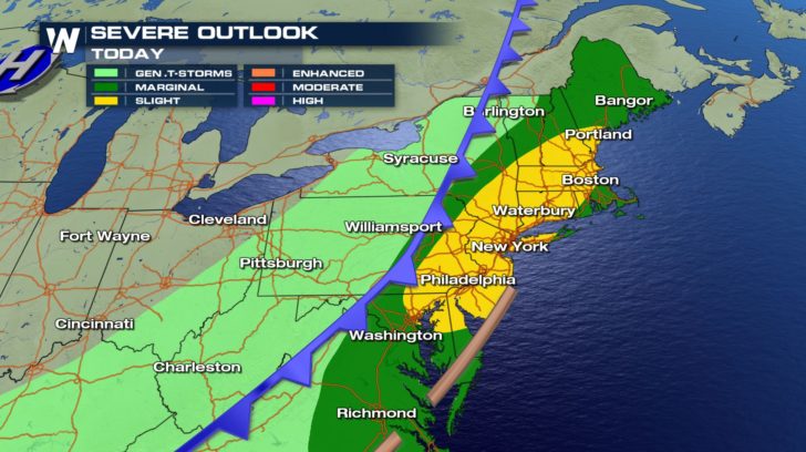 Much of the Northeast is under a marginal to slight risk of severe weather. This means numerous severe thunderstorms could push through the area, especially during the afternoon hours.
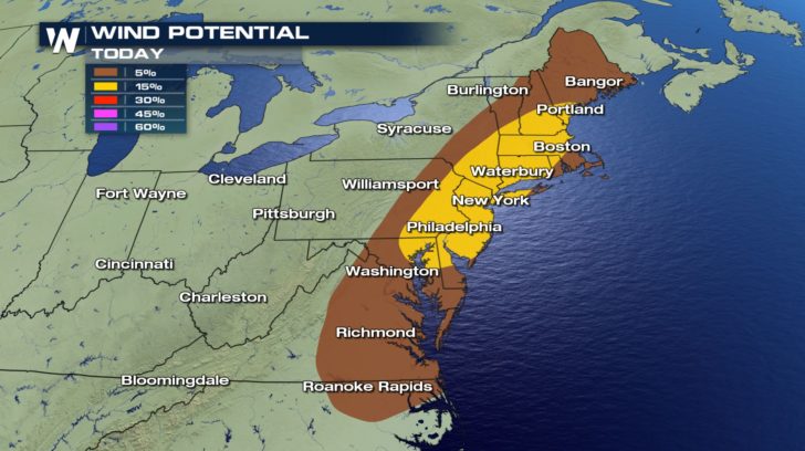 For some of these storms, wind gusts could reach from 60-70 mph. Tree damage and power pole damage might occur.
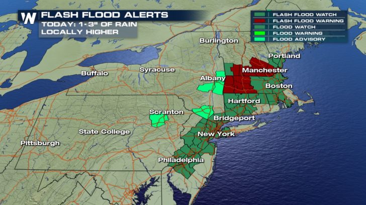 Heavy rain is possible with these storms. Multiple flash flood watches, flash flood warnings, and flood advisories are in place. We could see 1-3 inches of rain.
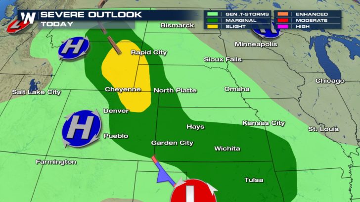 Over into the High Plains, a marginal to slight risk of severe weather also exists.
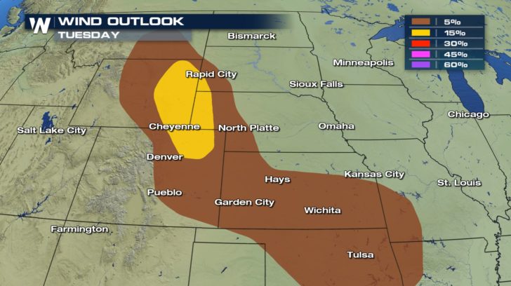 Gusts could also reach 60-70 mph in Wyoming, South Dakota, Nebraska, and Colorado for areas in the yellow.
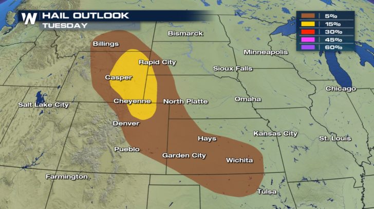 Damaging hail from 1-2 inches in diameter might occur in some of these storms.
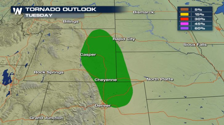 We will also have a potential for tornadoes for these areas.
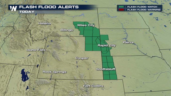 Flash flood watches are in effect due to the possibility of heavy rains.
For WeatherNation -Meteorologist Shelly Lindblade
Flash flood watches are in effect due to the possibility of heavy rains.
For WeatherNation -Meteorologist Shelly Lindblade
Much of the Northeast is under a marginal to slight risk of severe weather. This means numerous severe thunderstorms could push through the area, especially during the afternoon hours.
For some of these storms, wind gusts could reach from 60-70 mph. Tree damage and power pole damage might occur.
Heavy rain is possible with these storms. Multiple flash flood watches, flash flood warnings, and flood advisories are in place. We could see 1-3 inches of rain.
Over into the High Plains, a marginal to slight risk of severe weather also exists.
Gusts could also reach 60-70 mph in Wyoming, South Dakota, Nebraska, and Colorado for areas in the yellow.
Damaging hail from 1-2 inches in diameter might occur in some of these storms.
We will also have a potential for tornadoes for these areas.
Flash flood watches are in effect due to the possibility of heavy rains.
For WeatherNation -Meteorologist Shelly Lindblade
All Weather News
More
Wildfire Outbreak in the Pacific Northwest
Conditions have been incredibly dry out west.
2 Aug 2026 1:30 PM

After Reaching Category 5, Genevieve Weakens in the Pacific
PacificGenevieve formed on last Friday south
2 Aug 2026 1:25 PM

More Storms for the East Sunday and Monday
A low-pressure system crashing through the Mi
2 Aug 2026 1:25 PM


Flooding, Severe Storms Target the Midwest Again
After an active week of storms across the nor
1 Aug 2026 1:40 AM

Flooding Risk Increases as Heavy Rain Targets the Tri-State Area
Tuesday, heavy rainfall moved across the Nort
30 Jul 2026 12:25 AM

Severe Weather: Energy From the Midwest Now in the Southeast
UPPER MIDWEST - Through Monday, dangerous tor
29 Jul 2026 10:30 PM