Cooler Mid-Atlantic & Wetter Northeast This Weekend

Special Stories
20 Apr 2019 9:56 AM
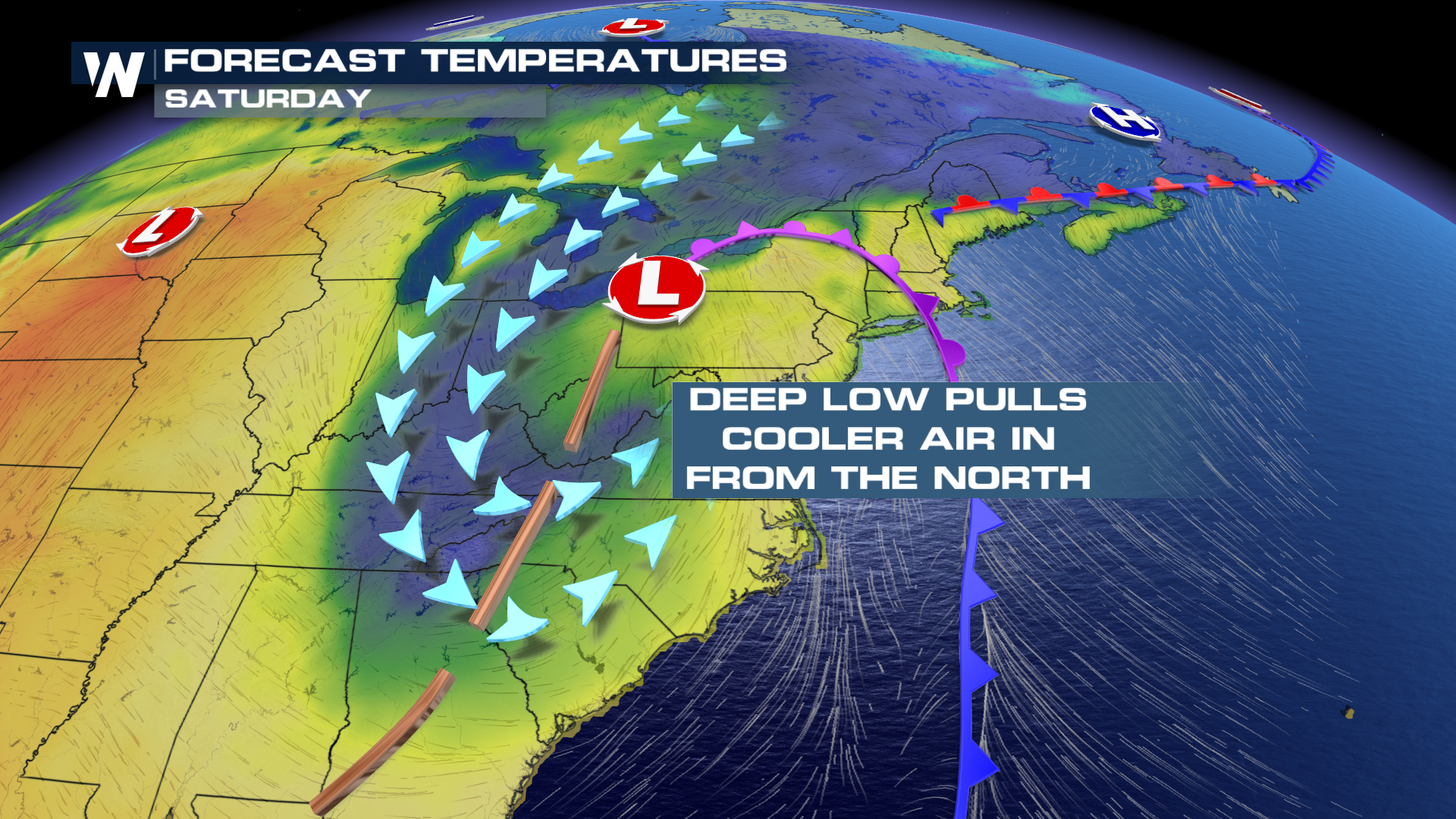
A powerful spring-time storm will remain nearly stationary through the weekend as a downstream blocking pattern keeps cooler temps and wet weather in place over the next 48 hours. The upper level low will sit and spin throughout the Mid-Atlantic states, pulling in cooler temperatures from the north, as well as ushering in wet weather from the south.
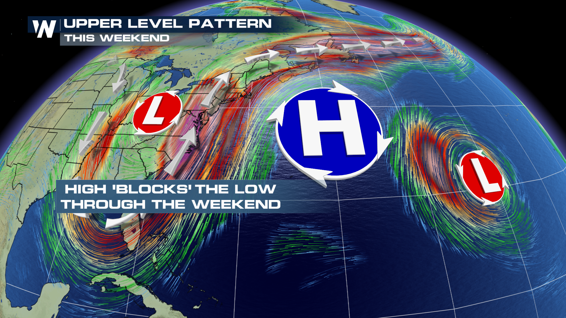 As the southerly surge of moist air stays in the forecast over the next few days, areas in the northeast will deal with flooding issues that last through the Easter weekend. This is all thanks to an upper level ridge parked just off the East Coast, stalling the forward movement of the low pressure system. As the low remains in place, it will create southerly flow on the east side of the storm, generating a wet weather pattern for the northeast. On the backside of the low, winds will wrap around from the north, pulling in much cooler conditions from Canada. This will likely keep temperatures well below average throughout the Mid-Atlantic until early next week.
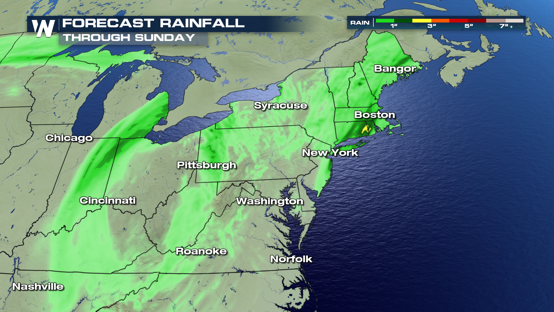
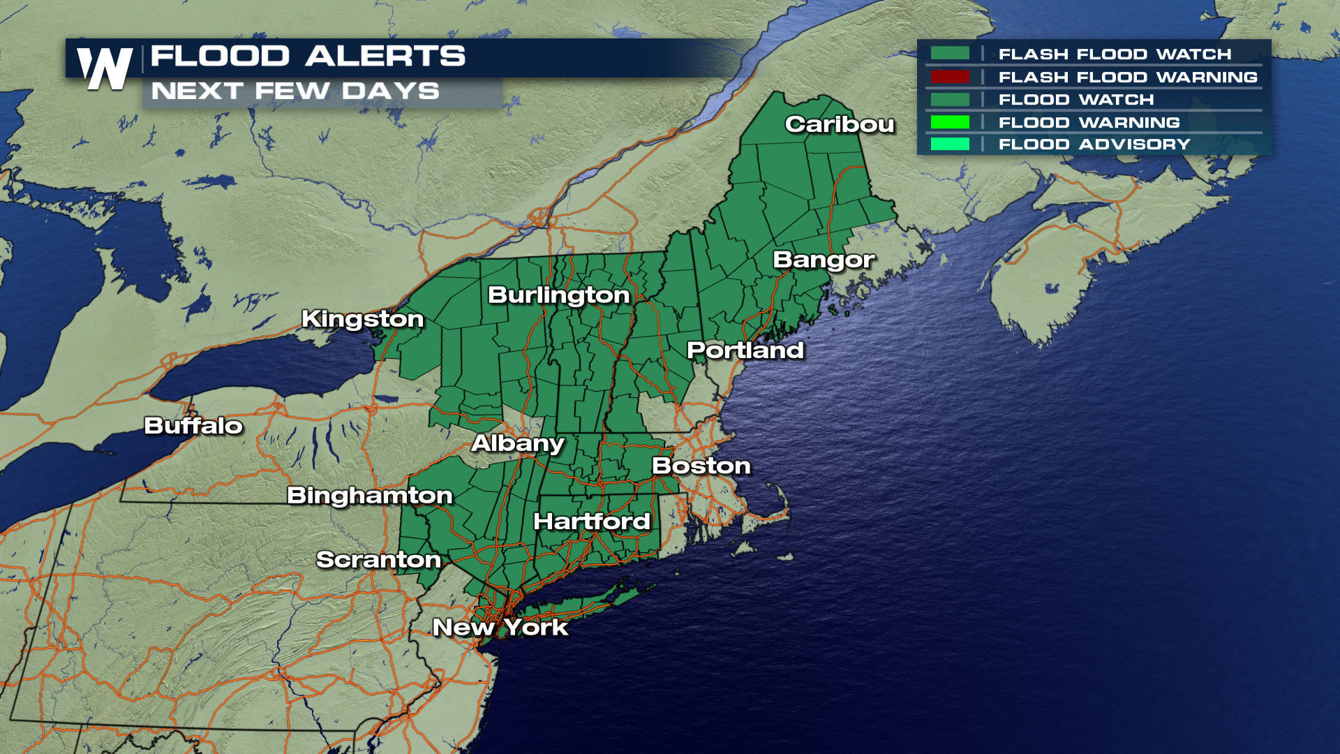 Flooding concerns will likely be an issue from areas in the northeast and into New England over the next 48 hours, thanks to the slow moving storm system. Saturated soils combined with scattered showers will generate flood alerts for all the counties shaded in green. Areas include New York City north through Vermont and into Maine.
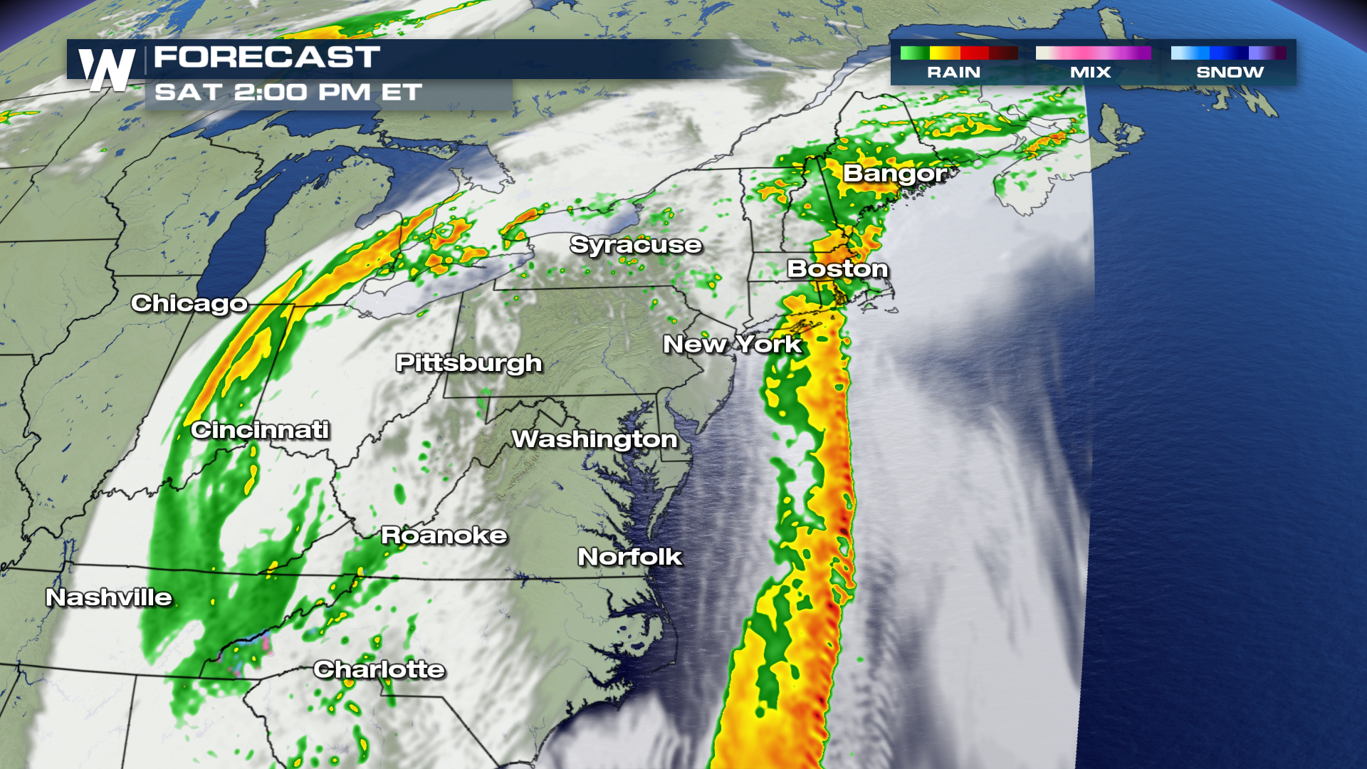 Here is the timing of expected shower activity as it wraps around from the south and moves north through Saturday afternoon. Showers and even a few thunderstorms are possible through the weekend, with moderate rain totals anticipated by early next week.
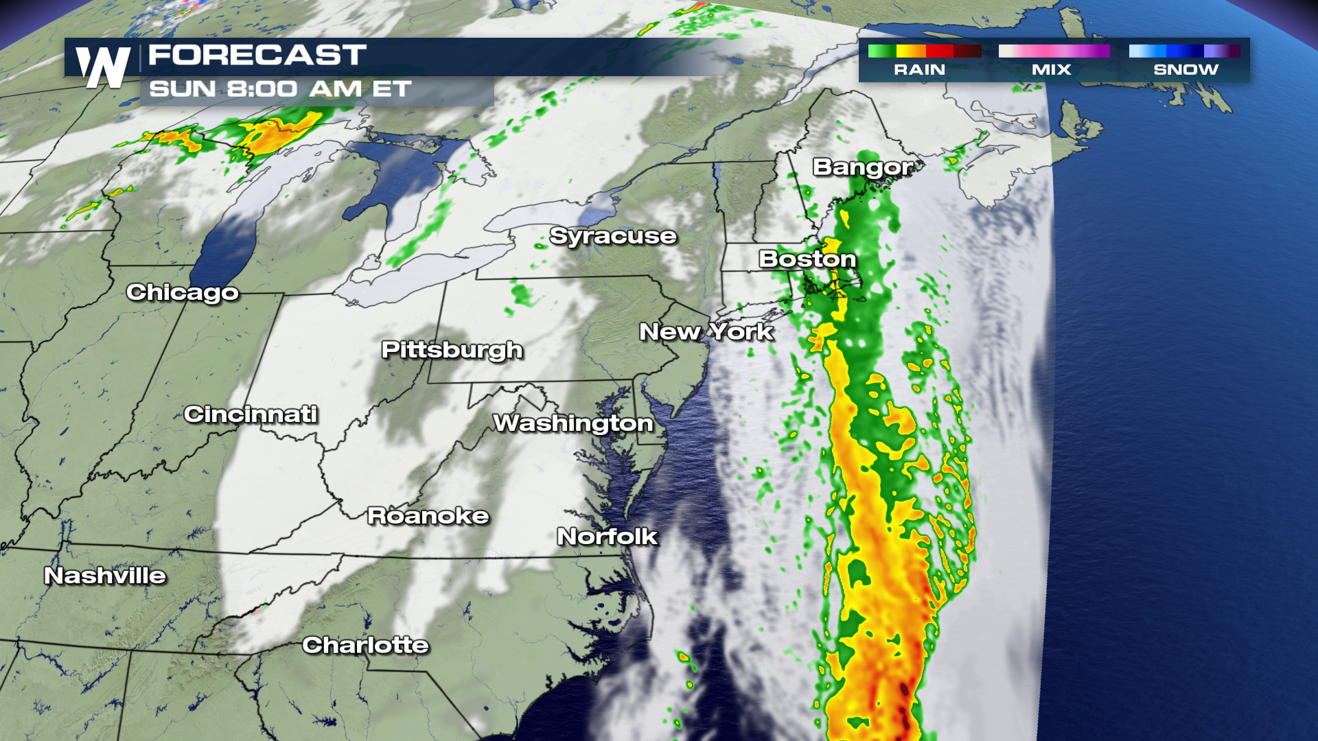 Totals may exceed 3"+ of rain in areas near Boston and to the south. Most locations will likely see anywhere from .5" - 2" of total accumulation.
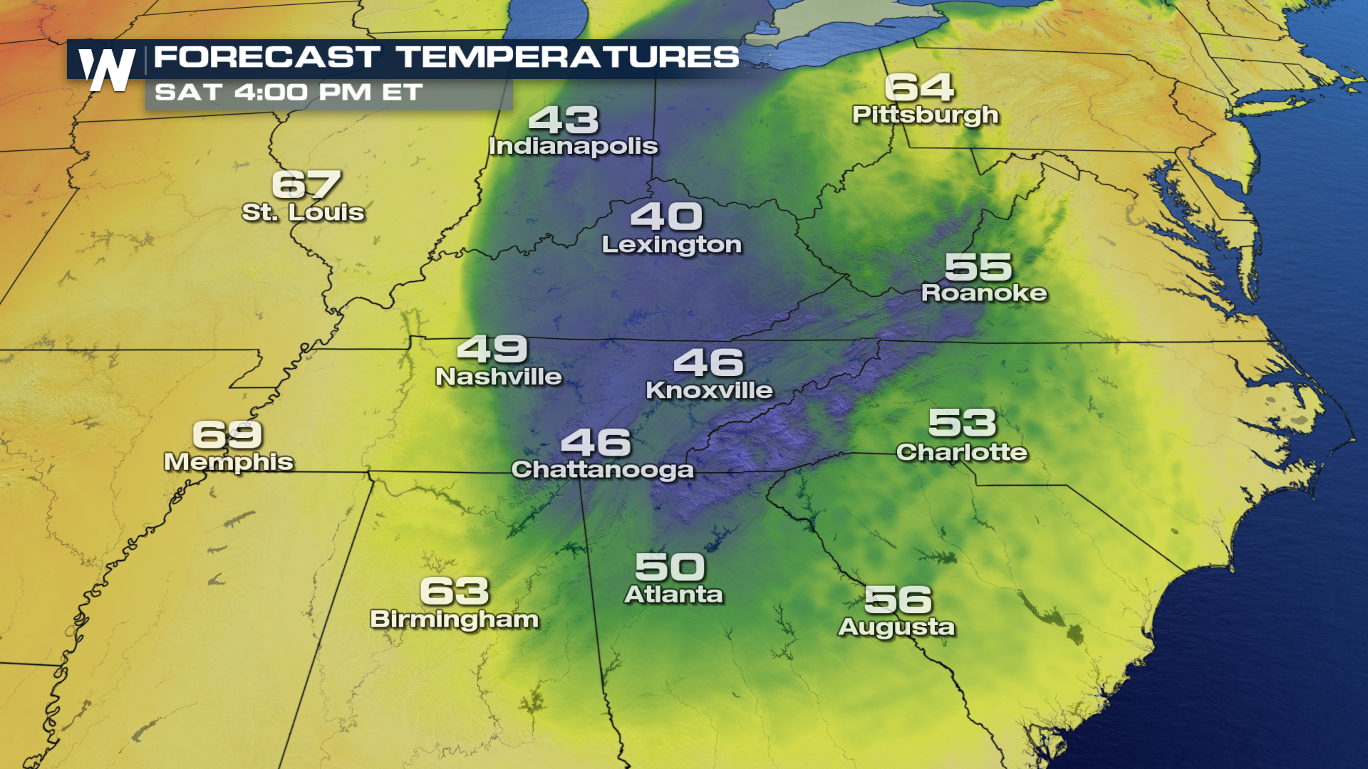
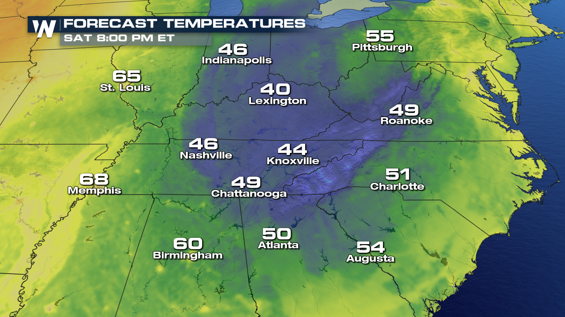
 As cooler temperatures move in from the north on the backside of the storm system, afternoon highs will likely remain 5-15° below average.
 The coolest temperatures will be felt through the Mid-Atlantic states over the weekend. The cooler shaded colors of blue represent the coolest air-mass, which are located under the upper level low center.
 For WeatherNation, I'm Meteorologist Greg Rule
As the southerly surge of moist air stays in the forecast over the next few days, areas in the northeast will deal with flooding issues that last through the Easter weekend. This is all thanks to an upper level ridge parked just off the East Coast, stalling the forward movement of the low pressure system. As the low remains in place, it will create southerly flow on the east side of the storm, generating a wet weather pattern for the northeast. On the backside of the low, winds will wrap around from the north, pulling in much cooler conditions from Canada. This will likely keep temperatures well below average throughout the Mid-Atlantic until early next week.
Flooding concerns will likely be an issue from areas in the northeast and into New England over the next 48 hours, thanks to the slow moving storm system. Saturated soils combined with scattered showers will generate flood alerts for all the counties shaded in green. Areas include New York City north through Vermont and into Maine.
Here is the timing of expected shower activity as it wraps around from the south and moves north through Saturday afternoon. Showers and even a few thunderstorms are possible through the weekend, with moderate rain totals anticipated by early next week.
Totals may exceed 3"+ of rain in areas near Boston and to the south. Most locations will likely see anywhere from .5" - 2" of total accumulation.
As cooler temperatures move in from the north on the backside of the storm system, afternoon highs will likely remain 5-15° below average.
The coolest temperatures will be felt through the Mid-Atlantic states over the weekend. The cooler shaded colors of blue represent the coolest air-mass, which are located under the upper level low center.
For WeatherNation, I'm Meteorologist Greg Rule
All Weather News
More

More Storms for the East Through Monday
A low-pressure system that moved through the
3 Aug 2026 12:20 PM


After Reaching Category 5, Genevieve Weakens in the Pacific
PacificGenevieve formed last Friday south of
3 Aug 2026 12:30 AM

Flooding, Severe Storms Target the Midwest Again
After an active week of storms across the nor
1 Aug 2026 1:40 AM

Flooding Risk Increases as Heavy Rain Targets the Tri-State Area
Tuesday, heavy rainfall moved across the Nort
30 Jul 2026 12:25 AM