Damaging Wind Threat in the Southeast and Mid-Atlantic Tuesday
Top Stories
23 Jul 2019 5:32 AM
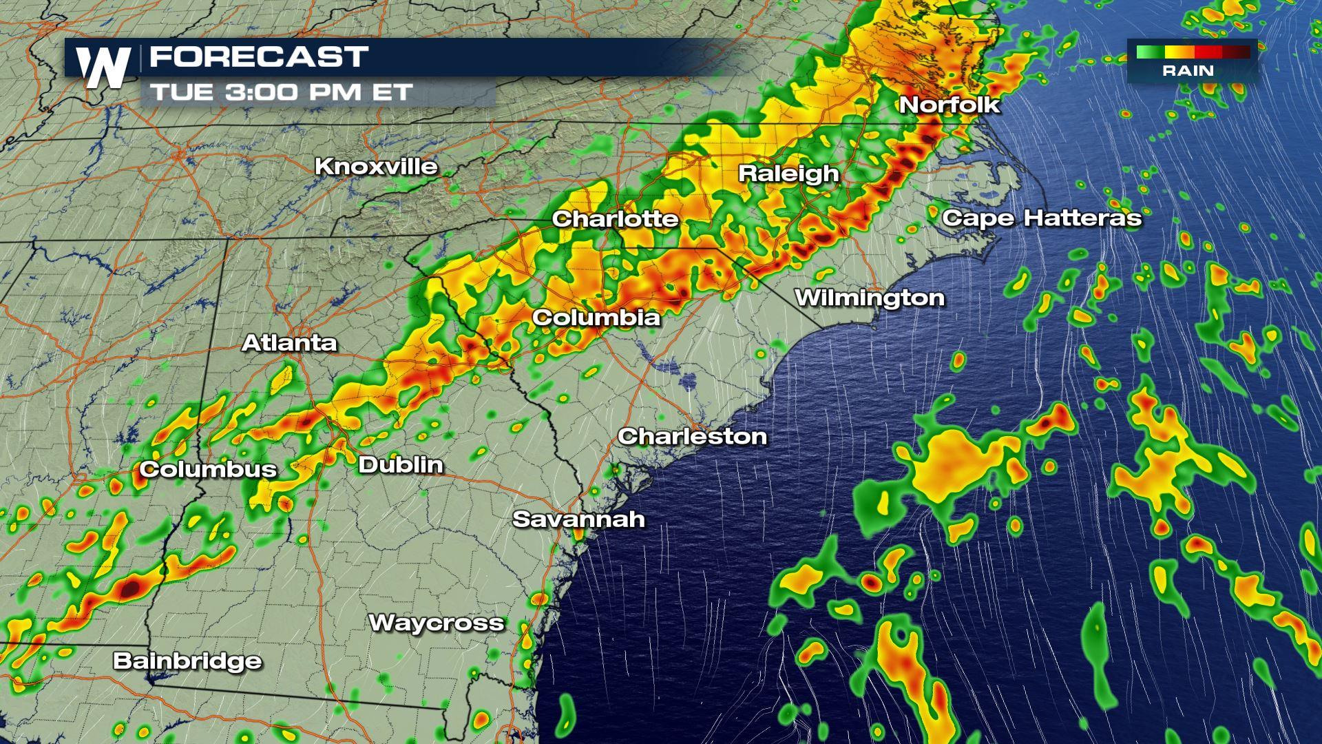
A strong cold front will bring increasing storm chances to the Carolinas and Georgia today and tonight. Damaging winds will be the main weather threat, but heavy rain could lead to flash flooding as well. Here is the very latest forecast.
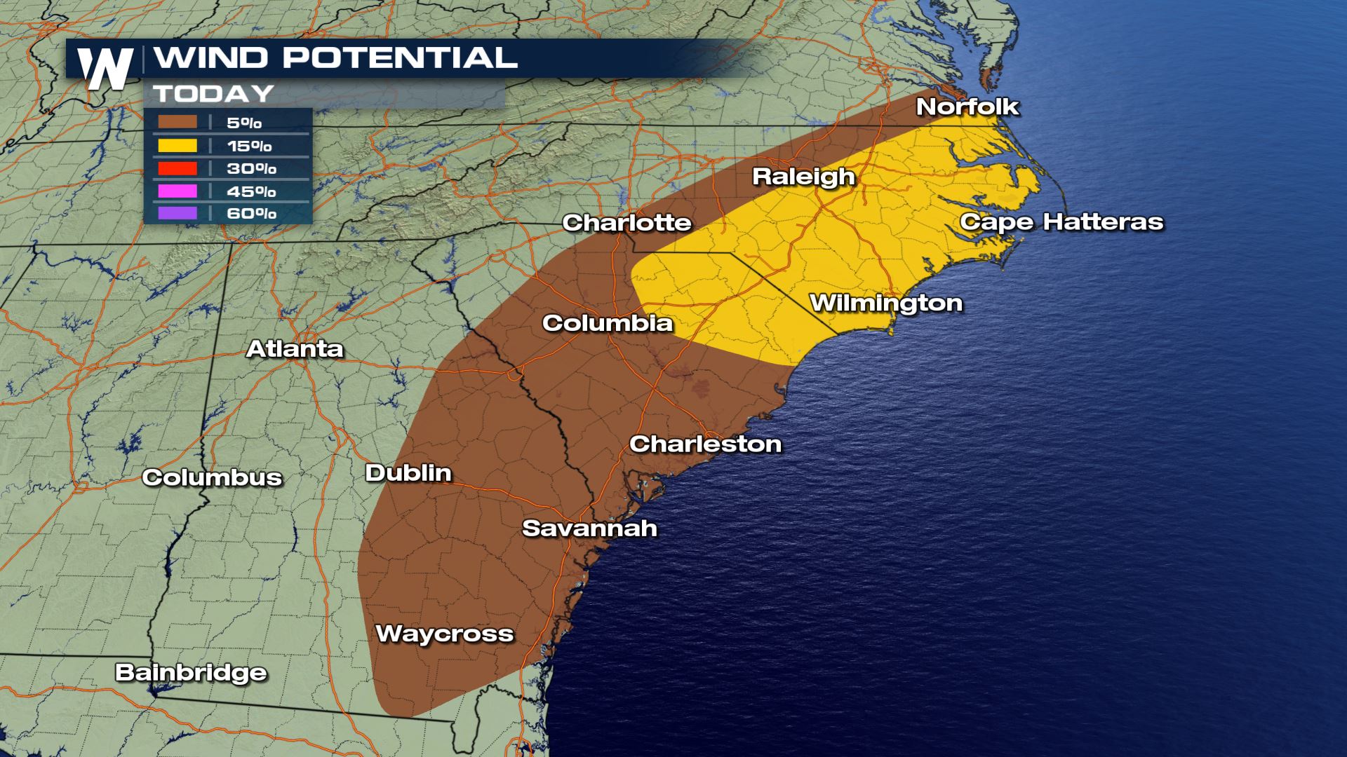 Here is a look at the damaging winds risk. Areas like Cape Hatteras and Wilmington, North Carolina could experience wind gust over 70 mph within today's storms. You will want to secure any loose outdoor items or bring indoors anything that could blow away.
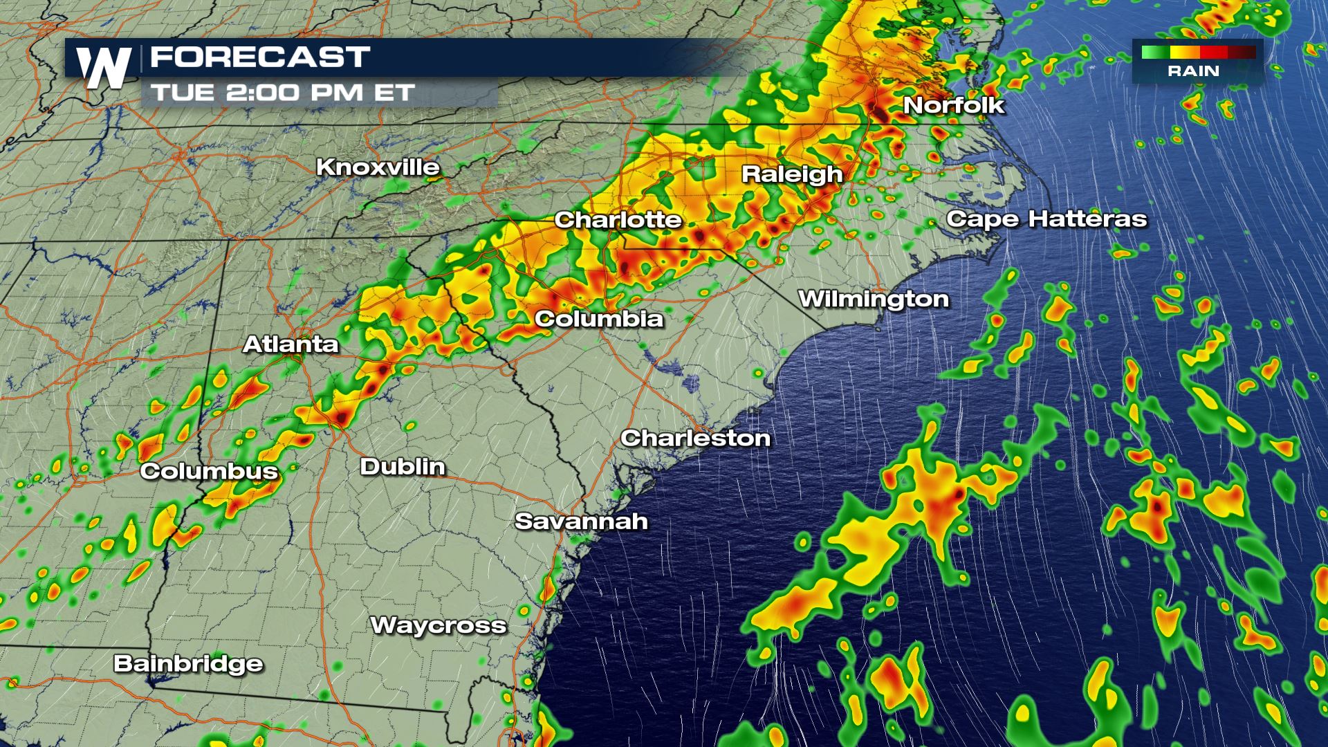

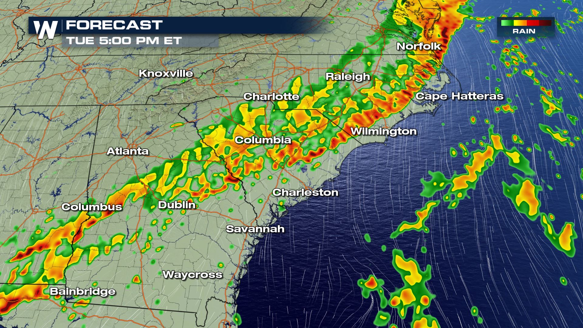
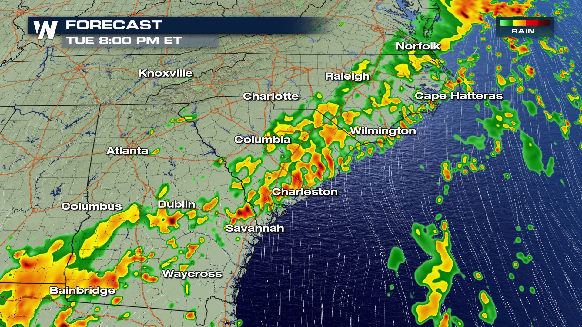 The slow moving cold front will bring storms chances all day, but the severe risk will likely be the highest during the peak heating hours of the afternoon. Keep checking back with WeatherNation for more severe weather updates.
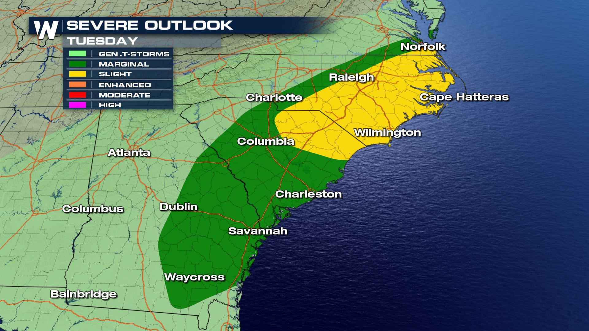
Severe Outlook
Severe Risk
Here is a look at the damaging winds risk. Areas like Cape Hatteras and Wilmington, North Carolina could experience wind gust over 70 mph within today's storms. You will want to secure any loose outdoor items or bring indoors anything that could blow away.
Forecast
The slow moving cold front will bring storms chances all day, but the severe risk will likely be the highest during the peak heating hours of the afternoon. Keep checking back with WeatherNation for more severe weather updates.
All Weather News
More
Heat Wave Grips Central, Western U.S.
Are you over the summer heat yet? SouthwestEx
25 Jul 2026 11:10 AM

Tropics: Fausto Heads to Hawaii; Genevieve Has Formed and Could Become a Major Hurricane
Atlantic BasinBertha has dissipated after mov
25 Jul 2026 11:00 AM

Severe Storms Target the Midwest This Weekend
Extreme heat will be a big story this week ac
25 Jul 2026 11:00 AM

Southeast Flood Risk Lingers Near Stalled Front
A stalled boundary over the Southeast will ke
25 Jul 2026 10:55 AM

Fire Weather Continues This Weekend
Conditions have been really dry out west. We'
25 Jul 2026 10:50 AM

Another Round of Storms Targets the Northeast
Tuesday brought severe weather again across p
23 Jul 2026 1:15 AM

Another Round of Severe Weather for the Upper Midwest and Great Lakes
The upper-level low train continues to keep t
21 Jul 2026 1:45 AM