East Coast Severe Outlook for Wednesday
Special Stories
1 Aug 2018 5:57 AM
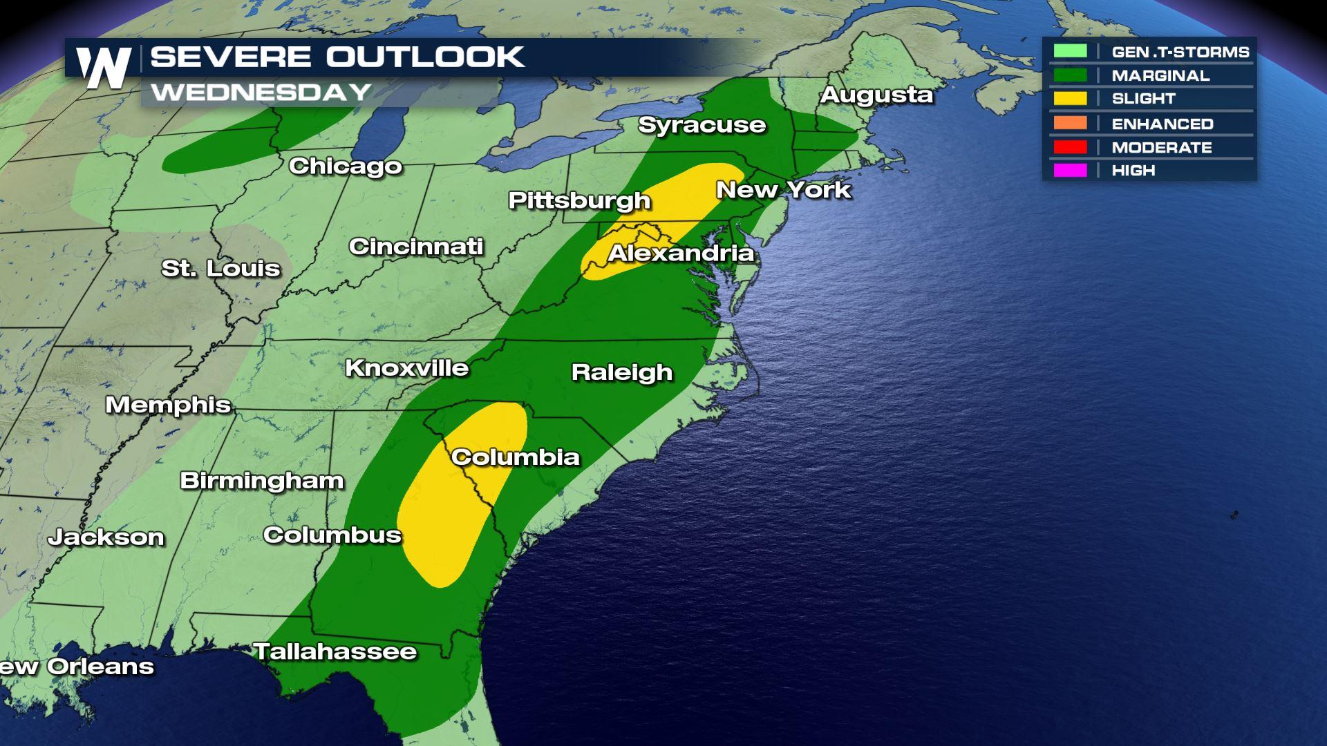
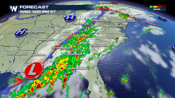 Much of the east is under a slight to marginal risk of severe weather for today. This is due to multiple fronts moving across the east coast. Rain will be very widespread throughout the day, especially during the afternoon and evening hours.
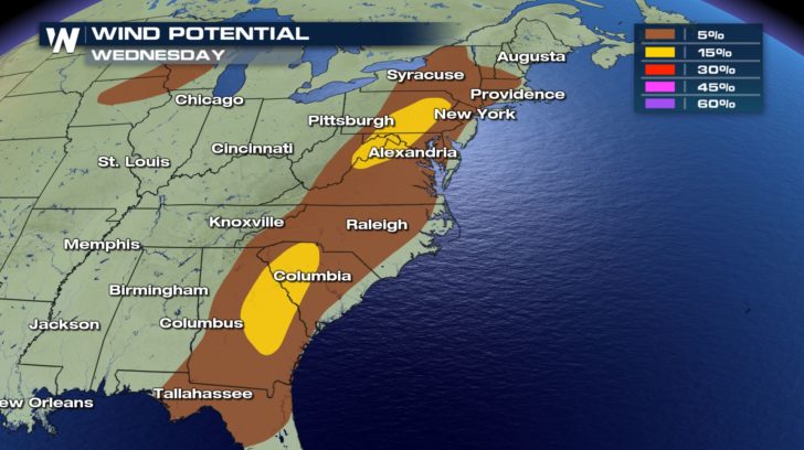
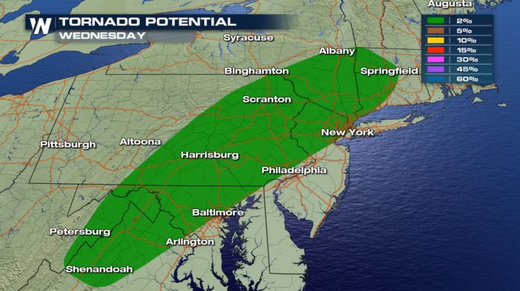 There is a risk for strong winds and tornado activity. Wind or wind gusts might reach up to 60 mph today.
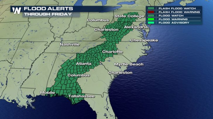 The east has already seen exceptional amounts of rain for the past few days. The ground is very saturated. With the additional rain today, much of it will not be able to be absorbed into the ground, making flooding a big concern. Multiple flash flood watches are in effect today.
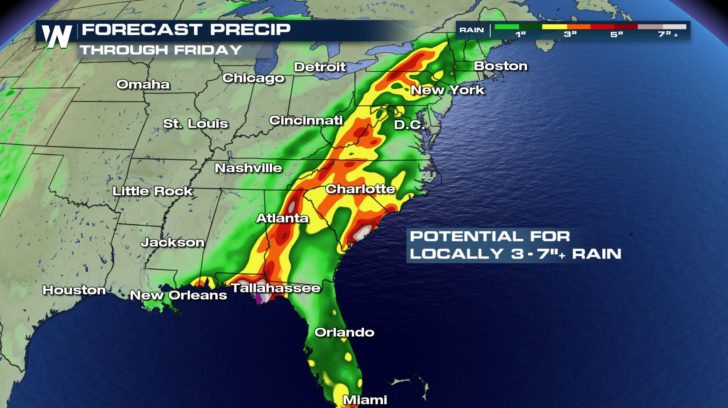 Over the next few days combined, many areas will receive anywhere from 3-7 inches of rain. Stay weather aware throughout the next few days!
For WeatherNation -Meteorologist Shelly Lindblade
Over the next few days combined, many areas will receive anywhere from 3-7 inches of rain. Stay weather aware throughout the next few days!
For WeatherNation -Meteorologist Shelly LindbladeAll Weather News
More
East Gears Up for Stormy, Wet Weekend
A low pressure system crashing through the Mi
1 Aug 2026 6:15 PM


Flooding, Severe Storms Target the Midwest Again
After an active week of storms across the nor
1 Aug 2026 1:40 AM

After Reaching Category 5, Genevieve Weakens in the Pacific
PacificFausto is now a post-tropical cyclone.
31 Jul 2026 1:30 AM

Flooding Risk Increases as Heavy Rain Targets the Tri-State Area
Tuesday, heavy rainfall moved across the Nort
30 Jul 2026 12:25 AM

Severe Weather: Energy From the Midwest Now in the Southeast
UPPER MIDWEST - Through Monday, dangerous tor
29 Jul 2026 10:30 PM