East Shivers Early in a September Cool Snap
Special Stories
24 Sep 2020 11:00 AM
September 2020 is putting an end to a string of very warm Septembers in the Mid-Atlantic and Northeast since 2015. An early season cold snap just spent summer’s final weekend enveloping much of the east, as temperatures plunged between 10 and 25 degrees below normal over a span of 4 days.
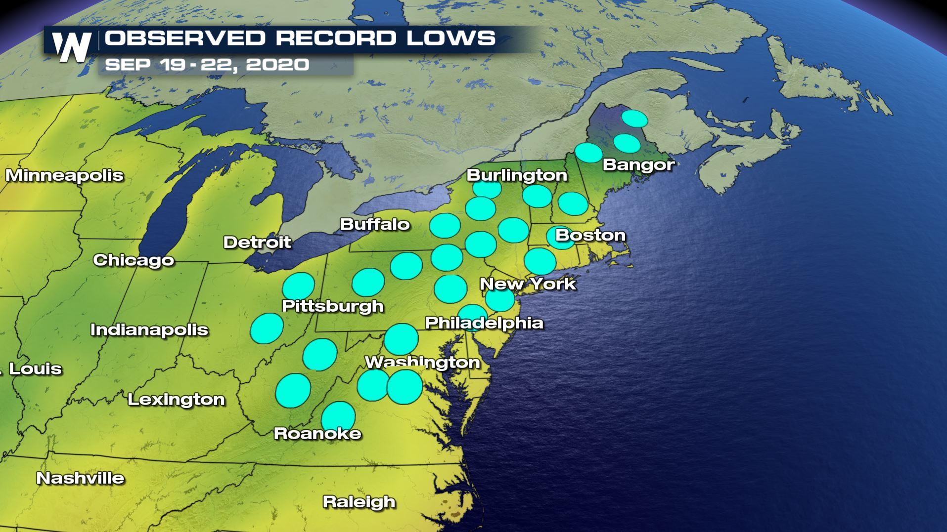
More than 50 record lows were tied or broken between the 19th and 22nd, from Ohio to Virginia, northeastward through New England.
Concord, New Hampshire dropped to 27 degrees on September 21, which was a record low and now marks the earliest in the season that the city got so cold. Bangor, Maine also dropped to a record low of 26 degrees on September 21, which marks the earliest that they have gotten so chilly in the season. The 26 degree low is also now their 6th coldest September temperature on record.
Allentown, Pennsylvania saw a “hat trick” of record lows from the 20th to the 22nd. The city broke records on three straight mornings, with the coldest morning being the final full day of summer, as the mercury plunged to 33 degrees.
Philadelphia dropped into the 40s on four straight mornings. This was already enough to be the most number of 40-degree mornings in the City of Brotherly Love in a September since 2000. In fact, in the 19 Septembers since 2000, there had only been four such mornings in total. Plus, no September from 2013 to 2019 had temperatures dip below the 50 degree mark.
Finally, in Washington, DC, the mercury dropped to 46 degrees on September 21. That was the city’s coldest September reading since 2001, and helped to notch their coldest “final summer weekend” in 91 years. The four consecutive mornings with temperatures in the 40s was also the first time that Washington, DC has achieved that feat in September since 1950.
https://www.youtube.com/watch?v=XsdjSCdj4bM
All Weather News
More
Wildfire Outbreak in the Pacific Northwest
SPOKANE, WA - On Saturday, August 1st, the Ol
3 Aug 2026 1:55 AM

More Storms for the East Through Monday
A low-pressure system that moved through the
3 Aug 2026 1:50 AM


After Reaching Category 5, Genevieve Weakens in the Pacific
PacificGenevieve formed last Friday south of
3 Aug 2026 12:30 AM

Flooding, Severe Storms Target the Midwest Again
After an active week of storms across the nor
1 Aug 2026 1:40 AM

Flooding Risk Increases as Heavy Rain Targets the Tri-State Area
Tuesday, heavy rainfall moved across the Nort
30 Jul 2026 12:25 AM

Severe Weather: Energy From the Midwest Now in the Southeast
UPPER MIDWEST - Through Monday, dangerous tor
29 Jul 2026 10:30 PM