El Nino Underway - What it Means for the Rest of Winter
[NOAA] NOAA’s Climate Prediction Center issued an El Nino Advisory last week, indicating the climate pattern has taken effect and is likely to continue through the spring. While the El Nino is expected to be weak, it may bring wetter conditions across the southern half of the U.S. during the coming months.
“El Nino conditions across the equatorial Pacific have come together, and we can now announce its arrival,” said Mike Halpert, deputy director, NOAA’s Climate Prediction Center, and ENSO forecaster. “While sea surface temperatures are above average, current observations and climate models indicate that this El Nino will be weak, meaning we do not expect significant global impacts through the remainder of winter and into the spring.”
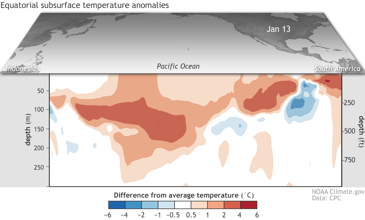
[Departure from average of the surface and subsurface tropical Pacific sea temperature averaged over 5-day periods starting in early June 2018. The vertical axis is depth below the surface (meters) and the horizontal axis is longitude, from the western to eastern tropical Pacific. This cross-section is right along the equator. NOAA Climate figure from CPC data.]
Forecasters say there is about a 55-percent chance that El Nino conditions will continue through the spring. The Climate Prediction Center will update the long range forecasts (for the next 30 and 90 days) later this week. The previous outlook that covered February to April highlighted a minor influence from El Nino.
Scientists say that some of the above-normal precipitation this winter in parts of the West is related to subseasonal variability attributed to another climate phenomena, the Madden Julian Oscillation (MJO), rather than El Nino influences. The MJO can trigger enhanced rainfall along the West Coast.
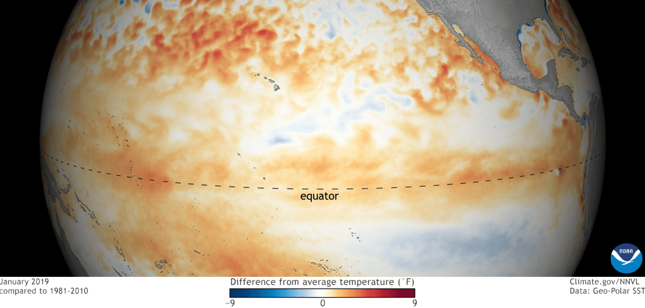
https://twitter.com/NWSCPC/status/1085895732685463552El Nino is a natural, ocean-atmospheric phenomenon marked by warmer-than-average sea surface temperatures in the central Pacific Ocean near the equator. Typical El Nino patterns during winter and early spring include below-average precipitation and warmer-than-average temperatures along the northern tier of the U.S., and above-normal precipitation and cooler conditions across the South.
Last winter, La Nina took effect in October 2017 and lasted through April 2018 before a return to neutral conditions. NOAA scientists will continue to monitor the El Nino and will issue the next monthly update on March 14.
Edited for WeatherNation by Meteorologist Mace Michaels


