Elevating Houses Can Protect Against Damaging Floods. But How High is High Enough?
Now new research supported by NOAA’s Climate Program Office (CPO) and led by Penn State University suggests that, in the face of economic, engineering, and environmental uncertainties, homeowners would reduce the most damage by raising their homes beyond the minimum guidelines recommended by the Federal Emergency Management Agency (FEMA). The findings were reported in Nature Communications.
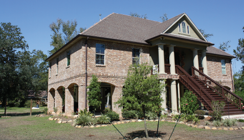 [With attention to detail and planning, homeowners have created attractive retrofitted homes. From FEMA]
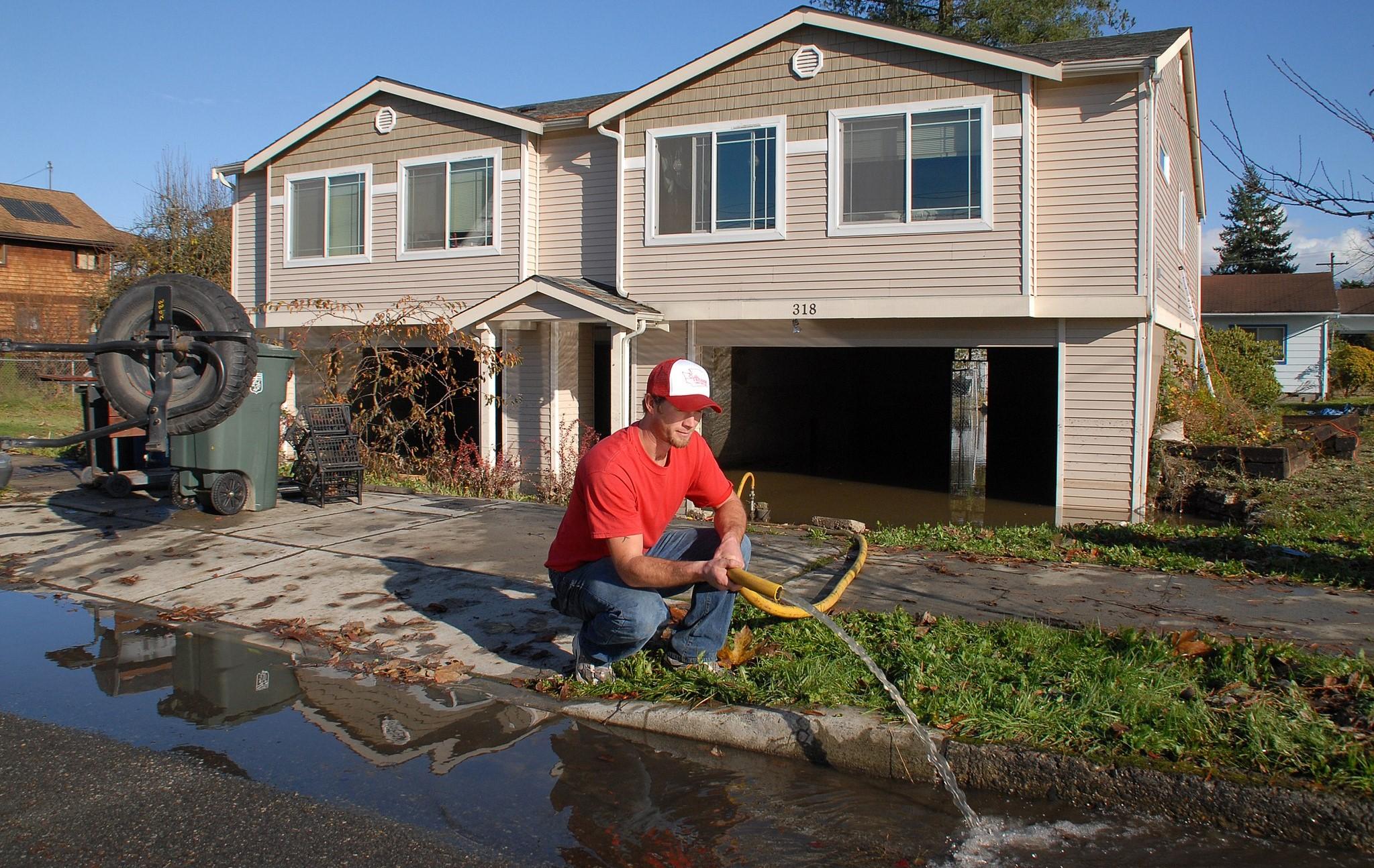
"Many houses located along rivers in Pennsylvania are in danger of being flooded," said Klaus Keller, co-lead of CPO’s Mid-Atlantic Regional Integrated Sciences and Assessments (MARISA) team and Penn State Professor. "Some houses are elevated high, some to intermediate levels and some not at all. Why is this?"
Homeowners in river flood zones are looking for good strategies on how high to elevate their houses. FEMA recommends elevating houses to the height of a flood that has a one percent chance of occurring in a given year, also known as the 100-year flood, plus at least one foot. This is the minimum elevation for which federal funding may be available.
But determining how high to elevate a house requires homeowners to consider the costs and benefits of doing so, which depend on uncertainties such as future flood hazards in the context of climate variability and change, the future value of money, and building vulnerabilities like structural durability.
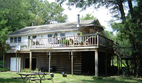 [This home in Cedar Falls, IA, was elevated one full story. The garage and storage area are at the home’s original elevation. Image from FEMA]
Using rain gage data from the U.S. Geological Survey and a framework—called a multi-objective robust decision-making method—the researchers analyzed the complex interactions of uncertainties and different cost-benefit trade-offs to assess whether they might improve on FEMA’s suggested elevation. Their study focused on 1,000 hypothetical homes in Selinsgrove, Pennsylvania where river flooding is a consistent concern.
"Looking at the range of possible outcomes can help to improve decisions on how high to elevate a house," said Mahkameh Zarekarizi, former Penn State postdoctoral fellow now a hydroclimate scientist at Jupiter Intelligence. "It is arguably better to fail in a computer model than in real life. In the computer, we can look at many possible future outcomes of flooding, costs and other uncertainties."
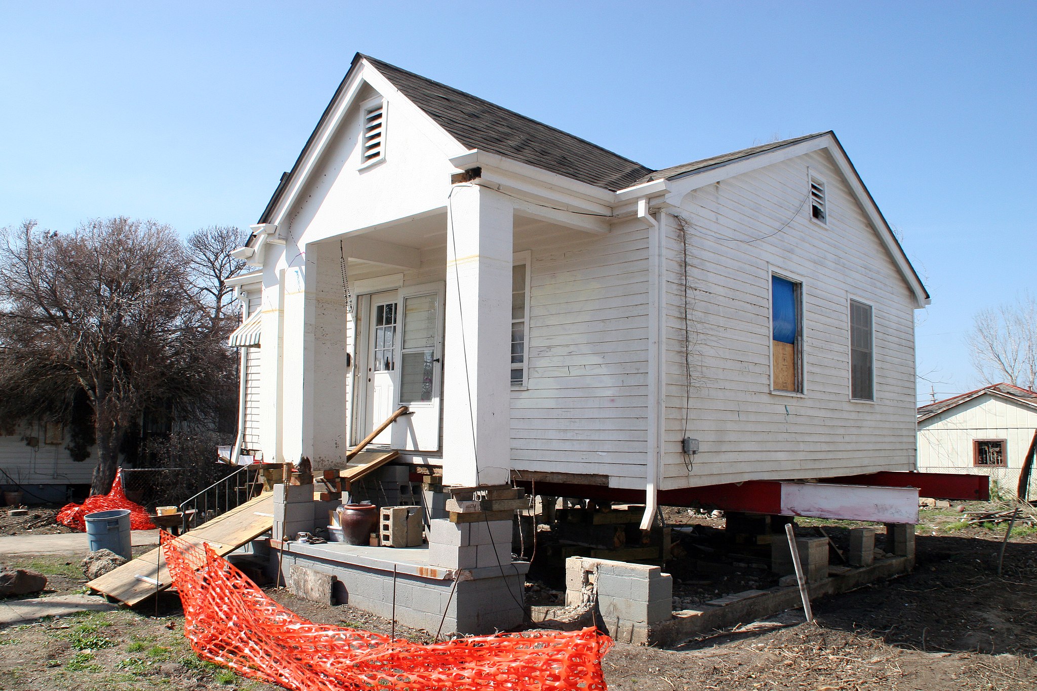 [This house in Gentilly is in the process of being elevated above the base flood elevation adopted by the community in result of flooding from Hurricane Katrina. The homeowner will raise the house a total of 11' and has received the Increased Cost of Compliance (ICC) benefit included with his National Flood Insurance Program (NFIP) policy because of his compliance to the community's floodplain management ordinance. Image from Robert Kaufmann/FEMA, New Orleans, LA, March 8, 2006]
According to the authors’ findings, 68% of the hypothetical homeowners could reduce the likelihood of being flooded and the net costs by considering protections a few feet above FEMA’s minimum recommendation. While their study is location-specific, the framework can be applied to other flood prone areas and used to evaluate economic impacts due to climate variability and change.
"The decision makers may benefit from a map that shows the trade-offs between goals," said Vivek Srikrishnan, assistant research professor with Penn State’s Earth and Environmental Systems Institute. "Home owners may want to see, for example, the total net price of reducing the risk of being flooded. A single recommendation such as the 100-year flood height plus at least one foot is silent on this question."


