End of Year Outlook: Warm & Dry over Most of the Nation
Special Stories
25 Sep 2020 2:00 AM
The outlook for the last 3 months of the year was issued recently by NOAA's Climate Prediction Center, continuing the trend from the summer: warm and dry. The temperature outlook for October through December is full of orange and red with above average temperatures expected from coast to coast. The Southwest and Northeast have the highest likelihood to be warmer than normal.
https://twitter.com/NWSCPC/status/1306589806856605698
The precipitation outlook has a large area of drier than normal weather from the Lower Mississippi Delta to the Desert Southwest. This will lead to a continuation and possible expansion of the drought in the Southwest and Plains. Wetter than average weather is expected in the Northwest, which should improve or bring an end to drought conditions.
https://twitter.com/NWSCPC/status/1306590523923165188
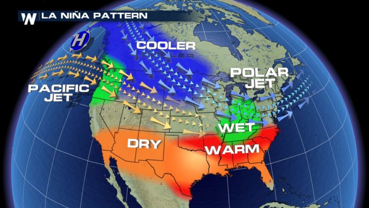
The CPC says that La Nina conditions are starting to be observed in the Pacific Ocean and are expected into early next year. La Nina was discussed earlier this month by the CPC. The trends of an El Nino or La Nina often take some time to establish, so it is likely to see its effects felt gradually over the coming months.
https://twitter.com/WeatherNation/status/1304450458501742594
La Nina occurs when the waters of the Pacific Ocean show a general trend of cooling, the opposite of an El Nino. During La Nina periods, the Jet Stream is less active in the Southern U.S. This usually leads to less storms systems and below average precipitation. Cooler than normal weather typically occurs across the northern tier of the country and occasionally wetter periods as well.


All Weather News
More