UPDATE: Moderate Risk for Severe Storms Tuesday
Special Stories
3 Apr 2018 9:41 AM
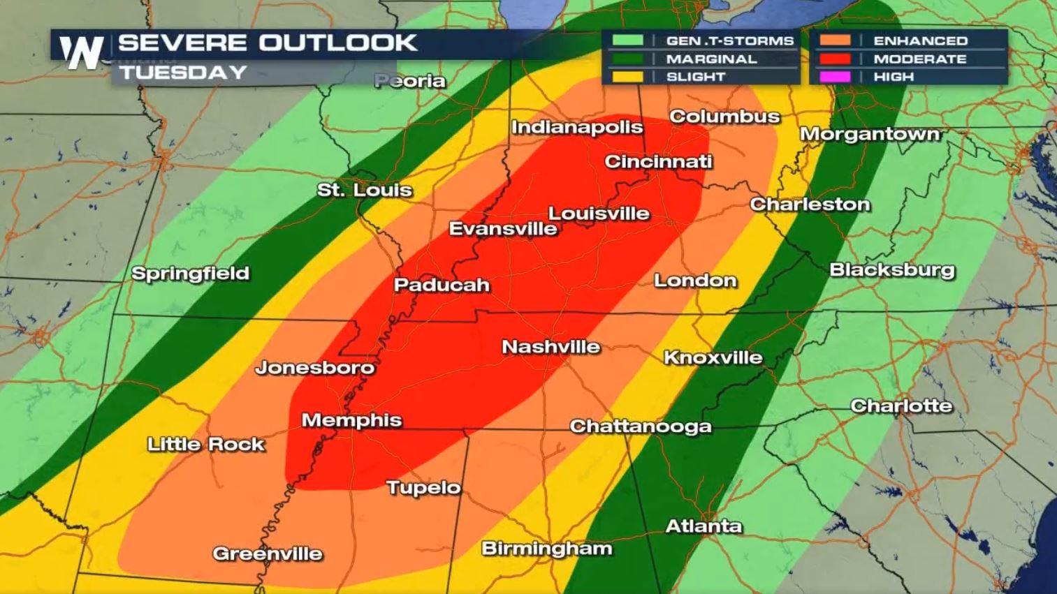
There is a moderate risk for severe storms for Tuesday, April 3, 2018. The Storm Prediction Center upgraded the risk from an enhanced to a moderate Tuesday morning.
https://www.facebook.com/WeatherNation/videos/10156398609424874/
The Storm Prediction Center has outlined the moderate risk for thunderstorm-wind damage, tornadoes and large hail from the mid-South to parts of the Ohio Valley.
https://www.facebook.com/WeatherNation/videos/10156398466749874/
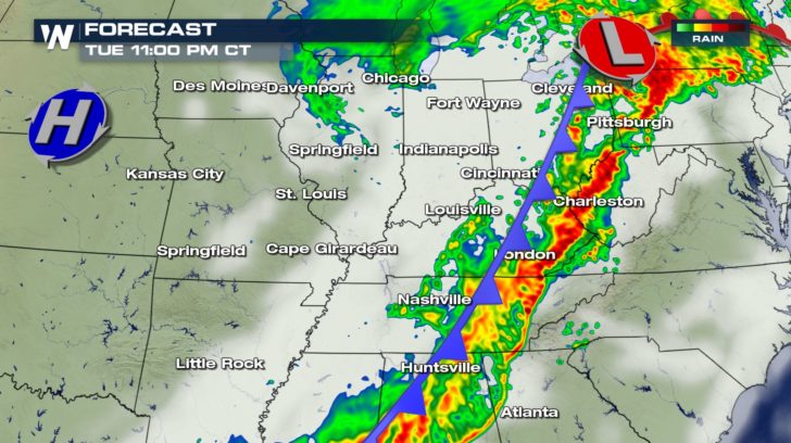
Scattered storms will start to develop ahead and along the cold front Tuesday afternoon.
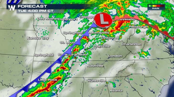 Those scattered storms will continue to push east and are expected to become severe. Lines of severe storms will begin to form with the possibility for embedded supercells inside those lines of storms.
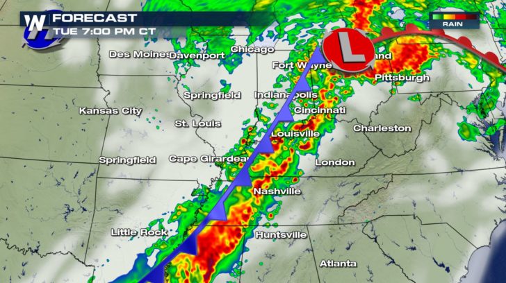 Storms are expected to last into late tonight and into early Wednesday morning.
 A Severe Thunderstorm Watch was issued Monday for East Texas, northwest Louisiana, southwest Arkansas, and southeast Oklahoma.
https://twitter.com/WeatherNation/status/981195401364516866
Make sure to stay with WeatherNation for all of the latest on these severe storms.
A Severe Thunderstorm Watch was issued Monday for East Texas, northwest Louisiana, southwest Arkansas, and southeast Oklahoma.
https://twitter.com/WeatherNation/status/981195401364516866
Make sure to stay with WeatherNation for all of the latest on these severe storms.
Those scattered storms will continue to push east and are expected to become severe. Lines of severe storms will begin to form with the possibility for embedded supercells inside those lines of storms.
Storms are expected to last into late tonight and into early Wednesday morning.
A Severe Thunderstorm Watch was issued Monday for East Texas, northwest Louisiana, southwest Arkansas, and southeast Oklahoma.
https://twitter.com/WeatherNation/status/981195401364516866
Make sure to stay with WeatherNation for all of the latest on these severe storms.
All Weather News
More
Severe Storms in the Midwest Could Dampen Holiday Plans
NORTHERN PLAINS - A frontal system is expecte
4 Jul 2025 3:20 AM

Near Seasonal Temperatures for Many Come July 4th!
AAA is expecting over 70 million travelers to
4 Jul 2025 3:15 AM

NHC Monitoring Front in the Southeast Ahead of 4th of July
Tropical downpours for a long holiday weekend
4 Jul 2025 3:10 AM

Flossie is No More, Eastern Pacific Remains Active
Post Tropical FlossieThe National Hurricane C
4 Jul 2025 3:05 AM


Northwest Heat Met With Thunderstorm Risk
NORTHWEST - Today, portions of Montana are un
3 Jul 2025 12:00 AM

Severe Weather Threat Continues in the Midwest
It has been an active, severe season across t
30 Jun 2025 9:00 PM