Fast-Moving Front Crosses The Rockies Today
Special Stories
20 Feb 2021 3:00 PM
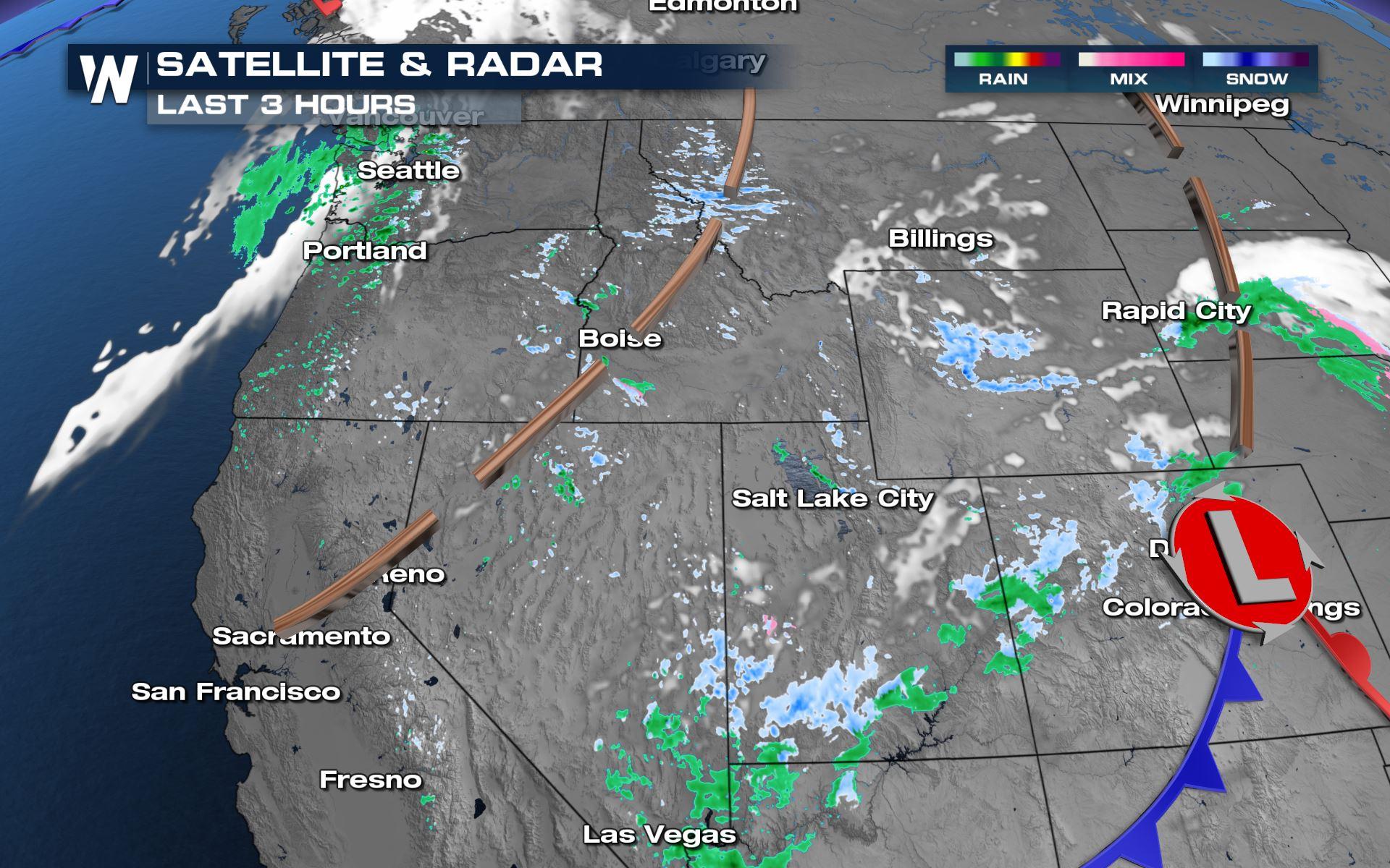
Bursts of snow and wind can be expected across the Rocky Mountains of the western United States today and through tonight, reducing visibility and causing a quick accumulation on the roads.
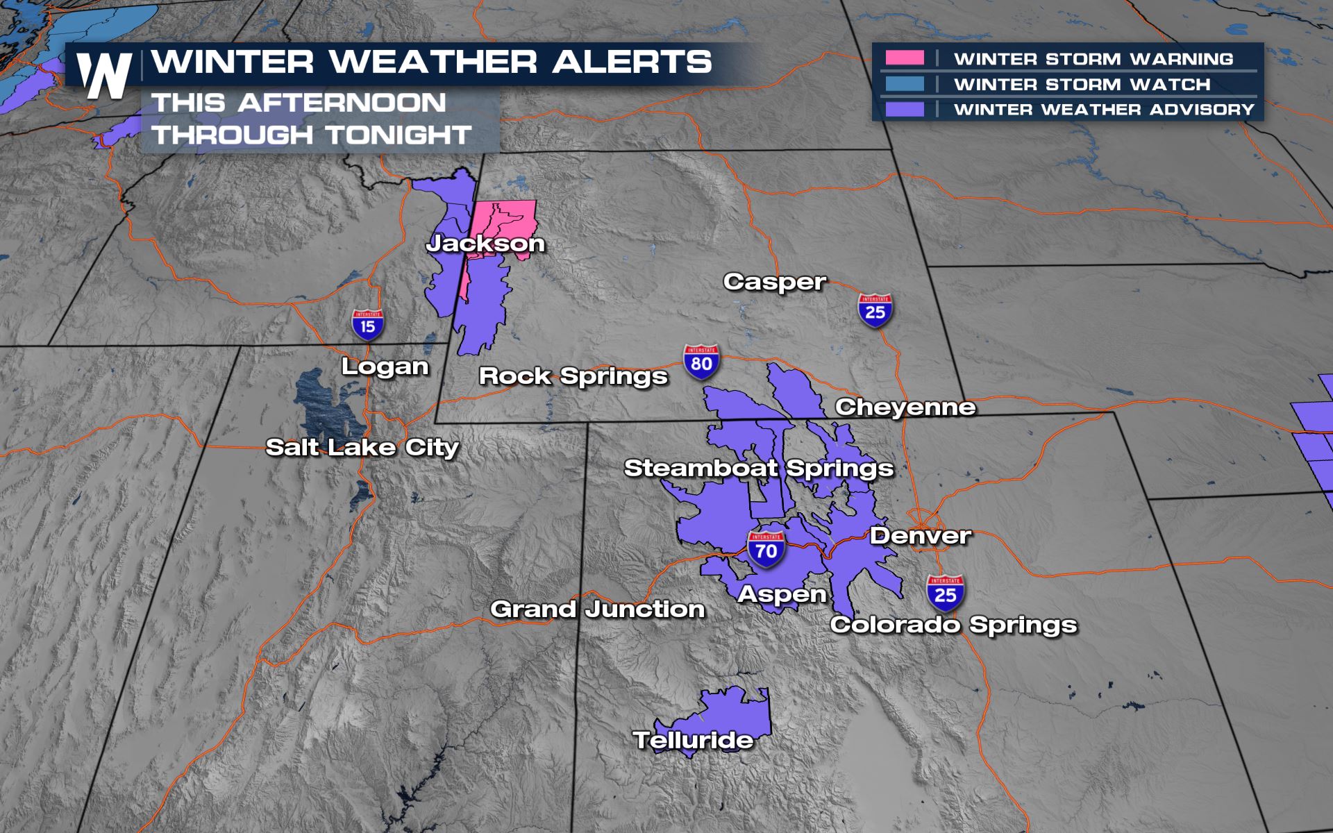 Winter weather alerts are in effect across numerous states in the Rockies. These stretch from the western slope of Colorado to Wyoming's Tetons and Absaroka Range. These alerts are in effect now and they last through this evening and into tonight for bursts of snow and a quick 4-8" for the mountains and 1-4" for the valleys/foothills.
A cold front will quickly cross the Rockies through tonight bringing the potential for snow squalls and even thundersnow across Utah, Wyoming, and Colorado!
Winter weather alerts are in effect across numerous states in the Rockies. These stretch from the western slope of Colorado to Wyoming's Tetons and Absaroka Range. These alerts are in effect now and they last through this evening and into tonight for bursts of snow and a quick 4-8" for the mountains and 1-4" for the valleys/foothills.
A cold front will quickly cross the Rockies through tonight bringing the potential for snow squalls and even thundersnow across Utah, Wyoming, and Colorado!
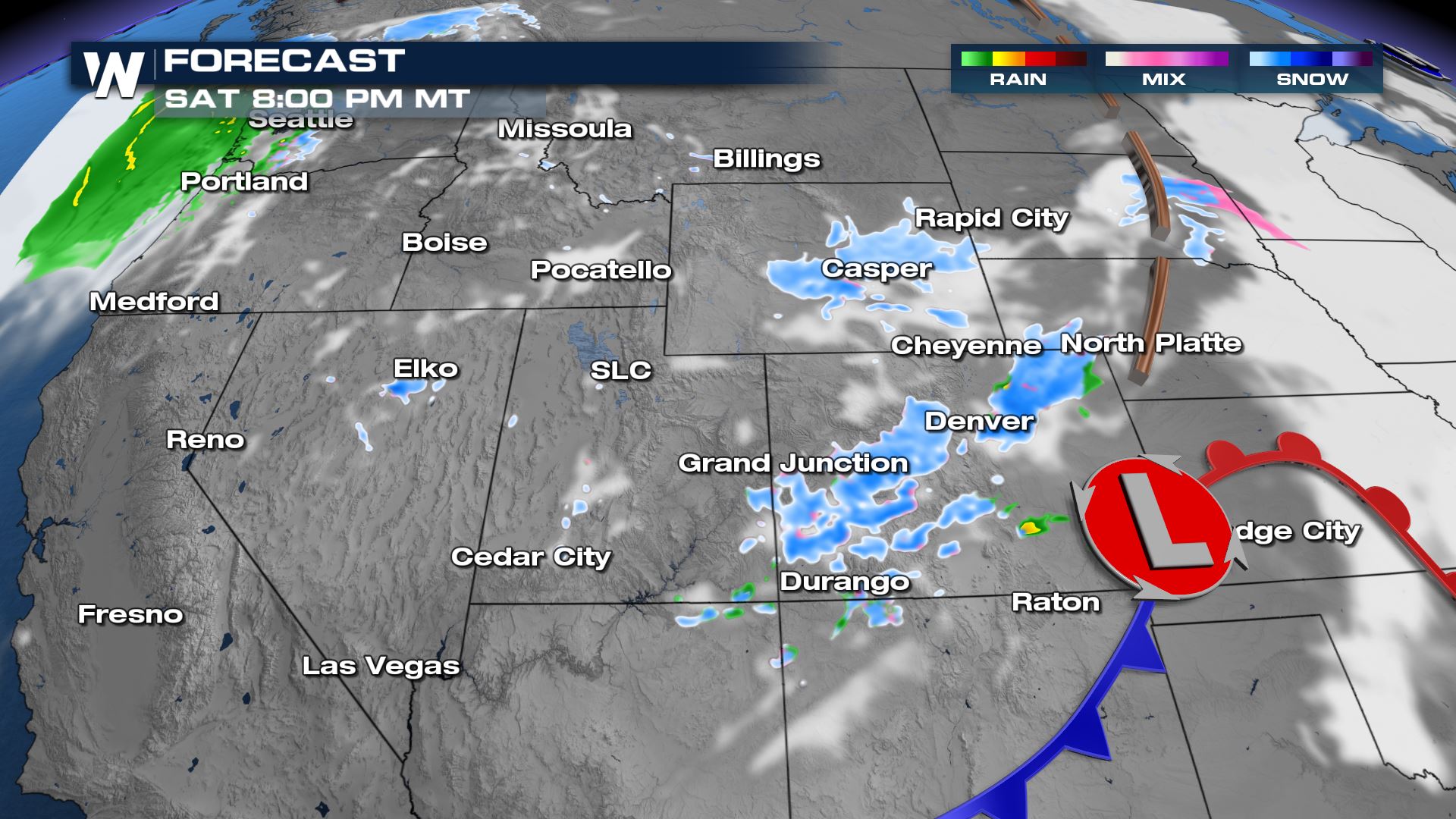 The low pressure center [L] and cold front [blue line] will quickly press east tonight and bring the accumulating snow across the Plains for Sunday.
Related Story: Snow Chances Return to the Midwest This Weekend
The low pressure center [L] and cold front [blue line] will quickly press east tonight and bring the accumulating snow across the Plains for Sunday.
Related Story: Snow Chances Return to the Midwest This Weekend
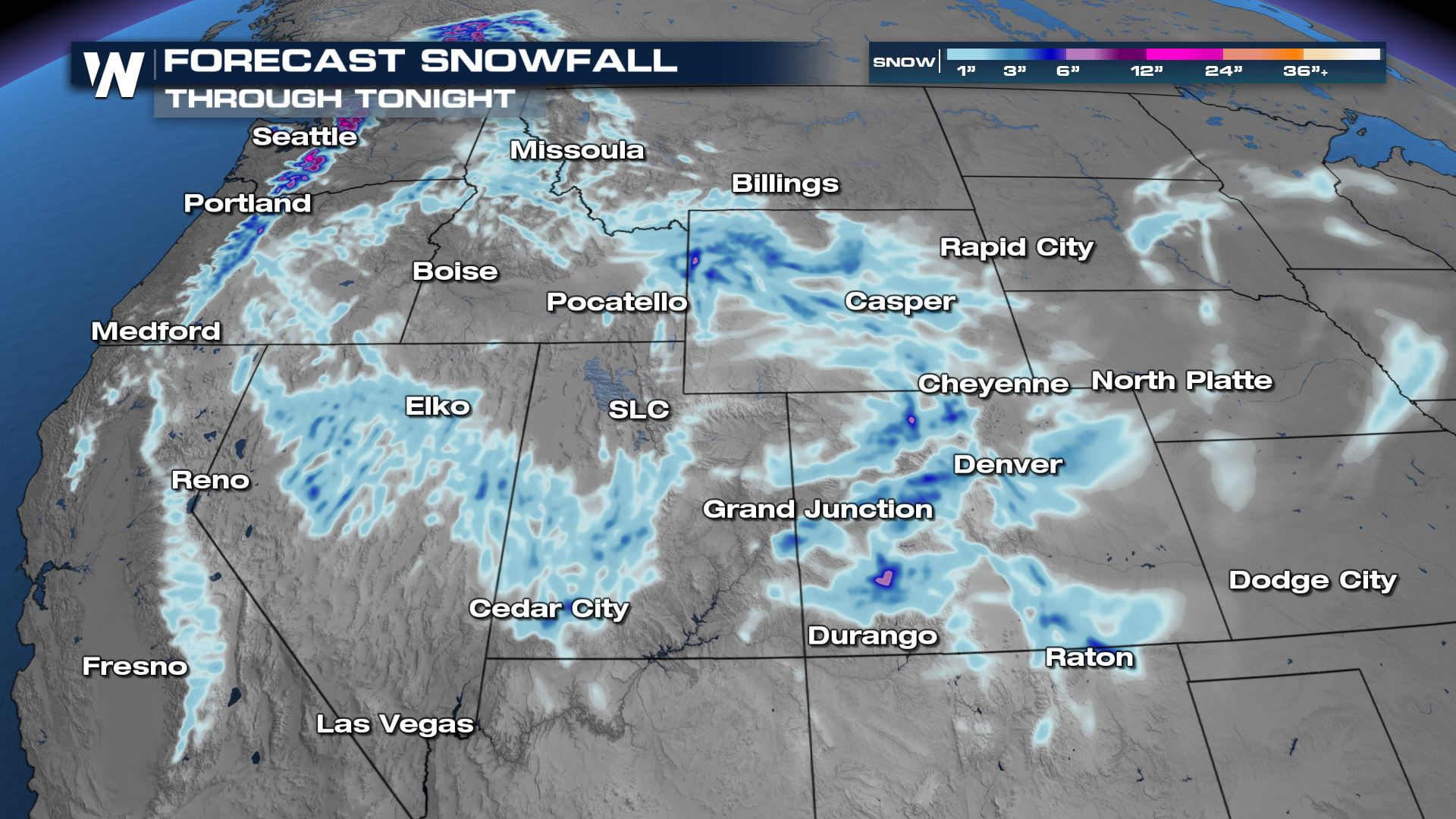 In all, snowfall accumulation will be highest on the west-northwest facing slopes of the Rockies with 4-8" and the lower elevations could see a coating to up to 4" in the hillier terrain.
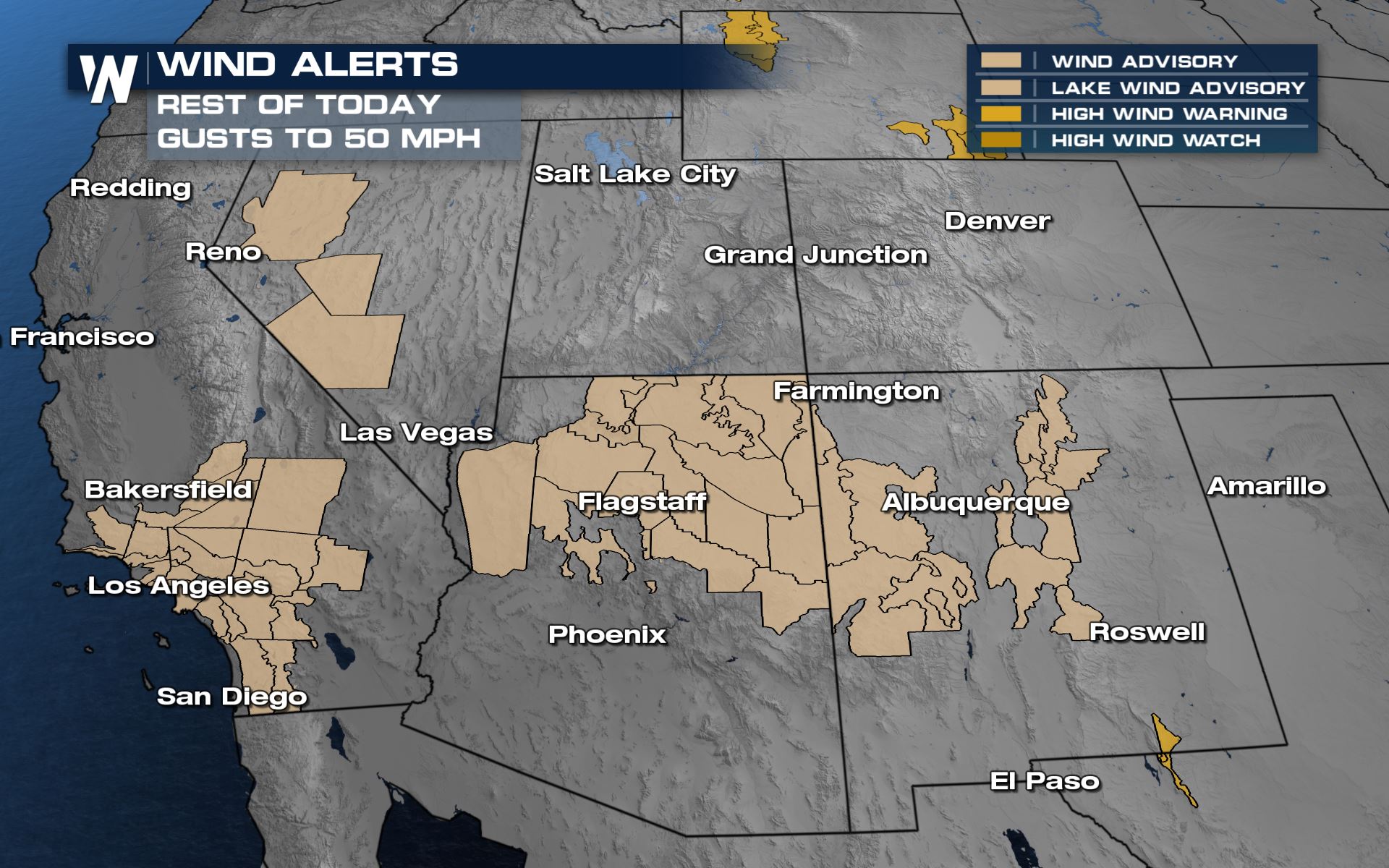 Meanwhile the wind will be gusty at times as this cold front moves through. A wind advisory [beige] is in effect through the remainder of today for gusts up to 50 mph.
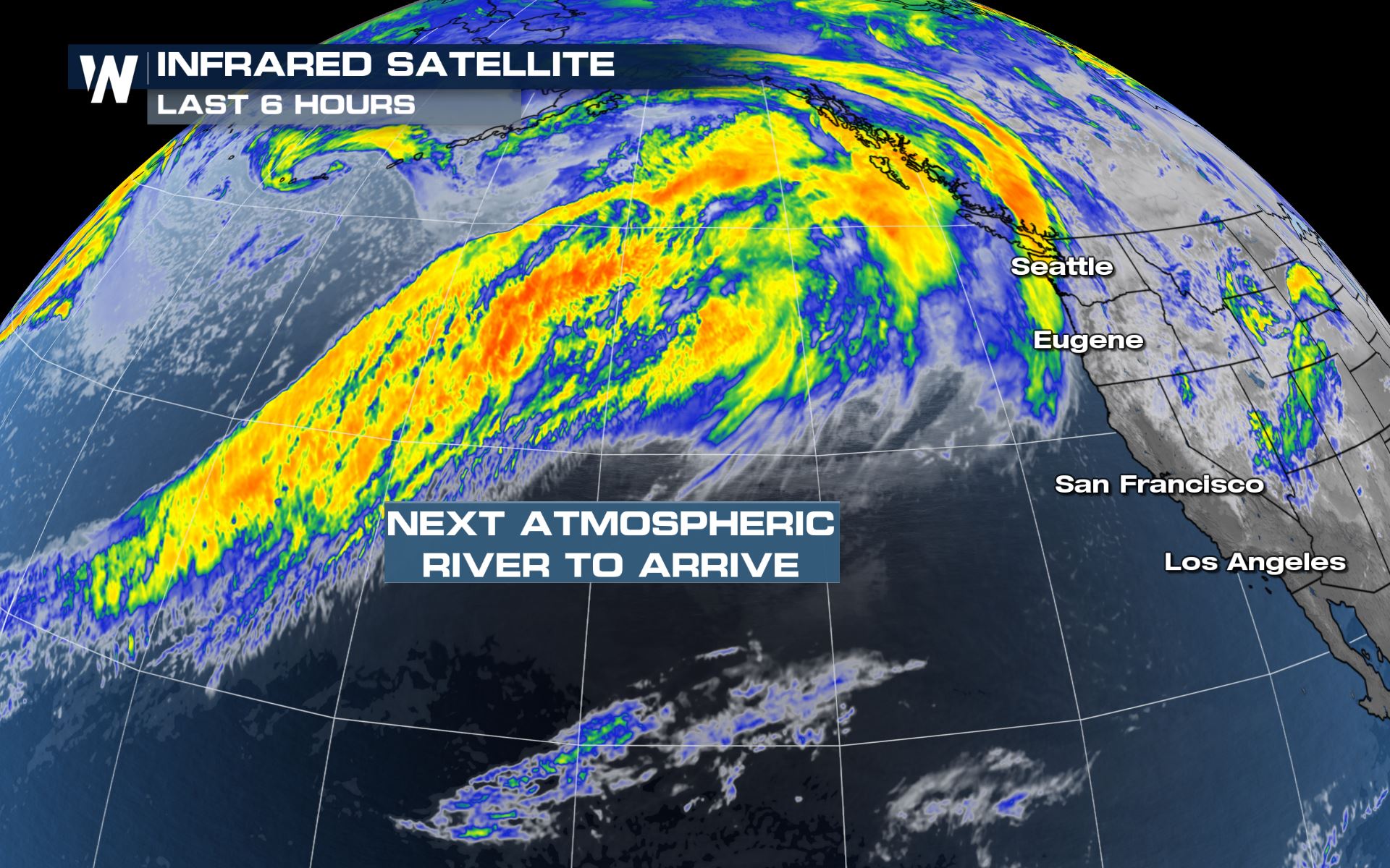 After this cold front, the Northwest U.S. remains quite active with more rounds of heavy rain and snow. You can read more about that part of the story by clicking/tapping here.
Winter weather alerts are in effect across numerous states in the Rockies. These stretch from the western slope of Colorado to Wyoming's Tetons and Absaroka Range. These alerts are in effect now and they last through this evening and into tonight for bursts of snow and a quick 4-8" for the mountains and 1-4" for the valleys/foothills.
A cold front will quickly cross the Rockies through tonight bringing the potential for snow squalls and even thundersnow across Utah, Wyoming, and Colorado!
The low pressure center [L] and cold front [blue line] will quickly press east tonight and bring the accumulating snow across the Plains for Sunday.
Related Story: Snow Chances Return to the Midwest This Weekend
In all, snowfall accumulation will be highest on the west-northwest facing slopes of the Rockies with 4-8" and the lower elevations could see a coating to up to 4" in the hillier terrain.
Meanwhile the wind will be gusty at times as this cold front moves through. A wind advisory [beige] is in effect through the remainder of today for gusts up to 50 mph.
After this cold front, the Northwest U.S. remains quite active with more rounds of heavy rain and snow. You can read more about that part of the story by clicking/tapping here.All Weather News
More
Mount Slushmore? Taking a look at Dakota Snow Chances
The cooler weather is finding places to go fi
26 Oct 2026 6:30 PM

Southwest Gets More Active By Halloween Weekend
Heading towards the Halloween weekend, the so
26 Oct 2026 5:45 PM

Tropical Storm Vance Swirling in the Pacific, Olana Forms West of Hawaii
After becoming a hurricane Friday, Vance has
26 Oct 2026 5:40 PM

HALLOWEEN 2026: Is the weather a Trick or a Treat?
Hopefully the costume's picked out by now, th
26 Oct 2026 2:30 PM

Sunny Day Flooding; King Tides Surge This Week
This week, the ocean is coming to low lying a
26 Oct 2026 10:15 AM

Major River Flooding Causes Damage; Another Day of Storms in New Mexico
A powerful low pressure system has been movin
26 Oct 2026 1:00 AM

Warmer Than Average: Above-Normal Temperatures Across the Central U.S. This Week
WHAT TO EXPECTA ridge of high pressure linger
25 Oct 2026 10:15 AM