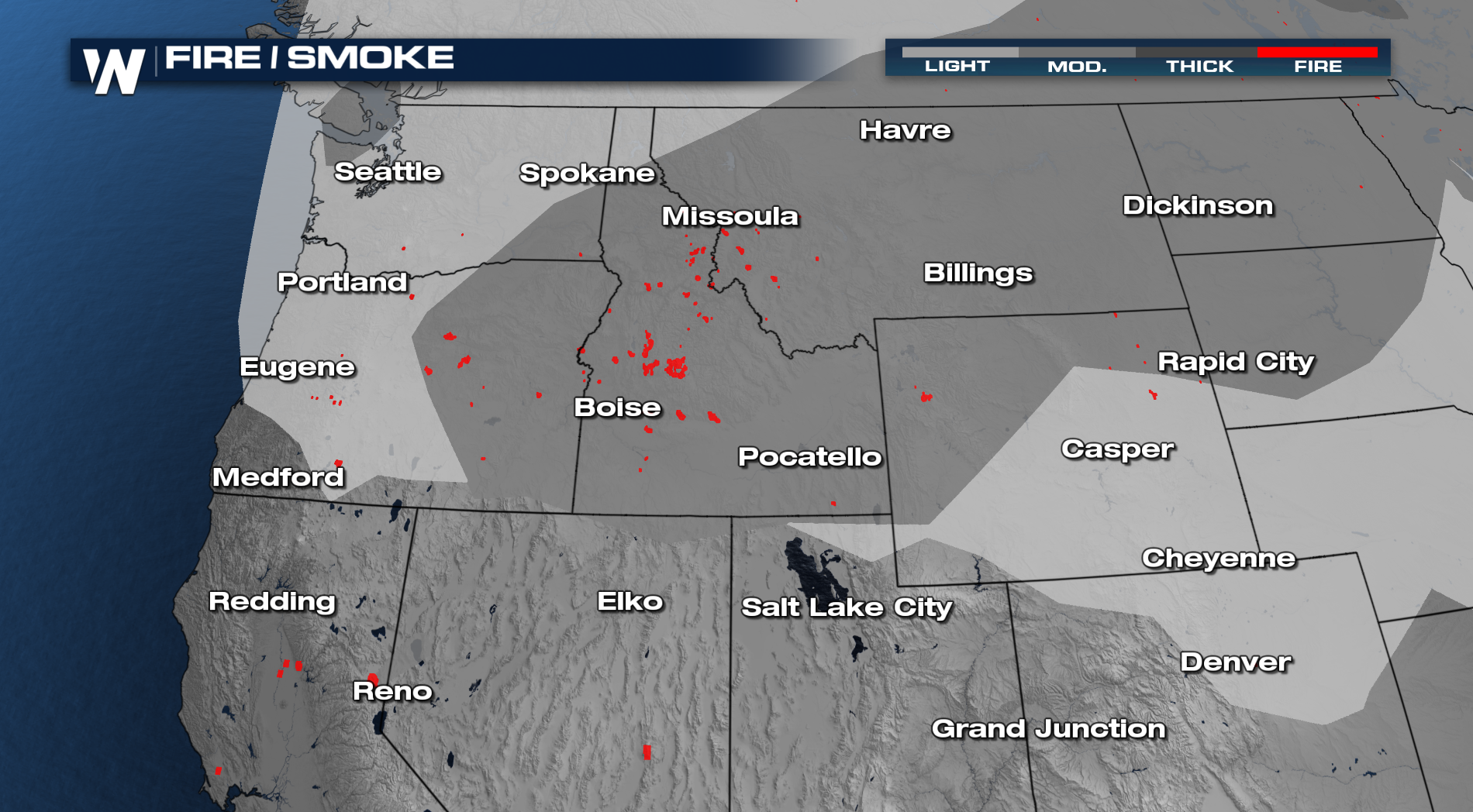
Fire Concerns Return Out West

An active pattern is set to return to parts of the northwest over the next few days. High pressure will bring the heat, but an incoming trough will kick up rain chances AND fire concerns. Fire and rain? How is that possible?
 DRY THUNDERSTORMS! Some of these high-based storms that develop bring rain to the area, however, the rain doesn't always make it to the surface if there is a dry airmass at the surface. So, the storm can bring the lightning and wind but not the rain, which causes the fire concern. If the surface fuels are dry, and lightning strikes the wind can spread that blaze very quickly.
Air quality alerts are also in place for the region from fires currently across the Northwest. This means particulate matter may cause issues for sensitive groups. These groups which include, those with respiratory or heart disease, the elderly, and children should limit prolonged exertion.
As our next system moves onshore, some more rain chances will accompany it. For many, this is beneficial rainfall where some could pick up a much-needed inch of rain.
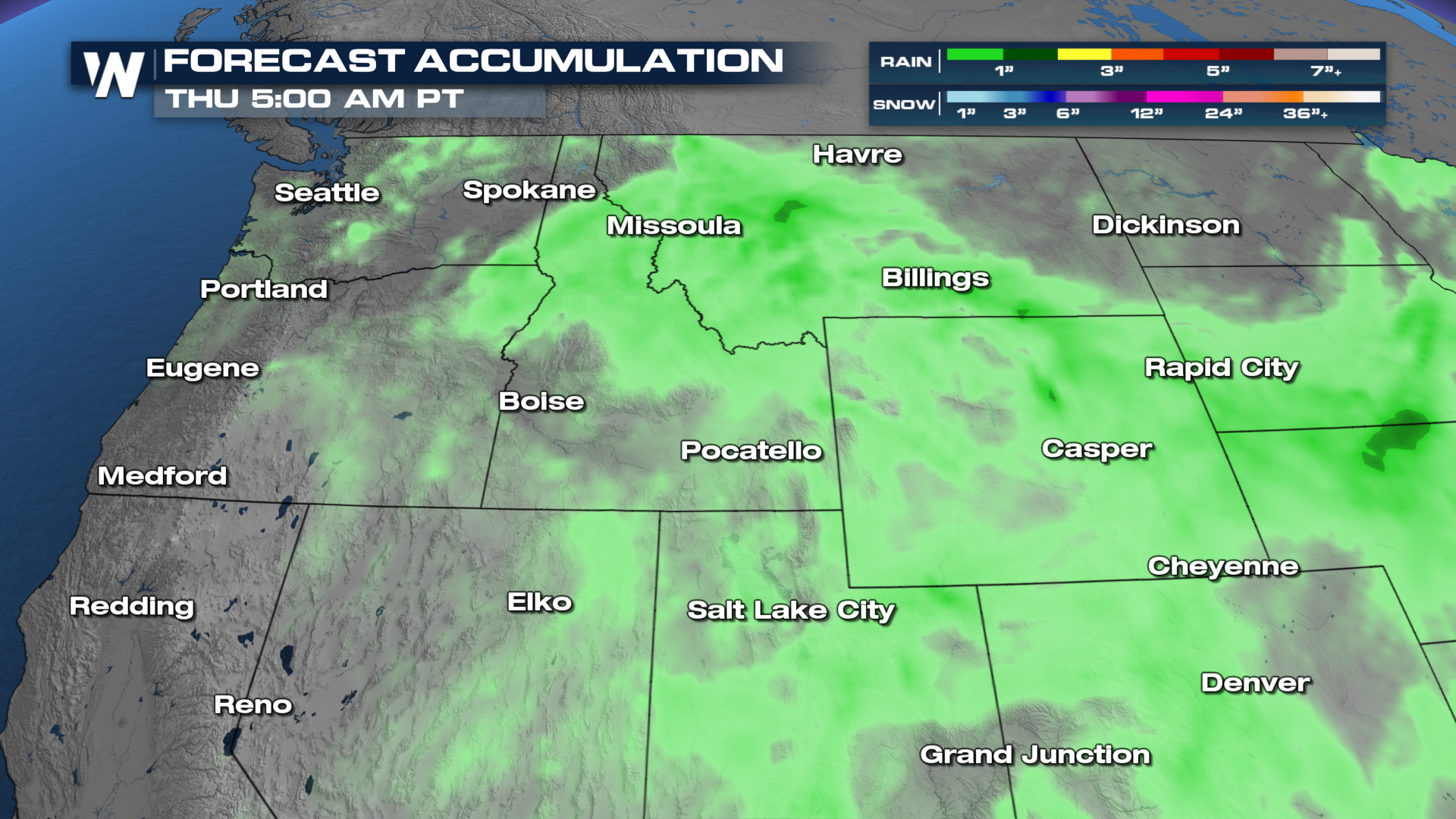 However, with some thunderstorms possible, new wildfires could ignite because of the lightning. Areas we're more concerned about are those that pick up little to no meaningful rainfall but the same lightning.
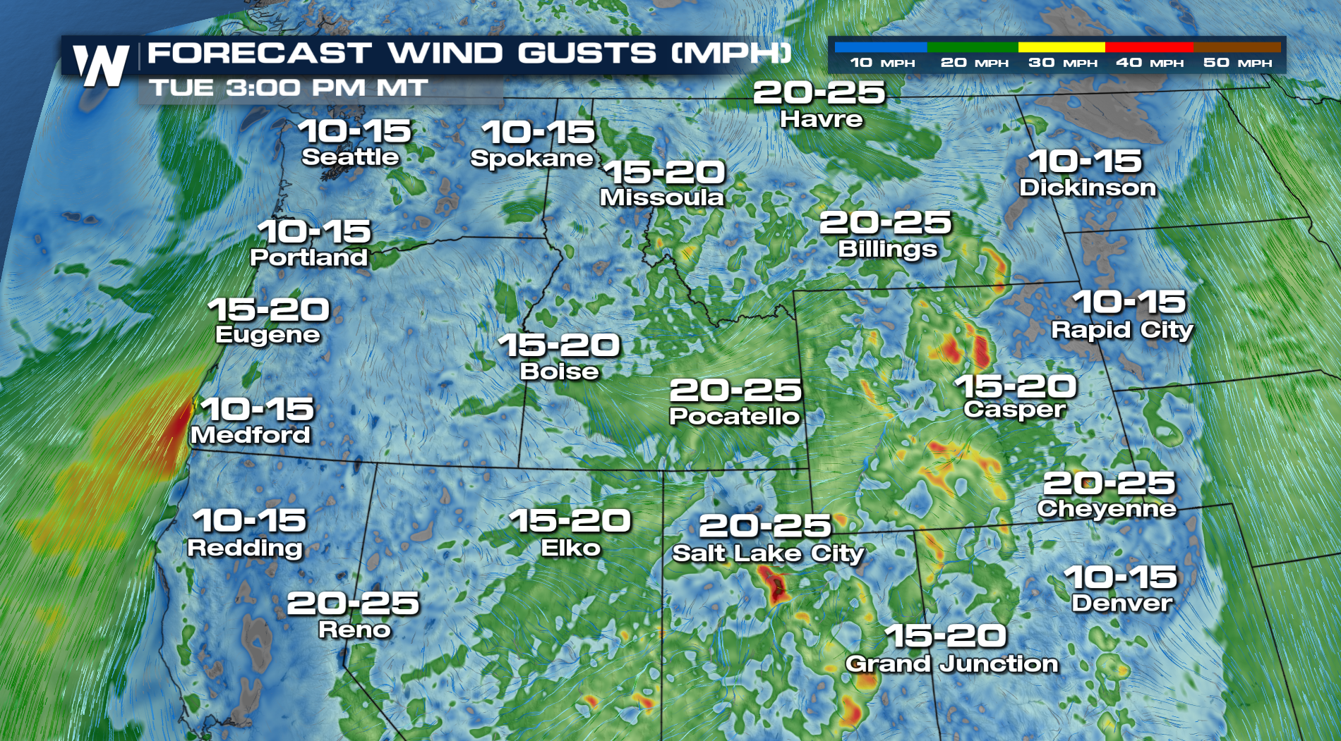
WINDS
BRIEF COOLDOWN
Best news in all of this? Temperatures will take a brief hiatus from the triple digits. The tail end of this week looks warmer than average, which could be a theme for the first half of September...
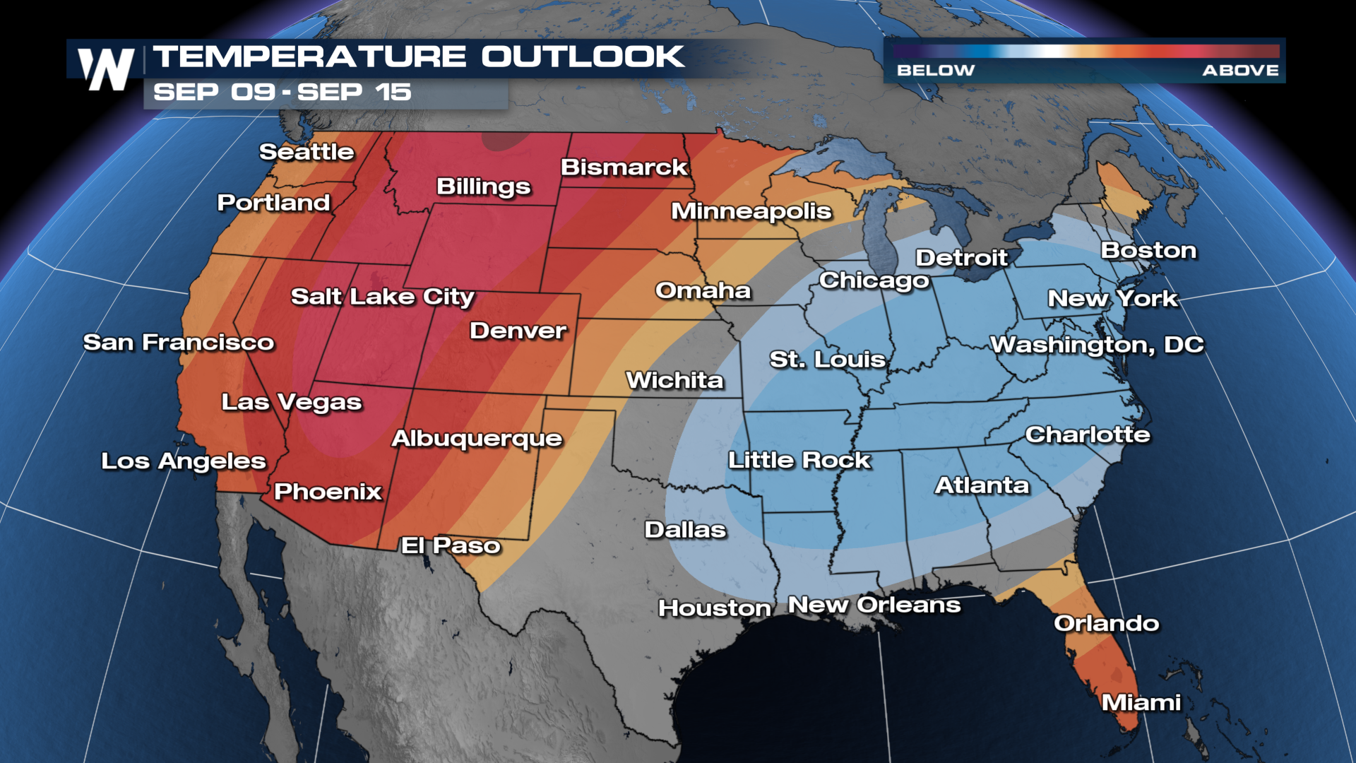 Stay tuned to WeatherNation as the temperatures start to climb once again out west.


