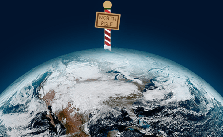
Five Things You Probably Didn't Know About the North Pole
Special Stories
2 Jan 2019 3:03 AM
[NOAA] Around this time of year, Santa and his elves are resting after working hard at the North Pole to make sure all the toys were ready for Christmas. However, we don’t always hear a lot about the place where all the magic happens. Here are just a few fun, scientific facts you should know about the North Pole:
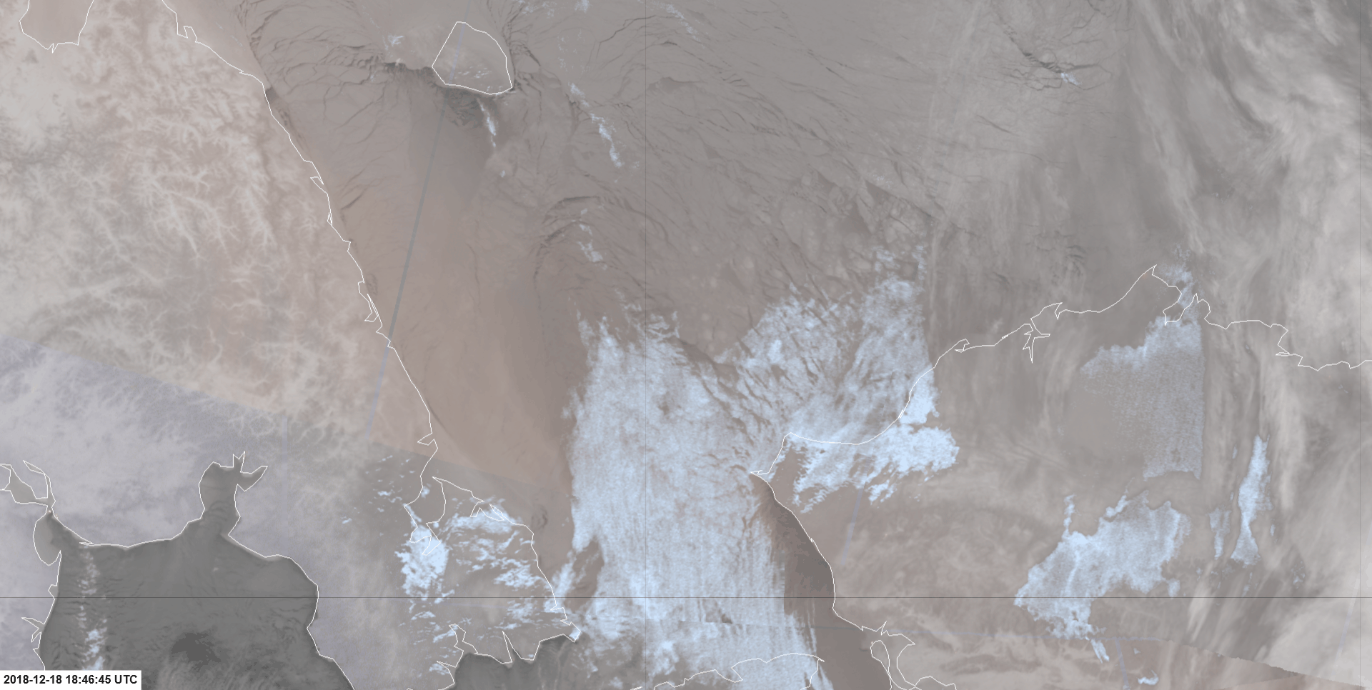 [This view from NOAA-20 and Suomi NPP show young ice moving horizontally in the Chukchi Sea, which is located northwest of Alaska. This imagery was taken on Dec. 18, 2018, using the satellite's VIIRS instrument, which is particularly useful because the region is currently experiencing polar night. (Jorel Torres/CIRA)]
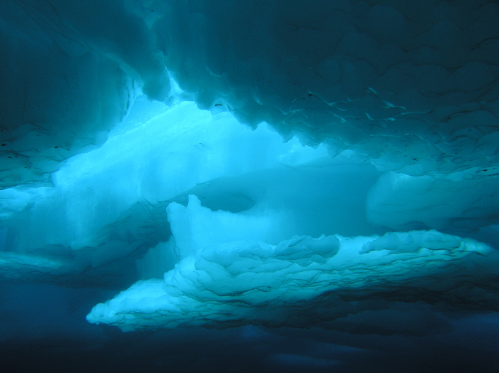 [This image shows ice in the Beaufort Sea, which is just north of Alaska. (Credit: Elisabeth Calvert, Hidden Ocean 2005 Expedition: NOAA Office of Ocean Exploration)]
Using the Advanced Technology Microwave Sounder (ATMS) on-board NOAA-20 and Suomi NPP, researchers can monitor sea ice extent throughout the year even under cloudy skies, explained Mitch Goldberg, a JPSS program scientist. In addition, Goldberg said NOAA uses data from the microwave imager onboard the Japanese Space Agency’s Global Change Observation Mission – Climate (GCOM-C) satellite.
Each year, data from these satellites help ice analysts estimate the total sea ice extent as well as differentiate between first-year and multi-year ice. Multi-year ice is thicker and has survived at least one melt season, whereas first-year ice is much thinner. Arctic sea ice usually reaches its minimum around mid-September each year. In 2018, the National Snow and Ice Data Center noted that the amount of multi-year ice remaining this summer was the sixth lowest on record.
[This image shows ice in the Beaufort Sea, which is just north of Alaska. (Credit: Elisabeth Calvert, Hidden Ocean 2005 Expedition: NOAA Office of Ocean Exploration)]
Using the Advanced Technology Microwave Sounder (ATMS) on-board NOAA-20 and Suomi NPP, researchers can monitor sea ice extent throughout the year even under cloudy skies, explained Mitch Goldberg, a JPSS program scientist. In addition, Goldberg said NOAA uses data from the microwave imager onboard the Japanese Space Agency’s Global Change Observation Mission – Climate (GCOM-C) satellite.
Each year, data from these satellites help ice analysts estimate the total sea ice extent as well as differentiate between first-year and multi-year ice. Multi-year ice is thicker and has survived at least one melt season, whereas first-year ice is much thinner. Arctic sea ice usually reaches its minimum around mid-September each year. In 2018, the National Snow and Ice Data Center noted that the amount of multi-year ice remaining this summer was the sixth lowest on record.
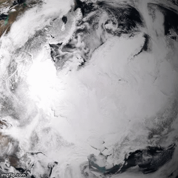 [Ice is seen melting from April to September 2018 in this composite imagery from NOAA-20. (NESDIS)]
While the shrinking Arctic ice cap won’t contribute to sea level rise, it could influence normal weather patterns and the global climate, according to the National Ocean Service. Sea ice acts like a mirror and helps reflect sunlight and heat back into the atmosphere. If that sea ice shrinks or disappears, more of that solar energy would be absorbed by the open ocean. Additional heat in the ocean will cause temperatures in the Arctic to rise further. Scientists are studying how warming in the Arctic is changing atmospheric pressure patterns, including the jet stream, which has implications for weather across the U.S. and the globe.
[Ice is seen melting from April to September 2018 in this composite imagery from NOAA-20. (NESDIS)]
While the shrinking Arctic ice cap won’t contribute to sea level rise, it could influence normal weather patterns and the global climate, according to the National Ocean Service. Sea ice acts like a mirror and helps reflect sunlight and heat back into the atmosphere. If that sea ice shrinks or disappears, more of that solar energy would be absorbed by the open ocean. Additional heat in the ocean will cause temperatures in the Arctic to rise further. Scientists are studying how warming in the Arctic is changing atmospheric pressure patterns, including the jet stream, which has implications for weather across the U.S. and the globe.
 Forecasters then have a better idea of how fast a weather system will travel.
“So if there’s a polar vortex or a cold wave coming from Canada, then our satellites help to provide better predictions of those,” he added.
Airlines rely on this type of information because, as Goldberg explained, “the wind speeds at the altitudes planes travel are very important.”
Forecasters then have a better idea of how fast a weather system will travel.
“So if there’s a polar vortex or a cold wave coming from Canada, then our satellites help to provide better predictions of those,” he added.
Airlines rely on this type of information because, as Goldberg explained, “the wind speeds at the altitudes planes travel are very important.”
 [Scientists captured this view of sea ice in the Kotzebue Sound on April 12, 2018, using the VIIRS Day/Night Band. (NWS Fairbanks)]
 When tracking down Santa at Christmas, maybe leave it to the experts at the North American Aerospace Defense Command (NORAD). They have been tracking Santa’s journey from the North Pole for more than 60 years!
Edited for WeatherNation by Meteorologist Mace Michaels
When tracking down Santa at Christmas, maybe leave it to the experts at the North American Aerospace Defense Command (NORAD). They have been tracking Santa’s journey from the North Pole for more than 60 years!
Edited for WeatherNation by Meteorologist Mace Michaels
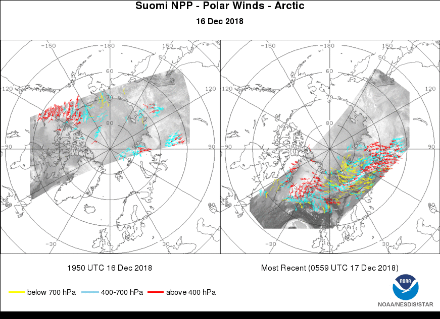
Polar-orbiting satellites observe different parts of the Arctic 14 times per day
Two satellites in the Joint Polar Satellite System constellation, NOAA-20 and the Suomi National Polar-orbiting Partnership (Suomi NPP), circle the Earth from pole-to-pole 14 times each day as the planet rotates on its axis. The two satellites are separated by 50 minutes, which allows researchers to see ice moving in the Arctic using looped imagery.
[This view from NOAA-20 and Suomi NPP show young ice moving horizontally in the Chukchi Sea, which is located northwest of Alaska. This imagery was taken on Dec. 18, 2018, using the satellite's VIIRS instrument, which is particularly useful because the region is currently experiencing polar night. (Jorel Torres/CIRA)]
There’s no land at the North Pole
Unlike Antarctica, there’s no land at the North Pole. Instead it’s all ice that’s floating on top of the Arctic Ocean. Over the past four decades, scientists have seen a steep decline in both the amount and thickness of Arctic sea ice during the summer and winter months.
[This image shows ice in the Beaufort Sea, which is just north of Alaska. (Credit: Elisabeth Calvert, Hidden Ocean 2005 Expedition: NOAA Office of Ocean Exploration)]
Using the Advanced Technology Microwave Sounder (ATMS) on-board NOAA-20 and Suomi NPP, researchers can monitor sea ice extent throughout the year even under cloudy skies, explained Mitch Goldberg, a JPSS program scientist. In addition, Goldberg said NOAA uses data from the microwave imager onboard the Japanese Space Agency’s Global Change Observation Mission – Climate (GCOM-C) satellite.
Each year, data from these satellites help ice analysts estimate the total sea ice extent as well as differentiate between first-year and multi-year ice. Multi-year ice is thicker and has survived at least one melt season, whereas first-year ice is much thinner. Arctic sea ice usually reaches its minimum around mid-September each year. In 2018, the National Snow and Ice Data Center noted that the amount of multi-year ice remaining this summer was the sixth lowest on record.
[Ice is seen melting from April to September 2018 in this composite imagery from NOAA-20. (NESDIS)]
While the shrinking Arctic ice cap won’t contribute to sea level rise, it could influence normal weather patterns and the global climate, according to the National Ocean Service. Sea ice acts like a mirror and helps reflect sunlight and heat back into the atmosphere. If that sea ice shrinks or disappears, more of that solar energy would be absorbed by the open ocean. Additional heat in the ocean will cause temperatures in the Arctic to rise further. Scientists are studying how warming in the Arctic is changing atmospheric pressure patterns, including the jet stream, which has implications for weather across the U.S. and the globe.
Knowing the wind speed over the North Pole is important for weather forecasts
As the Suomi NPP and NOAA-20 satellites fly over the Arctic, they collect valuable information about the ocean and atmosphere. By tracking clouds using Channel 15 of the Visible Infrared Imaging Radiometer Suite (VIIRS) onboard each satellite, researchers can see how the clouds are moving, which helps to estimate wind speed and direction. “Those data are fed into numerical weather prediction models to help better forecast weather particularly out to 3 to 7 days,” Goldberg explained.
Forecasters then have a better idea of how fast a weather system will travel.
“So if there’s a polar vortex or a cold wave coming from Canada, then our satellites help to provide better predictions of those,” he added.
Airlines rely on this type of information because, as Goldberg explained, “the wind speeds at the altitudes planes travel are very important.”
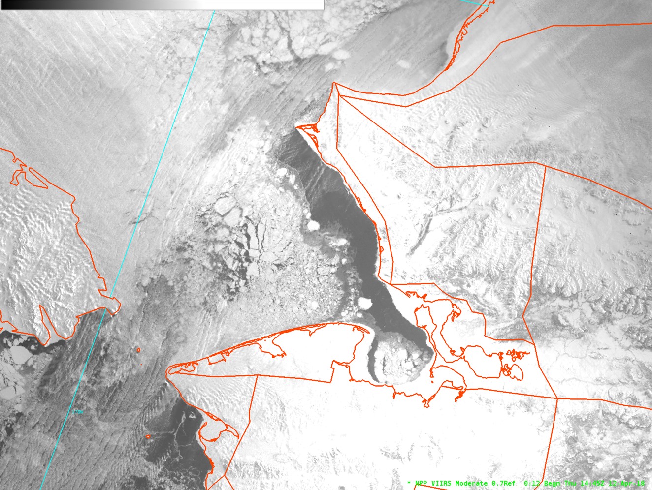
The North Pole is experiencing total darkness
From early October to early March, the North Pole experiences total darkness. So how do polar orbiting satellites still capture imagery of the Arctic during that period? Arron Layns, the JPSS algorithm management project lead, explained that the VIIRS Day/Night Band (DNB) is very sensitive to low levels of visible light at night. The DNB can see nighttime city lights, the light from a single ship at sea, auroras and even the glow of Earth’s atmosphere. This band is particularly useful for forecasters in Alaska because it allows them to see low-level clouds, sea ice and snow during the long nights of the Arctic winter.
[Scientists captured this view of sea ice in the Kotzebue Sound on April 12, 2018, using the VIIRS Day/Night Band. (NWS Fairbanks)]
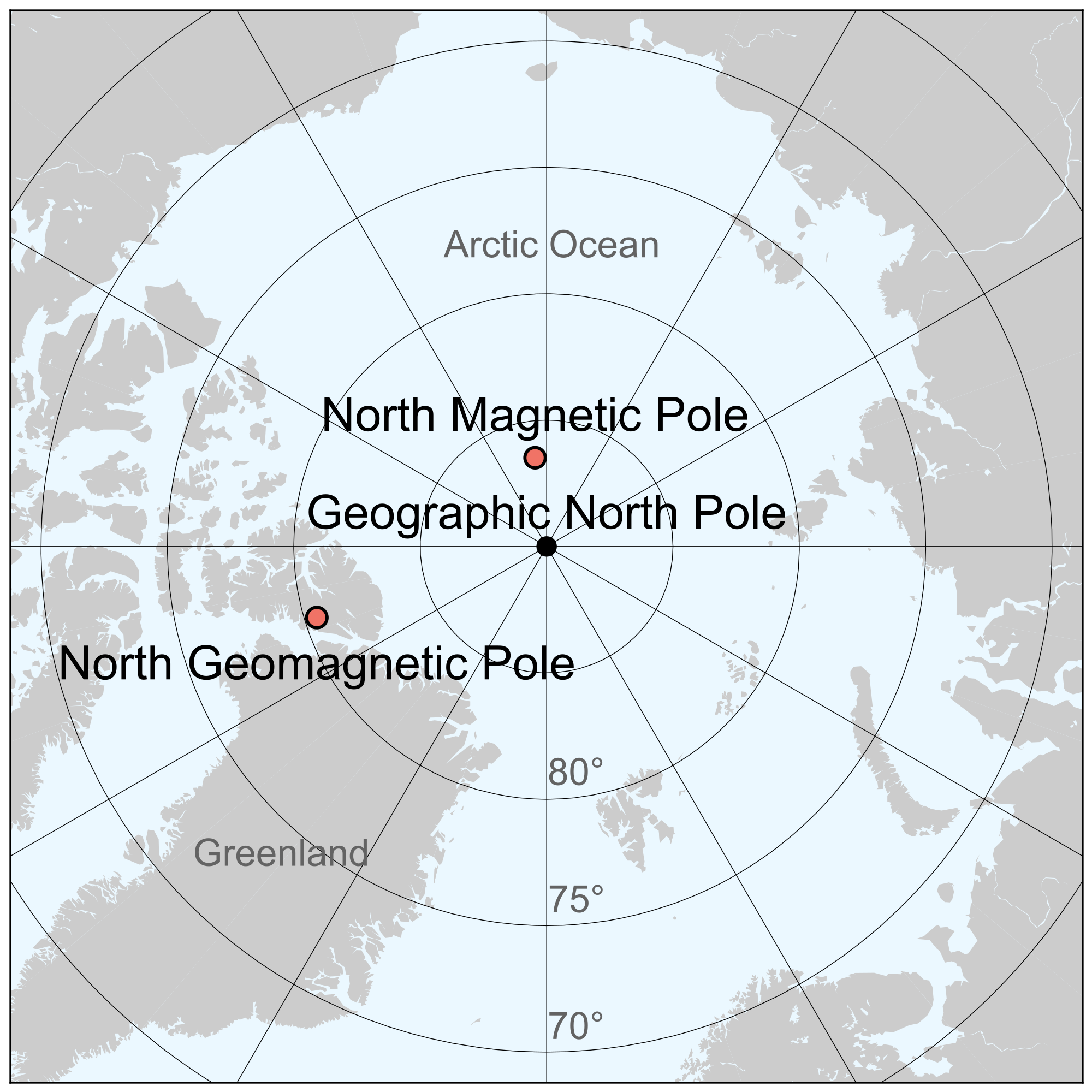
There’s a difference between the North Pole and the Geomagnetic North Pole
Did you know that using a compass won’t necessarily take you due north if you’re traveling to the North Pole? That’s because there’s a difference between the geographic North Pole and the geomagnetic North Pole, which is what compasses and that handy GPS app on your phone use. Geomagnetic poles change over time, so what was geomagnetic north 10 years ago isn’t the same as it is in 2018. In other words, trekking from Greenland to the North Pole isn’t the best idea if you’re relying solely on a compass.
When tracking down Santa at Christmas, maybe leave it to the experts at the North American Aerospace Defense Command (NORAD). They have been tracking Santa’s journey from the North Pole for more than 60 years!
Edited for WeatherNation by Meteorologist Mace MichaelsAll Weather News
More

Flooding, Severe Storms Target the Midwest Again
After an active week of storms across the nor
1 Aug 2026 1:40 AM


After Reaching Category 5, Genevieve Weakens in the Pacific
PacificFausto is now a post-tropical cyclone.
31 Jul 2026 1:30 AM

Flooding Risk Increases as Heavy Rain Targets the Tri-State Area
Tuesday, heavy rainfall moved across the Nort
30 Jul 2026 12:25 AM

Severe Weather: Energy From the Midwest Now in the Southeast
UPPER MIDWEST - Through Monday, dangerous tor
29 Jul 2026 10:30 PM