Flash Flood Watches in the Ohio and Tennessee Valleys
Special Stories
24 Sep 2018 9:07 AM
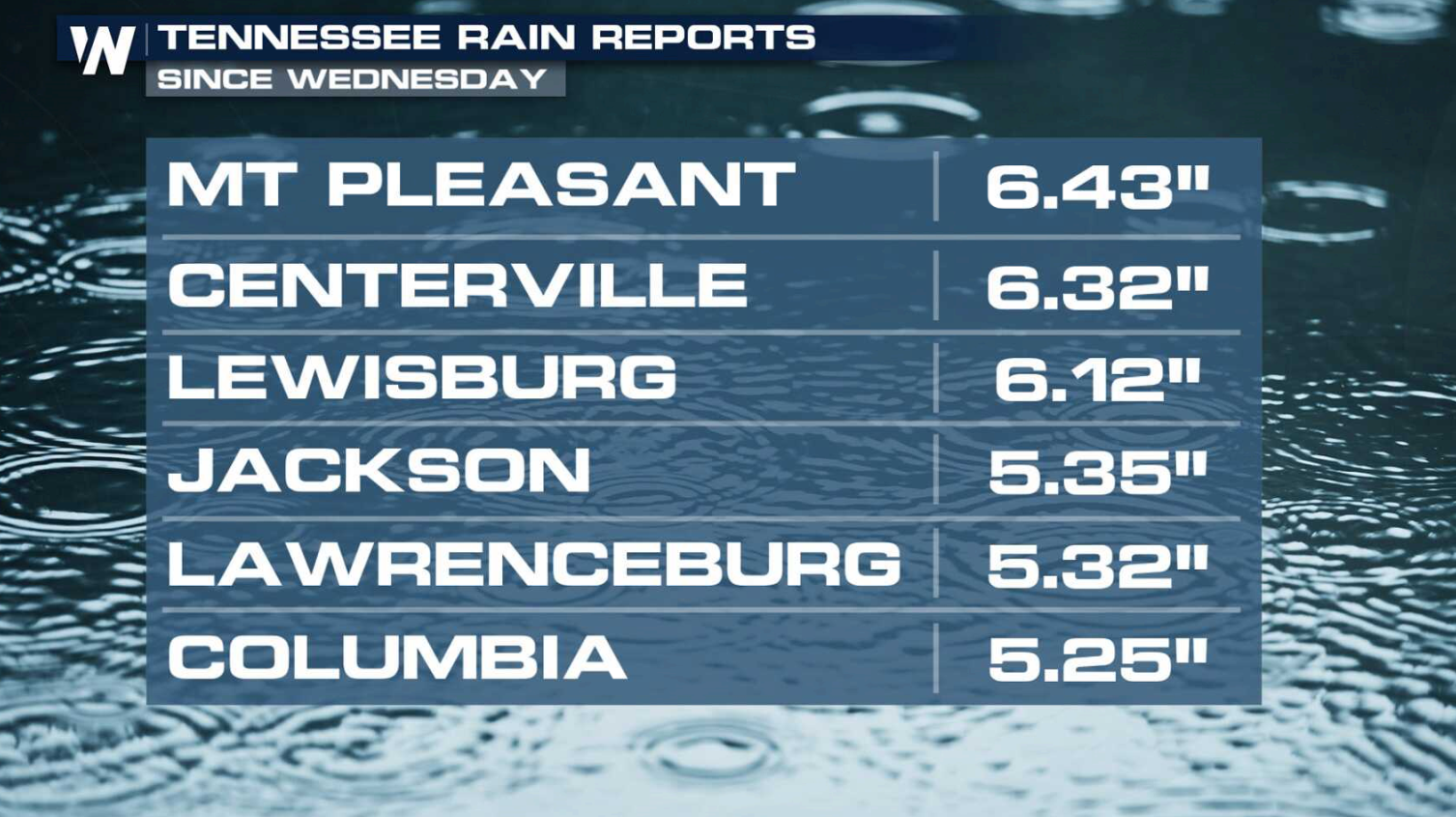
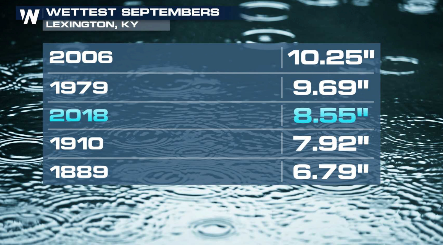
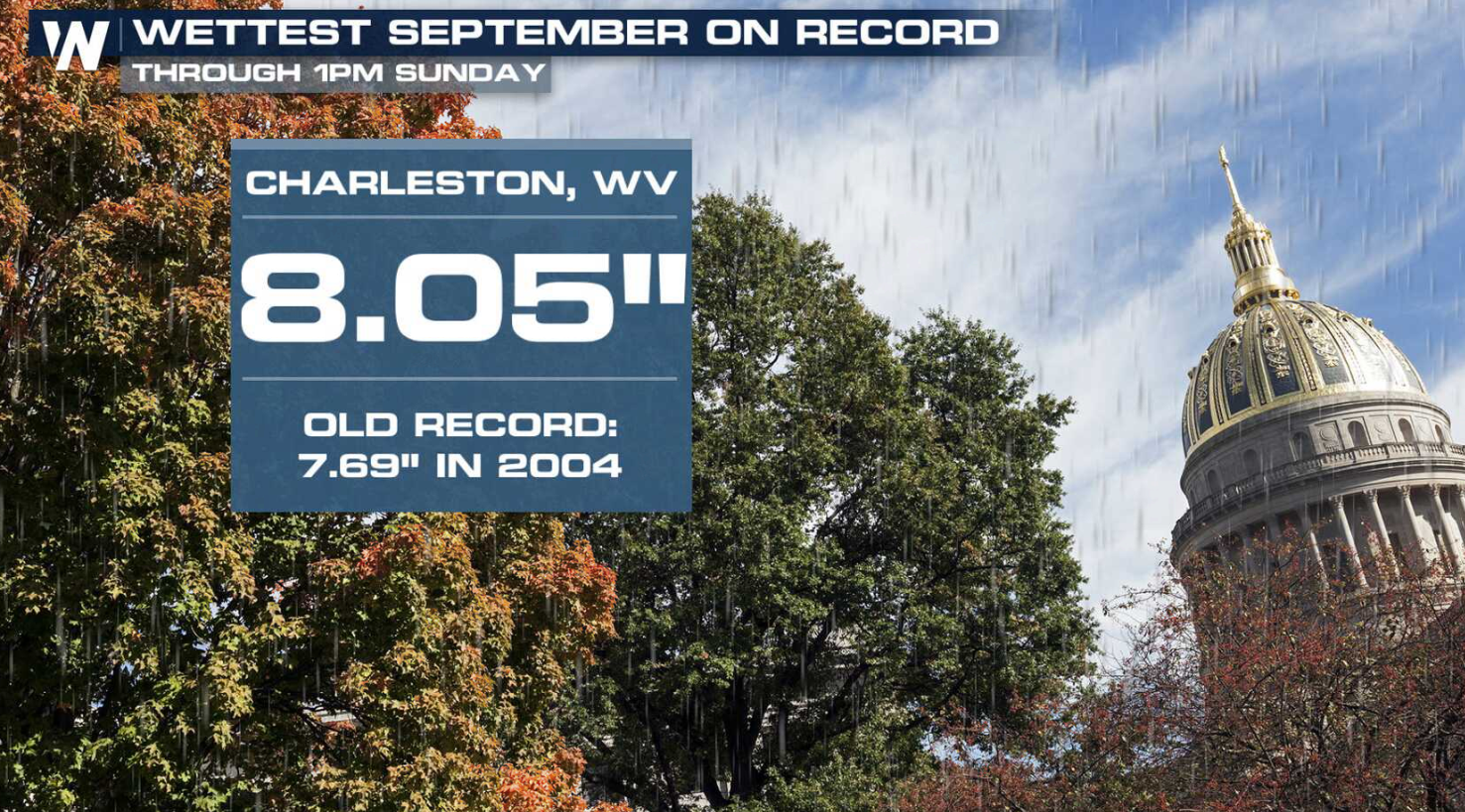
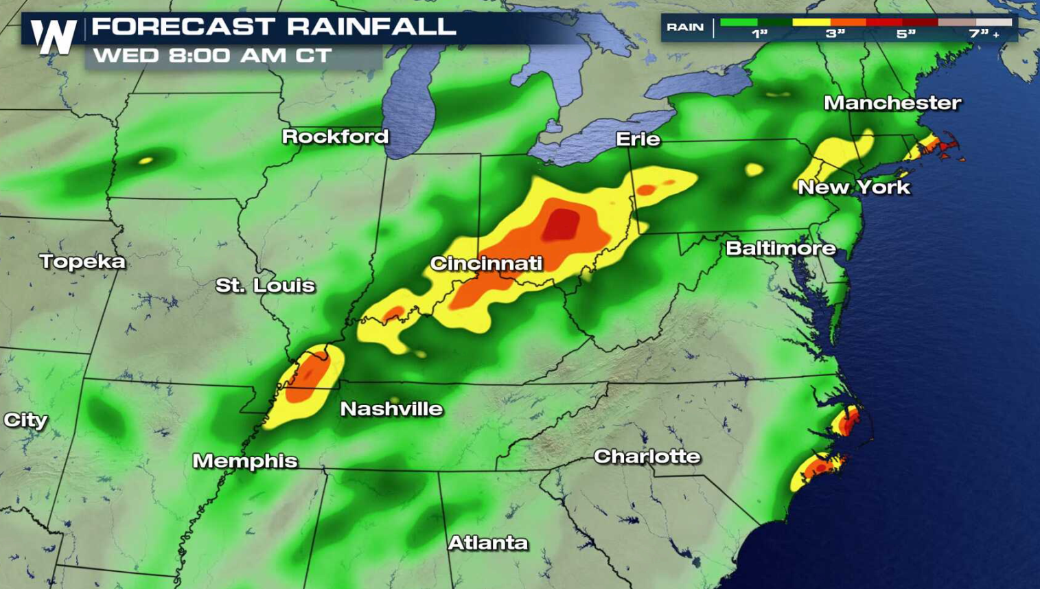
It has been a wet month in the Ohio and Tennessee Valleys. Several cities have seen more than a half a foot of rain in September. Much of it has fallen over the last week with moisture from Hurricane Florence. Charleston, West Virginia has already set a record for the month and Lexington, Kentucky is less than 2" away.
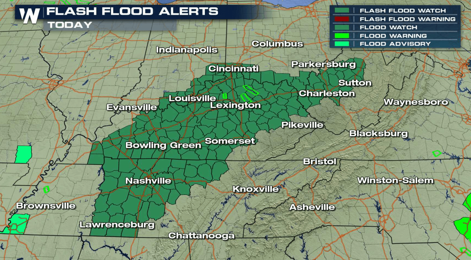
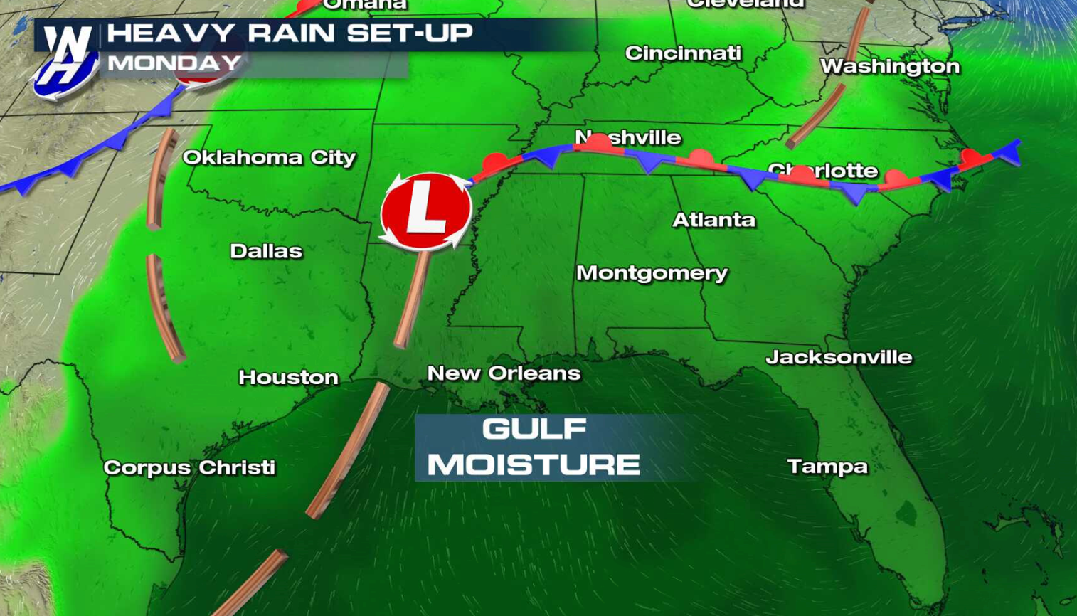
 Flash Flood Watches continue from West Virginia to Tennessee. By the middle of this week, another 3" to 6" of rain is likely to fall over portions of the region. A stalled front in the Deep South coupled with high humidity from the Gulf of Mexico will produce the excessive rainfall totals.
 For WeatherNation: Meteorologist Mace Michaels
Flash Flood Watches continue from West Virginia to Tennessee. By the middle of this week, another 3" to 6" of rain is likely to fall over portions of the region. A stalled front in the Deep South coupled with high humidity from the Gulf of Mexico will produce the excessive rainfall totals.
For WeatherNation: Meteorologist Mace MichaelsAll Weather News
More
Wildfire Outbreak in the Pacific Northwest
SPOKANE, WA - On Saturday, August 1st, the Ol
3 Aug 2026 1:55 AM

More Storms for the East Through Monday
A low-pressure system that moved through the
3 Aug 2026 1:50 AM


After Reaching Category 5, Genevieve Weakens in the Pacific
PacificGenevieve formed last Friday south of
3 Aug 2026 12:30 AM

Flooding, Severe Storms Target the Midwest Again
After an active week of storms across the nor
1 Aug 2026 1:40 AM

Flooding Risk Increases as Heavy Rain Targets the Tri-State Area
Tuesday, heavy rainfall moved across the Nort
30 Jul 2026 12:25 AM

Severe Weather: Energy From the Midwest Now in the Southeast
UPPER MIDWEST - Through Monday, dangerous tor
29 Jul 2026 10:30 PM