Flood Concerns in the Mississippi and Tennessee Valleys

Special Stories
27 Feb 2018 5:37 PM
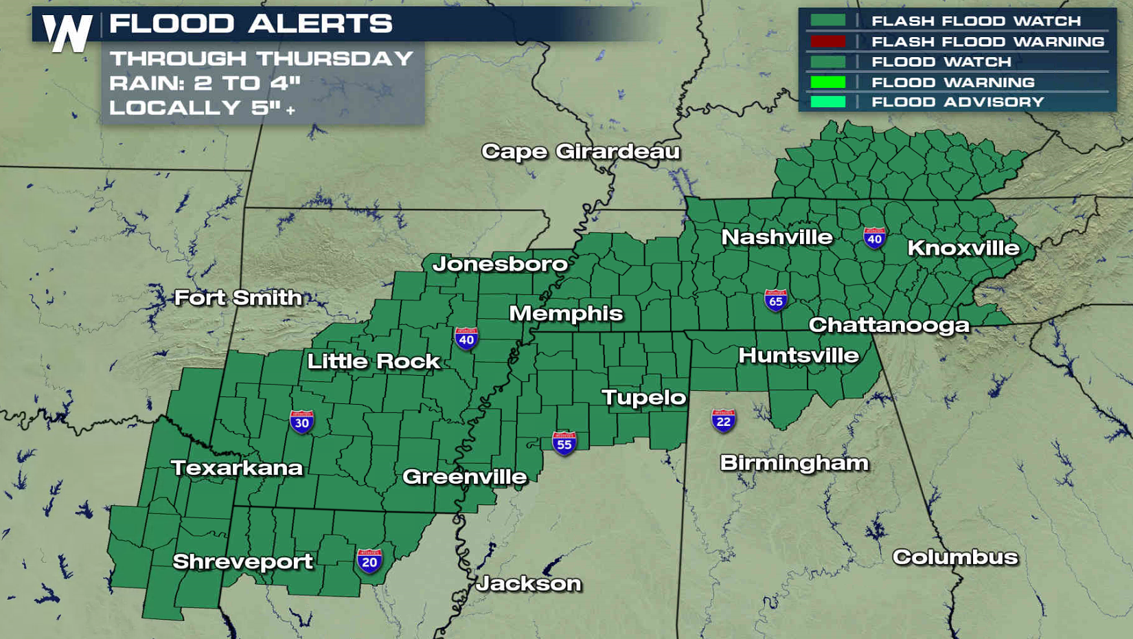
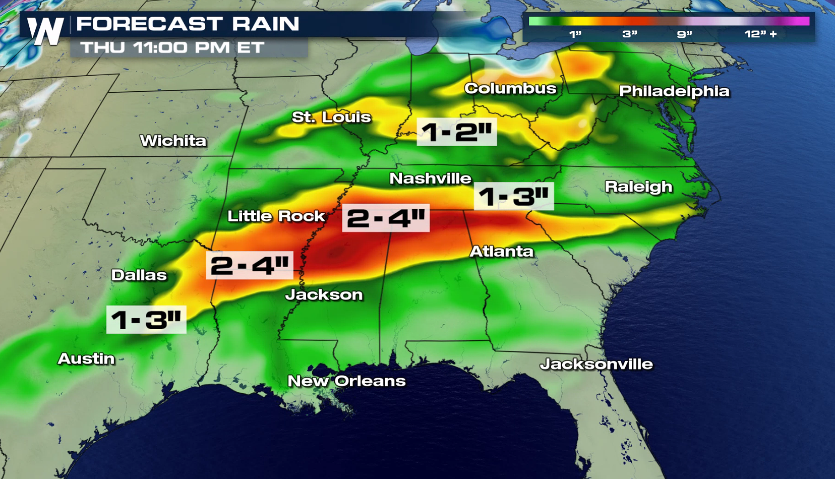
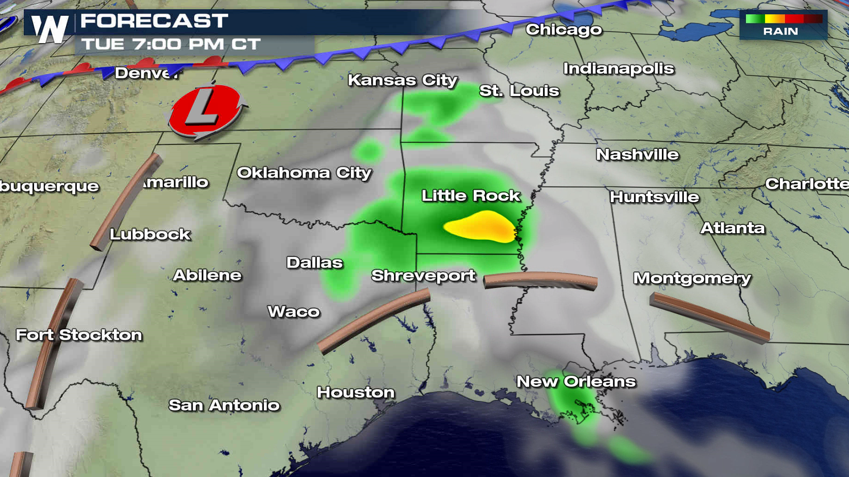
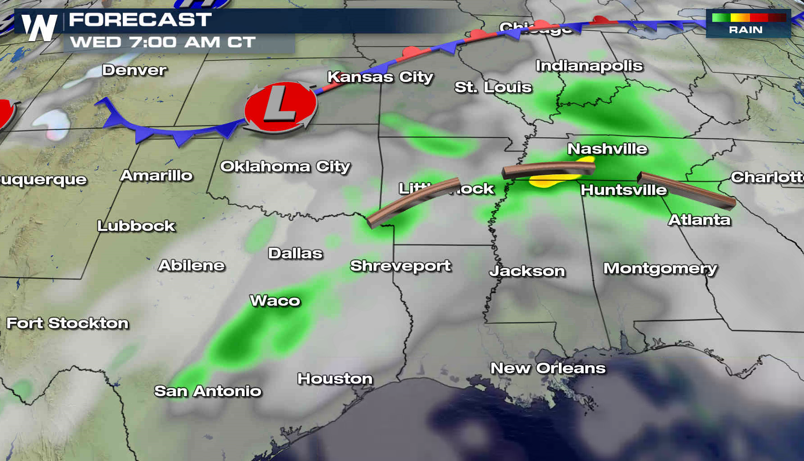
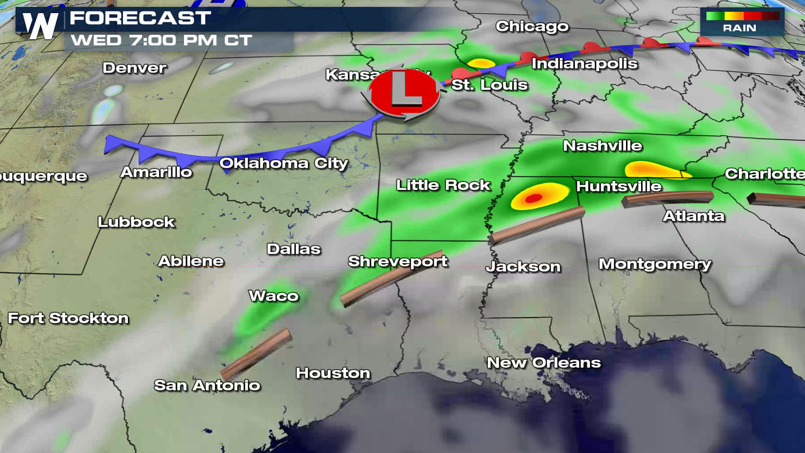
More rain is on the way from the Tennessee Valley to the Arklatex through Thursday with a continued concern for flooding. Flood Watches remain in effect from Kentucky to Texas. Rainfall totals of 2" to 4" are likely with some areas possibly seeing up to 5".
 Humidity remains high as air pushes in from the Gulf of Mexico, raising dew points. Aloft, the sub -tropical Jet Stream remains strong and moist.
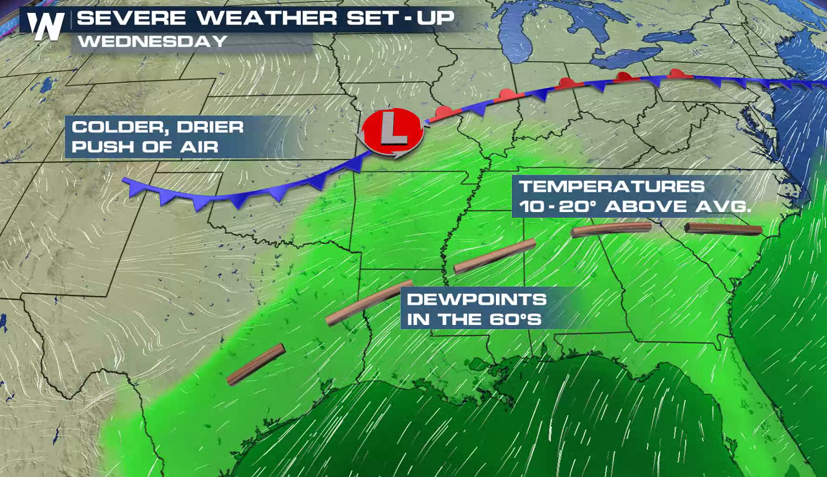
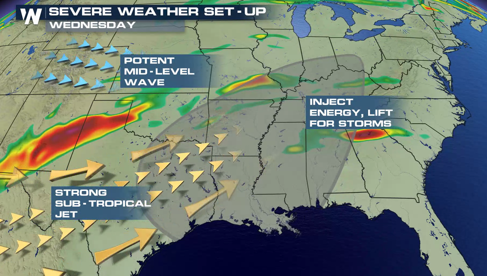 A trough remains draped over the region, providing energy for thunderstorm development. As a cold front and low pressure center sinks southward, additional thunderstorms will pop-up with the potential for heavy rainfall.
 For WeatherNation: Meteorologist Mace Michaels
Humidity remains high as air pushes in from the Gulf of Mexico, raising dew points. Aloft, the sub -tropical Jet Stream remains strong and moist.
A trough remains draped over the region, providing energy for thunderstorm development. As a cold front and low pressure center sinks southward, additional thunderstorms will pop-up with the potential for heavy rainfall.
For WeatherNation: Meteorologist Mace MichaelsAll Weather News
More
More Storms for the East Through Monday
A low-pressure system that moved through the
3 Aug 2026 12:20 PM


After Reaching Category 5, Genevieve Weakens in the Pacific
PacificGenevieve formed last Friday south of
3 Aug 2026 12:30 AM

Flooding, Severe Storms Target the Midwest Again
After an active week of storms across the nor
1 Aug 2026 1:40 AM

Flooding Risk Increases as Heavy Rain Targets the Tri-State Area
Tuesday, heavy rainfall moved across the Nort
30 Jul 2026 12:25 AM

Severe Weather: Energy From the Midwest Now in the Southeast
UPPER MIDWEST - Through Monday, dangerous tor
29 Jul 2026 10:30 PM