Flood Impacts Continue Across the Country
Special Stories
28 Mar 2019 11:47 AM
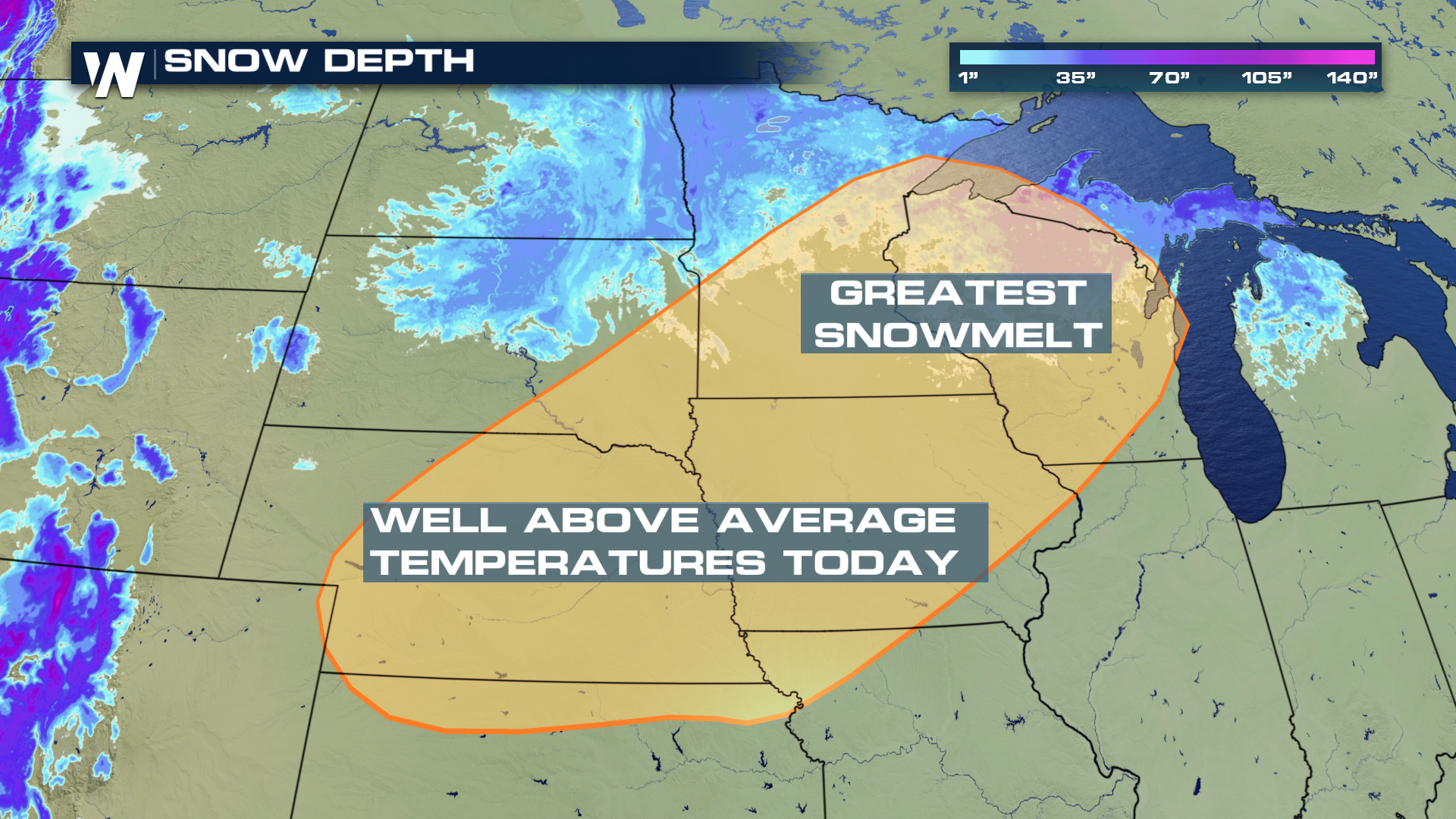
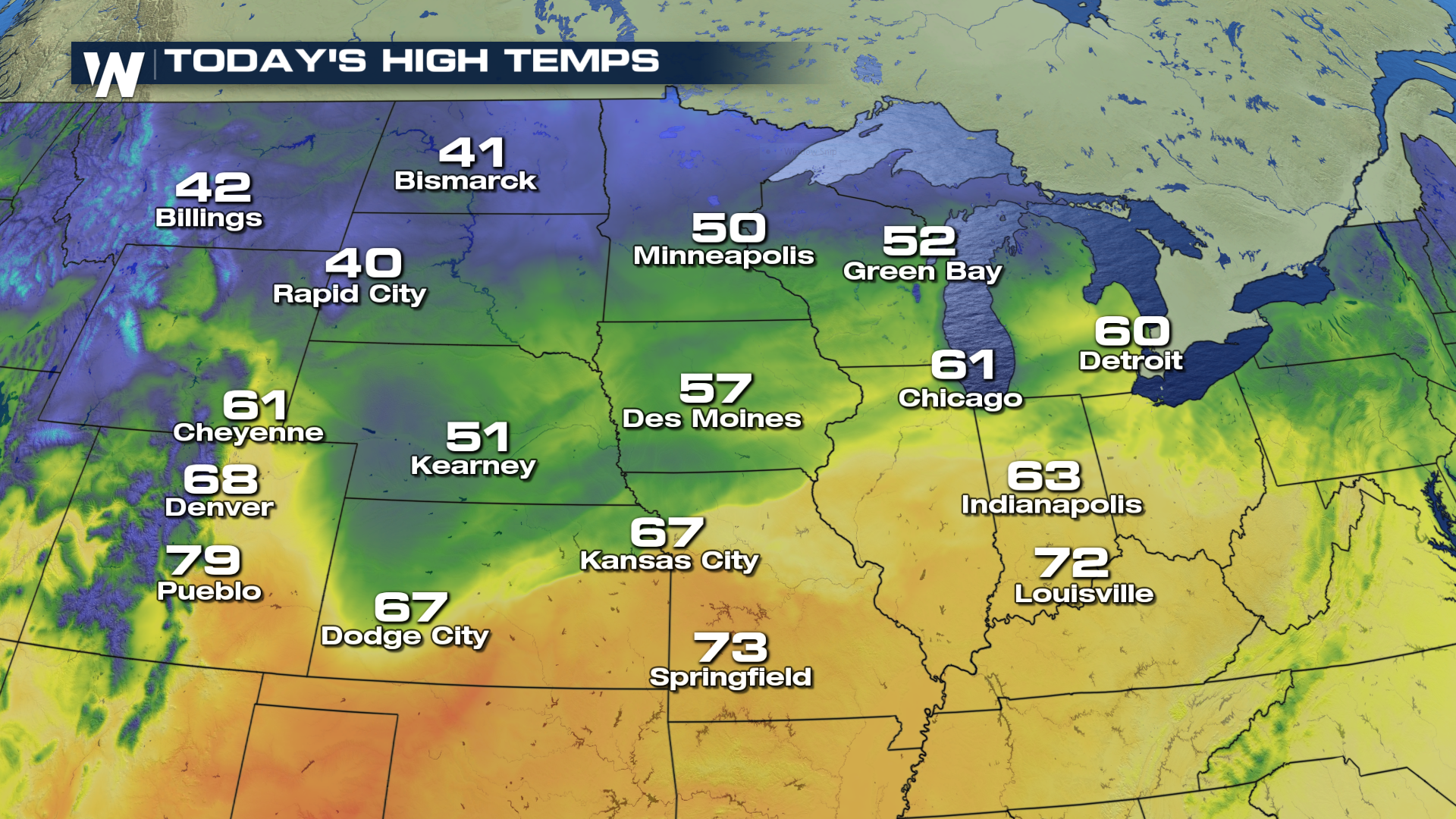
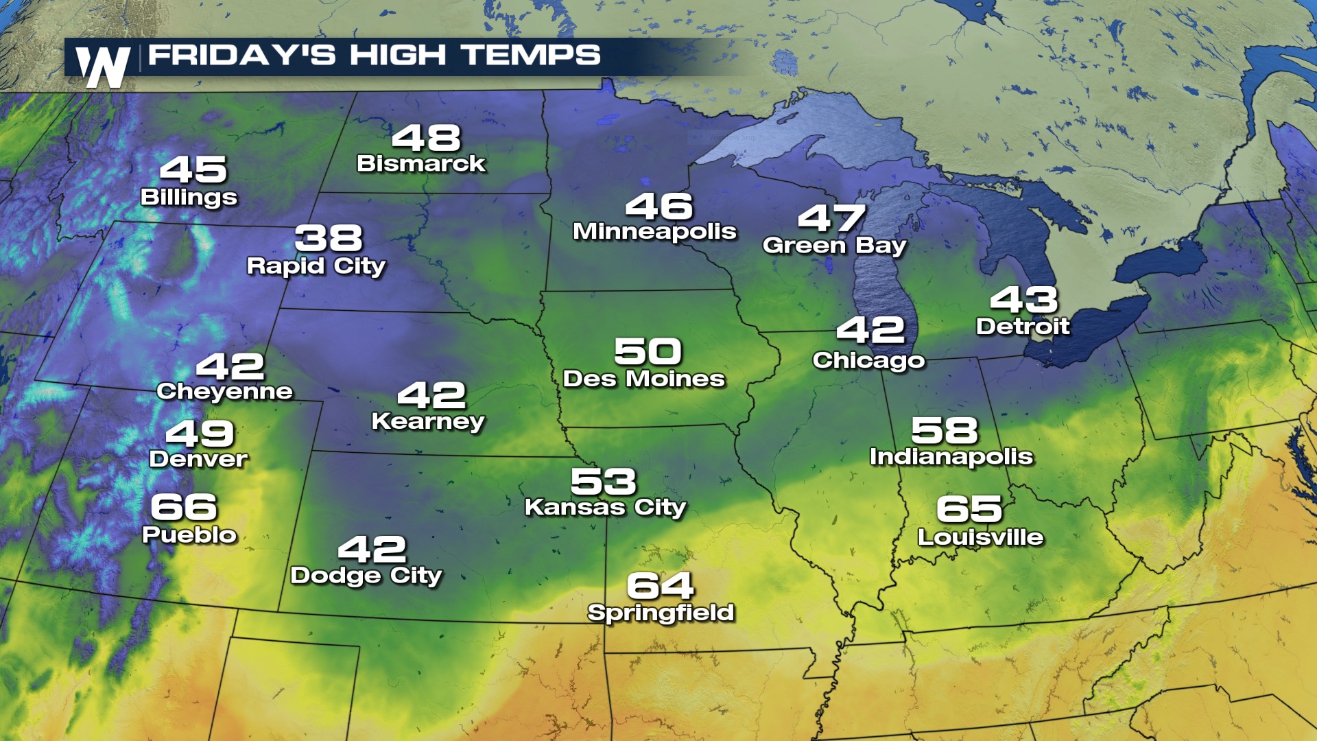
As we continue to march forward into the spring months, melting snow on top of falling rain has inundated portions of the country with major to record setting levels of flooding. The current snow-pack, shown below, will continue to decrease as warmer weather remains in the forecast. Afternoon high temperatures are expected to stay well above average over the extended period. As the snow melts, it will keep river levels at moderate to major criteria for flooding issues.
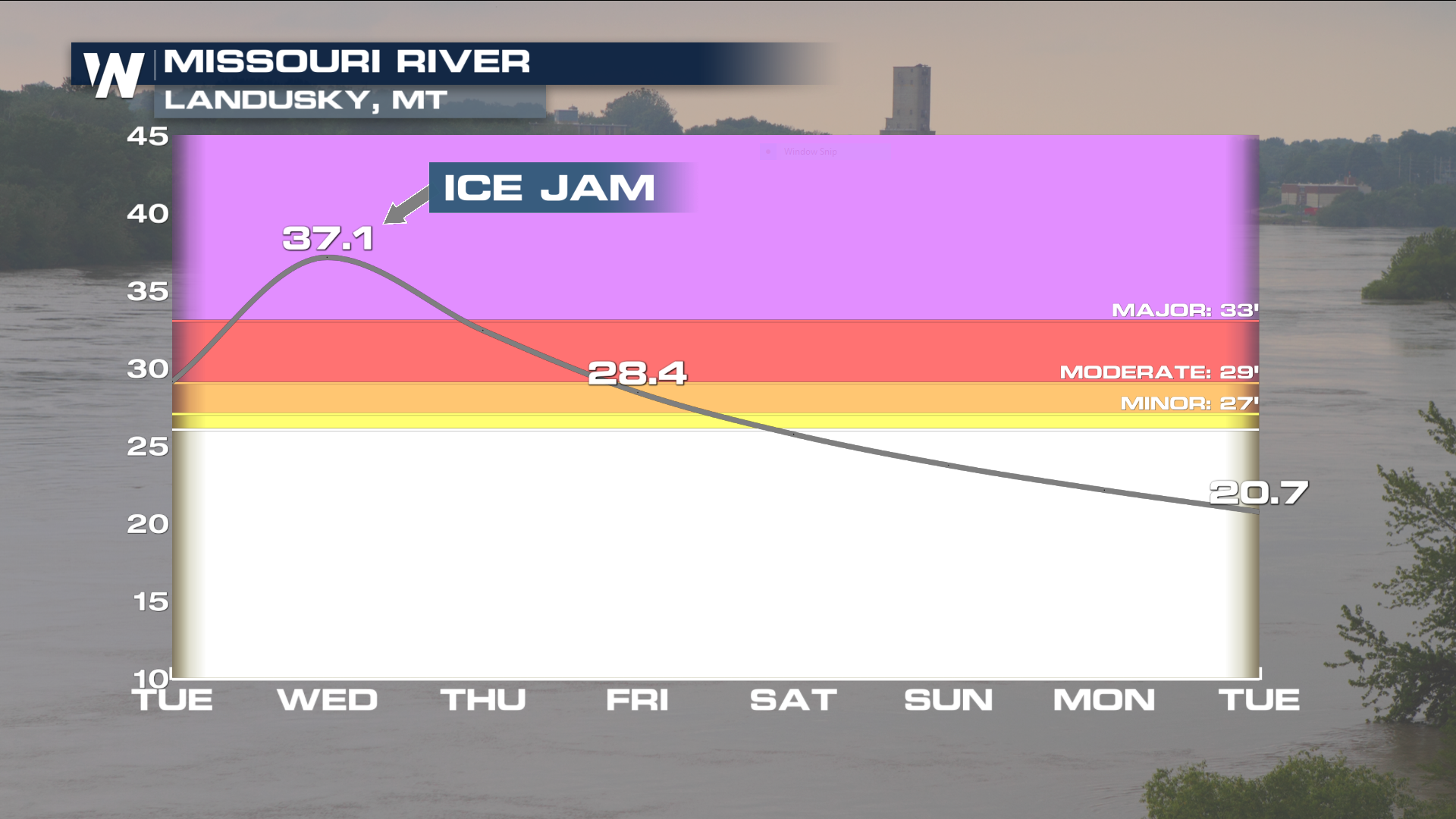
 There have been numerous rivers that have experienced record levels of flooding. The Missouri River near Landusky, MT hit major flood levels as it dealt with an ice jam over the last few days. The freeze/thaw cycle due to daytime highs and overnight lows has increased these occurrences across the country over the last few weeks and will likely continue to impact local waterways as we head in April.
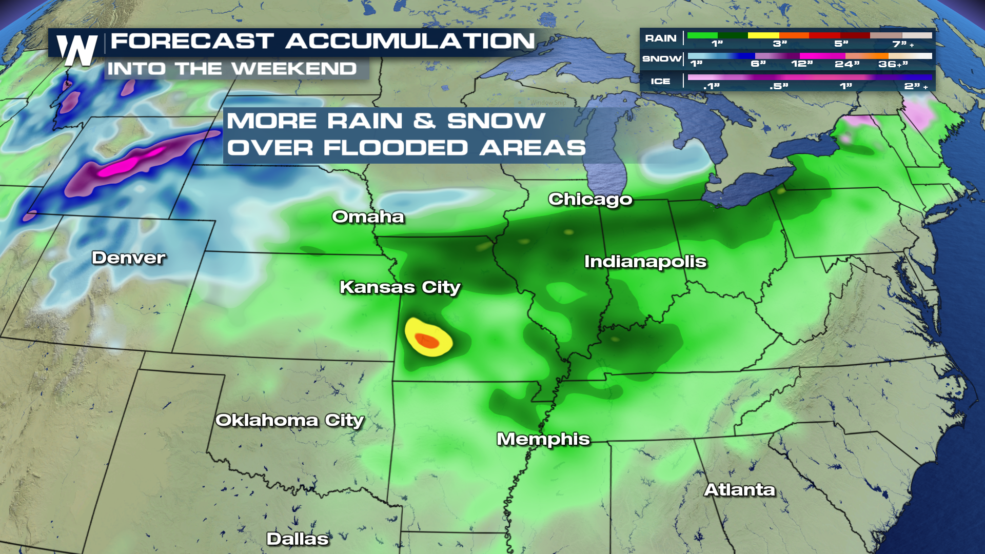
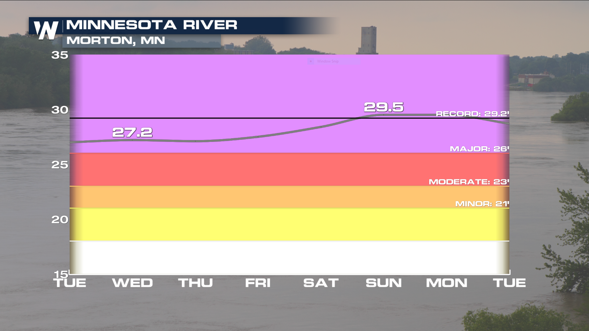 As storms continue to work their way across the country, both rain and snow will accumulate into the weekend. Many major rivers and their tributaries will soak up the precipitation and keep river levels dangerously high for this time of year.
 Note that all areas across the region will continue to remain well above the freezing point of 32°, allowing the current snow-pack to melt at a rapid rate. These mild temperatures will remain in the forecast through the end of the week.
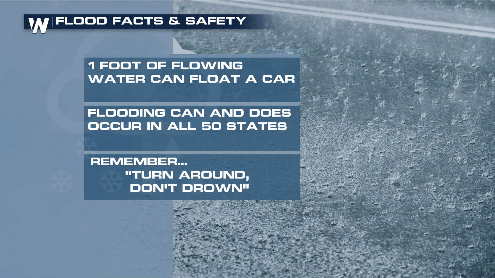
 Here are a few facts about river flooding and flowing water that are useful to anyone dealing with the current issues across the country.
 For WeatherNation, I'm Meteorologist Greg Rule
 There have been numerous rivers that have experienced record levels of flooding. The Missouri River near Landusky, MT hit major flood levels as it dealt with an ice jam over the last few days. The freeze/thaw cycle due to daytime highs and overnight lows has increased these occurrences across the country over the last few weeks and will likely continue to impact local waterways as we head in April.

 As storms continue to work their way across the country, both rain and snow will accumulate into the weekend. Many major rivers and their tributaries will soak up the precipitation and keep river levels dangerously high for this time of year.
 Note that all areas across the region will continue to remain well above the freezing point of 32°, allowing the current snow-pack to melt at a rapid rate. These mild temperatures will remain in the forecast through the end of the week.

 Here are a few facts about river flooding and flowing water that are useful to anyone dealing with the current issues across the country.
 For WeatherNation, I'm Meteorologist Greg Rule
All Weather News
More