Flood Potential from the Western Great Lakes to the Central Plains
Special Stories
20 Aug 2018 10:35 AM
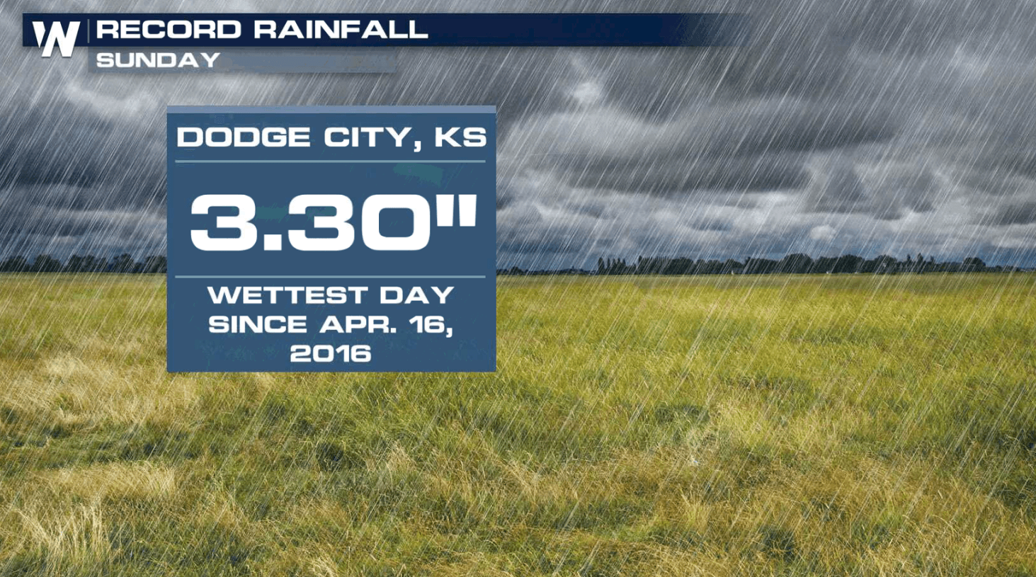
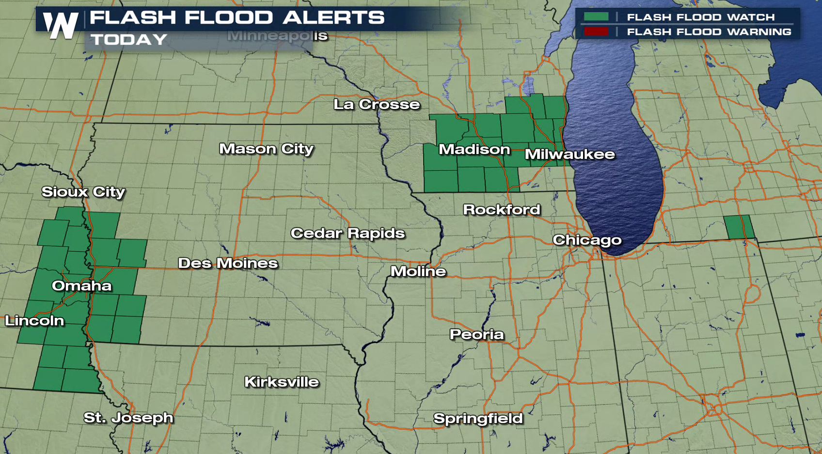
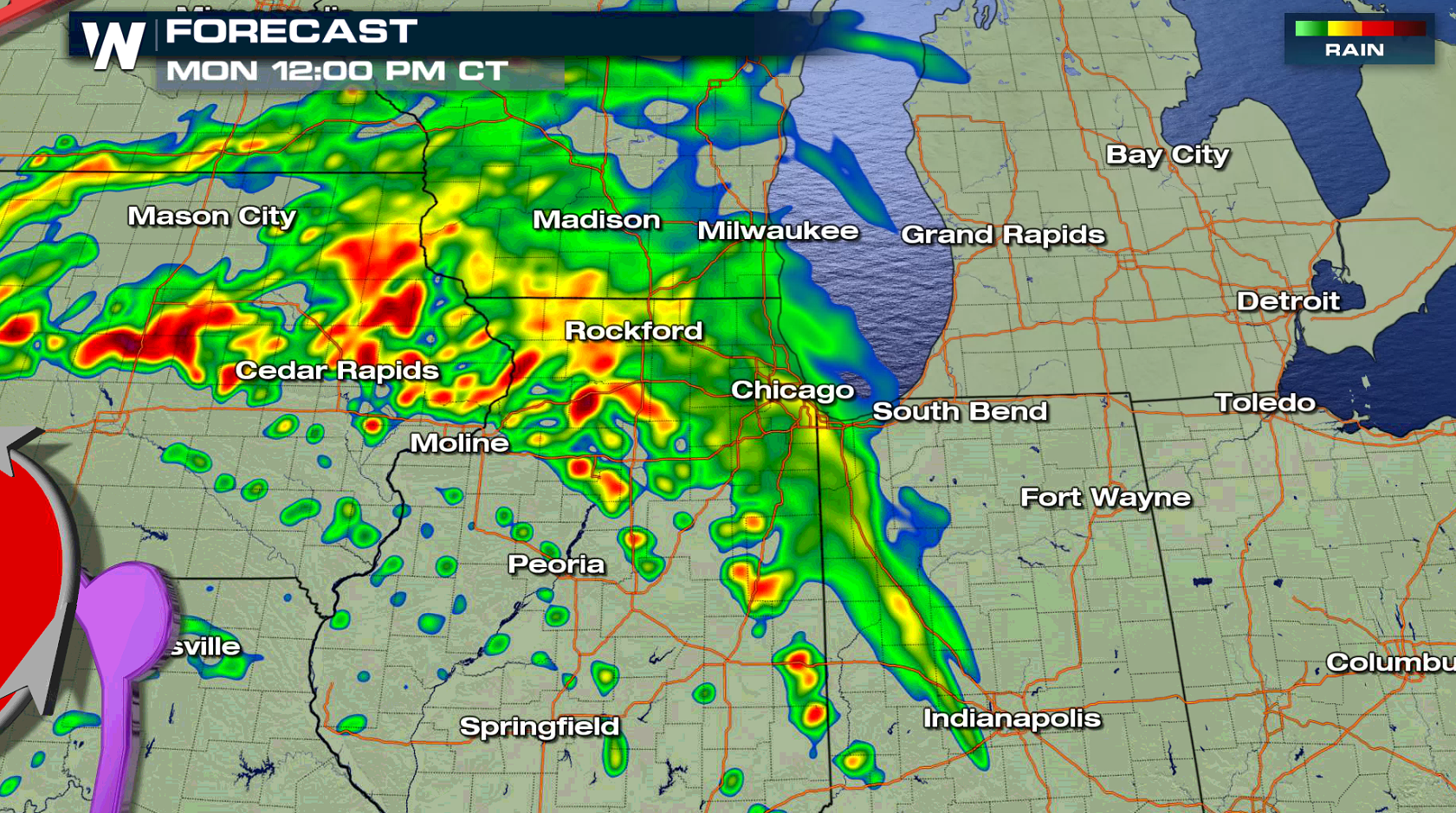
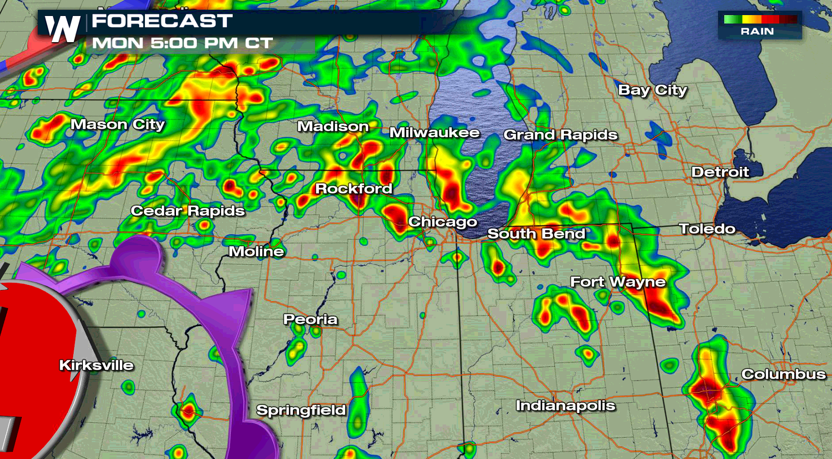
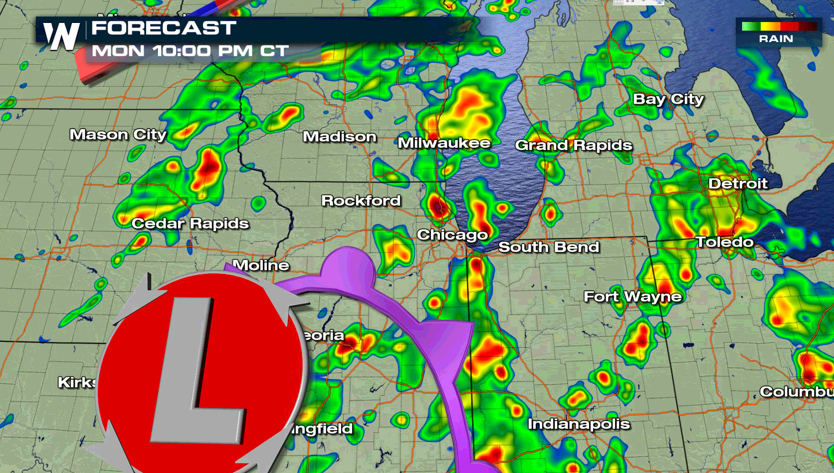
A slow moving storm system may produce flooding rains today (Monday) from the western Great Lakes into the central Plains. Flash Flood Watches have been issued in parts of Wisconsin, Michigan, Iowa and Nebraska. More than 3" of rain may fall in some areas with showers and thunderstorms into Tuesday.
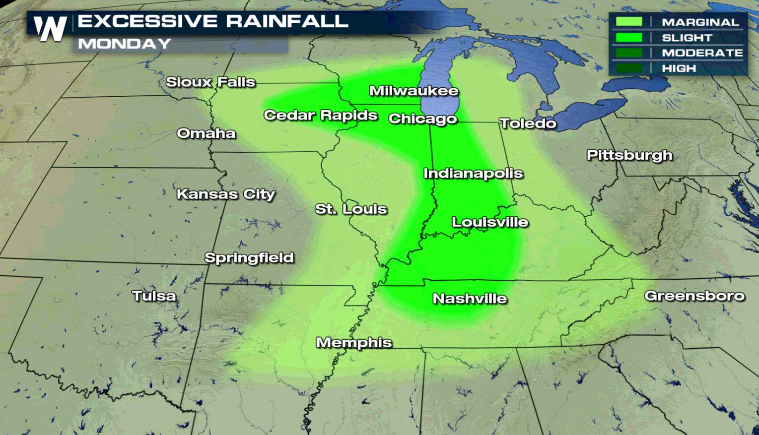
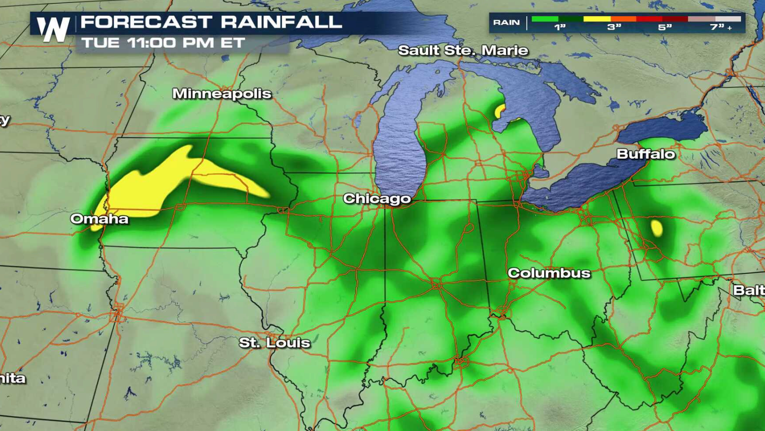 The low pressure center will slowly move across Iowa into Illinois with numerous showers and thunderstorms. The slow moving nature of the storms, coupled with high humidity, may produce flooding in some areas this afternoon and evening (Monday). As some storms re-develop over the same area, the ground could become over-saturated, increasing the flooding threat.
 For WeatherNation: Meteorologist Mace Michaels
The low pressure center will slowly move across Iowa into Illinois with numerous showers and thunderstorms. The slow moving nature of the storms, coupled with high humidity, may produce flooding in some areas this afternoon and evening (Monday). As some storms re-develop over the same area, the ground could become over-saturated, increasing the flooding threat.
For WeatherNation: Meteorologist Mace MichaelsAll Weather News
More


More Storms for the East Through Monday
A low-pressure system that moved through the
3 Aug 2026 1:50 AM

After Reaching Category 5, Genevieve Weakens in the Pacific
PacificGenevieve formed last Friday south of
3 Aug 2026 12:30 AM

Flooding, Severe Storms Target the Midwest Again
After an active week of storms across the nor
1 Aug 2026 1:40 AM

Flooding Risk Increases as Heavy Rain Targets the Tri-State Area
Tuesday, heavy rainfall moved across the Nort
30 Jul 2026 12:25 AM

Severe Weather: Energy From the Midwest Now in the Southeast
UPPER MIDWEST - Through Monday, dangerous tor
29 Jul 2026 10:30 PM