Flood Threat Winding Down for the Lone Star State

After multiple spots in southeast Texas received one to two FEET of rain in just 24 hours in the last week, many instances of extreme flooding are ongoing. Roads are washed out, rivers and creeks are running high with water still standing over roads in some spots, and major flooding is expected to continue along rivers over the next few days. This video was taken about 20 miles north of Houston, in Humble, TX. Please remember, turn around, don't drown.
More heavy rain and flooding are expected to close out the weekend in southeast Texas. A moderate risk (level 3 out of 4) is issued for Houston and Lufkin.
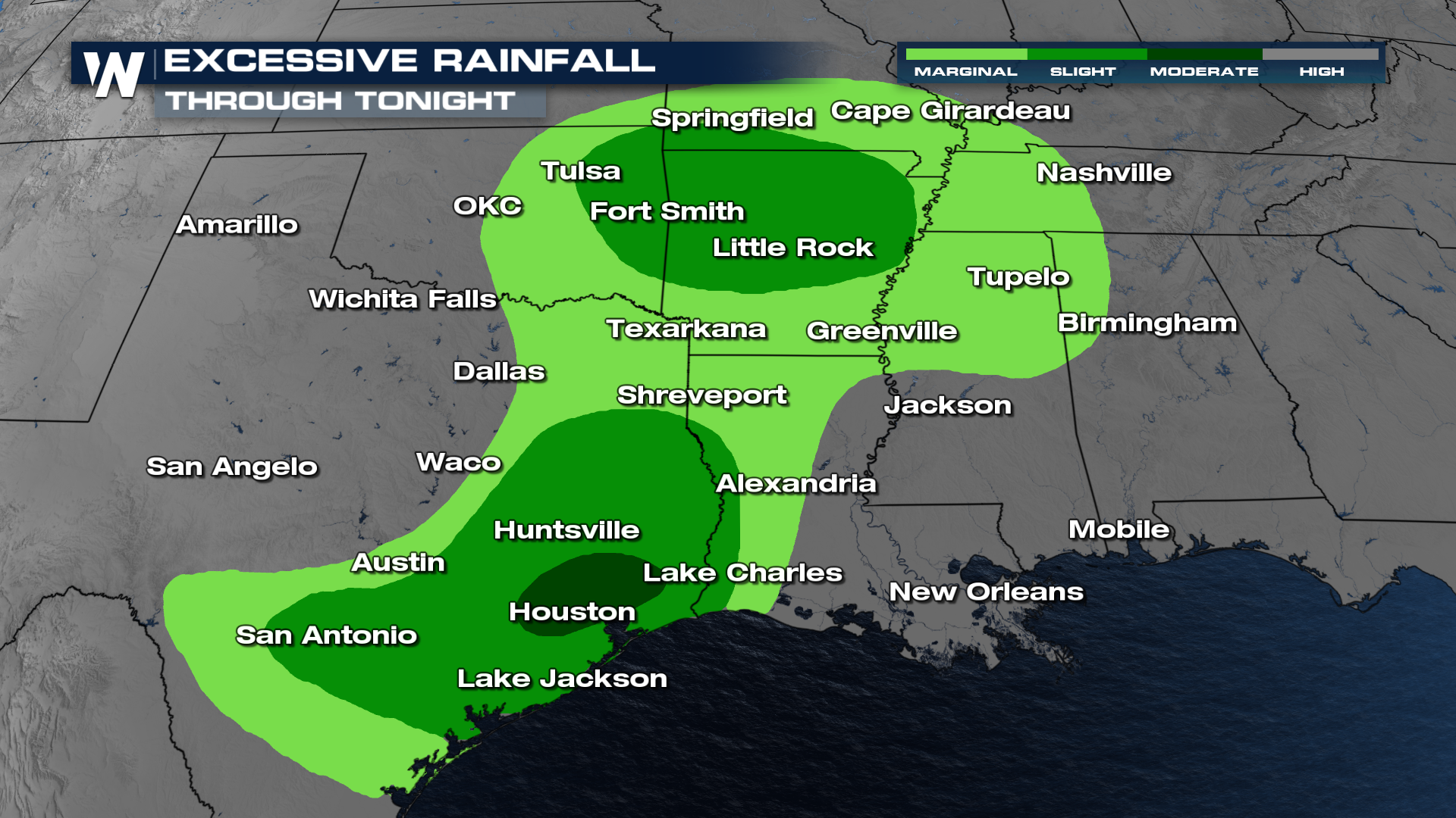 This level 3 out of 4 on the flood risk scale indicates that numerous flash floods are likely, with some significant flash flooding possible. This area corresponds with the already-flooded part of the state with standing water and rivers still in a major flood stage (see top of page).

The heavy rainfall threat will continue across Texas due to the oversaturation of soils. Any additional amount of rainfall could lead to flooding fairly quickly.
Related article: Tornado Hits West Texas, More Storms this Weekend
If you live in southeast Texas, be careful and seek higher ground if a flash flood warning is issued, especially if water starts rising. Rain totals by the end of the weekend will be anywhere from 1-3" overall, but pockets of 4-5" are possible where multiple rounds of storms come through. Flooding will be expected in areas of southeast Texas already hard-hit by flooding earlier this week. Never drive through flooded roads!


